Parking
Park in the small lot at Mineral King Ranger Station, then walk a few hundred feet into Cold Springs Campground to the wooden trail sign between sites 6 and 7.

Sequoia National Park, CA
A gentle river walk to Mineral King's historic mining site.
Overview
Map & elevation
Plan your hike

The highest, rockiest slopes around here are a summer buffet for grizzly bears.
Sequoia Tour Guide
Parkwolf is a GPS audio tour guide for Sequoia National Park. As you drive, it chimes in with what’s ahead: hidden gems, upcoming stops, history, geology, and wildlife, right through your car’s speakers.
See the Sequoia audio tourRecorded for this trailhead
Cold Springs Campground and Nature Trail“Cold Springs Campground is coming up, a tent-only base among aspens and conifers at about seventy-five hundred feet.”
Plays as you drive up to this trailhead in the Parkwolf Sequoia Tour Guide.
More stories near here in the app
“…The kids and my husband and I all agree that the narration really added to our experience driving through the parks. We learned so much about the history and the flora & fauna.”


Trail guide
Cold Springs Nature Trail is a 2.4-mile out-and-back from Cold Springs Campground to the Beulah mining site and the Eagle-Mosquito trailhead area. The path is about 1.2 miles each way; allow around two hours if you pause at the river or interpretive panels. Published totals range from 2 to 3 miles, but 2.4 fits the mapped named trail corridor. It is a good choice for an easy-grade look at Mineral King's river and meadow country, not a shortcut to the high lakes; those require separate, much longer and steeper hikes.
The wooden trail sign is between campground sites 6 and 7. The first few steps pass beside site 6 and can look like a campsite entrance, so keep going onto the signed path. Park in the small lot at Mineral King Ranger Station, a few hundred feet away, then walk into the campground. Pit toilets are available there; the trail is for day use.
The dirt tread is rocky in places but the incline is easy. The East Fork of the Kaweah runs alongside the first part of the walk, and short side paths reach the water; one climbs to a rocky outcrop above a cascade. Those are optional spurs, not part of the mapped mileage. The path then rises through stunted aspens and grassy meadows. At the second large meadow, look toward Timber Gap and Empire Mountain beyond the lodgepole pines and firs. Early October can bring yellow and orange color to the river-side cottonwoods and aspens, and the meadow makes the best wide view for a photo.
This trail reaches the site of Beulah, a Mineral King mining settlement. The first town plat was surveyed in 1875, and interpretive panels tell more of the area's mining story. Old cabins nearby are privately owned, so stay on the trail and give residents their space. The Eagle-Mosquito routes continue beyond this walk toward Eagle Lake, Mosquito Lakes, and White Chief Bowl; leave those for a separate, more strenuous hike.
The trail starts around 7,500 feet, so the easy grade can still feel strenuous if you are not acclimated. Carry your own water because stream water is not guaranteed safe to drink. Pets are not allowed on park trails. Mineral King Road closes for winter in mid-November and usually reopens later in spring; check seasonal access before driving in. Early-summer mosquitoes can be troublesome, and marmots may damage parked vehicles, especially in spring and early summer.
Wildlife
 691 sightingsBlack BearMost seen around 6 PMSighting map
 17 sightingsMountain LionMost seen around 6 AMSighting map
 18 sightingsBobcatMost seen around 7 PMSighting map
 24 sightingsCoyoteMost seen around 7 PMSighting map
 15 sightingsGolden EagleMost seen around 11 AMSighting map
 20 sightingsSpotted OwlMost seen around 7 PMSighting map
Sighting maps show where each species has been reported across Sequoia. Wildlife moves, so no sighting is guaranteed.
Keep exploring
 ChallengingTar Gap Trail to Hockett Meadow18.6 mi · 10 hr · 0.2 mi awayA long Sierra climb through lakes and forest to Hockett Meadow.
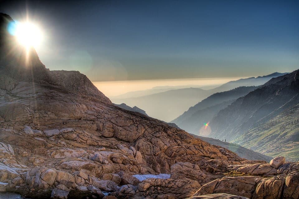 ChallengingSawtooth Pass Trail11 mi · 9 hr · 0.8 mi awayA high, rough climb above Monarch Lakes to Sawtooth Pass.
 ChallengingBig Five and Little Five Lakes Loop31.2 mi · 1.3 days · 0.8 mi awayTwo lake basins, two high passes, and a real backpacking test
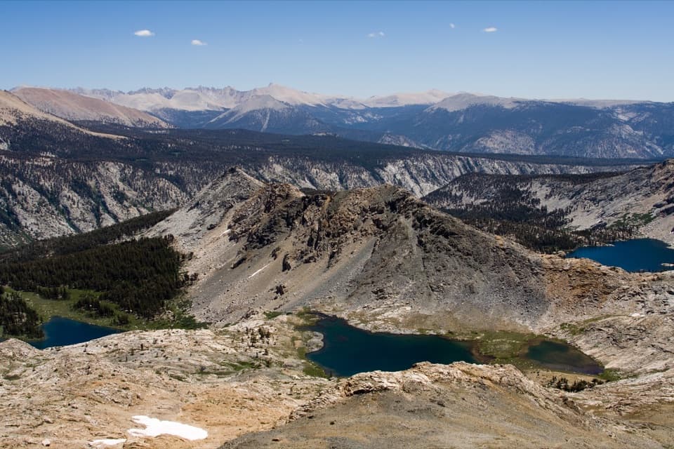 ChallengingBlack Rock Pass Trail23 mi · 17.5 hr · 0.8 mi awayA 23-mile climb to a pass between the Five Lakes basins
 ChallengingTimber Gap Trail4.5 mi · 3.5 hr · 0.8 mi awayA steep climb to a red-fir pass above Mineral King.
 ChallengingCrystal Lake Trail9.8 mi · 6.5 hr · 0.8 mi awayA hard climb to a small 1900s dam beneath high Sierra walls.
 ChallengingEagle Lake Trail6.8 mi · 4.5 hr · 0.9 mi awayA steep, rocky climb to a high lake above Mineral King.
 ChallengingMosquito Lake Trail7.2 mi · 4.5 hr · 0.9 mi awayA mountain lake above Mineral King, reached by a steady climb.
 Ranger station · 0.1 mi awayMineral King Ranger StationA useful stop for maps, permits, trail advice, and marmot tarps.
 Campground · 0.2 mi awayCold Springs CampgroundA quiet, tent-only base for Mineral King hikes.
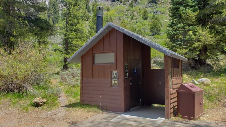 Restroom · 0.9 mi awayEagle-Mosquito Trailhead RestroomA practical restroom before the strenuous Eagle and Mosquito Lakes hikes.
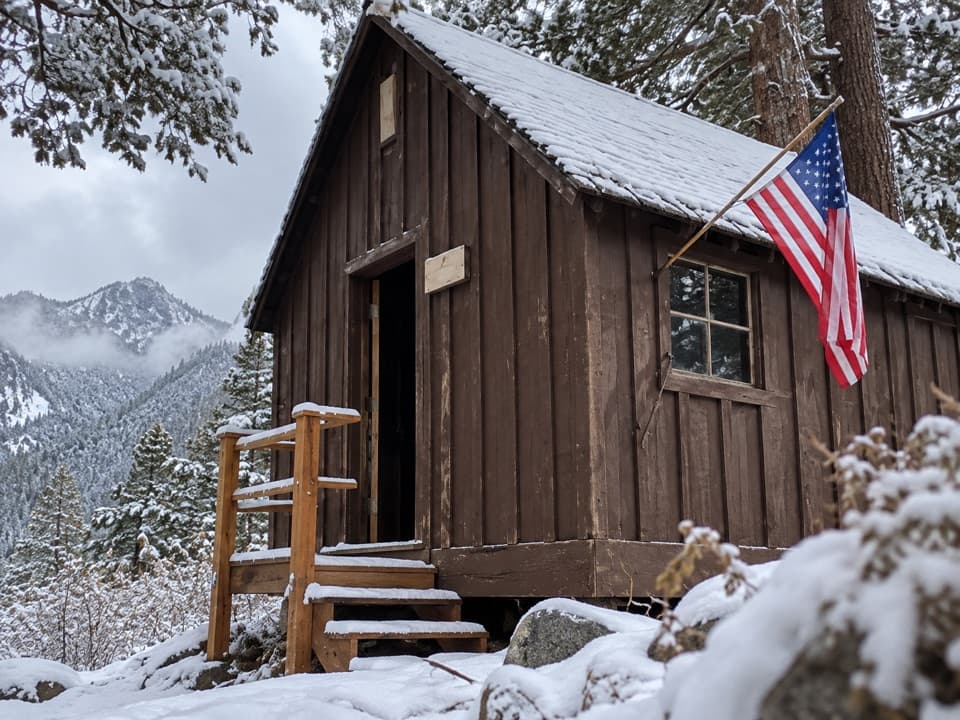 Sight · 0.9 mi awayHoneymoon CabinA cabin shifted eight to ten feet in a slow snow slide.
 Sight · 2.2 mi awayMosquito LakesA small alpine lake reached by a long Mineral King climb
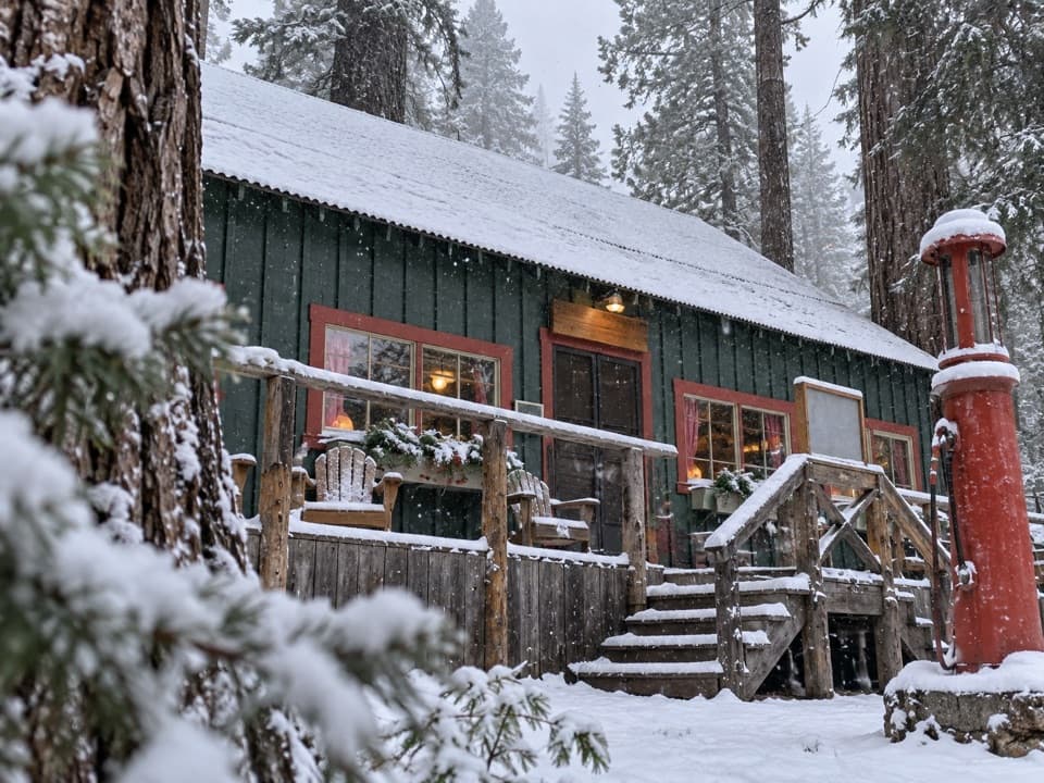 Lodging · 2.3 mi awaySilver City Mountain ResortA patio slice and a small market after the long climb.
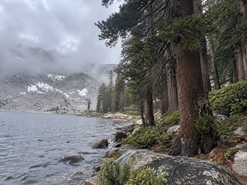 Sight · 2.4 mi awayEagle LakeBlue water at the end of a steep Mineral King hike.
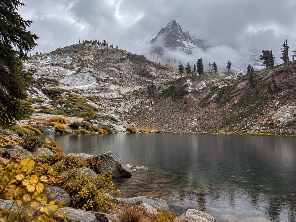 Sight · 2.5 mi awayMonarch LakesTwo alpine lakes below Sawtooth Peak after a hard climb.
Parkwolf’s Sequoia ranking

The audio tour guide for the drive, plus offline maps, trails, and wildlife heatmaps for when the signal drops.





