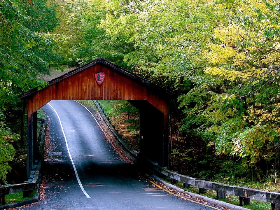
Pierce Stocking Covered Bridge in Sleeping Bear Dunes National Lakeshore

Sight · Sleeping Bear Dunes National Lakeshore

Pierce Stocking Covered Bridge

A historic roadside bridge at the scenic drive's first stop.

Photo: Flickr
Type
Sight
Nearest trail
0.6 mi
Audio stories
15 nearby
  • Pullout
  • Exhibit
  • Scenic viewpoint
  • #18 of 72 sights

Hear the audio tour

Pierce Stocking Covered Bridge: The Porcupine Problem

Overview

About Pierce Stocking Covered Bridge

Why stop

  • An easy, no-hike bridge photo stop.

Map

Where it is

Loading the Sleeping Bear Dunes map
Full map
SightPierce Stocking Covered Bridge44.86117, -86.04367
Keep this map with you offline in the Parkwolf app

Plan your stop

Before you go

1 active Sleeping Bear Dunes alert

  • ClosureManitou Islands access closures during 2026 constructionNorth and South Manitou Islands have limited visitor access throughout the 2026 season: all facilities, docks, and utilities on both islands remain closed during major construction.Official details

Sleeping Bear Dunes alerts
A park ranger sits on a dash-mounted phone, talking, as Parkwolf’s Tour Guide plays “Army Cutworm Moths: A Grizzly Bear Buffet” on Grand Loop Road below Dunraven Pass in Yellowstone
Parkwolf Tour GuideThe highest, rockiest slopes around here are a summer buffet for grizzly bears.

Sleeping Bear Dunes Tour Guide

Your drive to Pierce Stocking Covered Bridge, narrated.

Parkwolf is a GPS audio tour guide for Sleeping Bear Dunes National Lakeshore. As you drive, it chimes in with what’s ahead: hidden gems, upcoming stops, history, geology, and wildlife, right through your car’s speakers.

Recorded for this place

Pierce Stocking Covered Bridge: The Porcupine Problem
0:00 / 0:17
“Up ahead is Pierce Stocking Covered Bridge at Stop One, an easy pull-off if you'd like a closer look without a hike.”

Plays as you drive up to Pierce Stocking Covered Bridge in the Parkwolf Sleeping Bear Dunes Tour Guide.

More stories near here in the app

  • Cottonwoods Connected Under the Sand
  • When the Lake Sloshes
  • Glen Lake Overlook: Two Lakes, Two Blues
  • Shauger Hill: Woods Instead of Lake Views
  • 73 audio storiesacross Sleeping Bear Dunes’s roads, triggered by GPS as you drive
  • Wildlife heatmapsfor Piping Plover, Bald Eagle, White-tailed Deer, and 13 more
  • Works offlinemaps, 34 trails, 89 places, and audio download before you lose signal
  • CarPlay readysimple controls built for the drive
★★★★★
“Fantastic app with many points of information… It’s great to just turn on while you’re driving and it gives you an audio tour of the national Park. We love it!!!!”
JMJamesApp Store review
Download Parkwolf on the App StoreGet Parkwolf on Google Play

4.7 from 8,600+ ratings

Guide

More about Pierce Stocking Covered Bridge

A quick first stopPierce Stocking Covered Bridge is a timber road bridge and roadside photo stop at Stop 1 of the…

Pierce Stocking Covered Bridge is a timber road bridge and roadside photo stop at Stop 1 of the 7.4-mile Pierce Stocking Scenic Drive. The short pull-off is the point: you can see the bridge without a hike. I'd treat it as an easy opener on the drive, not a reason to detour on its own.

The bridge's second lifePierce Stocking built the original bridge in the 1960s as part of his scenic drive.

Pierce Stocking built the original bridge in the 1960s as part of his scenic drive. Covered-bridge roofs protected timber from rain and snow, but porcupines chewed the sides of the original. The present bridge replaced it in 1986, giving this familiar-looking photo stop a very local twist.

Get the road in the frameThe bridge crosses the road itself, so keep some pavement in the picture to show how the drive…

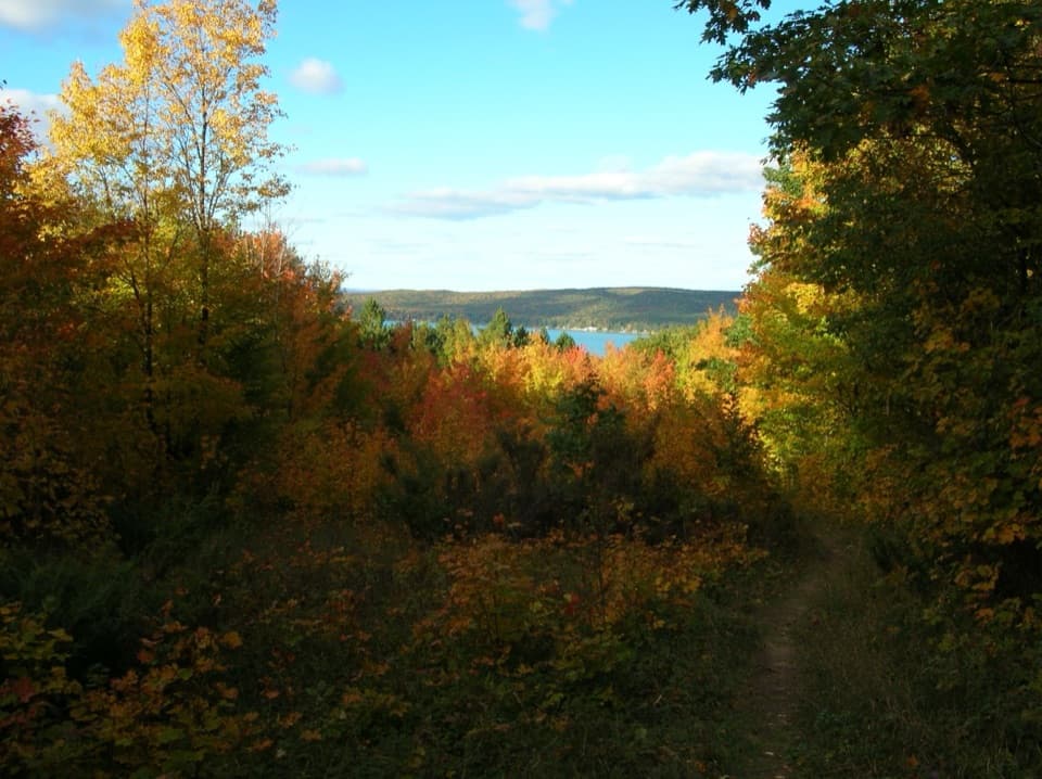
The bridge crosses the road itself, so keep some pavement in the picture to show how the drive passes through it. The surrounding trees turn yellow in autumn, and the pull-off gives you the view without walking away from the road.

Make the drive workThis is the first of 12 stops on a one-way 7.4-mile route.

This is the first of 12 stops on a one-way 7.4-mile route. Follow the one-way signs and keep to 20 mph; trailers aren't allowed, and the bridge clearance is 13 feet 6 inches. Vehicle access generally runs from late May to late October; when the drive is closed to cars, it remains open for walking. A park entrance pass is required. Vault toilets are listed at the drive entrance, but not at this bridge pull-off.

Wildlife

Wildlife in Sleeping Bear Dunes

All Sleeping Bear Dunes wildlife maps

Sighting maps show where each species has been reported across Sleeping Bear Dunes. Wildlife moves, so no sighting is guaranteed.

Keep exploring

Near Pierce Stocking Covered Bridge

See it all on the map

Trails nearby

More stops nearby

Parkwolf’s Sleeping Bear Dunes ranking

Top sights in Sleeping Bear Dunes

All 89 places
  1. 1Dune ClimbSight
  2. 2Lake Michigan OverlookSight
  3. 3Pyramid Point OverlookSight
  4. 4Empire Bluff OverlookSight
  5. 5South Manitou Lighthouse ComplexSight
  6. 6North Bar BeachBeach

Take Parkwolf to Sleeping Bear Dunes.

The audio tour guide for the drive, plus offline maps, trails, and wildlife heatmaps for when the signal drops.

4.7 from 8,600+ ratings

Download Parkwolf on the App StoreGet Parkwolf on Google Play