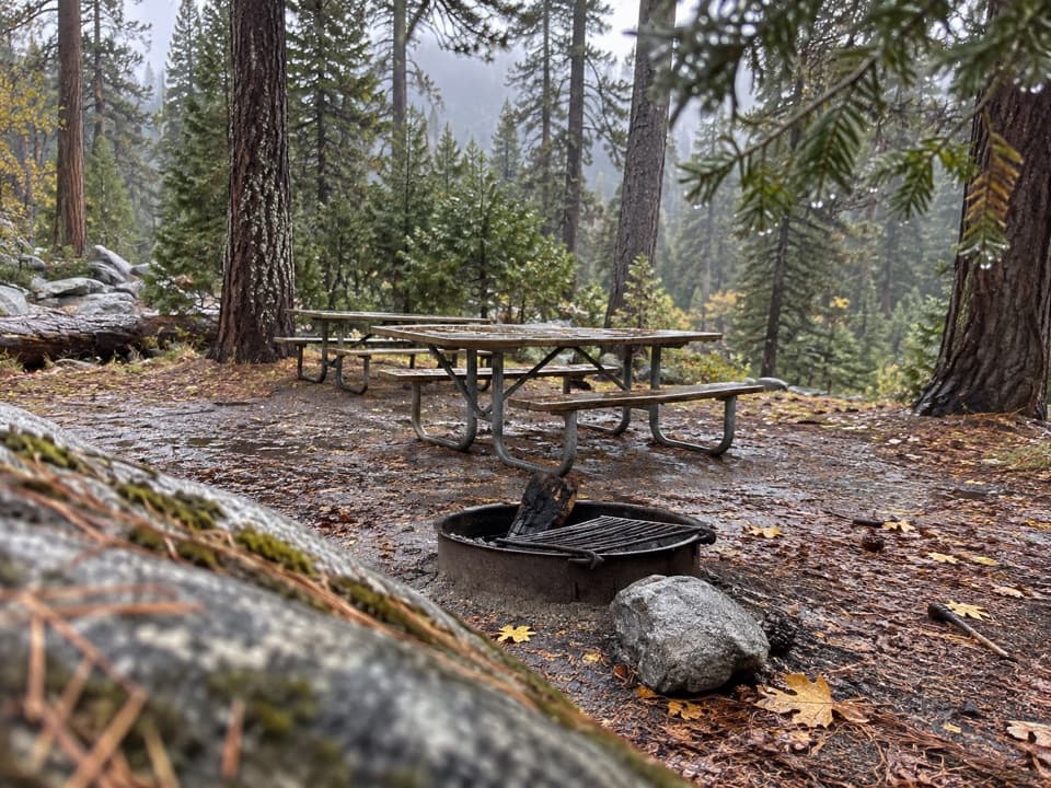
Yosemite Creek Picnic Area in Yosemite National Park

Picnic area · Yosemite National Park

Yosemite Creek Picnic Area

A quiet, pine-shaded picnic beside Yosemite Creek.

Type
Picnic area
Nearest trail
0.2 mi
Audio stories
4 nearby
  • Picnic tables
  • Restrooms
  • Parking

Hear the audio tour

Yosemite Creek Picnic Area and Ten Lakes

Overview

About Yosemite Creek Picnic Area

Why stop

  • Pine-shaded tables beside Yosemite Creek

Heads up

  • Very limited parking; no potable water or grills

Map

Where it is

Loading the Yosemite map
Full map
Picnic areaYosemite Creek Picnic Area37.85041, -119.57327
Keep this map with you offline in the Parkwolf app

Plan your stop

Before you go

Access and facilities

Tioga Road’s seasonal opening controls vehicle access, usually from late spring into fall; dates shift with snow, so check the road status before setting out. Picnic areas are first come, first served from dawn to dusk. There’s one extended-top accessible picnic table and an accessible vault toilet, but Yosemite Creek isn’t wheelchair accessible overall: the ground around the tables may be uneven and unpaved, and there are no designated accessible parking spaces.

4 active Yosemite alerts

  • ClosureDome Fire closes Glacier Point Road and trailsGlacier Point Road is temporarily closed because Dome Fire smoke reduces visibility and to allow firefighting operations; some trails south of the road are also closed.Official details
  • CautionMist Trail access limited during October repairsThe Mist Trail between its John Muir Trail junction above the Vernal Fall footbridge and the top of Vernal Fall has limited access through October for repair work.Official details
See all 4 alerts
The Parkwolf Tour Guide on a dash-mounted phone, driving into Yosemite Valley

“Ten Lakes Trailhead is coming up, with Yosemite Creek Picnic Area nearby. For a short break, I'd choose the creekside tables under the pines. You're beside the stream that feeds Yosemite Falls farther downstream.”

Yosemite Tour Guide

Yosemite, narrated.

Parkwolf is a GPS audio tour guide for Yosemite National Park. As you drive, it chimes in with what’s ahead: hidden gems, upcoming stops, history, geology, and wildlife, right through your car’s speakers.

See the Yosemite audio tour

Recorded for this place

Yosemite Creek Picnic Area and Ten Lakes
0:00 / 0:30
“Ten Lakes Trailhead is coming up, with Yosemite Creek Picnic Area nearby. For a short break, I'd choose the creekside tables under the pines. You're beside the stream that feeds Yosemite Falls farther downstream.”

Plays as you drive up to Yosemite Creek Picnic Area in the Parkwolf Yosemite Tour Guide.

More stories near here in the app

  • Mapping a Vertical Wall
  • Lakes Before the Trout
  • Why Summer Clouds Build Up
  • Yosemite Creek Campground
  • 125 audio storiesacross Yosemite’s roads, triggered by GPS as you drive
  • Wildlife heatmapsfor Black Bear, Peregrine Falcon, Mule Deer, and 13 more
  • Works offlinemaps, 141 trails, 99 places, and audio download before you lose signal
  • CarPlay readysimple controls built for the drive
★★★★★
“We just drove through Yosemite and it made our trip listening to this app as we drove through. Like having a tour guide in the car with you.”
Roddy 3210App Store review
Download Parkwolf on the App StoreGet Parkwolf on Google Play

4.7 from 8,600+ ratings

Guide

More about Yosemite Creek Picnic Area

A handy stop on Tioga RoadYosemite Creek Picnic Area is a small day-use picnic spot beside Yosemite Creek, tucked under…

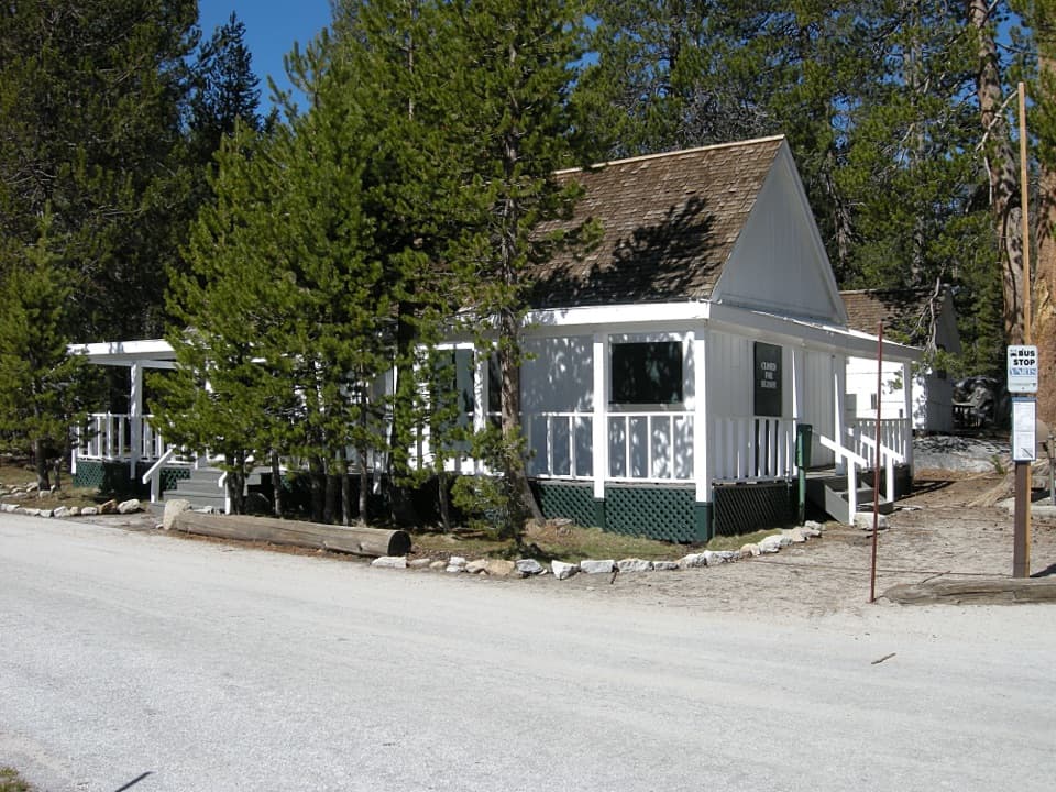
Yosemite Creek Picnic Area is a small day-use picnic spot beside Yosemite Creek, tucked under the pines. If you’re already driving Tioga Road, it makes a pleasant place to eat or pause; I wouldn’t plan a long detour around it. Parking is very limited, so be ready to keep going if the spaces are taken.

Creekside, not a big attractionThe tables sit in mixed conifer forest beside the creek.

The tables sit in mixed conifer forest beside the creek. Yosemite Creek eventually feeds Yosemite Falls, a neat connection between this quiet stop and one of the park’s major waterfalls. Bring your own food: this is a simple picnic area, with vault toilets but no grills or potable water.

Wildlife

Wildlife in Yosemite

All Yosemite wildlife maps

Sighting maps show where each species has been reported across Yosemite. Wildlife moves, so no sighting is guaranteed.

Keep exploring

Near Yosemite Creek Picnic Area

See it all on the map

Trails nearby

More stops nearby

Parkwolf’s Yosemite ranking

Top sights in Yosemite

All 99 places
  1. 1Tunnel ViewSight
  2. 2Glacier PointSight
  3. 3Yosemite FallsSight
  4. 4Half DomeSight
  5. 5Bridalveil FallSight
  6. 6El Capitan MeadowSight

Take Parkwolf to Yosemite.

The audio tour guide for the drive, plus offline maps, trails, and wildlife heatmaps for when the signal drops.

4.7 from 8,600+ ratings

Download Parkwolf on the App StoreGet Parkwolf on Google Play