Pa'rus Trail in Zion National Park

Zion National Park, UT

Pa'rus Trail

A paved riverside walk with Watchman views and shared bike traffic.

Photo: Public Domain
Length
1.6mi
Time
1hr
Elev. change
105ft
Difficulty
Easy
  • Dogs allowed
  • High point 4,045 ft
  • #19 of 54 in Zion

Hear the audio tour

Zion Canyon Visitor Center

Overview

About Pa'rus Trail

Why go

  • Paved river path with Watchman views and several bridges.
  • The only Zion trail that allows leashed pets.

Heads up

  • Shared bicycle traffic can pass quickly or close.
  • Long open stretches have little shade.

Map & elevation

The route

Loading the Zion map
Full map
Elevation3,940–4,045 ft
TrailheadPa'rus Trailhead beside South Campground37.20182, -112.98675
Keep this map with you offline in the Parkwolf app

Plan your hike

Before you go

Parking

For the south-end access, start at the Zion Canyon Visitor Center plaza (shuttle stop #1), then follow the sidewalk over the pedestrian bridge and crosswalk to the signed trail entrance beside South Campground. Canyon Junction shuttle stop #3 is the north-end access; plan a ride back or walk the route in reverse.

Safety

Bicycles share the paved path, and visitors report some quick, close passes. Long stretches have little shade in summer. The 2025 access assessment notes a maximum 11.4 percent grade and bridge decking gaps up to three inches, details mobility-device users should check before setting out.

3 active Zion alerts

  • CautionToxic cyanobacteria in Zion waterwaysDo not drink Zion in-stream water, submerge your head, or touch or ingest algae mats; cyanobacteria can produce harmful toxins.Official details
  • ClosureWatchman Trail closed for repairsWatchman Trail is closed pending repairs; do not enter the trail and choose another hike. Check current park conditions before setting out.Official details
See all 3 alerts
A park ranger sits on a dash-mounted phone, talking, as Parkwolf’s Tour Guide plays “Army Cutworm Moths: A Grizzly Bear Buffet” on Grand Loop Road below Dunraven Pass in Yellowstone
Parkwolf Tour GuideThe highest, rockiest slopes around here are a summer buffet for grizzly bears.

Zion Tour Guide

Your drive to Pa'rus Trail, narrated.

Parkwolf is a GPS audio tour guide for Zion National Park. As you drive, it chimes in with what’s ahead: hidden gems, upcoming stops, history, geology, and wildlife, right through your car’s speakers.

See the Zion audio tour

Recorded for this trailhead

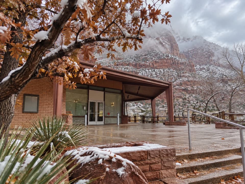
Zion Canyon Visitor Center
0:00 / 0:32
“Zion Canyon Visitor Center is ahead, where you can get ranger advice, browse the outdoor exhibits and board the canyon shuttle.”

Plays as you drive up to this trailhead in the Parkwolf Zion Tour Guide.

More stories near here in the app

  • Watchman Campground
  • Zion Nature Center
  • How a Cottonwood Gets Its Start
  • Zion Human History Museum
  • 45 audio storiesacross Zion’s roads, triggered by GPS as you drive
  • Wildlife heatmapsfor California Condor, Bighorn Sheep, Mountain Lion, and 13 more
  • Works offlinemaps, 54 trails, 36 places, and audio download before you lose signal
  • CarPlay readysimple controls built for the drive
★★★★★
“Fantastic app with many points of information… It’s great to just turn on while you’re driving and it gives you an audio tour of the national Park. We love it!!!!”
JMJamesApp Store review
Download Parkwolf on the App StoreGet Parkwolf on Google Play

4.7 from 8,600+ ratings

Trail guide

Hiking Pa'rus Trail

An easy one-way walkPa'rus Trail is a paved 1.

Pa'rus Trail is a paved 1.6-mile point-to-point walk from the signed south entrance beside South Campground to Canyon Junction. It follows the Virgin River beneath the Watchman and other canyon walls. From the Zion Canyon Visitor Center plaza, cross the footbridge and road crossing to reach the trail entrance; that short access walk is outside the mapped trail mileage. Allow about an hour each way for a relaxed walk and the interpretive stops. Walking back along the trail makes about 3.2 miles, then you still have the short approach to the Visitor Center. When the park shuttle is running, stops #1 and #3 make a one-way walk possible.

What the route feels likeThis is a riverside path rather than a climb: the paved tread runs through open meadows and…

This is a riverside path rather than a climb: the paved tread runs through open meadows and follows the river north, with five bridges carrying you over the water. The route has several river access points and trail-side exhibits. The optional unpaved connector to the Human History Museum is a separate spur around the middle of the walk, not part of this mapped route; it is not designed for wheelchairs and is not approved for bikes or pets.

Accessible, with measurements to checkThe National Park Service lists Pa'rus as accessible. Its 2025 assessment records 93.

The National Park Service lists Pa'rus as accessible. Its 2025 assessment records 93.6 percent paved surface and 6.4 percent hard wooden decking. It also notes five bridges, gaps in bridge decking up to three inches, a typical grade of 2.6 percent and a maximum grade of 11.4 percent. Those details matter if you use a wheelchair or other mobility device, so check the assessment against your own setup rather than assuming every section will feel the same. Restrooms and water refill are available at the Visitor Center.

Look for the Watchman and the riverThe Watchman is the route's strongest landmark, rising above the river corridor, and the park…

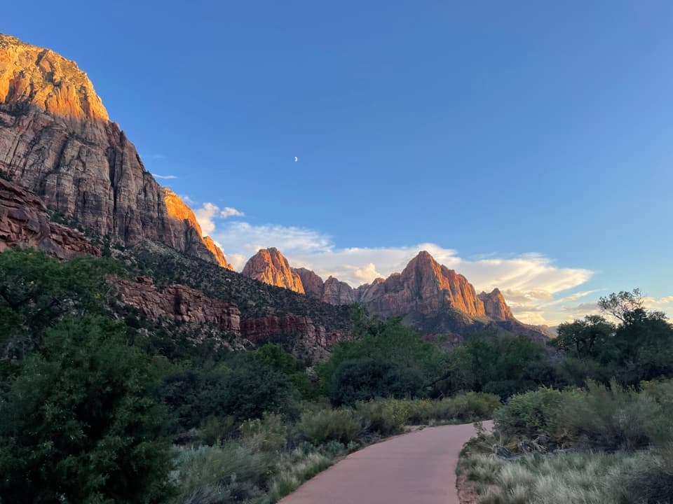
The Watchman is the route's strongest landmark, rising above the river corridor, and the park recommends the trail for sunset views and stargazing. For a trail photo, keep the curved pavement in the foreground with the Watchman behind it; that shows the walk itself as well as the canyon scale. Pa'rus means “bubbling water” in Paiute. The trail-side exhibits add context about river plants and animals, geology and human history, and deer are often seen in meadows near the path.

Bikes, dogs and open sunBicycles share the pavement with walkers.

Bicycles share the pavement with walkers. Visitors report quick, close passes, so stay alert around children and leashed dogs. Long sections have little shade, which makes the route a hot choice in summer midday; the open canyon and evening light are a better fit later in the day. Dogs are allowed on this trail on a leash no longer than six feet, but they cannot ride the park shuttle or use the museum connector.

Wildlife

Wildlife in Zion

All Zion wildlife maps

Sighting maps show where each species has been reported across Zion. Wildlife moves, so no sighting is guaranteed.

Keep exploring

Near Pa'rus Trail

See it all on the map

Trails that start nearby

Places near the trailhead

Parkwolf’s Zion ranking

Top-rated trails in Zion

All 54 trails
  1. 1Angels Landing TrailChallenging · 4.2 mi
  2. 2The Narrows from the Bottom UpChallenging · 9.4 mi
  3. 3Canyon Overlook TrailModerate · 1 mi
  4. 4East Mesa Trail to Observation PointModerate · 6.8 mi
  5. 5Left Fork (Subway) Bottom-UpChallenging · 9 mi
  6. 6West Rim Trail (Top-Down)Challenging · 14.6 mi

Take Parkwolf to Zion.

The audio tour guide for the drive, plus offline maps, trails, and wildlife heatmaps for when the signal drops.

4.7 from 8,600+ ratings

Download Parkwolf on the App StoreGet Parkwolf on Google Play