Upper Pine Creek Wash Hike in Zion National Park

Zion National Park, UT

Upper Pine Creek Wash Hike

A sandstone wash with a boulder choke and no fixed endpoint.

Length
2.8mi
Time
3hr
Elev. change
451ft
Difficulty
Moderate
  • No dogs
  • High point 5,593 ft

Hear the audio tour

Canyon Overlook

Overview

About Upper Pine Creek Wash Hike

Why go

  • A sandy wash, slickrock shelves, and tall sandstone walls in one short outing
  • No fixed endpoint, so you can turn around before the difficult upper scrambling

Heads up

  • Unmarked route with a boulder choke and a slickrock bypass to find
  • Only a few small roadside parking spaces near the drainage

Map & elevation

The route

Loading the Zion map
Full map
Elevation5,142–5,593 ft
TrailheadUpper Pine Creek crossing, Zion–Mount Carmel Highway (Route 9)37.21543, -112.93564
Keep this map with you offline in the Parkwolf app

Plan your hike

Before you go

Parking

Use a small roadside pull-off near the Upper Pine Creek crossing on Route 9, just east of Canyon Overlook. A few spaces are near Shelf Canyon and several smaller pull-offs lie east of the crossing; capacity is limited. The Canyon Overlook lot is a nearby alternative but is commonly busy, and it is not this hike’s trailhead. Walk the road carefully to reach the use path into the wash.

Safety

This is an unmarked wash route with a boulder choke and increasingly difficult scrambling upstream. Backtrack to the west-side slickrock bypass and turn around before you climb terrain you cannot safely descend. Flash floods can rush through dry washes after storms miles away; check Zion’s flash-flood potential and avoid the route when it is rated Possible or higher.

3 active Zion alerts

  • CautionLarge-vehicle limits on Zion–Mount Carmel HighwayMentions Mount Carmel Highway, referenced in this guideVehicles exceeding Zion–Mount Carmel Highway size or weight limits cannot travel between Canyon Junction and the East Entrance; measure your vehicle and plan an alternate route if it exceeds any…Official details
  • CautionToxic cyanobacteria in Zion waterwaysDo not drink Zion in-stream water, submerge your head, or touch or ingest algae mats; cyanobacteria can produce harmful toxins.Official details
See all 3 alerts
A park ranger sits on a dash-mounted phone, talking, as Parkwolf’s Tour Guide plays “Army Cutworm Moths: A Grizzly Bear Buffet” on Grand Loop Road below Dunraven Pass in Yellowstone
Parkwolf Tour GuideThe highest, rockiest slopes around here are a summer buffet for grizzly bears.

Zion Tour Guide

Your drive to Upper Pine Creek Wash Hike, narrated.

Parkwolf is a GPS audio tour guide for Zion National Park. As you drive, it chimes in with what’s ahead: hidden gems, upcoming stops, history, geology, and wildlife, right through your car’s speakers.

See the Zion audio tour

Recorded for this area

Canyon Overlook
0:00 / 0:28
“Canyon Overlook trailhead is coming up, just east of the Zion-Mount Carmel Tunnel.”

Plays on the road 0.3 mi from the trailhead in the Parkwolf Zion Tour Guide.

More stories near here in the app

  • Clear Creek Wash
  • Zion–Mount Carmel Tunnel and Great Arch
  • How the Canyon Gets Wider
  • A Desert Turned to Stone
  • 45 audio storiesacross Zion’s roads, triggered by GPS as you drive
  • Wildlife heatmapsfor California Condor, Bighorn Sheep, Mountain Lion, and 13 more
  • Works offlinemaps, 54 trails, 36 places, and audio download before you lose signal
  • CarPlay readysimple controls built for the drive
★★★★★
“Fantastic app with many points of information… It’s great to just turn on while you’re driving and it gives you an audio tour of the national Park. We love it!!!!”
JMJamesApp Store review
Download Parkwolf on the App StoreGet Parkwolf on Google Play

4.7 from 8,600+ ratings

Trail guide

Hiking Upper Pine Creek Wash Hike

What this isUpper Pine Creek is an informal out-and-back through an open sandstone wash, about 2.

Upper Pine Creek is an informal out-and-back through an open sandstone wash, about 2.8 miles round trip on the mapped itinerary. Allow 2–4 hours. The line follows the wash about 1.4 miles to a flexible turnaround and back; there is no marked trail or fixed end. Expect about 400 feet of net climb on this version. Choose it for time in a quiet canyon, not for a summit or overlook.

Where the route changesA use path drops from Route 9 to sandy streambed and slickrock; the first roughly 0.

A use path drops from Route 9 to sandy streambed and slickrock; the first roughly 0.7 mile is easy going. A boulder choke ends at a tall sandy slope. Back out of that section and use the short slickrock scramble on the west side to reach the upper drywash rather than climbing the slope. Farther up, brush and scrambling increase. Turn around while you can still reverse every move comfortably. The separate, exposed Overlooked Peak scramble adds about 1.1 miles and is not part of this hike.

The wash and its wallsThis is the open Upper Pine Creek drainage, distinct from the technical Pine Creek canyoneering…

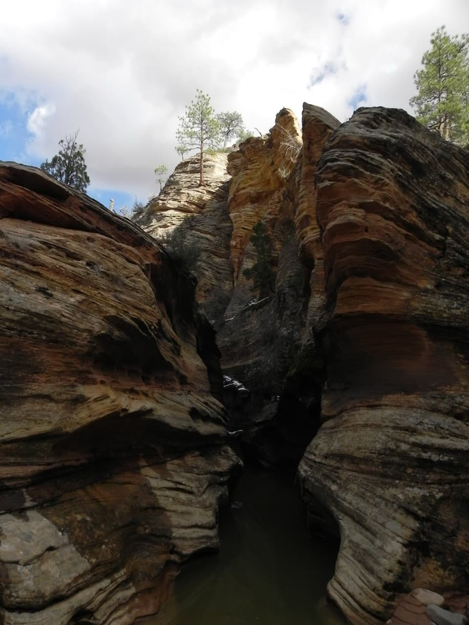
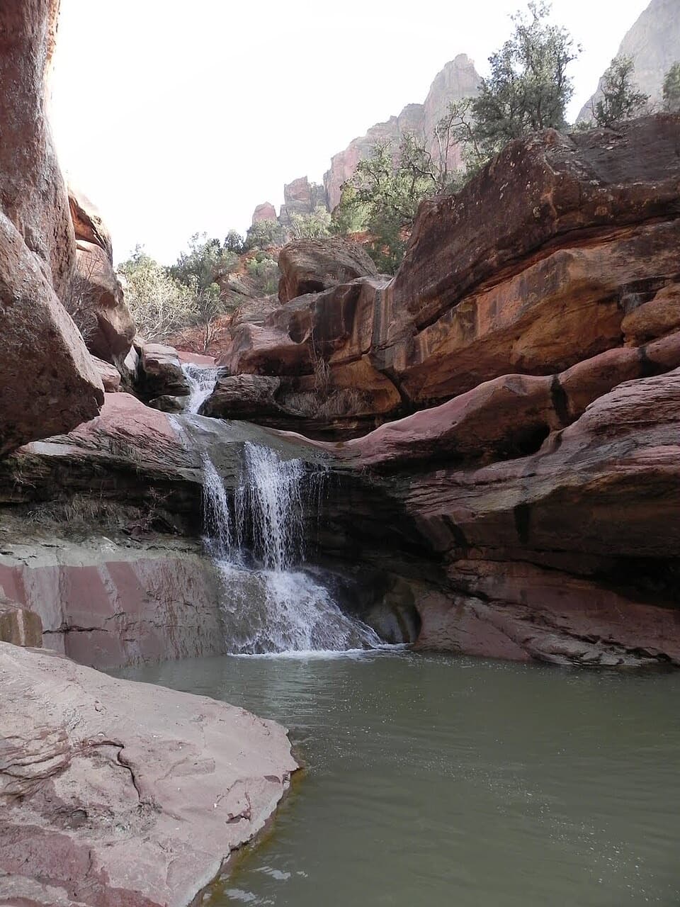
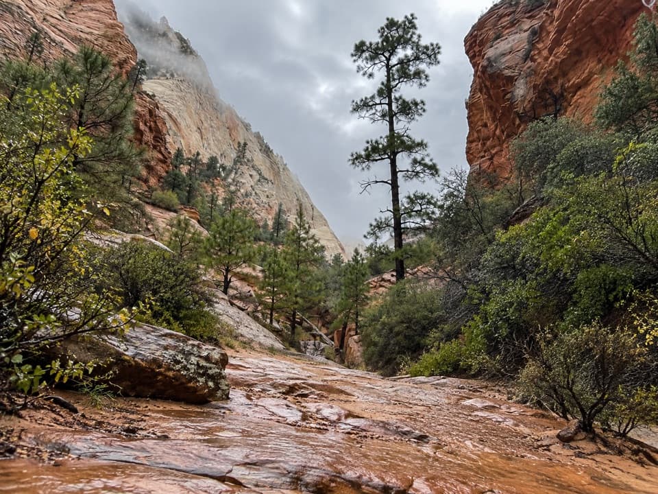
This is the open Upper Pine Creek drainage, distinct from the technical Pine Creek canyoneering route near the tunnel bridge. Sand gives way to slickrock shelves and boulders between steep sandstone walls; a small fracture-line mini-canyon and a notably flat stretch of streambed are details to watch for. The route has no single destination, and the upper section becomes less straightforward as it grows over.

Access, floods, and dogsUse one of the small roadside pull-offs near the Upper Pine Creek crossing, just east of Canyon…

Use one of the small roadside pull-offs near the Upper Pine Creek crossing, just east of Canyon Overlook. Spaces are limited; the nearby Canyon Overlook lot is often busy, and the crossing itself is not a formal trailhead. Walk along Route 9 carefully to find the use path. This route follows a dry wash: flash floods can arrive from storms miles away, even under clear skies. Check Zion’s flash-flood potential and choose another plan when it is rated Possible or higher. Dogs are not allowed on Zion trails other than Pa’rus, so leave them off this route.

Wildlife

Wildlife in Zion

All Zion wildlife maps

Sighting maps show where each species has been reported across Zion. Wildlife moves, so no sighting is guaranteed.

Keep exploring

Near Upper Pine Creek Wash Hike

See it all on the map

Trails that start nearby

Places near the trailhead

Parkwolf’s Zion ranking

Top-rated trails in Zion

All 54 trails
  1. 1Angels Landing TrailChallenging · 4.2 mi
  2. 2The Narrows from the Bottom UpChallenging · 9.4 mi
  3. 3Canyon Overlook TrailModerate · 1 mi
  4. 4East Mesa Trail to Observation PointModerate · 6.8 mi
  5. 5Left Fork (Subway) Bottom-UpChallenging · 9 mi
  6. 6West Rim Trail (Top-Down)Challenging · 14.6 mi

Take Parkwolf to Zion.

The audio tour guide for the drive, plus offline maps, trails, and wildlife heatmaps for when the signal drops.

4.7 from 8,600+ ratings

Download Parkwolf on the App StoreGet Parkwolf on Google Play