Virgin River Narrows (Top-Down) in Zion National Park

#10 of 54 trails in Zion

Zion National Park, UT

Virgin River Narrows (Top-Down)

A permit is required for this 16-mile river hike through the Narrows.

Photo: Wikimedia Commons
Length
16mi
Time
12.3hr
Elev. change
1,365ft
Difficulty
Challenging
  • No dogs
  • High point 5,851 ft
Parkwolf audio tour45 stories across Zion’s roads

Overview

About Virgin River Narrows (Top-Down)

Why go

  • The canyon changes from open upper river to the towering Wall Street corridor.
  • Big Springs and the tributary confluences make strong landmarks along a long, otherwise river-following route.

Heads up

  • Most of the route is wading over slippery river rocks and around boulders.
  • A 10 to 14 hour point-to-point day needs a wilderness permit and separately arranged transport to the remote start.

Map & elevation

The route

Loading the Zion map
Full map
Elevation4,486–5,851 ft
TrailheadChamberlain's Ranch (Zion Narrows) Trailhead37.38533, -112.83898
Keep this map with you offline in the Parkwolf app

Plan your hike

Before you go

Parking

Start at Chamberlain's Ranch (Zion Narrows) Trailhead; the park shuttle does not serve this remote access, so arrange your own ride. Finish at Temple of Sinawava, Shuttle Stop 9, and plan the return to your vehicle before starting. This is not a loop.

Best time to go

The park estimates 10 to 14 hours; its landmark schedule allows about 12 hours and 20 minutes with stops and a slower pace. River level can change both the effort and whether the route is open. Spring snowmelt can keep it closed into summer, and July through September storms bring flash-flood danger. Check the current park status and follow permit or ranger instructions before setting out; don't rely on one fixed flow number. Dogs aren't allowed. Carry safe drinking water, and don't drink from the river untreated.

Safety

Flash floods can be deadly, and a long section below Big Springs has no safe high ground. Most of the route is in variable river water over slippery rocks and boulders, with deeper sections. The Narrows closes at high flow or during flash-flood warnings; check current National Park Service status and follow permit or ranger instructions. Do not drink untreated river water. No pets.

3 active Zion alerts

  • CautionToxic cyanobacteria in Zion waterwaysDo not drink Zion in-stream water, submerge your head, or touch or ingest algae mats; cyanobacteria can produce harmful toxins.Official details
  • ClosureWatchman Trail closed for repairsWatchman Trail is closed pending repairs; do not enter the trail and choose another hike. Check current park conditions before setting out.Official details
See all 3 alerts
A park ranger sits on a dash-mounted phone, talking, as Parkwolf’s Tour Guide plays “Army Cutworm Moths: A Grizzly Bear Buffet” on Grand Loop Road below Dunraven Pass in Yellowstone
Parkwolf Tour GuideThe highest, rockiest slopes around here are a summer buffet for grizzly bears.

Zion Tour Guide

Your drive to Virgin River Narrows (Top-Down), narrated.

Parkwolf is a GPS audio tour guide for Zion National Park. As you drive, it chimes in with what’s ahead: hidden gems, upcoming stops, history, geology, and wildlife, right through your car’s speakers.

See the Zion audio tour
  • 45 audio storiesacross Zion’s roads, triggered by GPS as you drive
  • Wildlife heatmapsfor California Condor, Bighorn Sheep, Mountain Lion, and 13 more
  • Works offlinemaps, 54 trails, 36 places, and audio download before you lose signal
  • CarPlay readysimple controls built for the drive
★★★★★
“Fantastic app with many points of information… It’s great to just turn on while you’re driving and it gives you an audio tour of the national Park. We love it!!!!”
JMJamesApp Store review
Download Parkwolf on the App StoreGet Parkwolf on Google Play

4.7 from 8,600+ ratings

Trail guide

Hiking Virgin River Narrows (Top-Down)

The full through-hikeThe Virgin River Narrows (Top-Down) is a 16-mile, one-way wilderness route from Chamberlain's…

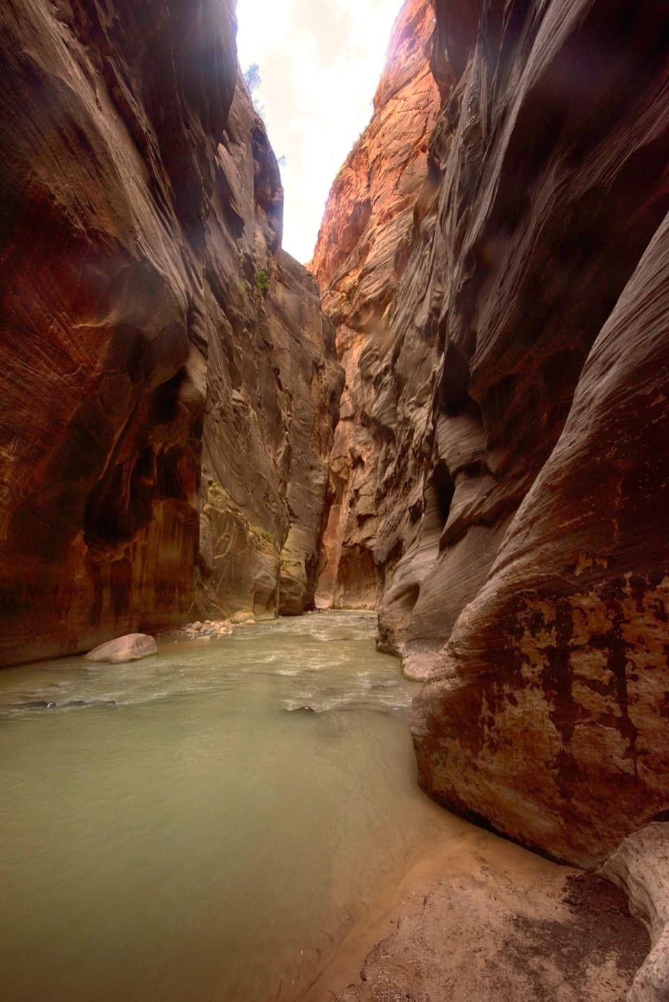
The Virgin River Narrows (Top-Down) is a 16-mile, one-way wilderness route from Chamberlain's Ranch to the Temple of Sinawava. It drops about 1,300 feet and ends on the paved Riverside Walk. This is the full river trip, not the shorter hike upstream from the Temple. Expect a 10 to 14 hour day. At least 80 percent of the route is river travel, with wading, boulder steps and deeper sections. It's for hikers ready to spend most of a long day moving through water. Use 16 miles as the published planning figure; detailed route lines can measure differently where they handle the river bends and upper approach differently.

Permits and the two endsEvery top-down trip requires a Zion Wilderness permit, including the same-day hike.

Every top-down trip requires a Zion Wilderness permit, including the same-day hike. An overnight permit allows one night in one of the designated camps, not a multi-night trip. Chamberlain's Ranch is remote, and the park's canyon shuttle does not go there, so arrange your own ride to the start. The finish is Temple of Sinawava, Shuttle Stop 9; plan how to connect back to your vehicle before starting. This is not a loop, and the start and end are far apart.

The upper North ForkThe route starts beside a small stream on open ranch country, then passes Bulloch's Cabin about…

The route starts beside a small stream on open ranch country, then passes Bulloch's Cabin about three miles in. Beyond the cabin, the road gives way to a canyon and repeated crossings of the North Fork. There's no maintained footpath for much of this hike, so use the river and its tributaries as landmarks. First Narrows is about three and a half hours from the start on the park's itinerary. At North Fork Waterfall, the apparent falls are a boulder and log jam; the narrow bypass is on the south side when facing downstream. Goose Creek's mouth is easy to miss, so pay attention at that junction.

Deep Creek and Big SpringsDeep Creek joins around mile nine.

Deep Creek joins around mile nine. The added water makes progress slower below the confluence, with more obstacles and route choices in the river. Big Springs, about 11.5 miles in, is another clear landmark: seeps and small falls spill from the wall beneath a hanging garden. Water moving through Navajo Sandstone feeds these pockets of ferns, mosses and wildflowers. Treat the spring as a landmark, not a guaranteed drinking-water stop; don't drink untreated river water.

Wall Street and the exitBelow Big Springs, Wall Street is the most enclosed stretch, with tall close walls, large…

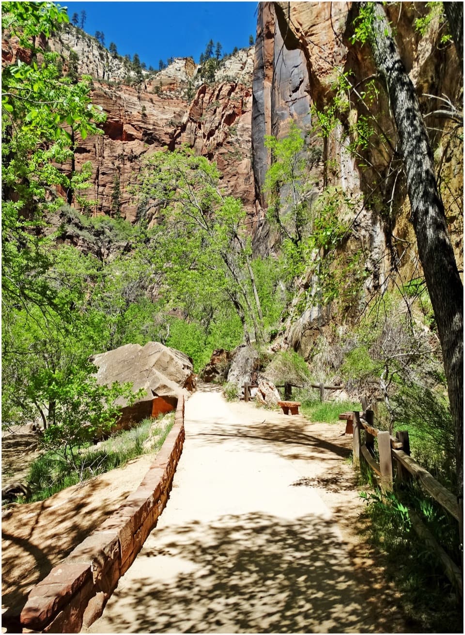
Below Big Springs, Wall Street is the most enclosed stretch, with tall close walls, large boulders and deeper water. The park map marks a long section here with no safe high ground. Orderville Canyon joins about 13.5 miles in, and the route then follows the shared lower Narrows toward Mystery Falls. You'll leave the river for the paved Riverside Walk for roughly the last mile to the Temple. The tall walls need something for scale in a photo; a person crossing the river shows their height better than a frame filled only with sandstone.

Wildlife

Wildlife in Zion

All Zion wildlife maps

Sighting maps show where each species has been reported across Zion. Wildlife moves, so no sighting is guaranteed.

Keep exploring

Near Virgin River Narrows (Top-Down)

See it all on the map

Trails that start nearby

Places near the trailhead

Parkwolf’s Zion ranking

Top-rated trails in Zion

All 54 trails
  1. 1Angels Landing TrailChallenging · 4.2 mi
  2. 2The Narrows from the Bottom UpChallenging · 9.4 mi
  3. 3Canyon Overlook TrailModerate · 1 mi
  4. 4East Mesa Trail to Observation PointModerate · 6.8 mi
  5. 5Left Fork (Subway) Bottom-UpChallenging · 9 mi
  6. 6West Rim Trail (Top-Down)Challenging · 14.6 mi

Take Parkwolf to Zion.

The audio tour guide for the drive, plus offline maps, trails, and wildlife heatmaps for when the signal drops.

4.7 from 8,600+ ratings

Download Parkwolf on the App StoreGet Parkwolf on Google Play