Cadillac Summit Loop Trail in Acadia National Park

#7 of 142 trails in Acadia

Acadia National Park, ME

Cadillac Summit Loop Trail

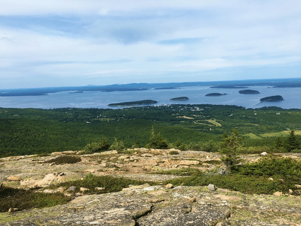
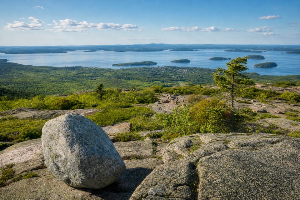
Granite underfoot, island-dotted water in every direction.

Length
0.4mi
Time
20min
Elevation
Flat
Difficulty
Easy
  • Loop
  • Dogs allowed
  • High point 1,503 ft

Hear the audio tour

Cadillac Mountain Summit

Overview

About Cadillac Summit Loop Trail

Why go

  • A short paved circuit reaches several broad summit overlooks
  • Restrooms and a gift shop sit beside the starting lot

Heads up

  • Summer parking can fill around sunrise and sunset
  • Steeper grades and steps interrupt the otherwise short walk

Map & elevation

The route

Loading the Acadia map
Full map
Elevation1,467–1,503 ft
TrailheadCadillac Summit parking area, near the summit loop entrance44.35284, -68.22447
Keep this map with you offline in the Parkwolf app

Plan your hike

Before you go

Parking

Start from the circular Cadillac Summit parking area. A timed vehicle reservation applies to Cadillac Summit Road during its seasonal reservation program, and an Acadia entrance pass is required for visitors age 16 and older. The lot is often congested and can fill around sunrise and sunset. Accessible restrooms and the gift shop are beside the lot.


Safety

The short paved circuit has steeper grades and stairs; nearby ramps bypass some steps. Check the park access map if you need a continuous step-free route. Wind, rain, fog and cold can reach the exposed summit even in summer.

4 active Acadia alerts

  • CautionAvoid water contact at Sand Beach LagoonDo not swim at Sand Beach Lagoon. - Bacterial levels have exceeded public-health standards, so the NPS has posted a Public Health Advisory.Official details
  • ClosureSchoodic Mountain Road closed for repairsSchoodic Mountain Road is closed from Schoodic Loop Road to the summit of Schoodic Head. - The closure began August 31 for resurfacing, regrading, and ditching.Official details
See all 4 alerts
A park ranger sits on a dash-mounted phone, talking, as Parkwolf’s Tour Guide plays “Army Cutworm Moths: A Grizzly Bear Buffet” on Grand Loop Road below Dunraven Pass in Yellowstone
Parkwolf Tour GuideThe highest, rockiest slopes around here are a summer buffet for grizzly bears.

Acadia Tour Guide

Your drive to Cadillac Summit Loop Trail, narrated.

Parkwolf is a GPS audio tour guide for Acadia National Park. As you drive, it chimes in with what’s ahead: hidden gems, upcoming stops, history, geology, and wildlife, right through your car’s speakers.

Recorded for this trailhead

Cadillac Mountain Summit
0:00 / 0:28
“You're approaching the summit of Cadillac Mountain, where a short walk opens up the view across Frenchman Bay and the Porcupine Islands.”

Plays as you drive up to this trailhead in the Parkwolf Acadia Tour Guide.

More stories near here in the app

  • The Chickadee’s Hidden Pantry
  • Cadillac’s Train to the Top
  • Bubble Pond and Its Rustic Bridge
  • Dorr Mountain’s Ladder Trail
  • 116 audio storiesacross Acadia’s roads, triggered by GPS as you drive
  • Wildlife heatmapsfor Bald Eagle, Peregrine Falcon, White-tailed Deer, and 13 more
  • Works offlinemaps, 142 trails, 72 places, and audio download before you lose signal
  • CarPlay readysimple controls built for the drive
★★★★★
“…As we drove through Acadia it gave us a tour, which was really cool. Lots of great info about the parks and how to avoid the crowds. It’s a great travel companion!”
MyMysteryChicaApp Store review
Download Parkwolf on the App StoreGet Parkwolf on Google Play

4.7 from 8,600+ ratings

Trail guide

Hiking Cadillac Summit Loop Trail

A short circuit at the topCadillac Summit Loop is a 0.

Cadillac Summit Loop is a 0.4-mile circuit around the exposed top of Cadillac Mountain, starting beside the summit parking area. It is the easy way to get out and walk at the summit without taking one of Cadillac’s longer ridge hikes. Expect about 15–20 minutes of walking, or half an hour and more if you linger at the overlooks and waysides. The route brings you over open granite and paved walkway to broad views of Frenchman Bay, the Porcupine Islands and the Downeast coast.

How the loop feels underfootThe path makes a compact circuit among the summit viewing platforms.

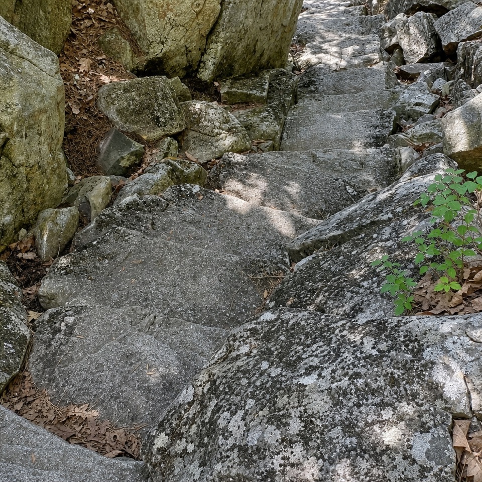
The path makes a compact circuit among the summit viewing platforms. Much of it is paved, with short sections that cross granite or gravel. It alternates flatter stretches with steeper grades and stair sections, so it is more than a level stroll even though the distance is short. Ramped paths nearby bypass some steps; the usual mapped circuit still includes stairs. If you need a continuous step-free route, check the park’s access map before setting out. Wayside displays along the walk explain the summit’s natural features.

Take in the island viewsThe views open across the walk rather than arriving only at one distant destination.

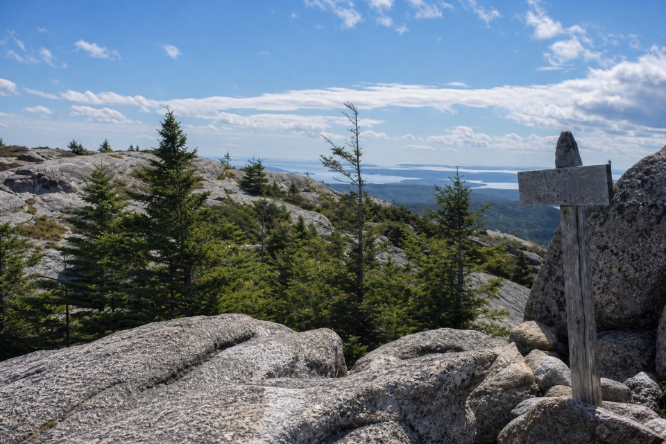
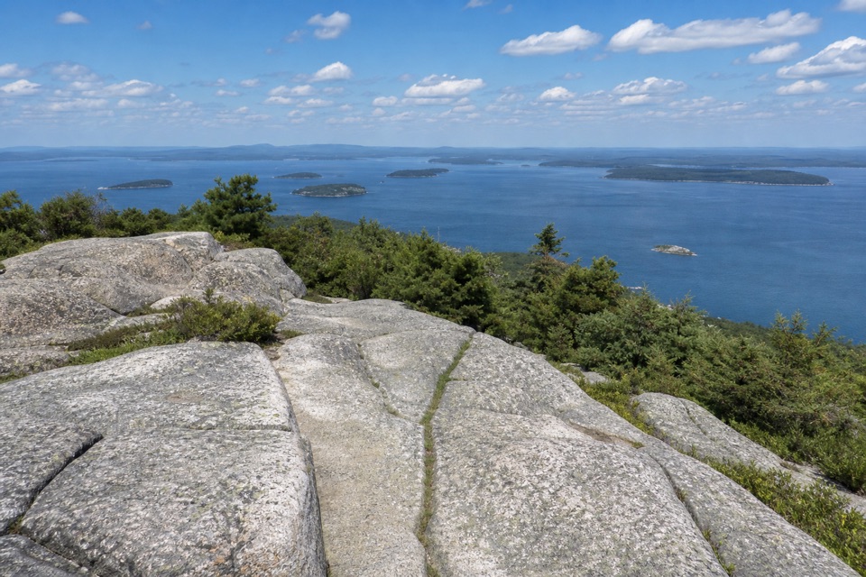
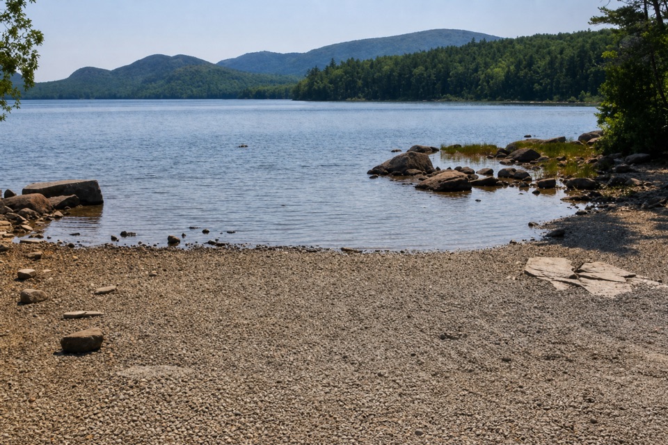
The views open across the walk rather than arriving only at one distant destination. From the granite and gravel platforms, look across Frenchman Bay to the Porcupine Islands and the mainland coast; the open summit also gives a wide look at Acadia’s surrounding mountains. For a photo, put an exposed slab of granite in the foreground and the islands across the water behind it. That gives the picture a sense of the summit’s bare, rocky setting as well as the view.

A small alpine landscapeThe summit is an exposed, glaciated granite landscape with shallow soil.

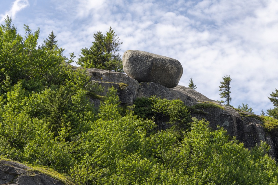
The summit is an exposed, glaciated granite landscape with shallow soil. Small plants make use of the cracks and hollows: sub-arctic three-toothed cinquefoil grows in dry crevices, while blueberries and birches appear in moister pockets. These plants are easy to miss beside the broad panorama and particularly easy to damage, so stay on the marked walkway and granite platforms rather than cutting across the vegetation. The waysides help explain why the summit’s plant life stays low and patchy.

Markers on the mountainPeople have come to this Wabanaki homeland for the mountain’s views over thousands of years.

People have come to this Wabanaki homeland for the mountain’s views over thousands of years. Cadillac was once called Green Mountain, and by the late 1800s its summit had become a destination for visitors. Look for survey markers dating to 1856 and 1954, and the site of a summit hotel that stood in the 1880s. The present road to the top was built between 1924 and 1931, changing the summit visit from a climb into a short walk for many people. Between October 7 and March 6, Cadillac is also the first place in the country to see the sunrise.

Plan the summit stopStart at the circular summit lot.

Start at the circular summit lot. A timed vehicle reservation is required to drive Cadillac Summit Road during its seasonal program, roughly mid-May through mid-October; check the current dates before you go. Visitors age 16 and older also need an Acadia entrance pass. The walk has no separate activity fee. Parking is often congested in summer and can fill around sunrise and sunset. Accessible restrooms and a gift shop are next to the lot. Dogs may join on a leash no longer than six feet. Wind, fog, rain or cold can reach the open summit even in summer, so bring a layer and be ready for less visibility than you have below.

Wildlife

Wildlife in Acadia

All Acadia wildlife maps

Sighting maps show where each species has been reported across Acadia. Wildlife moves, so no sighting is guaranteed.

Keep exploring

Near Cadillac Summit Loop Trail

See it all on the map

Trails that start nearby

Places near the trailhead

Parkwolf’s Acadia ranking

Top-rated trails in Acadia

All 142 trails
  1. 1Beehive Loop TrailChallenging · 1.4 mi
  2. 2Precipice TrailChallenging · 2.1 mi
  3. 3Jordan Pond PathModerate · 3.3 mi
  4. 4Bubbles TrailModerate · 1.5 mi
  5. 5Ocean PathEasy · 2.2 mi
  6. 6Cadillac Mountain South Ridge TrailChallenging · 7.8 mi

Take Parkwolf to Acadia.

The audio tour guide for the drive, plus offline maps, trails, and wildlife heatmaps for when the signal drops.

4.7 from 8,600+ ratings

Download Parkwolf on the App StoreGet Parkwolf on Google Play