Maple Spring Trail in Acadia National Park

Acadia National Park, ME

Maple Spring Trail

A steep brookside gorge with historic stonework and rebuilt bridges

Length
1.4mi
Time
1.8hr
Elev. change
988ft
Difficulty
Challenging
  • Dogs allowed
  • High point 1,286 ft
  • #65 of 142 in Acadia

Hear the audio tour

Norumbega Access to Bald Peak

Overview

About Maple Spring Trail

Why go

  • Follows a brook through a steep stone gorge with cascades
  • Historic masonry meets rebuilt bridges and boardwalk

Heads up

  • About 980 feet of climbing in just 1.4 miles
  • Point-to-point logistics; the lower road entrance is not signed

Map & elevation

The route

Loading the Acadia map
Full map
Elevation298–1,286 ft
TrailheadLower Maple Spring Trail at Hadlock Brook junction44.32767, -68.28490
Keep this map with you offline in the Parkwolf app

Plan your hike

Before you go

Parking

Use the roadside Giant Slide access on ME Route 198, about one mile south of ME Route 233; the National Park Service says parking is along the road and there is no road sign. The mapped Maple Spring segment starts at the lower Hadlock Brook junction nearby, but the precise pullout-to-junction connection is not pinned. Follow the marked public access and stay off private property.

Safety

This is a steep, rough climb with stone steps and bedrock. Wet streamside rock and condensation in the cool ravine can make footing slippery. The adjacent Giant Slide access begins on private land, so remain on the marked public trail and respect landowners. Dogs are allowed on a leash no longer than six feet; this steep, rocky route may be a poor fit for dogs that struggle with uneven footing.

3 active Acadia alerts

  • ClosureSouthern Ocean Path section closed for repairsThe southern section of Ocean Path is closed for repairs from the trailhead across from the Otter Point parking lot to the trail’s southern terminus.Official details
  • ClosureSchoodic Mountain Road closed for repairsSchoodic Mountain Road is closed for repairs from Schoodic Loop Road to the summit of Schoodic Head.Official details
See all 3 alerts
A park ranger sits on a dash-mounted phone, talking, as Parkwolf’s Tour Guide plays “Army Cutworm Moths: A Grizzly Bear Buffet” on Grand Loop Road below Dunraven Pass in Yellowstone
Parkwolf Tour GuideThe highest, rockiest slopes around here are a summer buffet for grizzly bears.

Acadia Tour Guide

Your drive to Maple Spring Trail, narrated.

Parkwolf is a GPS audio tour guide for Acadia National Park. As you drive, it chimes in with what’s ahead: hidden gems, upcoming stops, history, geology, and wildlife, right through your car’s speakers.

See the Acadia audio tour

Recorded for this area

Norumbega Access to Bald Peak
0:00 / 0:25
“You're nearing the Norumbega roadside trail access, where I'd choose the Bald Peak and Parkman Mountain loop for two open summits.”

Plays on the road 0.3 mi from the trailhead in the Parkwolf Acadia Tour Guide.

More stories near here in the app

  • Parkman Access to the Carriage Roads
  • The Life on the Rocks
  • Brown Mountain Gatehouse and Its Bells
  • The Periwinkle's Toothed Tongue
  • 116 audio storiesacross Acadia’s roads, triggered by GPS as you drive
  • Wildlife heatmapsfor Bald Eagle, Peregrine Falcon, White-tailed Deer, and 13 more
  • Works offlinemaps, 142 trails, 72 places, and audio download before you lose signal
  • CarPlay readysimple controls built for the drive
★★★★★
“…As we drove through Acadia it gave us a tour, which was really cool. Lots of great info about the parks and how to avoid the crowds. It’s a great travel companion!”
MyMysteryChicaApp Store review
Download Parkwolf on the App StoreGet Parkwolf on Google Play

4.7 from 8,600+ ratings

Trail guide

Hiking Maple Spring Trail

A hard, one-way climbMaple Spring Trail is the 1.

Maple Spring Trail is the 1.4-mile point-to-point climb from the lower Hadlock Brook junction to the Sargent South Ridge Trail. It follows Maple Spring Brook through a steep gorge between Gilmore Peak and Sargent Mountain. The mapped line measures 1.39 miles, and the route gains about 980 feet. Allow roughly 1¾ to 2 hours uphill. This is a connector, not a loop, and it ends below Sargent's summit. Continue on the ridge network, arrange a pickup, or return by the same path for about 2.8 miles round trip.

Down the brookside ravineThe trail tracks the stream beneath tall forest, then works through a narrow stone gorge with…

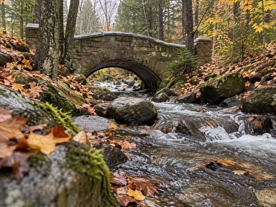
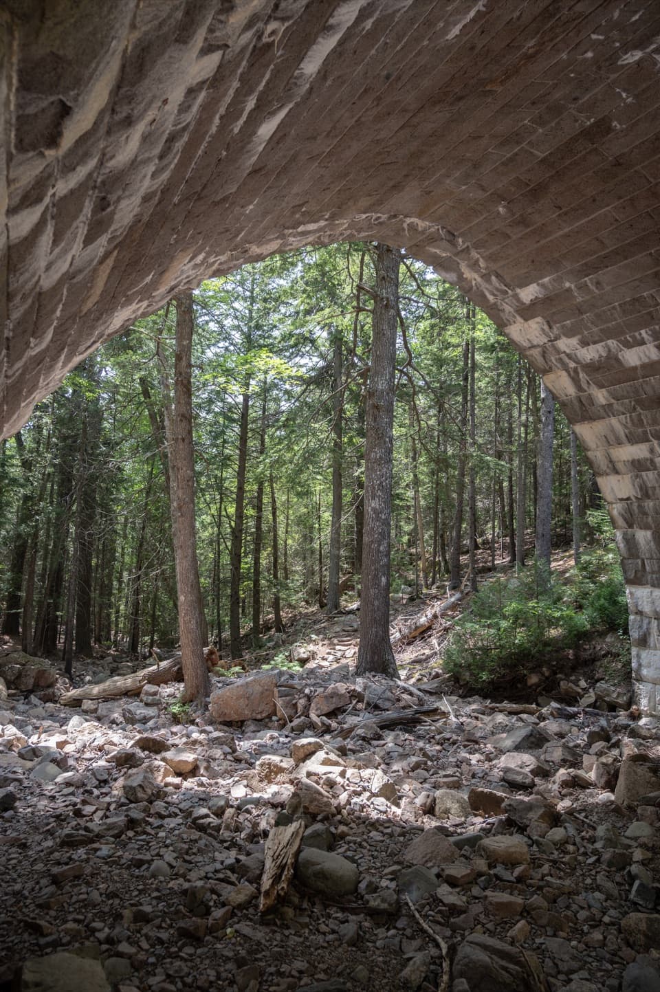
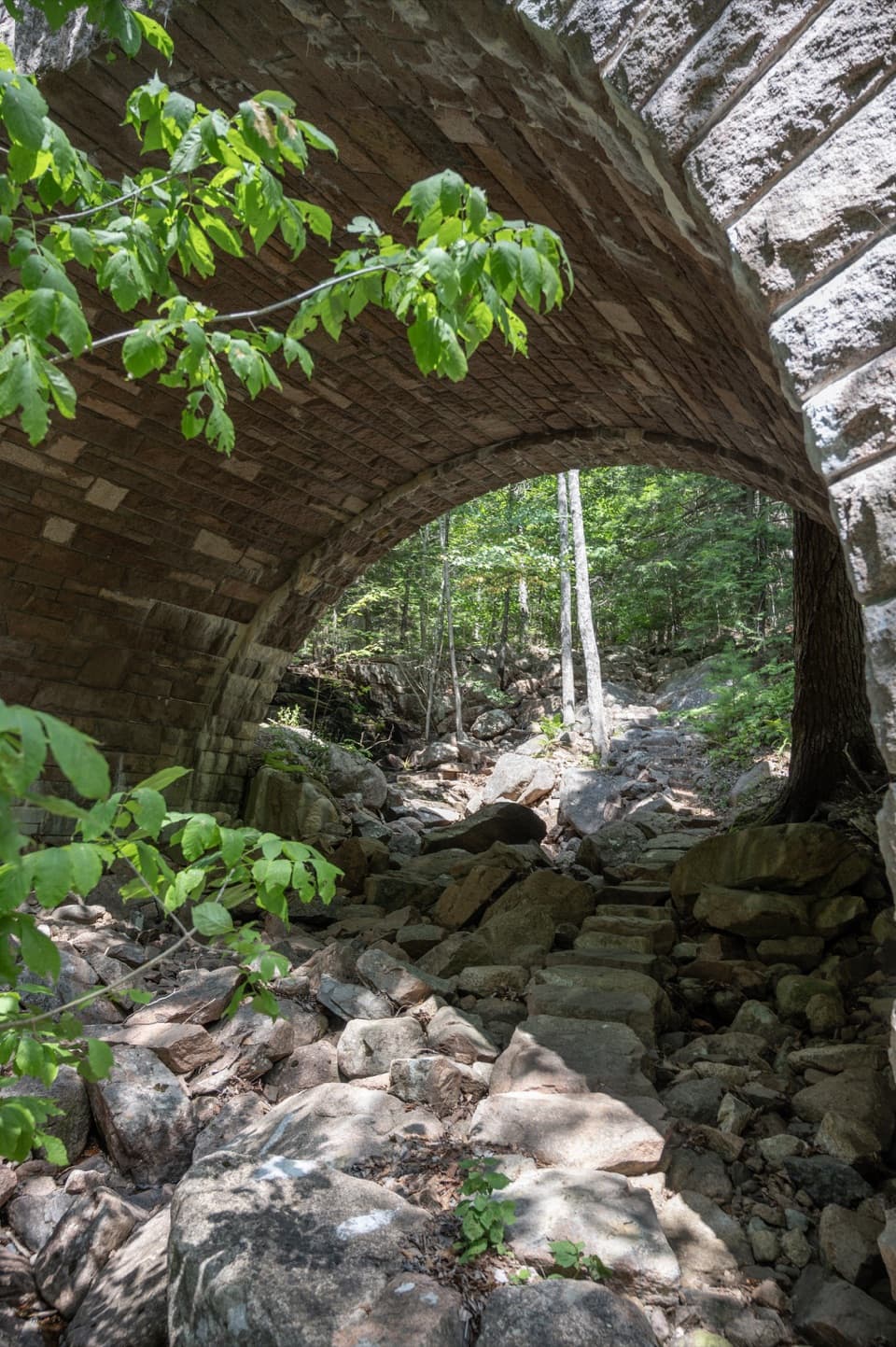
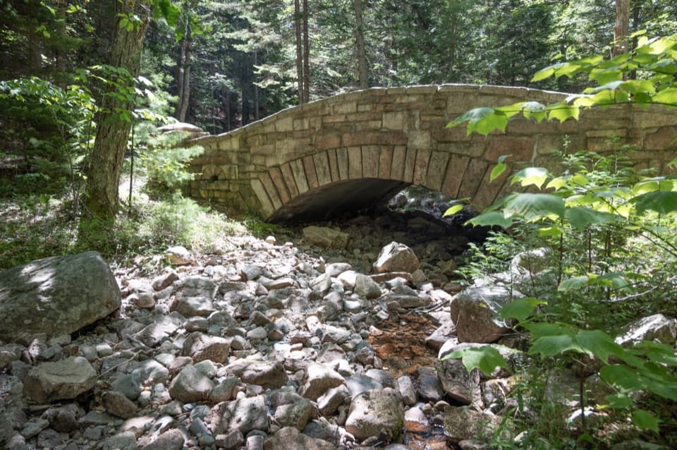
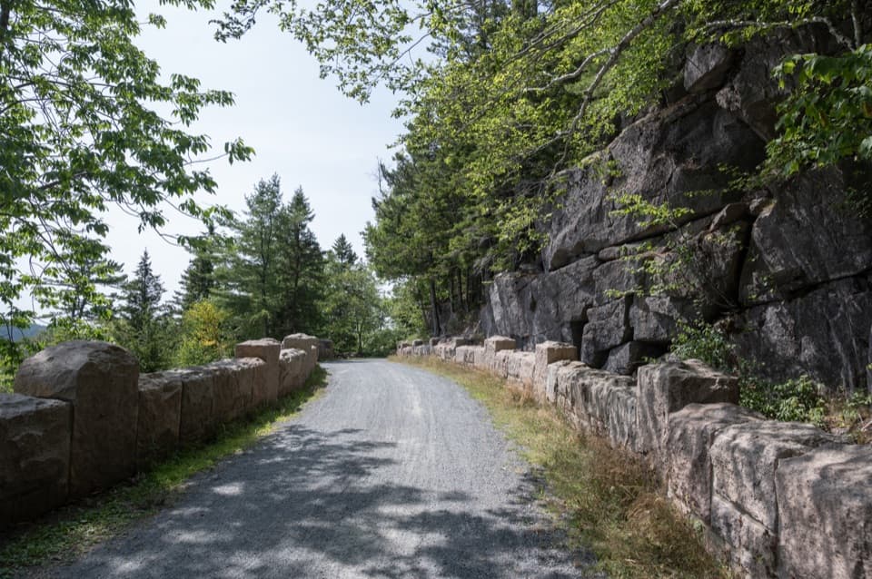
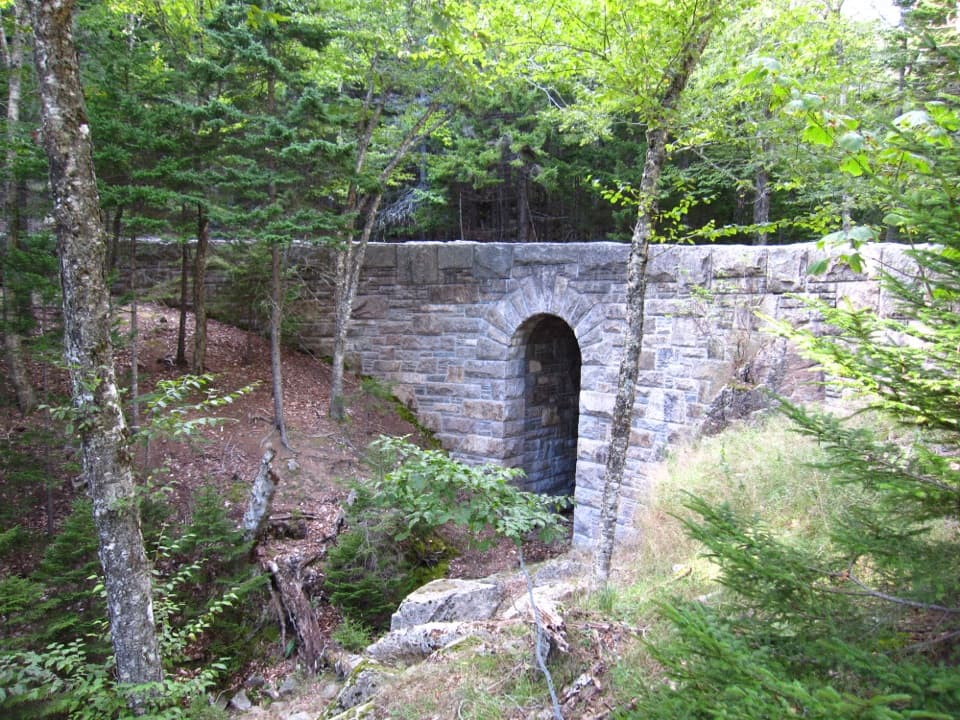
The trail tracks the stream beneath tall forest, then works through a narrow stone gorge with cascades and the rock feature called Pulpit Rock. The footing changes between old stone steps, bedrock, uneven paving and newer wooden bridges and boardwalk. The route stays close to the water, so wet streamside rock and condensation in the cool ravine can make footing slippery. At the boardwalk, include the brook and gorge walls in a photo to show how tightly the path follows the stream.

A trail with visible historyMaple Spring Trail was built in 1871 as an ascent of Sargent's South Ridge.

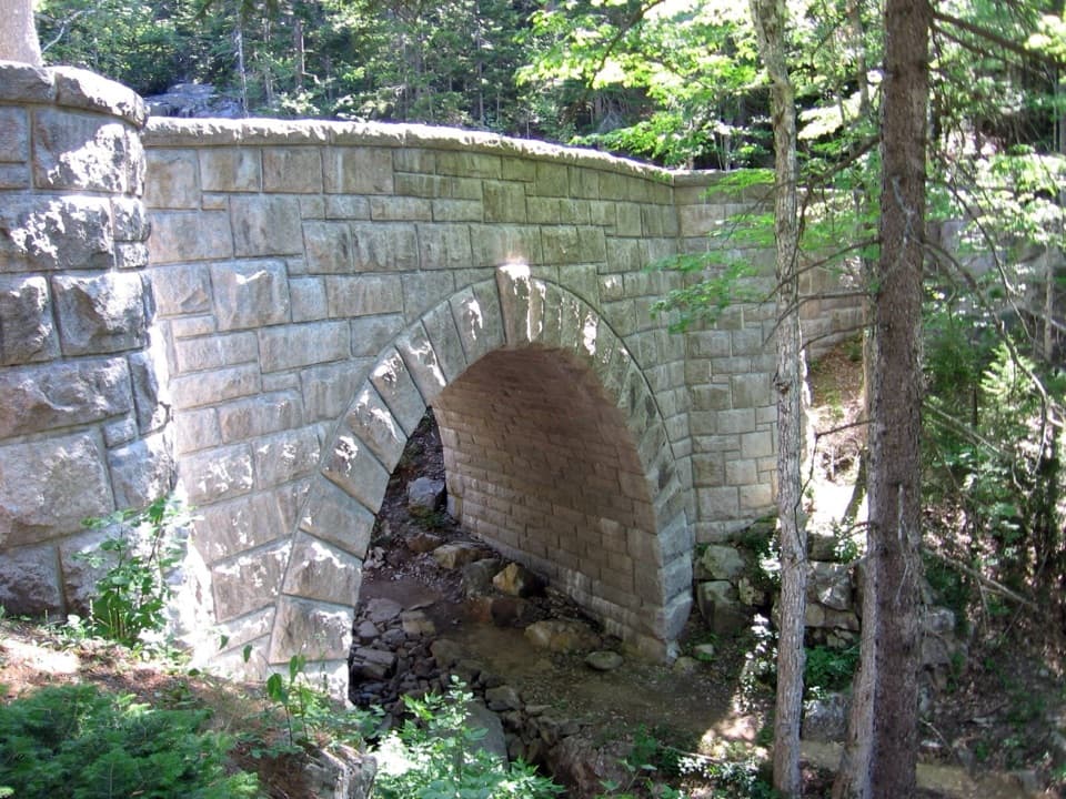
Maple Spring Trail was built in 1871 as an ascent of Sargent's South Ridge. Its stone steps, rubble walls and patio-stone paving are part of Mount Desert Island's historic trail network. A 2021 storm tore up about a quarter mile between Hemlock Bridge and the Giant Slide junction. The feature-by-feature repairs retained sound historic stonework and used a taller bridge, wood-and-stone steps, an elevated boardwalk, a short bridge and a steel handrail where the stream bank and trail had been undermined. Look for the places where old paving meets newer woodwork.

Access and trail mannersThe National Park Service directs drivers to the shared Giant Slide roadside access on ME 198,…

The National Park Service directs drivers to the shared Giant Slide roadside access on ME 198, about a mile south of ME 233. Parking is along the road, and there is no road sign; the mapped Maple Spring segment starts at the lower Hadlock Brook junction nearby. The exact pullout-to-junction connection is not clearly pinned, so check the marked public access and stay off private property. Dogs are allowed on a leash no longer than six feet; consider whether your dog can handle the steep, rocky footing. The shared trailhead has no accessible restroom.

Wildlife

Wildlife in Acadia

All Acadia wildlife maps

Sighting maps show where each species has been reported across Acadia. Wildlife moves, so no sighting is guaranteed.

Keep exploring

Near Maple Spring Trail

See it all on the map

Trails that start nearby

Places near the trailhead

Parkwolf’s Acadia ranking

Top-rated trails in Acadia

All 142 trails
  1. 1Beehive Loop TrailChallenging · 1.4 mi
  2. 2Precipice TrailChallenging · 2.1 mi
  3. 3Jordan Pond PathModerate · 3.3 mi
  4. 4Bubbles TrailModerate · 1.5 mi
  5. 5Ocean PathEasy · 2.2 mi
  6. 6Cadillac Mountain South Ridge TrailChallenging · 7.8 mi

Take Parkwolf to Acadia.

The audio tour guide for the drive, plus offline maps, trails, and wildlife heatmaps for when the signal drops.

4.7 from 8,600+ ratings

Download Parkwolf on the App StoreGet Parkwolf on Google Play