Helen Lake Trail in Banff National Park

#15 of 162 trails in Banff

Banff National Park, AB

Helen Lake Trail

A rooty climb earns glacier views before a modest alpine lake.

Photo: Flickr
Length
11.7km
Time
4.5hr
Elev. change
412m
Difficulty
Moderate
  • Dogs allowed
  • High point 2,389 m

Hear the audio tour

Helen Lake and the Cirque Peak Choice

Overview

About Helen Lake Trail

Why go

  • Bow Lake and Crowfoot Glacier views arrive before the lake.
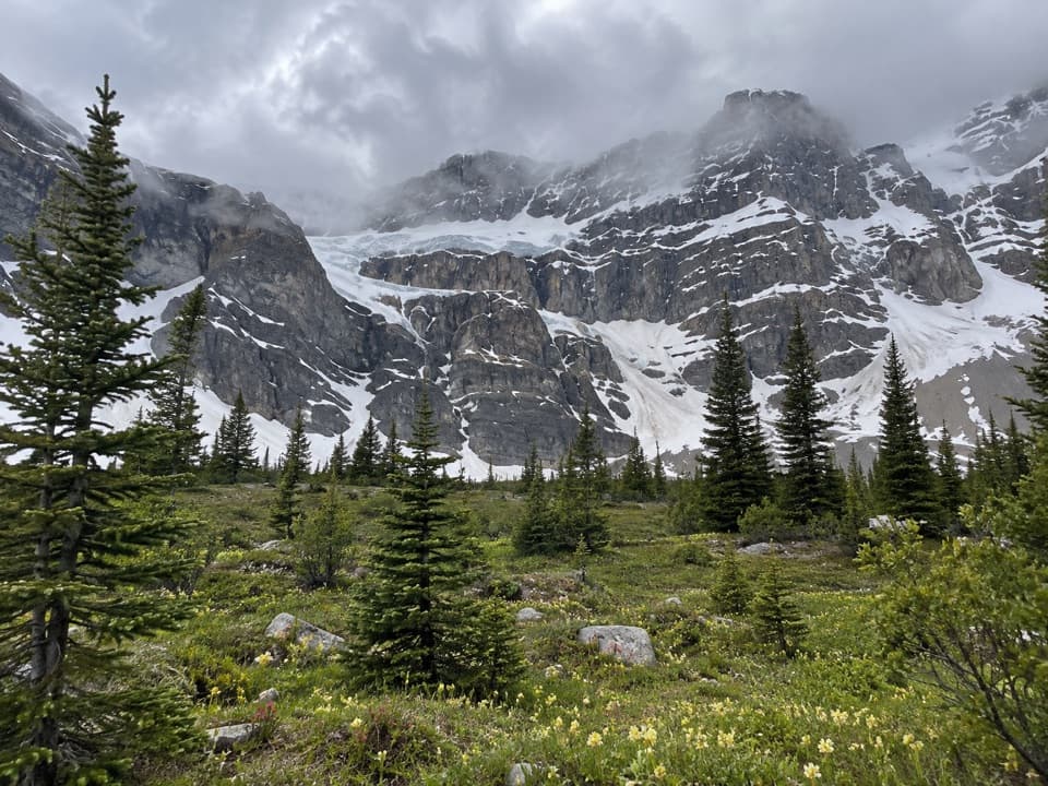
  • The open, flower-rich meadow breaks up the rooty forest climb.

Heads up

  • The first half is a long climb over exposed roots.
  • Helen Lake is smaller than many hikers expect.

Map & elevation

The route

Loading the Banff map
Full map
Elevation1,977–2,389 m
TrailheadHelen Lake Trailhead parking area51.66404, -116.43856
Keep this map with you offline in the Parkwolf app

Plan your hike

Before you go

Parking

Start at the Helen Lake parking area on the Icefields Parkway; the path begins at the lot’s north end. The lot is small for summer demand, and the nearby Crowfoot Glacier Viewpoint lot is sometimes used as overflow, but space is not guaranteed.

Safety

Exposed roots, uneven rock and small creek crossings require careful footing; rain can leave the trail muddy. The upper meadow is open to alpine weather, and cell service is unreliable. The Cirque Peak scramble continues beyond Helen Lake and is a much harder route.

8 active Banff alerts

  • ClosureJohnston Canyon Trail and Day Use Area closedJohnston Canyon Trail and Day Use Area are closed to all traffic and travel through December 11, 2026, because construction work requires protecting public and workers’ safety.Official details
  • ClosureBaker Lake and Hidden Lake campgrounds closed to campingCamping is prohibited at Baker Lake and Hidden Lake campgrounds through December 1, 2026, because a grizzly bear entered campsites and investigated tents and gear; the closures reduce risk to…Official details
See all 8 alerts
A park ranger sits on a dash-mounted phone, talking, as Parkwolf’s Tour Guide plays “Army Cutworm Moths: A Grizzly Bear Buffet” on Grand Loop Road below Dunraven Pass in Yellowstone
Parkwolf Tour GuideThe highest, rockiest slopes around here are a summer buffet for grizzly bears.

Banff Tour Guide

Your drive to Helen Lake Trail, narrated.

Parkwolf is a GPS audio tour guide for Banff National Park. As you drive, it chimes in with what’s ahead: hidden gems, upcoming stops, history, geology, and wildlife, right through your car’s speakers.

See the Banff audio tour

Recorded for this trailhead

Helen Lake and the Cirque Peak Choice
0:00 / 0:27
“Helen Lake trailhead is coming up, for a four-to-five-hour mountain walk through forest and alpine meadows. The lake is modest; I'd choose this hike for the views of Bow Lake and Crowfoot Glacier along the way.”

Plays as you drive up to this trailhead in the Parkwolf Banff Tour Guide.

More stories near here in the app

  • Crowfoot Glacier and Its Missing Toe
  • Bow Lake Picnic Site: Follow the Road Down
  • The Living Colour on the Rocks
  • Bow Lake: North Shore and a Café Stop
  • 185 audio storiesacross Banff’s roads, triggered by GPS as you drive
  • Wildlife heatmapsfor Grizzly Bear, Brown Bear, Gray Wolf, and 13 more
  • Works offlinemaps, 162 trails, 90 places, and audio download before you lose signal
  • CarPlay readysimple controls built for the drive
★★★★★
“…Loved the commentary as you drove thru. I’m sure the app can do more than I know but the tips were very helpful. I’m gonna use it when we go to Banff next month.”
tesja22App Store review
Download Parkwolf on the App StoreGet Parkwolf on Google Play

4.7 from 8,600+ ratings

Trail guide

Hiking Helen Lake Trail

Is Helen Lake the right hike?Helen Lake Trail is an 11.7 km (7.

Helen Lake Trail is an 11.7 km (7.3 mi) out-and-back from the Helen Lake parking area on the Icefields Parkway, with the lake as the turnaround. Allow four to five hours. A sustained climb through rooted forest eventually opens into alpine meadow, with Bow Lake, Crowfoot Glacier and several peaks appearing well before the lake. If you want a full mountain walk with changing views, the route earns its length. If the lake itself is your main reason to go, temper expectations: Helen Lake is modest, and the scenery along the way is the bigger reward.

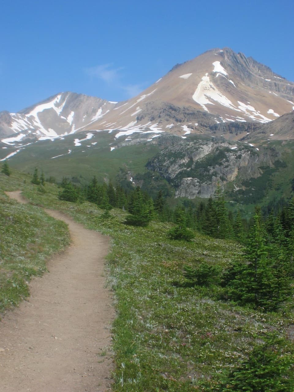
The climb through the treesThe path starts at the north end of the parking area and climbs almost immediately through…

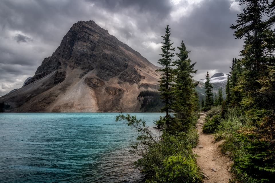
The path starts at the north end of the parking area and climbs almost immediately through conifer forest. It is broad but uneven, with many exposed roots and stretches of rock. The grade eases briefly after the first few hundred metres, then steepens as the trail works around the southeast shoulder of Crystal Ridge. Small creeks cross the path; one is easy to step over, while another has stones to use as stepping points. Rain can leave the roots and lower trail muddy, so take care on the descent as well as the climb.

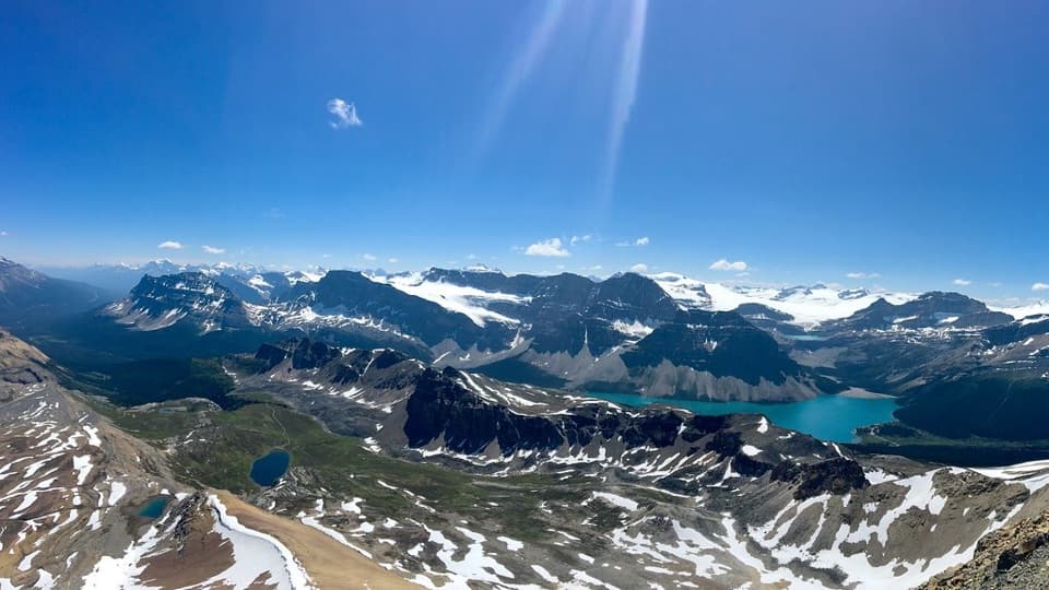
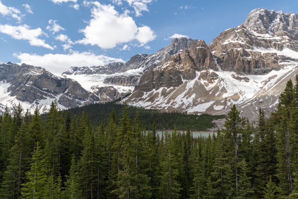
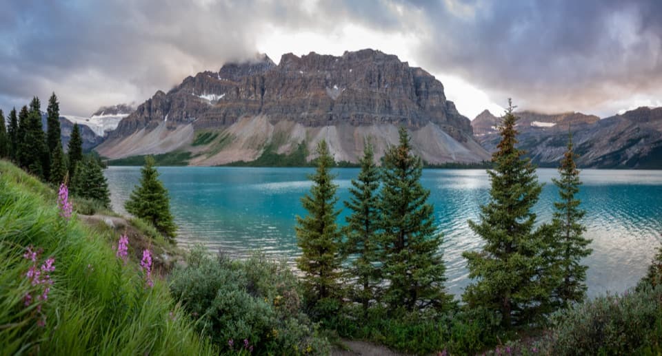
Bow Lake and Crowfoot GlacierViews of Bow Lake and Crowfoot Glacier begin to show through the trees as you gain height.

Views of Bow Lake and Crowfoot Glacier begin to show through the trees as you gain height. A clearing roughly 2 to 2.5 km from the start gives the broadest early panorama. Pause there and look back over the lake; it is the best place on this section to frame the water with the glacier and surrounding peaks. Around 3 km, the trail rounds Crystal Ridge's shoulder and the view turns toward Hector Peak and Mount Andromache. That change of direction marks the shift from the steepest forested stretch to more open walking.

The upper meadow and lakeBeyond the shoulder, the trail is gentler and more open.

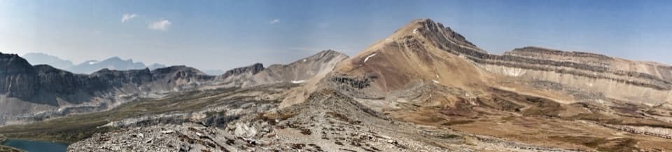
Beyond the shoulder, the trail is gentler and more open. Dolomite Peak stands to the east, while Cirque Peak comes into view ahead. You may hear a waterfall before reaching the river and small cascade near the 5 km mark; a bridge crosses the stream. After that, the final approach winds through nearly treeless alpine meadow beneath Cirque Peak's colored rock bands. Wildflowers can be abundant in late July, but the timing varies with elevation and year. At about 5.9 km one way, Helen Lake sits in grassy meadow below the peak, with a rocky rise along its far side. It is a good place to rest and eat before retracing the route.

Access and where the route endsA valid Parks Canada pass is required for park access, and dogs may accompany hikers on leash.

A valid Parks Canada pass is required for park access, and dogs may accompany hikers on leash. The Helen Lake parking area is small for a popular summer trail; a nearby Crowfoot Glacier Viewpoint lot is sometimes used when it fills, though space there is not guaranteed. Expect lingering snow or muddy tread in early summer; alpine routes generally become more reliable from mid-July through mid-September. Cell service is unreliable along this stretch of the Parkway. The mapped hike ends at Helen Lake. Cirque Peak rises above it, but continuing to the summit is a separate, much harder scramble and is not included in this distance.

Wildlife

Wildlife in Banff

All Banff wildlife maps

Sighting maps show where each species has been reported across Banff. Wildlife moves, so no sighting is guaranteed.

Keep exploring

Near Helen Lake Trail

See it all on the map

Trails that start nearby

Places near the trailhead

Parkwolf’s Banff ranking

Top-rated trails in Banff

All 162 trails
  1. 1Sentinel Pass via Larch Valley TrailChallenging · 11.2 km
  2. 2Plain of Six Glaciers TrailModerate · 11.6 km
  3. 3Lake Agnes TrailModerate · 7.8 km
  4. 4Johnston Canyon Trail to Upper FallsEasy · 4.8 km
  5. 5Larch Valley / Minnestimma Lakes TrailModerate · 9 km
  6. 6Parker Ridge TrailModerate · 5.6 km

Take Parkwolf to Banff.

The audio tour guide for the drive, plus offline maps, trails, and wildlife heatmaps for when the signal drops.

4.7 from 8,600+ ratings

Download Parkwolf on the App StoreGet Parkwolf on Google Play