Rock Isle Lake Trail in Banff National Park

Banff National Park, AB

Rock Isle Lake Trail

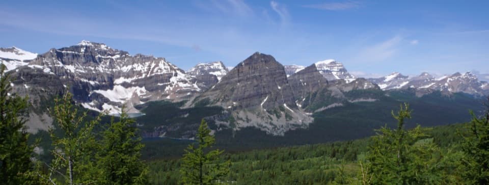
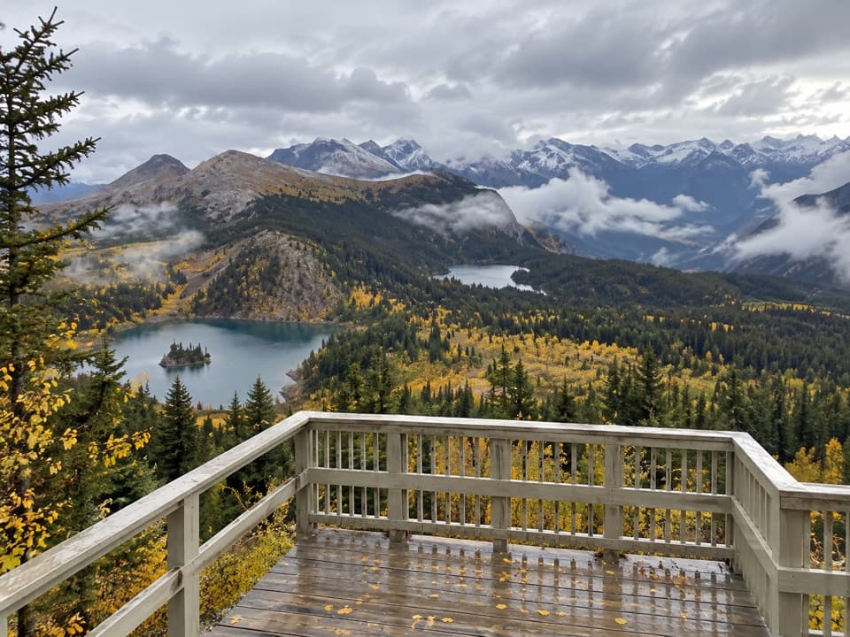
Cross the Divide for a close view of the lake’s wooded island.

Photo: Wikimedia Commons
Length
4km
Time
2hr
Elev. change
98m
Difficulty
Moderate
  • Dogs allowed
  • High point 2,284 m
  • #28 of 162 in Banff

Hear the audio tour

Sunshine Village: Lifts to the Meadows

Overview

About Rock Isle Lake Trail

Why go

  • A wooded island gives the lake viewpoint a clear focal point.
  • The shorter route reaches the alpine scenery without taking on the whole network.

Heads up

  • Reaching the upper village depends on the seasonal gondola or shuttle.

Map & elevation

The route

Loading the Banff map
Full map
Elevation2,186–2,284 m
TrailheadRock Isle Road trail access, Sunshine Village upper village51.07763, -115.78223
Keep this map with you offline in the Parkwolf app

Plan your hike

Before you go

Parking

Use the Sunshine Village base lot off Sunshine Village Access Road; parking is a mix of paved and unlined gravel. The upper trailhead is reached by seasonal gondola or Sunshine shuttle. Flush toilets are at the base lot; capacity and fees were not found.

Safety

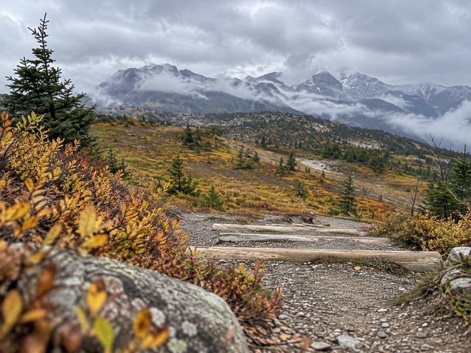
The route includes four wooden cylinder steps up to 15 cm high about 200 m from the start and uneven gravel footing. Stay on the marked route and boardwalk to protect the fragile alpine meadow. Dogs must stay leashed and under physical control.

8 active Banff alerts

  • ClosureJohnston Canyon Trail and Day Use Area closedJohnston Canyon Trail and Day Use Area are closed to all traffic and travel through December 11, 2026, because construction work requires protecting public and workers’ safety.Official details
  • ClosureBaker Lake and Hidden Lake campgrounds closed to campingCamping is prohibited at Baker Lake and Hidden Lake campgrounds through December 1, 2026, because a grizzly bear entered campsites and investigated tents and gear; the closures reduce risk to…Official details
See all 8 alerts
A park ranger sits on a dash-mounted phone, talking, as Parkwolf’s Tour Guide plays “Army Cutworm Moths: A Grizzly Bear Buffet” on Grand Loop Road below Dunraven Pass in Yellowstone
Parkwolf Tour GuideThe highest, rockiest slopes around here are a summer buffet for grizzly bears.

Banff Tour Guide

Your drive to Rock Isle Lake Trail, narrated.

Parkwolf is a GPS audio tour guide for Banff National Park. As you drive, it chimes in with what’s ahead: hidden gems, upcoming stops, history, geology, and wildlife, right through your car’s speakers.

See the Banff audio tour

Recorded for this trailhead

Sunshine Village: Lifts to the Meadows
0:00 / 0:35
“You're approaching the gondola base for Sunshine Village. In summer, take the gondola and Standish chairlift for high meadows and a short walk to a deck overlooking alpine lakes.”

Plays as you drive up to this trailhead in the Parkwolf Banff Tour Guide.

More stories near here in the app

  • The Grouse That Grows a Bigger Gut
  • Two Ways to Ice a Branch
  • The Rectangular Holes in the Tree
  • 185 audio storiesacross Banff’s roads, triggered by GPS as you drive
  • Wildlife heatmapsfor Grizzly Bear, Brown Bear, Gray Wolf, and 13 more
  • Works offlinemaps, 162 trails, 90 places, and audio download before you lose signal
  • CarPlay readysimple controls built for the drive
★★★★★
“…Loved the commentary as you drove thru. I’m sure the app can do more than I know but the tips were very helpful. I’m gonna use it when we go to Banff next month.”
tesja22App Store review
Download Parkwolf on the App StoreGet Parkwolf on Google Play

4.7 from 8,600+ ratings

Trail guide

Hiking Rock Isle Lake Trail

The short route to Rock IsleRock Isle Lake Trail is a roughly 2.5-mile (4.

Rock Isle Lake Trail is a roughly 2.5-mile (4.0 km) out-and-back from the upper village at Sunshine Meadows to a boardwalk viewpoint above Rock Isle Lake. It crosses the Continental Divide and climbs about 400 feet. Plan on around two hours; this is the shorter choice when you want the lake and alpine meadows without spending half a day on the connected trail network.

A climb through open countryThe route follows Rock Isle Road on hard aggregate and gravel, climbing through scattered…

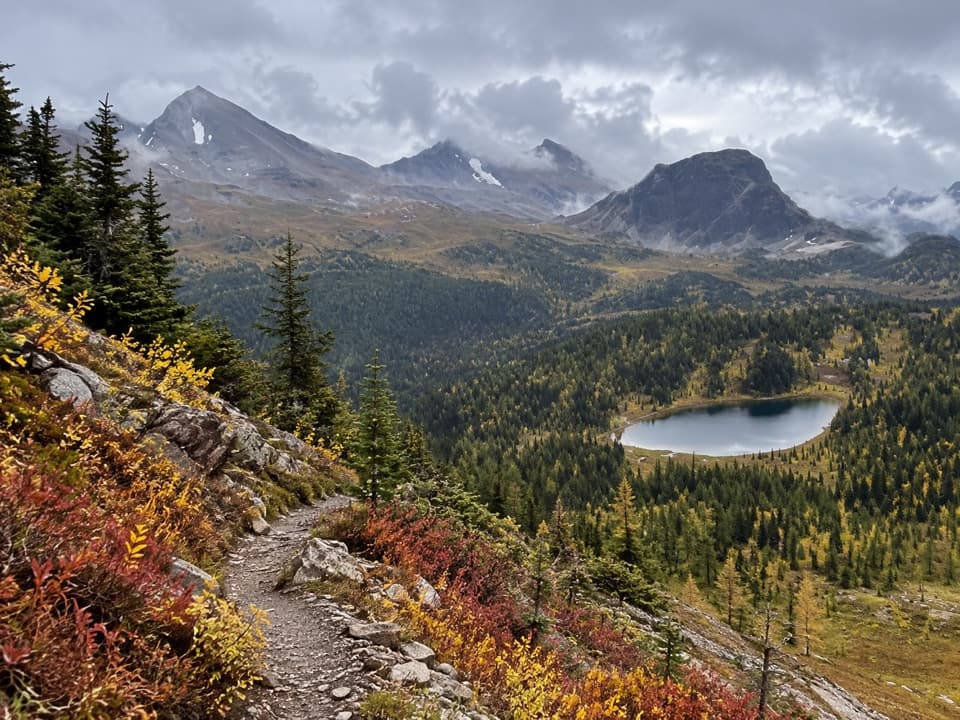
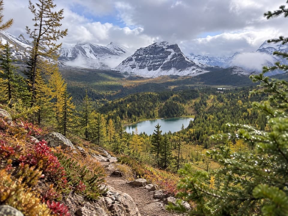
The route follows Rock Isle Road on hard aggregate and gravel, climbing through scattered spruce, alpine fir, and larch. Near the Divide, the trees thin and the meadow opens; the path then descends toward the lake. It crosses from Alberta into British Columbia. Four wooden cylinder steps, up to 15 cm high, begin about 200 m from the trailhead. The footing is uneven in places, so the short distance does not make this a flat stroll.

Later in summer, wildflowers add color to the open meadow. Alpine larch turn gold in fall before shedding their needles.

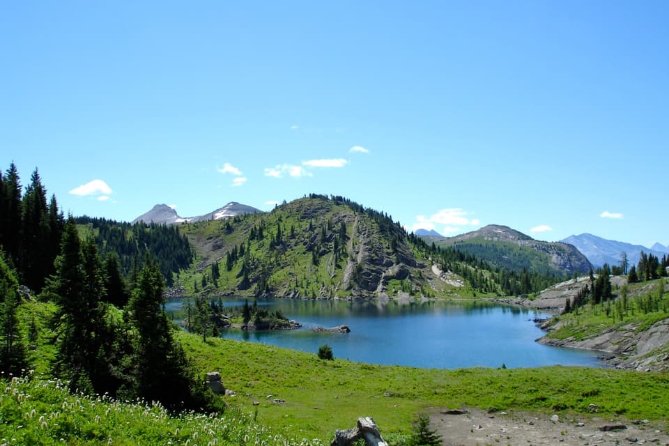
Above the lakeA short boardwalk spur reaches the Rock Isle Lake viewpoint.

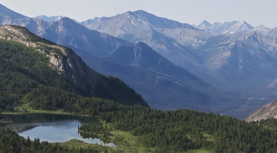
A short boardwalk spur reaches the Rock Isle Lake viewpoint. The small wooded island is the detail to frame against the open water and ridge behind it. Stay on the marked path and boardwalk: the alpine meadow is fragile, and walking off trail can damage it.

Getting to the trailheadPark at the Sunshine Village base lot, then take the seasonal gondola or Sunshine shuttle to…

Park at the Sunshine Village base lot, then take the seasonal gondola or Sunshine shuttle to the upper village. The lift and shuttle run during the summer hiking season, with dates that vary by year. Flush toilets are listed at the base lot; water and toilets along the route are not listed. Dogs are allowed on summer trails unless a restriction says otherwise; keep them leashed and under physical control.

Want to keep going?The viewpoint sits in a larger network with routes toward Larix and Grizzly lakes, Twin Cairns…

The viewpoint sits in a larger network with routes toward Larix and Grizzly lakes, Twin Cairns and Meadow Park, and Standish Viewpoint. The 10.3 km and 4–5 hour figures describe the whole Sunshine Meadows network, not this Rock Isle out-and-back.

Wildlife

Wildlife in Banff

All Banff wildlife maps

Sighting maps show where each species has been reported across Banff. Wildlife moves, so no sighting is guaranteed.

Keep exploring

Near Rock Isle Lake Trail

See it all on the map

Trails that start nearby

Places near the trailhead

Parkwolf’s Banff ranking

Top-rated trails in Banff

All 162 trails
  1. 1Sentinel Pass via Larch Valley TrailChallenging · 11.2 km
  2. 2Plain of Six Glaciers TrailModerate · 11.6 km
  3. 3Lake Agnes TrailModerate · 7.8 km
  4. 4Johnston Canyon Trail to Upper FallsEasy · 4.8 km
  5. 5Larch Valley / Minnestimma Lakes TrailModerate · 9 km
  6. 6Parker Ridge TrailModerate · 5.6 km

Take Parkwolf to Banff.

The audio tour guide for the drive, plus offline maps, trails, and wildlife heatmaps for when the signal drops.

4.7 from 8,600+ ratings

Download Parkwolf on the App StoreGet Parkwolf on Google Play