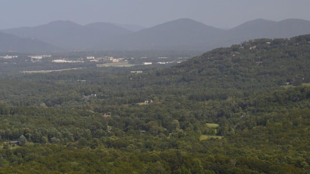
Haw Creek Valley (MP 380.0) in Blue Ridge Parkway

Scenic pullout · Blue Ridge Parkway

Haw Creek Valley (MP 380.0)

Quick overlook with big sunset views near Asheville

Photo: National Park Service
Type
Scenic pullout
Nearest trail
2.1 mi
Audio stories
3 nearby
  • Pullout
  • Parking
  • Scenic viewpoint
  • #88 of 188 sights

Hear the audio tour

Haw Creek Valley and its Sunset View

Overview

About Haw Creek Valley (MP 380.0)

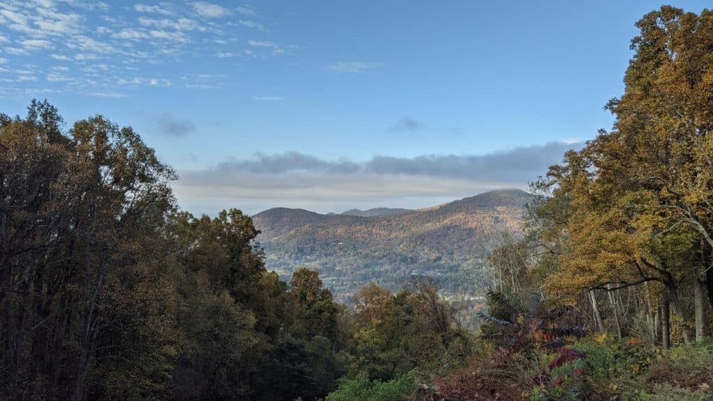
Perched at milepost 380.0, Haw Creek Valley Overlook is one of the Parkway’s easiest wins near Asheville. You pull off for a few minutes and get an expansive, west-facing view over Haw Creek Valley toward the city and a parade of Blue Ridge peaks.

Why stop

  • Big, west-facing panorama across Haw Creek Valley and Asheville
  • Convenient pull-off just minutes from downtown Asheville

Heads up

  • Small parking area that fills at sunset and on weekends
  • No restrooms or other services on site
Two things make this stop stand out: it’s incredibly close to Asheville yet feels airy and rural, and its westward view makes it a legit sunset favorite. The Park Service periodically trims vegetation here to preserve the vista, which also benefits birds and other wildlife that use the edge habitat.
Parkwolf’s verdictWhy It’s Not Just Another Overlook

Map

Where it is

Loading the Blue Ridge Parkway map
Full map
Scenic pulloutHaw Creek Valley (MP 380.0)35.61696, -82.49163
Keep this map with you offline in the Parkwolf app

Local know-how

Tips for visiting Haw Creek Valley (MP 380.0)

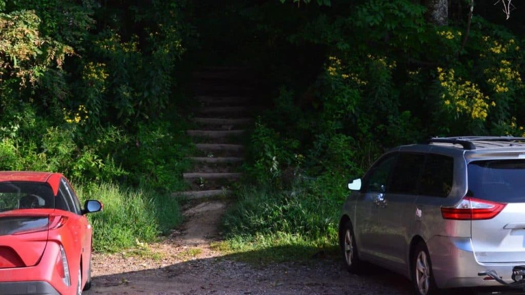
  1. For a short hike-in, start at Masters Park, then walk the Parkway left to the overlook.

  2. Visit on weekdays or arrive 30–60 minutes before sunset to find parking.

  3. There are no restrooms; the nearest are at the Folk Art Center (MP 382).

  4. Pack water and snacks if you’re hiking up—there’s no water on site.

  5. Mind your footing near the edges; there are no guardrails on the rocks.

Plan your stop

Before you go

Best time to visit

Late afternoon into sunset is the sweet spot for light and views. Weekends can get busy, so aim for weekdays or arrive 30–60 minutes before sunset if you want an easy parking spot. Clear days after midday haze lifts tend to produce the best long-range views.

Amenities & Logistics

Keep expectations simple: this is a classic Parkway pullout with a small paved parking area and an interpretive sign. There are no restrooms, water, or picnic tables here; the closest services are at the Folk Art Center (MP 382).

2 active Blue Ridge Parkway alerts

  • ClosureNorth Carolina Helene-related closuresAvoid the closed Parkway section from MP 344.2–355.3; recreation of any kind is prohibited there.Official details
  • ClosureVirginia Parkway closures and detourFollow the signed detour around the closed James River Bridge and avoid the closed Roanoke Mountain Loop. - James River Bridge (MP 63.5–63.Official details
Blue Ridge Parkway alerts
A park ranger sits on a dash-mounted phone, talking, as Parkwolf’s Tour Guide plays “Army Cutworm Moths: A Grizzly Bear Buffet” on Grand Loop Road below Dunraven Pass in Yellowstone
Parkwolf Tour GuideThe highest, rockiest slopes around here are a summer buffet for grizzly bears.

Blue Ridge Parkway Tour Guide

Your drive to Haw Creek Valley (MP 380.0), narrated.

Parkwolf is a GPS audio tour guide for Blue Ridge Parkway. As you drive, it chimes in with what’s ahead: hidden gems, upcoming stops, history, geology, and wildlife, right through your car’s speakers.

See the Blue Ridge Parkway audio tour

Recorded for this place

Haw Creek Valley and its Sunset View
Listen
“You're about to pull into Haw Creek Valley Overlook, which offers a really nice view, especially considering how close it is to Asheville.”

Plays as you drive up to Haw Creek Valley (MP 380.0) in the Parkwolf Blue Ridge Parkway Tour Guide.

More stories near here in the app

  • Night Lights: The Blue Ghost Fireflies
  • Folk Art Center: Appalachian Craft Hub
  • Craven Gap: A Woodsy Walk Near Asheville
  • Tanbark Ridge Overlook Near Asheville
  • 277 audio storiesacross Blue Ridge Parkway’s roads, triggered by GPS as you drive
  • Wildlife heatmapsfor Black Bear, Elk, White-tailed Deer, and 13 more
  • Works offlinemaps, 112 trails, 232 places, and audio download before you lose signal
  • CarPlay readysimple controls built for the drive
★★★★★
“…We knew we wanted to drive the Blue Ridge Parkway. The narration was impeccably timed. The facts and info provided were meaningful. Without it, the trip would not have been near as awesome.”
Ashl GApp Store review
Download Parkwolf on the App StoreGet Parkwolf on Google Play

4.7 from 8,600+ ratings

Guide

More about Haw Creek Valley (MP 380.0)

What You’ll SeeThe sightlines sweep across the Haw Creek community and out to named summits including Ducker…

The sightlines sweep across the Haw Creek community and out to named summits including Ducker Mountain, Chestnut Top, Ball Mountain, Double Head, Little Bald Mountain, Mount Pisgah, Scott Mountain, and Piney Mountain. On clear days you can also pick out recognizable buildings in Asheville’s skyline.

Hiking NotesThere’s no formal trailhead at the overlook, but you can hike up from Masters Park in about 25…

There’s no formal trailhead at the overlook, but you can hike up from Masters Park in about 25 minutes and then walk a short stretch of road to reach the pullout. The Mountains-to-Sea Trail also runs in the area, giving hikers more options if you want to turn the viewpoint into a leg-stretcher.

WildlifeExpect casual encounters with songbirds and the occasional deer in the surrounding woods and…

Expect casual encounters with songbirds and the occasional deer in the surrounding woods and meadow-like edges. The maintained clearing creates a mix of habitat that many species use, especially in quieter hours.

Wildlife

Wildlife in Blue Ridge Parkway

All Blue Ridge Parkway wildlife maps

Sighting maps show where each species has been reported across Blue Ridge Parkway. Wildlife moves, so no sighting is guaranteed.

Parkwolf’s Blue Ridge Parkway ranking

Top sights in Blue Ridge Parkway

All 232 places
  1. 1Linn Cove ViaductSight
  2. 2Mount MitchellSight
  3. 3Mount Mitchell State ParkSight
  4. 4Craggy Pinnacle OverlookSight
  5. 5Linville FallsSight
  6. 6Peaks of OtterSight

Take Parkwolf to Blue Ridge Parkway.

The audio tour guide for the drive, plus offline maps, trails, and wildlife heatmaps for when the signal drops.

4.7 from 8,600+ ratings

Download Parkwolf on the App StoreGet Parkwolf on Google Play