Best time to visit
Sunrise and sunset offer the most flattering light and the best photos. Weekdays are typically quieter; on fall weekends the few parking spots can fill. Watch the stone mileposts to zero in on 359–360 as you approach.
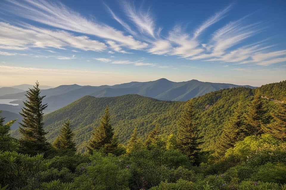
Scenic pullout · Blue Ridge Parkway
Quiet overlook with big views and trail access
Overview
A quiet, scenic pullout at MP 359.8, Walker Knob Overlook serves up wide‑open mountain vistas and a peaceful vibe without the tour-bus crowds. It sits between Ridge Junction Overlook to the south and Glassmine Falls View to the north, making it an easy, worthwhile stop on this stretch of the Parkway.
Expect sweeping panoramas that change with the seasons—misty blue layers, summer greens, and peak fall color. It’s calm and breezy up here; the air feels cooler and cleaner thanks to the elevation. Photographers love the soft light at daybreak and the warm glow late in the day.
 Parkwolf’s verdictWhy stop here
Map
Local know-how
Arrive early on fall weekends—the small turnout fills fast.
Bring layers; it’s windier and cooler up here than in town.
There are no services—pack water, snacks, and a trash bag.
For navigation, watch the Parkway’s stone mileposts near 359–360.
Golden hour brings the best color and depth for photos.
Plan your stop

The highest, rockiest slopes around here are a summer buffet for grizzly bears.
Blue Ridge Parkway Tour Guide
Parkwolf is a GPS audio tour guide for Blue Ridge Parkway. As you drive, it chimes in with what’s ahead: hidden gems, upcoming stops, history, geology, and wildlife, right through your car’s speakers.
See the Blue Ridge Parkway audio tourRecorded for this place
Walker Knob Overlook and the Big Butt Trail“The overlook you're approaching is Walker Knob, one of those quieter pullouts with really big mountain views. What makes it a great stop is that it's also a major trail access point.”
Plays as you drive up to Walker Knob Overlook (MP 359.8) in the Parkwolf Blue Ridge Parkway Tour Guide.
More stories near here in the app
“…We knew we wanted to drive the Blue Ridge Parkway. The narration was impeccably timed. The facts and info provided were meaningful. Without it, the trip would not have been near as awesome.”


Guide
This isn’t just a drive-up view. The pullout doubles as a trailhead for the Big Butt Trail, with options to continue to Little Butt or farther to Big Butt. The Mountains‑to‑Sea Trail also crosses right here, so you can turn a quick stop into a leg-stretching stroll or a longer ramble.
It’s a small paved turnout with limited spaces. There are no restrooms, water, or picnic tables, so come prepared and pack out everything. It can be windy and colder than lower elevations—layers help. Use care near drop‑offs if you wander off the pavement.
You may hear or spot songbirds and raptors riding the thermals, and the surrounding forest can host deer and the occasional wild turkey—early and late are your best windows for sightings.
You’re looking into the high ridges of the Southern Appalachians, near the Black Mountains subrange—classic, ancient Blue Ridge terrain that’s all about rolling layers and big sky.
Wildlife
 1,208 sightingsBlack BearMost seen around 7 AMSighting map
 1,020 sightingsElkMost seen around 7 AMSighting map
 2,257 sightingsWhite-tailed DeerMost seen around 6 PMSighting map
 200 sightingsCoyoteMost seen around 6 PMSighting map
 1,126 sightingsWild TurkeyMost seen around 7 AMSighting map
 255 sightingsRed-tailed HawkMost seen around 11 AMSighting map
Sighting maps show where each species has been reported across Blue Ridge Parkway. Wildlife moves, so no sighting is guaranteed.
Keep exploring
 ChallengingLittle Butt Trail4.8 mi · 4 hr · At the trailheadHigh-elevation ridge hike to a rocky overlook with big views
 ModerateOld Mitchell Trail4 mi · 2.5 hr · 3.2 mi awayA rocky climb to Mount Mitchell’s high-elevation summit
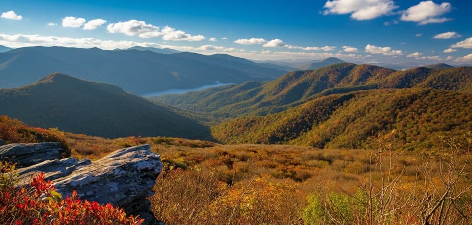 EasyPinnacle Trail1.4 mi · 45 min · 3.8 mi awayShort climb, giant views, and classic rhododendron tunnels
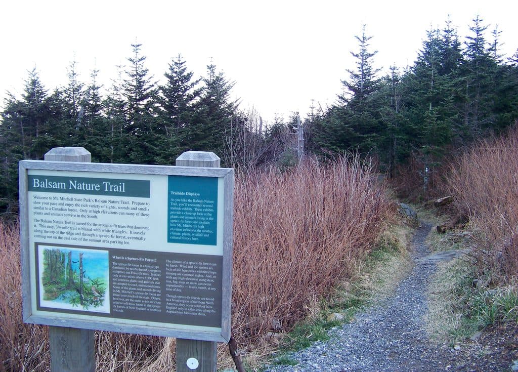 EasyBalsam Nature Trail (Mount Mitchell)0.8 mi · 30 min · 4 mi awayShort, moderate summit loop through rare Fraser fir and red spruce forest
 ChallengingDeep Gap Trail (Mount Mitchell)7.2 mi · 5.5 hr · 4.1 mi awayRugged high-elevation crest hike from Mount Mitchell to Deep Gap
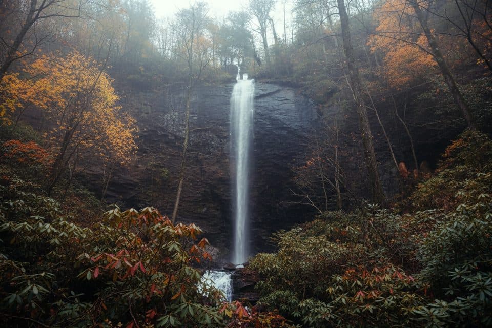 ChallengingDouglas Falls Trail6.6 mi · 5.5 hr · 4.2 mi awayRugged trek to a 70-foot waterfall through wild, hemlock forest
 ModerateCraggy Gardens Trail1.6 mi · 1 hr · 4.3 mi awayRhododendron-lined out-and-back from the visitor center to Craggy Gardens Picnic Area
 ChallengingSnowball Mountain Trail2.7 mi · 2 hr · 5 mi awayA short ridge hike to Hawkbill Rock, with a steep climb
 Scenic pullout · 1.1 mi awayGlassmine Falls Overlook (MP 361.2)Roadside perch for a distant, rain-fed ribbon of waterfall
 Scenic pullout · 3.1 mi awayGraybeard Mountain View (MP 363.4)Head-on views of Graybeard and the Seven Sisters
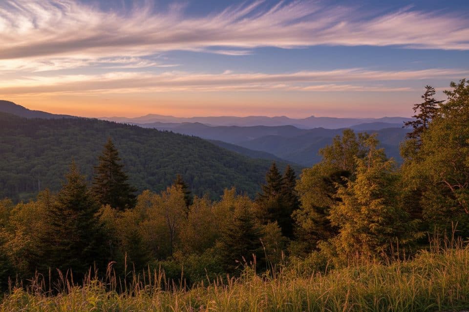 Scenic pullout · 3.8 mi awayRidge Junction Overlook (MP 355.3)Close views of the Black Mountains near the Mount Mitchell spur
 Sight · 4 mi awayCraggy Pinnacle OverlookShort hike to a 360-degree summit with knockout mountain views
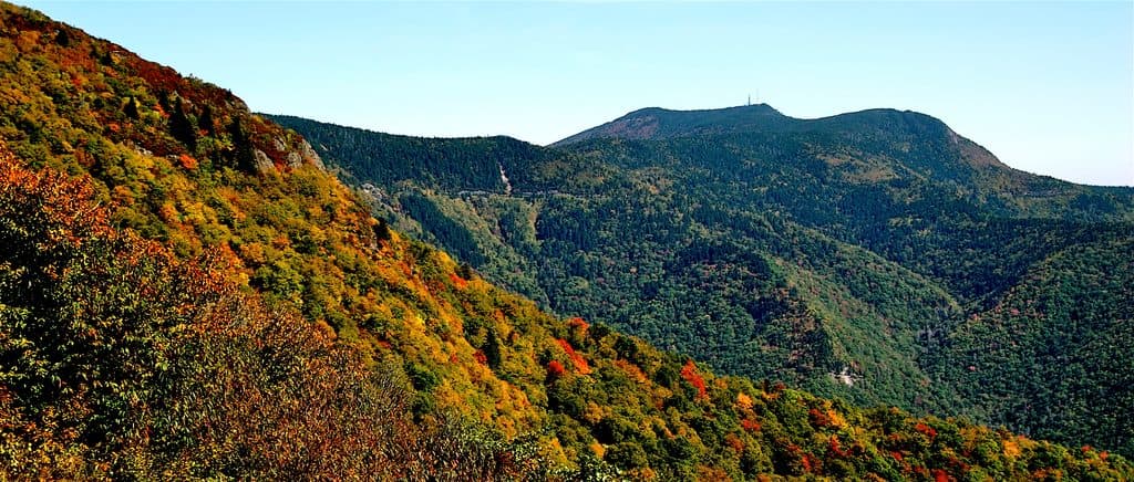 Sight · 4 mi awayMount MitchellShort walk to the East’s highest peak and sweeping 360-degree views
 Visitor center · 4.2 mi awayCraggy Gardens Visitor’s Center;Craggy GardensHigh-elevation views and June rhododendron blooms with easy hikes
 Sight · 4.3 mi awayMount Mitchell State ParkEasy summit of the East’s highest peak with sweeping views
 Picnic area · 4.7 mi awayCraggy Gardens Picnic AreaHigh-elevation picnic hub with trails and June rhododendrons
Parkwolf’s Blue Ridge Parkway ranking
The audio tour guide for the drive, plus offline maps, trails, and wildlife heatmaps for when the signal drops.


