Black Balsam Knob via Art Loeb in Blue Ridge Parkway

#10 of 112 trails in Blue Ridge Parkway

Blue Ridge Parkway, NC · VA

Black Balsam Knob via Art Loeb

Short out-and-back climb to a 6,214-foot bald with sweeping 360-degree views

Photo: Mapbox
Length
1.6mi
Time
1hr
Elev. change
285ft
Difficulty
Moderate
  • Dogs allowed
  • High point 6,181 ft

Hear the audio tour

The Parkway’s Bloom Calendar: Chasing Spring up the Mountains

Overview

About Black Balsam Knob via Art Loeb

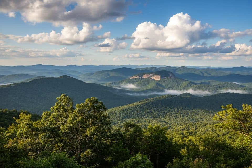
From the Art Loeb Trailhead on Black Balsam Road (FS 816) near Blue Ridge Parkway Milepost 420, this short out-and-back follows the Art Loeb Trail north through balsam fir and open meadow to Black Balsam Knob. The stored route is about 0.81 mile one way; the visitor hike is about 1.6 miles round trip and climbs roughly 400 feet to the 6,214-foot bald. The summit spur ends at the open knob; it does not continue toward Tennent Mountain or the longer Art Loeb route.\n\nExpect a steady climb on a rocky, sometimes rooty path before the route opens onto exposed grass and rock near the summit. The bald provides broad, 360-degree views, but little shade, and high-elevation wind, cold, rain, and sun can arrive quickly. Stay on the established path to protect fragile grassy vegetation, especially around the open summit.\n\nParking is along the shoulder near the trail crossing and is limited at busy times. There are no dependable water or restroom services at this trailhead, so carry what you need. Leashed dogs are allowed. The area is used year-round; confirm Blue Ridge Parkway and Forest Service access information before driving, and use a map because nearby routes continue toward Tennent Mountain, Ivestor Gap, and the longer Art Loeb Trail.

Why go

  • Panoramic views and open summit scenery for about 1.6 miles round trip
  • Direct access to Black Balsam Knob from the FS 816 shoulder

Heads up

  • Limited shoulder parking and heavy crowds at popular times
  • Exposed summit is windy and weather can change quickly

Map & elevation

The route

Loading the Blue Ridge Parkway map
Full map
Elevation5,896–6,181 ft
TrailheadArt Loeb Trailhead on Black Balsam Road (FS 816)35.32061, -82.87624
Keep this map with you offline in the Parkwolf app

Plan your hike

Before you go

Parking

Park only in marked shoulder spaces along Black Balsam Road (FS 816) near the Art Loeb Trail crossing, about 0.7 mile from the Blue Ridge Parkway at Milepost 420. Parking is limited; the Forest Service identifies paved roadside parking at the crest.

Safety

The high, open bald has little shade and can be cold, windy, or rainy; stay on the established trail to protect fragile grassy vegetation. Blue Ridge Parkway and FS 816 access can be seasonally closed, so confirm access before driving.

2 active Blue Ridge Parkway alerts

  • ClosureNorth Carolina Helene-related closuresAvoid the closed Parkway section from MP 344.2–355.3; recreation of any kind is prohibited there.Official details
  • ClosureVirginia Parkway closures and detourFollow the signed detour around the closed James River Bridge and avoid the closed Roanoke Mountain Loop. - James River Bridge (MP 63.5–63.Official details
Blue Ridge Parkway alerts
A park ranger sits on a dash-mounted phone, talking, as Parkwolf’s Tour Guide plays “Army Cutworm Moths: A Grizzly Bear Buffet” on Grand Loop Road below Dunraven Pass in Yellowstone
Parkwolf Tour GuideThe highest, rockiest slopes around here are a summer buffet for grizzly bears.

Blue Ridge Parkway Tour Guide

Your drive to Black Balsam Knob via Art Loeb, narrated.

Parkwolf is a GPS audio tour guide for Blue Ridge Parkway. As you drive, it chimes in with what’s ahead: hidden gems, upcoming stops, history, geology, and wildlife, right through your car’s speakers.

See the Blue Ridge Parkway audio tour

Recorded for this area

The Parkway’s Bloom Calendar: Chasing Spring up the Mountains
Listen
“Spring doesn't happen all at once here. It climbs the mountains at a rate of about one week for every 1,000 feet you go up.”

Plays on the road 0.5 mi from the trailhead in the Parkwolf Blue Ridge Parkway Tour Guide.

More stories near here in the app

  • Graveyard Fields: Waterfalls and Wild Blueberries
  • Devil's Courthouse: A Steep Climb to a Four-State View
  • Devil's Courthouse: The Best Punchy Climb on the Parkway
  • East Fork Overlook and the Ghost Trees
  • 277 audio storiesacross Blue Ridge Parkway’s roads, triggered by GPS as you drive
  • Wildlife heatmapsfor Black Bear, Elk, White-tailed Deer, and 13 more
  • Works offlinemaps, 112 trails, 232 places, and audio download before you lose signal
  • CarPlay readysimple controls built for the drive
★★★★★
“…We knew we wanted to drive the Blue Ridge Parkway. The narration was impeccably timed. The facts and info provided were meaningful. Without it, the trip would not have been near as awesome.”
Ashl GApp Store review
Download Parkwolf on the App StoreGet Parkwolf on Google Play

4.7 from 8,600+ ratings

Wildlife

Wildlife in Blue Ridge Parkway

All Blue Ridge Parkway wildlife maps

Sighting maps show where each species has been reported across Blue Ridge Parkway. Wildlife moves, so no sighting is guaranteed.

Keep exploring

Near Black Balsam Knob via Art Loeb

See it all on the map

Trails that start nearby

Places near the trailhead

Parkwolf’s Blue Ridge Parkway ranking

Top-rated trails in Blue Ridge Parkway

All 112 trails
  1. 1Art Loeb TrailChallenging · 30.1 mi
  2. 2Rough Ridge TrailModerate · 1.2 mi
  3. 3Sharp Top TrailChallenging · 3 mi
  4. 4Tennent Mountain LoopModerate · 5 mi
  5. 5Daniel Boone Scout TrailChallenging · 7.2 mi
  6. 6Deep Gap Trail (Mount Mitchell)Challenging · 7.2 mi

Take Parkwolf to Blue Ridge Parkway.

The audio tour guide for the drive, plus offline maps, trails, and wildlife heatmaps for when the signal drops.

4.7 from 8,600+ ratings

Download Parkwolf on the App StoreGet Parkwolf on Google Play