Table Mountain – Heartbreak Ridge Loop in Columbia River Gorge National Scenic Area

Columbia River Gorge National Scenic Area, OR · WA

Table Mountain – Heartbreak Ridge Loop

Steep talus leads to sheer Gorge cliffs and a hard-earned summit.

Photo: Wikimedia Commons
Length
8mi
Time
6hr
Elev. change
3,202ft
Difficulty
Challenging
  • Loop
  • No dogs
  • High point 3,343 ft
  • #19 of 111 in Columbia River Gorge

Hear the audio tour

Fort Cascades Historic Site

Overview

About Table Mountain – Heartbreak Ridge Loop

Why go

  • A steep route to a 360-degree Columbia Gorge panorama
  • A distinctive landslide story visible in the mountain’s south face

Heads up

  • Loose talus and exposed cliff-edge viewpoints
  • Paid resort parking and confusing PCT junctions

Map & elevation

The route

Loading the Columbia River Gorge map
Full map
Elevation141–3,343 ft
TrailheadBonneville Hot Springs Trailhead (resort back lot)45.65507, -121.96253
Keep this map with you offline in the Parkwolf app

Plan your hike

Before you go

Parking

Park in the gravel lot behind Bonneville Hot Springs Resort, reached from Washington Highway 14 via Hot Springs Road and Cascade Drive. This is the resort-side start; the Bonneville Trailhead opposite the dam is a separate, much longer approach. Resort day-use parking is paid; confirm the current fee onsite.

Safety

Expert-grade climb with about 3,200 feet of gain, loose talus and boulders, and viewpoints beside an 800-foot drop. PCT connections are confusing; follow detailed route directions. Washington DNR prohibits pets in the conservation area.

8 active Columbia River Gorge alerts

  • ClosureEagle Creek Fire area closureDo not enter Oneonta Gorge or the specified trail sections because hazards remain following the Eagle Creek Fire.Official details
  • CautionAircraft and drone restrictions at developed recreation sitesAircraft and drone landings, drop-offs, and pickups are prohibited at six high-use developed recreation sites to protect visitor safety.Official details
See all 8 alerts
A park ranger sits on a dash-mounted phone, talking, as Parkwolf’s Tour Guide plays “Army Cutworm Moths: A Grizzly Bear Buffet” on Grand Loop Road below Dunraven Pass in Yellowstone
Parkwolf Tour GuideThe highest, rockiest slopes around here are a summer buffet for grizzly bears.

Columbia River Gorge Tour Guide

Your drive to Table Mountain – Heartbreak Ridge Loop, narrated.

Parkwolf is a GPS audio tour guide for Columbia River Gorge National Scenic Area. As you drive, it chimes in with what’s ahead: hidden gems, upcoming stops, history, geology, and wildlife, right through your car’s speakers.

Recorded for this area

Fort Cascades Historic Site
0:00 / 0:30
“You're approaching Fort Cascades Historic Site, where a mile-and-a-half riverside loop traces a vanished portage town.”

Plays on the road 0.7 mi from the trailhead in the Parkwolf Columbia River Gorge Tour Guide.

More stories near here in the app

  • Bradford Island Visitor Center
  • Washington Shore Visitor Center at Bonneville Dam
  • When the Hillside Blocked the River
  • Bonneville Fish Hatchery
  • 217 audio storiesacross Columbia River Gorge’s roads, triggered by GPS as you drive
  • Wildlife heatmapsfor Bald Eagle, Black Bear, American Pika, and 13 more
  • Works offlinemaps, 111 trails, 78 places, and audio download before you lose signal
  • CarPlay readysimple controls built for the drive
★★★★★
“Fantastic app with many points of information… It’s great to just turn on while you’re driving and it gives you an audio tour of the national Park. We love it!!!!”
JMJamesApp Store review
Download Parkwolf on the App StoreGet Parkwolf on Google Play

4.7 from 8,600+ ratings

Trail guide

Hiking Table Mountain – Heartbreak Ridge Loop

A hard summit loopTable Mountain – Heartbreak Ridge Loop is an 8-mile lollipop loop from the gravel lot behind…

Table Mountain – Heartbreak Ridge Loop is an 8-mile lollipop loop from the gravel lot behind Bonneville Hot Springs Resort. It follows the forested Carpenters Meadow approach to the Pacific Crest Trail (PCT), climbs Heartbreak Ridge, crosses the summit ridge, then descends West Table Mountain Trail and retraces the PCT and access trail to close the loop. The route gains about 3,200 feet; allow around six hours plus breaks. This is an expert-grade outing for hikers who enjoy steep talus and summit exposure, not a gentle forest wander. Its reward is a huge view over the Columbia River Gorge and the Cascade peaks.

Across Carpenters MeadowThe first mile rises on a mossy old road track and the Carpenters Meadow Trail, with plank…

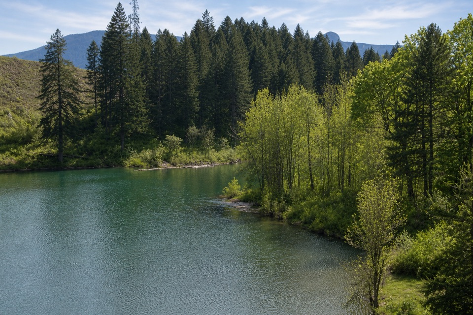
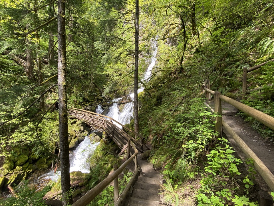
The first mile rises on a mossy old road track and the Carpenters Meadow Trail, with plank bridges over small streams, cobbled tread and young alders. In the wet season, this stretch can be muddy. The forest grows older as you climb, with Douglas-firs, vine maple and sword fern around hummocky ground shaped by an old landslide. Near Carpenters Lake, an old beaver marsh, an opening frames Sacaquawea and Papoose Rocks with Table Mountain beyond. From there, an old logging roadbed reaches the PCT, briefly crosses it and joins it again farther north. Those PCT connections are genuinely confusing: follow detailed route directions toward Heartbreak Ridge instead of trying to improvise at the forks.

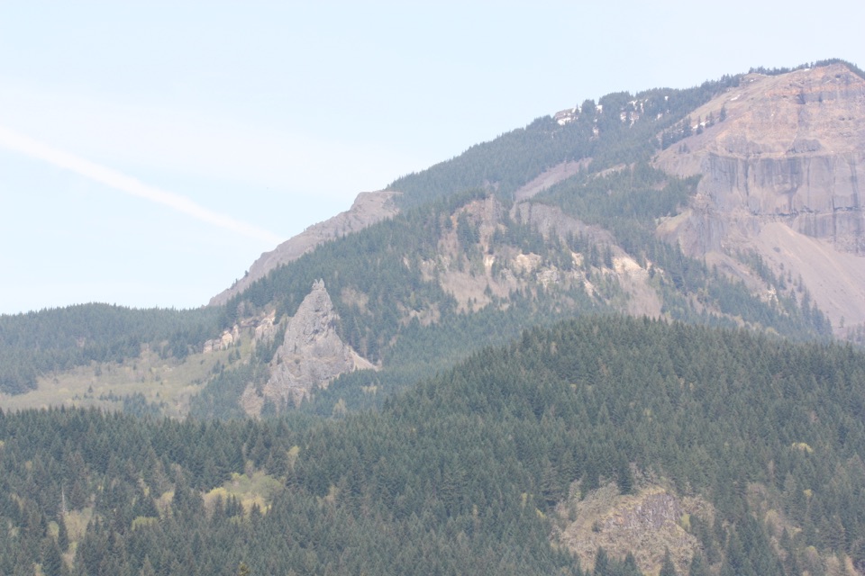
Heartbreak Ridge and the tableHeartbreak Ridge is the sustained climb: roughly 1,600 feet in 1.1 miles.

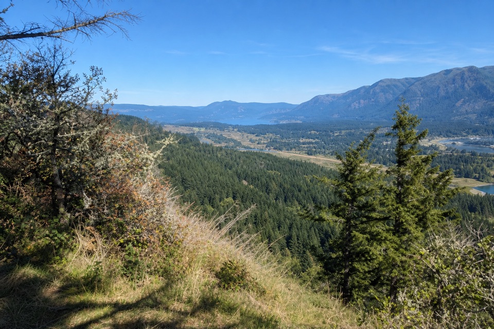
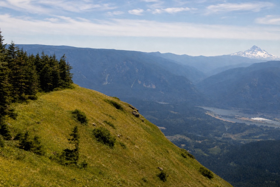
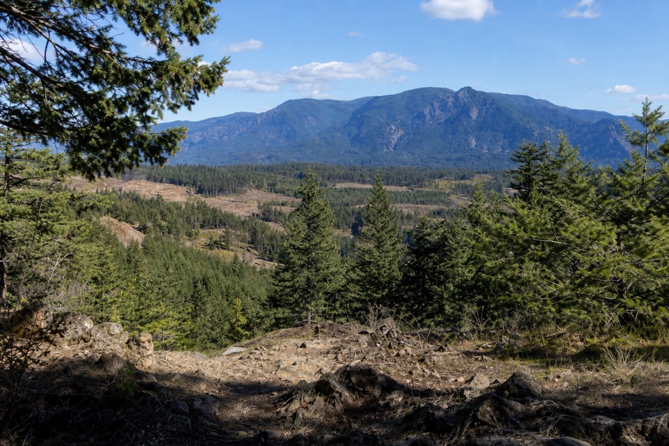
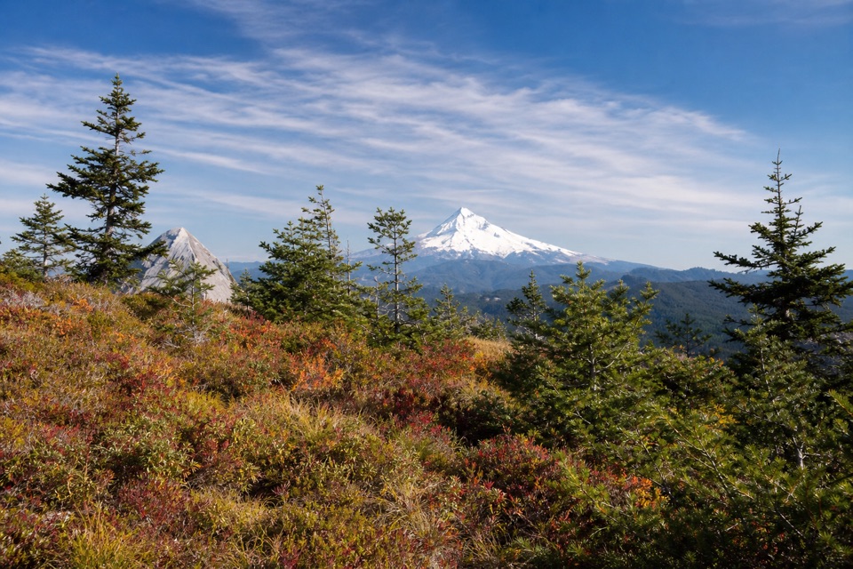
Heartbreak Ridge is the sustained climb: roughly 1,600 feet in 1.1 miles. Its lower tread is comparatively good, then steepens across loose talus and a boulder field. The south face appears only in short glimpses through the trees before the route opens onto the summit ridge. The broad top is wooded, but its open meadows carry spring wild onions and lead to viewpoints above an 800-foot cliff. On a clear day, look for Bonneville Dam, the Gorge, Mount Hood, Adams, St. Helens and Rainier. The south face is a landslide scar; a major slide sometime between 1200 and 1600 CE sent debris into the Columbia and created the original Bridge of the Gods. At the exposed viewpoint, include the cliff wall and talus below it in a phone photo so the scale reads; stay on the trail near the edge.

The return and accessThe loop leaves the summit by the West Table Mountain Trail, a very steep, rocky descent with…

The loop leaves the summit by the West Table Mountain Trail, a very steep, rocky descent with loose stones near Windbreak Rocks. It eases into forest before meeting the PCT; retrace the PCT and the resort approach to finish. Expect careful footing both uphill and down, and use a current detailed route map at the junctions. Start at the resort’s gravel back lot, reached from Washington Highway 14 via Hot Springs Road and Cascade Drive; do not start at the separate Bonneville Trailhead by the dam, which adds a much longer approach. Day parking at the resort is paid; confirm the current fee onsite. Washington DNR prohibits pets in the conservation area, so dogs cannot accompany this hike.

Wildlife

Wildlife in Columbia River Gorge

All Columbia River Gorge wildlife maps

Sighting maps show where each species has been reported across Columbia River Gorge. Wildlife moves, so no sighting is guaranteed.

Keep exploring

Near Table Mountain – Heartbreak Ridge Loop

See it all on the map

Trails that start nearby

Places near the trailhead

Parkwolf’s Columbia River Gorge ranking

Top-rated trails in Columbia River Gorge

All 111 trails
  1. 1Eagle Creek Trail #440 to Tunnel FallsChallenging · 11.7 mi
  2. 2Multnomah Falls Trail to the TopModerate · 2.4 mi
  3. 3Multnomah–Wahkeena Falls LoopChallenging · 4.8 mi
  4. 4Dog Mountain LoopChallenging · 6.9 mi
  5. 5Angel's Rest TrailModerate · 4.8 mi
  6. 6Cape Horn Loop TrailChallenging · 6.5 mi

Take Parkwolf to Columbia River Gorge.

The audio tour guide for the drive, plus offline maps, trails, and wildlife heatmaps for when the signal drops.

4.7 from 8,600+ ratings

Download Parkwolf on the App StoreGet Parkwolf on Google Play