Parking
Small signed pull-off on SH94; a nearby unmarked gravel area offers similar views with more space.

Fiordland National Park, SL
Roadside panorama over the Hollyford Valley with kea and a memorial
Overview
Yes—if you are driving Milford Road, this is a worthwhile quick stop for the views. Just know it is a look-and-go spot, not a destination hike. If you want a longer leg-stretcher, pair it with nearby trails from The Divide, such as Key Summit.
 Parkwolf’s verdictIs it worth it?
Map & elevation
Plan your hike

The highest, rockiest slopes around here are a summer buffet for grizzly bears.
Fiordland Tour Guide
Parkwolf is a GPS audio tour guide for Fiordland National Park. As you drive, it chimes in with what’s ahead: hidden gems, upcoming stops, history, geology, and wildlife, right through your car’s speakers.
See the Fiordland audio tourRecorded for this trailhead
Pop's View Lookout and the Hollyford Valley“The pull-off ahead is Pop's View Lookout, offering a huge panorama down the Hollyford Valley. It's a great spot to stretch your legs and see the classic U-shaped valley carved by ancient glaciers.”
Plays as you drive up to this trailhead in the Parkwolf Fiordland Tour Guide.
More stories near here in the app
“Fantastic app with many points of information… It’s great to just turn on while you’re driving and it gives you an audio tour of the national Park. We love it!!!!”


Trail guide
A quick roadside stroll from the signed Pop's View pull-off to a fenced lookout with sweeping views over the Hollyford Valley. This is a viewpoint stop on the Te Anau–Milford Highway (SH94), not a true hike—think stretch-your-legs, snap a photo, and soak in classic Fiordland drama.
It is roughly 0.13 miles (0.10 km) total out and back from the pull-off to the railings. Most people spend about 10–15 minutes here, including photos.
Expect a broad panorama over a glacier-carved U-shaped valley framed by Fiordland's rugged peaks. On clear days you can pick out the Darran Mountains to the northwest and the Alisa Mountains to the east, with notable peaks like Mount Christina, Mount Lyttle, and Mount Marian in the background. Lush temperate rainforest clings to the slopes, moss drapes the trees, and kea may patrol the railings and car park.
The lookout is named for Robert Alister Andrew ("Pop"), who was killed in an avalanche in 1983. A plaque at the site commemorates him. It sits along SH94 between The Divide and Milford Sound, making it an easy add-on while driving Milford Road.
Use the small signed pull-off on the Milford Highway, then follow the short parking-aisle route to the viewpoint. A nearby unmarked gravel area offers similar views with more space if the main pull-off is full.
Wildlife
 1,181 sightingsKeaMost seen around 10 AMSighting map
 199 sightingsFiordland PenguinMost seen around 7 PMSighting map
 228 sightingsBlue DuckMost seen around 5 PMSighting map
 32 sightingsBottlenose DolphinMost seen around 5 PMSighting map
 247 sightingsNew Zealand Fur SealMost seen around 6 PMSighting map
 58 sightingsKākāMost seen around 6 PMSighting map
Sighting maps show where each species has been reported across Fiordland. Wildlife moves, so no sighting is guaranteed.
Keep exploring
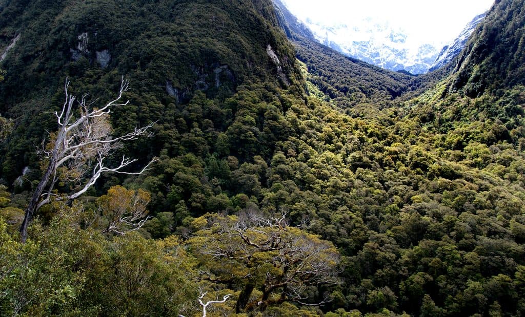 ChallengingLake Marian Track6.3 km · 3 hr · 0.4 km awayShort, rough climb to a mirror-still alpine lake in a hanging valley
 EasyMarian Falls Track1.3 km · 20 min · 0.4 km awayA quick rainforest stroll to photogenic cascades and a swing bridge
 ModerateRouteburn Track to Lake Mackenzie11.3 km · 5.5 hr · 1.9 km awayBeech forest, Earland Falls, and a glassy alpine lake
 ModerateRouteburn Track to Earland Falls13.4 km · 6 hr · 1.9 km awayA full-day walk to Fiordland's 174 m waterfall
 EasyLake Howden Track6.8 km · 3 hr · 1.9 km awayA short beech-forest walk from The Divide to Lake Howden.
 ModerateCaples Track33.5 km · 15 hr · 1.9 km awayPoint-to-point tramp through the Caples valley to The Divide Shelter
 ChallengingRouteburn Track33 km · 14 hr · 1.9 km awayA 20.5-mile alpine point-to-point Great Walk from The Divide to Routeburn Shelter
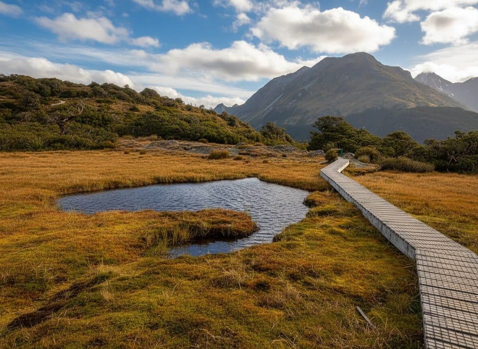 ModerateKey Summit Track6.9 km · 3 hr · 1.9 km awayA short alpine climb to tarns and Fiordland-wide views
 Scenic pullout · 0.1 km awayPop's View LookoutQuick pull-off with big Hollyford Valley views and cheeky kea
 Sight · 0.7 km awayMarian CascadeQuick, roaring cascades a short stroll from the Lake Marian track
 Sight · 1.6 km awayLake Marian LookoutShort walk to a gantry over thundering Marian Falls
 Sight · 1.8 km awayKey Summit Lookout360-degree alpine views and tarns via a short Routeburn side trip
 Trailhead · 1.9 km awayThe DivideBusy gateway to Routeburn and Key Summit with shelter and toilets
 Sight · 2.6 km awayLake HowdenQuiet forest lake at a famous track junction
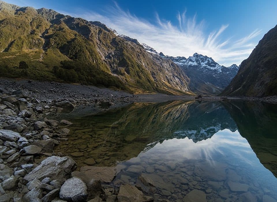
 Sight · 3.6 km awayHinepipiwai / Lake MarianMirror-still alpine lake in a dramatic hanging valley
 Sight · 3.9 km awayLake FergusQuiet roadside lake with mirror reflections in the Eglinton Valley
Parkwolf’s Fiordland ranking
The audio tour guide for the drive, plus offline maps, trails, and wildlife heatmaps for when the signal drops.


