Parking
Use Lafayette Campground Trailhead off I-93, then hike 1.6 miles up Lonesome Lake Trail to the hut. Parking on either side of I-93 is illegal; seasonal overflow is at the Cannon Mountain lot near Exit 34-C.

Franconia Notch State Park, NH
Ladders, slick ledges and a pond-side shelter make this AT leg count.
Overview
Map & elevation
Plan your hike

The highest, rockiest slopes around here are a summer buffet for grizzly bears.
Franconia Notch Tour Guide
Parkwolf is a GPS audio tour guide for Franconia Notch State Park. As you drive, it chimes in with what’s ahead: hidden gems, upcoming stops, history, geology, and wildlife, right through your car’s speakers.
See the Franconia Notch audio tourRecorded for this area
Lonesome Lake and Its Shoreline Loop“Lafayette Place is coming up, the starting point for a hike to Lonesome Lake, with Franconia Ridge across the water.”
Plays on the road 1 mi from the trailhead in the Parkwolf Franconia Notch Tour Guide.
More stories near here in the app
“Fantastic app with many points of information… It’s great to just turn on while you’re driving and it gives you an audio tour of the national Park. We love it!!!!”


Trail guide
Fishin’ Jimmy Trail is a 1.8-mile, one-way Appalachian Trail segment from Lonesome Lake Hut to the Kinsman Pond and Kinsman Ridge junction. It climbs through forest to a backcountry pond and shelter; it is not a loop. Allow about 1½ to 2 hours for this stretch. If you hike it as an out-and-back from the road, the 1.6-mile Lonesome Lake Trail approach each way brings the whole outing to roughly 6.8 miles.
The route starts fairly level, crosses a small creek, then climbs. Most of it stays under trees, and the path is often wet. Several short wooden ladders and timber steps fixed to a rock ledge break up the steep pitches; moss can make them slick. Take care on the steps, especially after rain.
The trail reaches the junction by Kinsman Pond Shelter on the pond’s north shore. There are tent platforms and a composting toilet, but no potable water. Treat pond water before drinking. From the shore, include the boulder-strewn edge in the foreground to keep the pond and wooded ridge together in the frame. The shelter connects onward to Kinsman Ridge and Kinsman Pond trails, so continuing to either Kinsman summit is a longer hike than this segment.
There is no road access at the start: park at Lafayette Campground Trailhead, then hike 1.6 miles up Lonesome Lake Trail to the hut, gaining about 1,000 feet. The approach usually takes one to two hours. Lonesome Lake Hut serves meals during its full-service season, but it is a separate stop at the start of Fishin’ Jimmy; dogs cannot stay overnight at the hut.
Wildlife
 66 sightingsBlack BearMost seen around 7 PMSighting map
 38 sightingsMooseMost seen around 6 AMSighting map
 19 sightingsWild TurkeyMost seen around 6 AMSighting map
 19 sightingsGreat Blue HeronMost seen around 5 PMSighting map
 13 sightingsTurkey VultureMost seen around noonSighting map
 23 sightingsRavenMost seen around 11 AMSighting map
Sighting maps show where each species has been reported across Franconia Notch. Wildlife moves, so no sighting is guaranteed.
Keep exploring
 ModerateKinsman Pond Trail2.2 mi · 2 hr · 0.7 mi awayA rough, wet climb to a high pond and backcountry shelter
 ModerateLonesome Lake Trail3 mi · 2.5 hr · 1 mi awayA climb to a glacial lake with Franconia Ridge across the water.
 ChallengingHi-Cannon Trail4.7 mi · 5.5 hr · 1 mi awayA steep Cannon climb with a ladder and a Lonesome Lake finish.
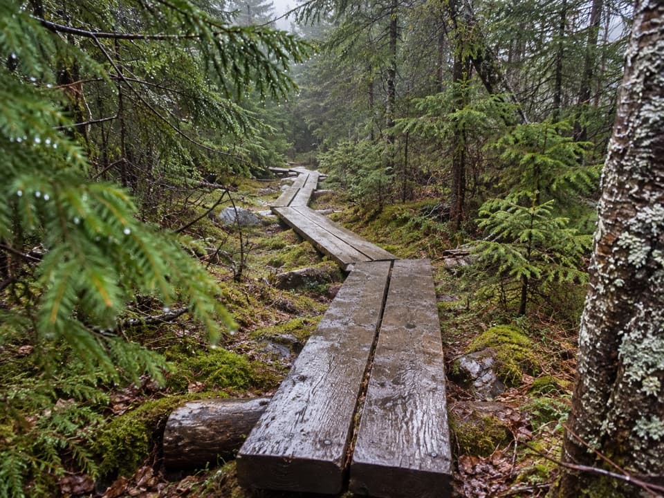 ChallengingNorth and South Kinsman via Fishin’ Jimmy Trail9.8 mi · 9 hr · 1 mi awayA long, rough climb links two Kinsman summits above Franconia Notch.
 ChallengingOld Bridle Path to Greenleaf Hut5.8 mi · 6 hr · 1.1 mi awayA steep hut climb with two open ledges and Franconia Notch views.
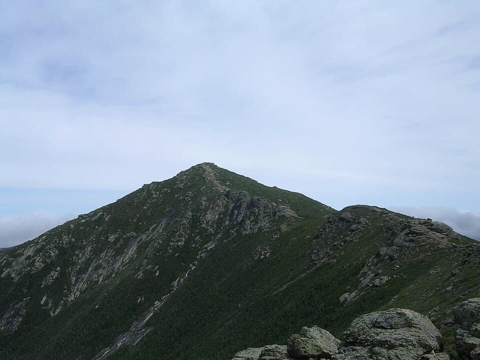 ChallengingFranconia Ridge Trail Loop8.1 mi · 8.5 hr · 1.2 mi awayA full-day loop over three exposed summits above Franconia Notch.
 ChallengingFalling Waters Trail5.9 mi · 5.5 hr · 1.2 mi awayWaterfalls up front; Little Haystack is the hard part.
 EasyCannon Mountain Rim Trail Loop0.4 mi · 45 min · 1.4 mi awayA short summit loop with Franconia Notch views and exposed ledges.
 Lodging · At the trailheadLonesome Lake HutA hike-in hut with bunks, hot soup, and a lakeside dock.Sight · 0.1 mi awayLonesome LakeFranconia Ridge across a small alpine lake, after a 1,000-foot climb.
 Campground · 1 mi awayLafayette Place CampgroundA wooded base camp for hiking, biking, fishing and swimming.
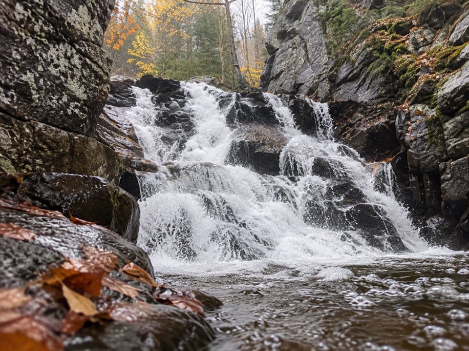 Sight · 1 mi awayRocky Glen FallsA stepped gorge waterfall worth the uphill finish.
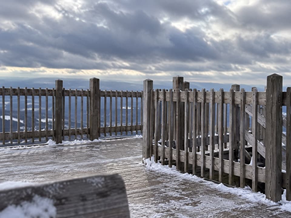 Sight · 1.3 mi awayCannon Mountain Observation TowerOn clear days, four states and Canada spread out from the summit.
 Sight · 1.3 mi awayKinsman FallsA narrow cleft sends Cascade Brook into a dark plunge pool.
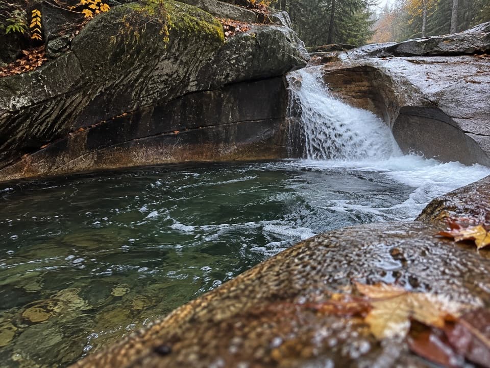 Sight · 1.6 mi awayThe BasinA river-carved granite bowl and waterfall, reached by a short paved walk.
 Sight · 1.6 mi awayBoise RockA glacial erratic paired with a wintry survival legend.
Parkwolf’s Franconia Notch ranking

The audio tour guide for the drive, plus offline maps, trails, and wildlife heatmaps for when the signal drops.