1 active Glacier alert
- ClosureTwo Medicine Campground closed for 2026 constructionTwo Medicine Campground is closed throughout 2026 because of construction in the Two Medicine developed area.Official details
#5 of 53 sights in Glacier
Sight · Glacier National Park
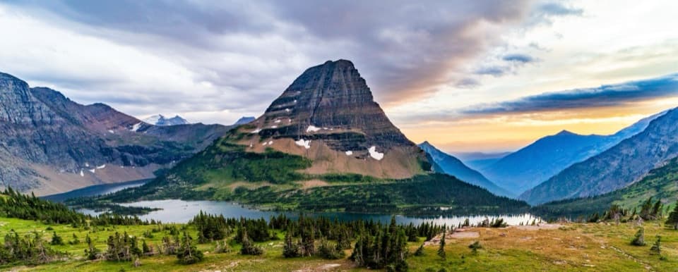
An exposed climb earns the park's classic view of Hidden Lake.
Overview
Map
Plan your stop

The highest, rockiest slopes around here are a summer buffet for grizzly bears.
Glacier Tour Guide
Parkwolf is a GPS audio tour guide for Glacier National Park. As you drive, it chimes in with what’s ahead: hidden gems, upcoming stops, history, geology, and wildlife, right through your car’s speakers.
See the Glacier audio tourRecorded for this place
Logan Pass and Hidden Lake“You’re approaching Logan Pass, the highest point on Going-to-the-Sun Road. Stop for the alpine meadows and mountain views even if you’re not planning a long hike.”
Plays as you drive up to Hidden Lake Overlook in the Parkwolf Glacier Tour Guide.
More stories near here in the app
“Our first time to glacier and we used the audio portion for Going to the Sun Road. Wonderful information with perfect advice of what to see and do along the road.”


Guide
Hidden Lake Overlook is a high-alpine viewpoint above Hidden Lake, reached on foot from Logan Pass Visitor Center. The lake sits below Bearhat Mountain, and this is the popular turnaround on the Hidden Lake Trail. The overlook is about 1.3 miles one way, so allow roughly 2.6 miles round trip. It is a good pick for the park's classic high-country view, but it is an uphill hike, not a quick roadside stop.
The trail starts behind the visitor center, then climbs on boardwalk and packed soil through open alpine meadows, with several sets of stairs and switchbacks. The meadows are known as the Hanging Gardens, cradled by Clements and Reynolds Mountains. Much of the route is exposed to sun and weather. Snow can linger into summer, so conditions can make this short mileage feel like a bigger outing.
Hidden Lake spreads below the steep face of Bearhat Mountain. Look west toward Mount Cannon and south toward Fusillade Mountain; Gunsight Mountain and Sperry Glacier sit farther southwest. For the defining photo, keep the lake in the lower frame with Bearhat rising behind it. That shows the drop from the overlook and the scale of the basin.
Most hikers turn around at the overlook. The lakeshore is another 1.2 miles along the trail and drops about 780 feet from the viewpoint, so reaching it adds a substantial descent and climb back. If the overlook is your goal, this is a natural place to stop; continue only if you want the longer lake walk.
Mountain goats are commonly seen near the overlook. Marmots and bighorn sheep are also reported in the area, so it can pay to scan the meadow and nearby rocky slopes as you walk. Sightings are never guaranteed.
The trail begins behind Logan Pass Visitor Center on Going-to-the-Sun Road. Parking, potable water, interpretive displays, and seasonal restrooms are at the trailhead, not at the overlook. This is a popular route and parking demand varies; arriving early can help, though the lot can fill early too. The stairs and switchbacks make this a non-step-free outing.
Wildlife
 404 sightingsGrizzly BearMost seen around 6 AMSighting map
 11 sightingsWolverineMost seen around 8 PMSighting map
 1,173 sightingsMountain GoatMost seen around 6 AMSighting map
 1,000 sightingsBighorn SheepMost seen around 6 AMSighting map
 395 sightingsMooseMost seen around 6 AMSighting map
 506 sightingsBlack BearMost seen around 8 PMSighting map
Sighting maps show where each species has been reported across Glacier. Wildlife moves, so no sighting is guaranteed.
Keep exploring
 ModerateHidden Lake Overlook Trail2.6 mi · 2.5 hr · 1.2 mi awayBoardwalk and switchbacks open onto a lake beneath Bearhat Mountain.
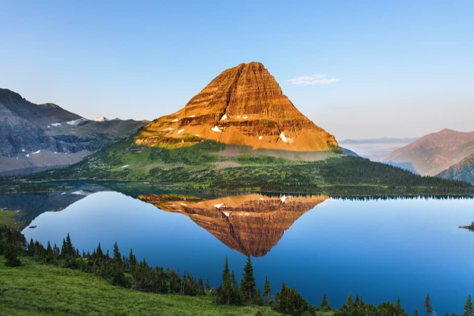 ChallengingHidden Lake Trail5.4 mi · 3.5 hr · 1.2 mi awayGo past the overlook only if you’re ready for a steep return.
 ChallengingHighline Trail11.8 mi · 8 hr · 1.3 mi awayA Garden Wall ledge walk with a long, steep finish.
 ChallengingHighline Trail to Grinnell Glacier Overlook15.1 mi · 9 hr · 1.3 mi awayA long, exposed traverse earns a knockout view over the glacier basin.
 ModerateAvalanche Lake Trail5 mi · 4.5 hr · 3.4 mi awayA half-mile of cedars before the big lake payoff.
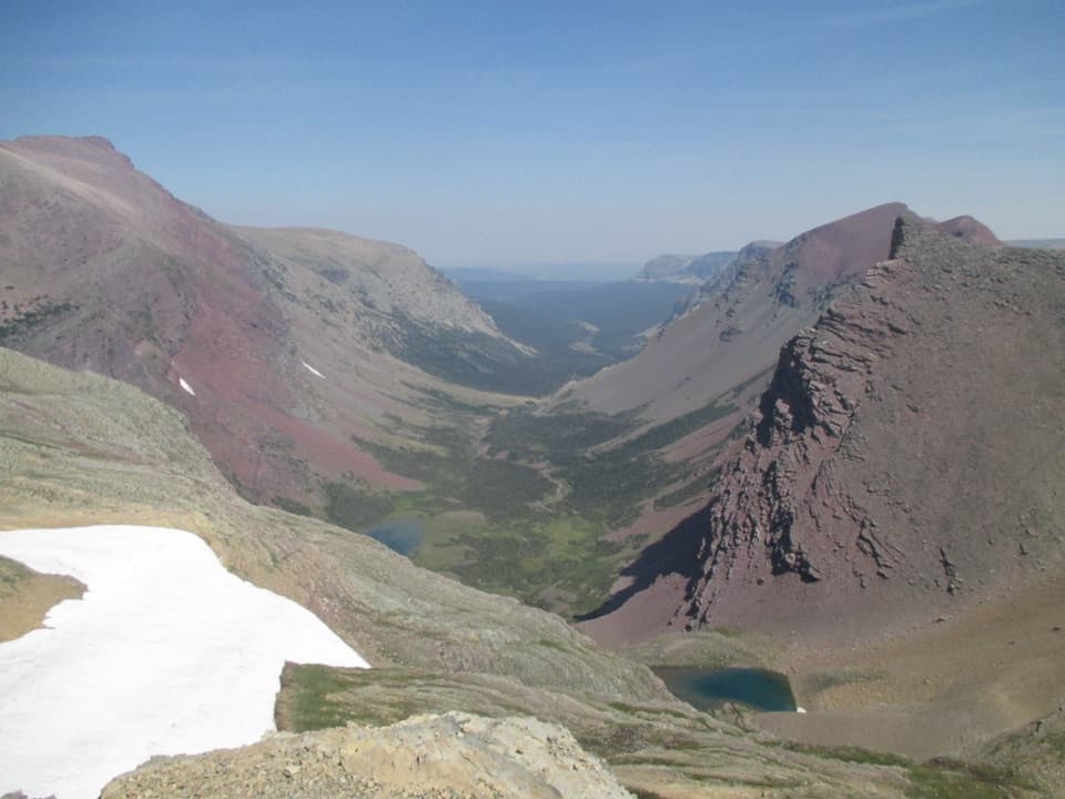 ChallengingSiyeh Pass Trail10 mi · 7 hr · 3.5 mi awayA steep pass crossing rewarded with Sexton Glacier and Baring Creek.
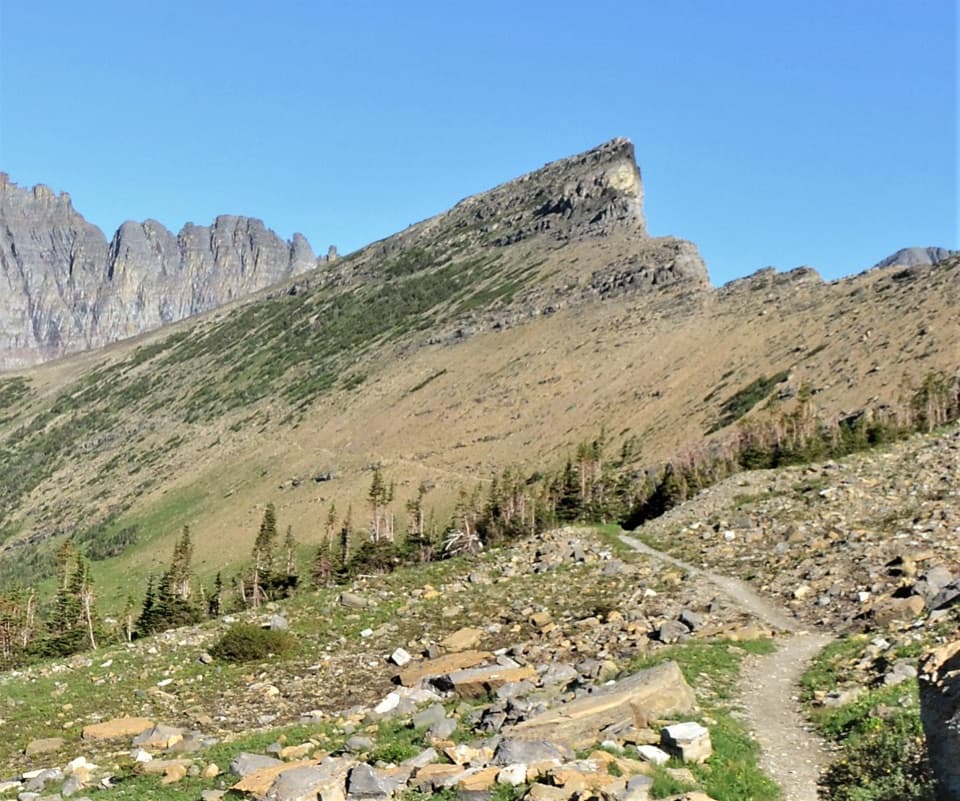 ChallengingPiegan Pass Trail9 mi · 6 hr · 3.5 mi awayA high saddle, glacier views, and a vanished railway bell.
 EasyTrail of the Cedars0.9 mi · 36 min · 3.6 mi awayA cedar boardwalk with an easy look into Avalanche Gorge.
 Sight · 1.2 mi awayOberlin BendThe last bend before Logan Pass opens onto a sweeping valley view.
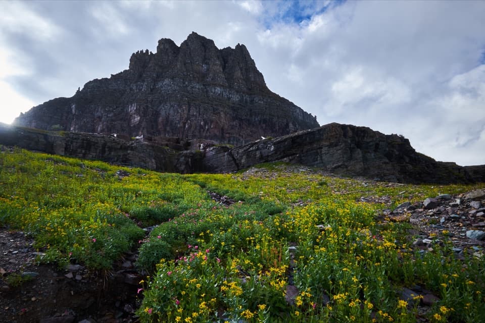 Sight · 1.3 mi awayLogan PassThe high point of the road is also a great trailhead.
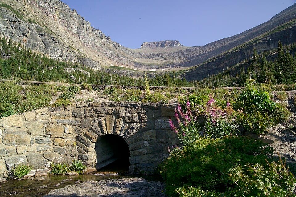 Sight · 1.9 mi awayLunch CreekA rock-step cascade beneath Pollock Mountain, framed by a stone bridge.
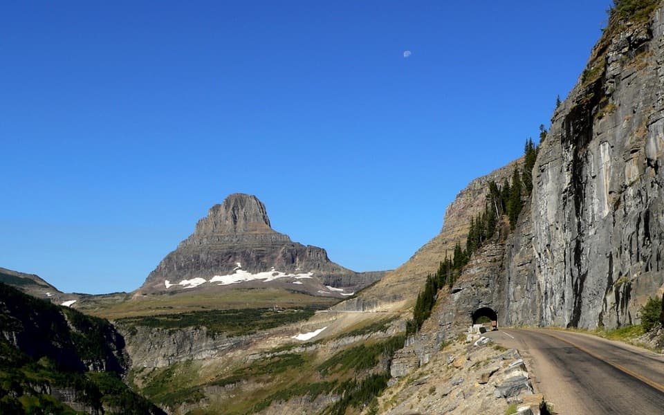 Sight · 2.2 mi awayEast TunnelA 408-foot cut through Piegan Mountain, right on the road.
 Sight · 2.3 mi awayTriple ArchesThree masonry arches carry Going-to-the-Sun Road across a mountainside.
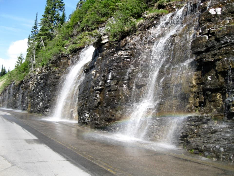 Sight · 2.8 mi awayWeeping WallA snowmelt curtain turns the road into a waterfall pass.
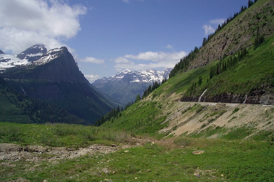 Scenic pullout · 2.9 mi awayBig BendA sweeping bend with Mount Cannon, Oberlin, and Heaven's Peak in view.
 Sight · 3 mi awayAvalanche LakeThin waterfalls stripe steep walls above a clear lake.
Parkwolf’s Glacier ranking

The audio tour guide for the drive, plus offline maps, trails, and wildlife heatmaps for when the signal drops.