Parking
Start at the difficult-to-find roadside pullout east of Going-to-the-Sun Road, about 1.5 miles northeast of Apgar Village. Finish at Sperry Trailhead near Lake McDonald Lodge; arrange a second vehicle or other ride.

Glacier National Park, MT
Hard miles in the trees, with Fish Lake waiting near the end.
Overview
Map & elevation
Plan your hike

The highest, rockiest slopes around here are a summer buffet for grizzly bears.
Glacier Tour Guide
Parkwolf is a GPS audio tour guide for Glacier National Park. As you drive, it chimes in with what’s ahead: hidden gems, upcoming stops, history, geology, and wildlife, right through your car’s speakers.
See the Glacier audio tourRecorded for this area
A Pika's Winter Pantry“On a high-country walk, a sharp squeak from a pile of broken rock is worth listening for. It may be a pika, a tiny relative of rabbits that lives among Glacier's rocky slopes.”
Plays on the road 0.2 mi from the trailhead in the Parkwolf Glacier Tour Guide.
More stories near here in the app
“Our first time to glacier and we used the audio portion for Going to the Sun Road. Wonderful information with perfect advice of what to see and do along the road.”


Trail guide
Snyder Ridge Trail is a 12.6-mile point-to-point route from an obscure Going-to-the-Sun Road pullout northeast of Apgar to the Sperry Trailhead by Lake McDonald Lodge. It follows the forested ridge along Lake McDonald’s south and east sides, then joins the Gunsight Pass Trail for the finish. The route gains about 2,800 feet. Allow 8–10 hours for the full traverse and arrange a pickup or second vehicle before setting out. Much of the walk stays under trees, so choose it for the long backcountry crossing and the late Fish Lake stop, not a steady chain of overlooks.
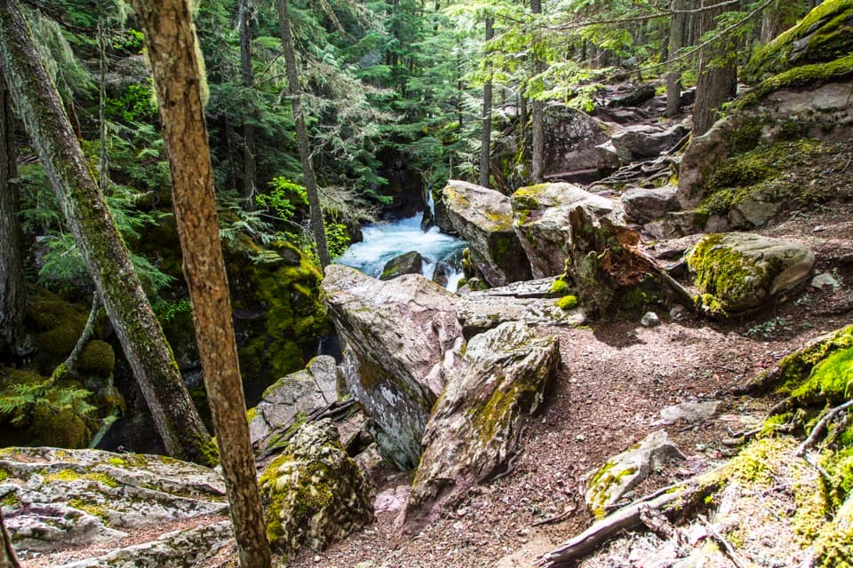
The climb starts through cedar rainforest stands and continues into lodgepole forest. The ridge rolls up and down, with few views for long stretches. The route is infrequently maintained; overgrown tread, fallen trees, washouts and route-finding are possible. Its current trail-specific condition has not been confirmed, so check before committing to the full traverse.
Creek crossings break up the wooded miles. Fish Lake arrives in the later part of the walk and is a welcome change after the ridge. Spring and early-summer water can be deep, swift and cold, and seasonal bridges are not available year-round. Take time at Fish Lake; it is one of the route’s clearest pauses in an otherwise long forest walk.
The start is a hard-to-spot pullout on the east side of Going-to-the-Sun Road about 1.5 miles northeast of Apgar Village. The mapped finish is the Sperry Trailhead beside Lake McDonald Lodge. Food, water and restrooms on the route were not documented, so carry what you need. Dogs are not allowed on park trails.
Wildlife
 404 sightingsGrizzly BearMost seen around 6 AMSighting map
 11 sightingsWolverineMost seen around 8 PMSighting map
 1,173 sightingsMountain GoatMost seen around 6 AMSighting map
 1,000 sightingsBighorn SheepMost seen around 6 AMSighting map
 395 sightingsMooseMost seen around 6 AMSighting map
 506 sightingsBlack BearMost seen around 8 PMSighting map
Sighting maps show where each species has been reported across Glacier. Wildlife moves, so no sighting is guaranteed.
Keep exploring
 EasyFish Creek Bike Path1.2 mi · 30 min · 1.4 mi awayA short, mostly level path through the woods to Fish Creek.
 EasyRocky Point Nature Trail1.8 mi · 1.3 hr · 1.4 mi awayA lakeside loop to Rocky Point and its mountain views.
 EasyApgar Bike Path3 mi · 1.2 hr · 1.6 mi awayFlat, shaded pavement links Apgar Village with Park Headquarters.
 ChallengingSouth Boundary Trail11.5 mi · 5.3 hr · 2.6 mi awayFollow the Middle Fork through an old ranger route to Lincoln Creek.
 ChallengingHowe Ridge Trail11.6 mi · 9 hr · 2.6 mi awayA rough ridge traverse where route-finding matters as much as climbing.
 EasyBelton Bridge Trail1 mi · 30 min · 2.7 mi awayA level riverside walk to the old entrance bridge.
 ChallengingApgar Lookout Trail7.2 mi · 4.5 hr · 3.4 mi awaySteep switchbacks through the 2003 burn climb to a fire lookout.
 EasyOld Flathead Ranger Station Trail6.9 mi · 3 hr · 3.6 mi awayA gentle old road leads to the Flathead River confluence.
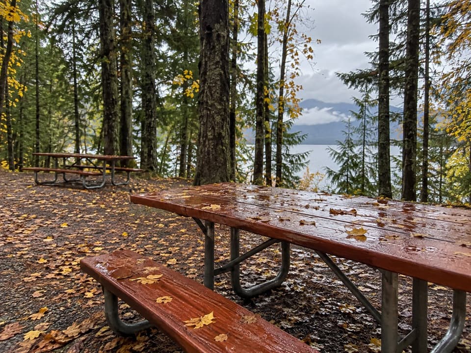 Picnic area · 0.9 mi awayApgar Picnic AreaA shaded picnic stop with Lake McDonald in front.
 Picnic area · 1 mi awayFish Creek Picnic AreaA short stop for Lake McDonald’s rocky shore and picnic tablesSight · 1.1 mi awayRocky PointA short shore walk opens broad views across Lake McDonald.
 Campground · 1.1 mi awayApgar CampgroundSleep in the pines, then walk to Lake McDonald for sunset.
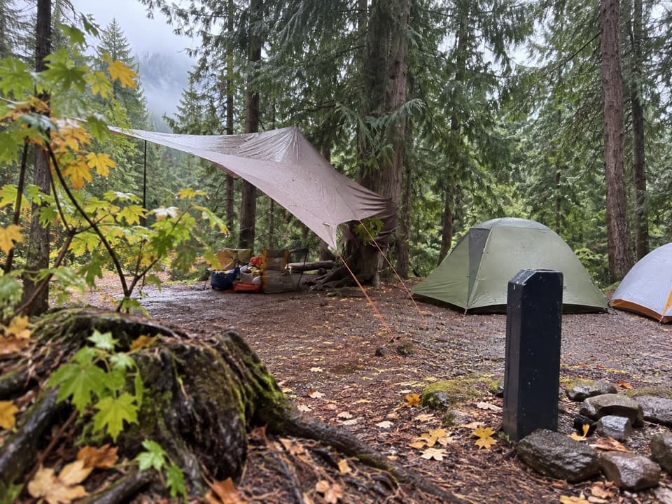 Campground · 1.1 mi awayFish Creek CampgroundA wooded west-side base with seasonal showers and Lake McDonald access.
 Sight · 1.4 mi awayApgar Nature CenterTouch animal pelts and build mountains in a 1929 Apgar cabin.
 Sight · 1.4 mi awayApgar VillageFood, boats and lake access share the west shore.
 Lodging · 1.4 mi awayVillage Inn at ApgarA 36-room lakeside inn where every room faces Lake McDonald.
Parkwolf’s Glacier ranking

The audio tour guide for the drive, plus offline maps, trails, and wildlife heatmaps for when the signal drops.