Old Flathead Ranger Station Trail in Glacier National Park

Glacier National Park, MT

Old Flathead Ranger Station Trail

A gentle old road leads to the Flathead River confluence.

Length
6.9mi
Time
3hr
Elev. change
138ft
Difficulty
Easy
  • No dogs
  • High point 3,337 ft

Hear the audio tour

Old Flathead Ranger Station Trail

Overview

About Old Flathead Ranger Station Trail

Why go

  • Gentle grade on a wide, easy-to-follow old road
  • A distinctive river-forks destination at the end

Heads up

  • Nearly seven miles of walking the same road back
  • Roadside parking at the start is not clearly established

Map & elevation

The route

Loading the Glacier map
Full map
Elevation3,199–3,337 ft
TrailheadQuarter Circle Bridge Road junction48.49901, -114.01768
Keep this map with you offline in the Parkwolf app

Plan your hike

Before you go

Parking

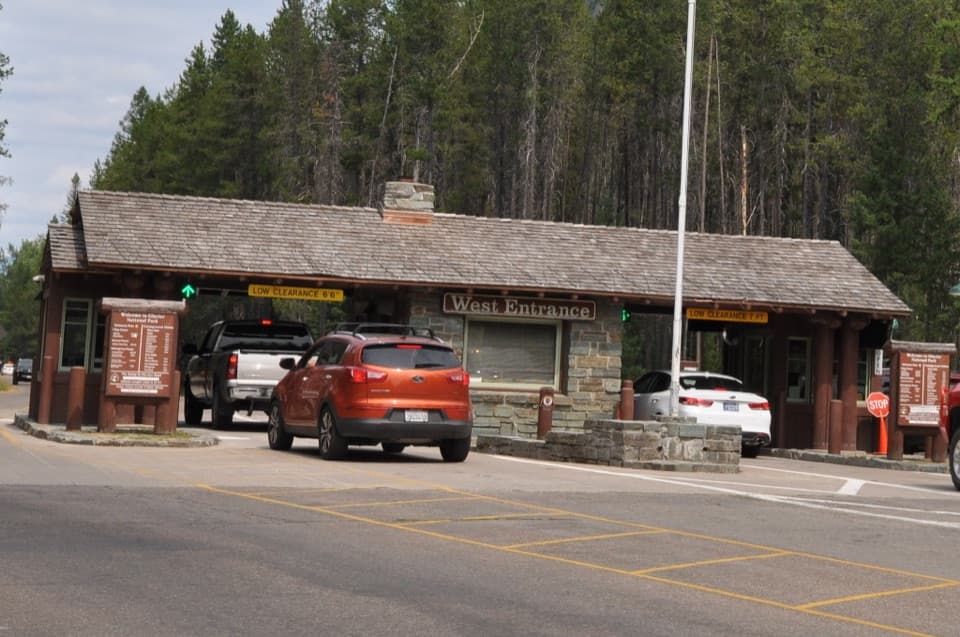
From the West Entrance, turn toward Apgar Lookout about half a mile beyond the entrance, cross Quarter Circle Bridge and continue to the junction before the road bends right. Reports disagree about whether a signed roadside lot is available there. Apgar Lookout Trailhead has ample parking; from that lot, walk back to the junction, adding about half a mile each way beyond the listed route.

Safety

Pets are not permitted on Glacier National Park trails.

1 active Glacier alert

  • ClosureTwo Medicine Campground closed for 2026 constructionTwo Medicine Campground is closed throughout 2026 because of construction in the Two Medicine developed area.Official details
Glacier alerts
A park ranger sits on a dash-mounted phone, talking, as Parkwolf’s Tour Guide plays “Army Cutworm Moths: A Grizzly Bear Buffet” on Grand Loop Road below Dunraven Pass in Yellowstone
Parkwolf Tour GuideThe highest, rockiest slopes around here are a summer buffet for grizzly bears.

Glacier Tour Guide

Your drive to Old Flathead Ranger Station Trail, narrated.

Parkwolf is a GPS audio tour guide for Glacier National Park. As you drive, it chimes in with what’s ahead: hidden gems, upcoming stops, history, geology, and wildlife, right through your car’s speakers.

See the Glacier audio tour

Recorded for this trailhead

Old Flathead Ranger Station Trail
0:00 / 0:26
“Up ahead is the start of Old Flathead Ranger Station Trail, a gentle old-road walk to views near the meeting of the Flathead's North and Middle Forks. Allow about three hours for nearly seven miles round trip.”

Plays as you drive up to this trailhead in the Parkwolf Glacier Tour Guide.

More stories near here in the app

  • Apgar Lookout Trailhead
  • How Ice Sharpens a Skyline
  • The Second Rainbow Runs in Reverse
  • Belton Chalet and Historic Depot
  • 204 audio storiesacross Glacier’s roads, triggered by GPS as you drive
  • Wildlife heatmapsfor Grizzly Bear, Wolverine, Mountain Goat, and 13 more
  • Works offlinemaps, 157 trails, 91 places, and audio download before you lose signal
  • CarPlay readysimple controls built for the drive
★★★★★
“Our first time to glacier and we used the audio portion for Going to the Sun Road. Wonderful information with perfect advice of what to see and do along the road.”
PaisleyParkFanApp Store review
Download Parkwolf on the App StoreGet Parkwolf on Google Play

4.7 from 8,600+ ratings

Trail guide

Hiking Old Flathead Ranger Station Trail

The walkOld Flathead Ranger Station Trail is a 6.

Old Flathead Ranger Station Trail is a 6.9-mile out-and-back along a broad former road, ending at the old station site above the meeting of the Middle and North Forks of the Flathead River. Allow about three hours and expect roughly 400 feet of climbing. The grade is gentle; the distance and long return matter more than any steep pitch.

From woods into the burnThe route starts under trees, then opens through fire-scarred country.

The route starts under trees, then opens through fire-scarred country. You can hear the Middle Fork before it comes into view near the far end. Dirt, grass and gravel make up the old road. In spring and early summer, the open stretch can show wildflowers; birds and occasional larger mammals are also reported here, though sightings vary.

Stay for the river viewsThe ranger station is gone, but the river is still a good reason to walk out.

The ranger station is gone, but the river is still a good reason to walk out. From the former site, a short walk reaches a Middle Fork view; about 500 feet farther is an overlook toward the North Fork and Blankenship Bridge. The route continues beyond, but the tread becomes overgrown and rougher, so use the overlooks as your turnaround.

A remote outpostThe station was established in the 1920s to address poaching.

The station was established in the 1920s to address poaching. Its original compound burned in the 1929 Half Moon Fire, was rebuilt in 1930, and most remaining structures were later removed by the park. The site is now a marker of that history, not a building visit.

Starting and returningThe trail begins at the road junction after Quarter Circle Bridge, before the road bends right…

The trail begins at the road junction after Quarter Circle Bridge, before the road bends right toward Apgar Lookout. Parking reports conflict: one describes a small signed roadside lot, while another says there is no designated parking. Apgar Lookout Trailhead has ample parking, but reaching this trail from there means walking back to the junction, about half a mile each way beyond the listed distance. Bicycles are allowed on this multi-use trail; pets are not.

Wildlife

Wildlife in Glacier

All Glacier wildlife maps

Sighting maps show where each species has been reported across Glacier. Wildlife moves, so no sighting is guaranteed.

Keep exploring

Near Old Flathead Ranger Station Trail

See it all on the map

Trails that start nearby

Places near the trailhead

Parkwolf’s Glacier ranking

Top-rated trails in Glacier

All 157 trails
  1. 1Highline TrailChallenging · 11.8 mi
  2. 2Grinnell Glacier TrailChallenging · 10 mi
  3. 3Iceberg Lake TrailModerate · 9.6 mi
  4. 4Hidden Lake Overlook TrailModerate · 2.6 mi
  5. 5Avalanche Lake TrailModerate · 5 mi
  6. 6Trail of the CedarsEasy · 0.9 mi

Take Parkwolf to Glacier.

The audio tour guide for the drive, plus offline maps, trails, and wildlife heatmaps for when the signal drops.

4.7 from 8,600+ ratings

Download Parkwolf on the App StoreGet Parkwolf on Google Play