Lake Wartook Lookout to Halls Gap in Grampians National Park

Grampians National Park, VIC

Lake Wartook Lookout to Halls Gap

Ridge-top sandstone and lake views, then a long forest descent to town

Length
10.9km
Time
3.5hr
Elev. change
584m
Difficulty
Challenging
  • No dogs
  • High point 821 m

Hear the audio tour

Lake Wartook Lookout: Through the Rock Slot

Overview

About Lake Wartook Lookout to Halls Gap

Why go

  • Ridge and lake views
  • Finishes in Halls Gap
  • Distinct forest change

Heads up

  • Requires a car shuffle or pickup
  • Steep, rocky and exposed sections
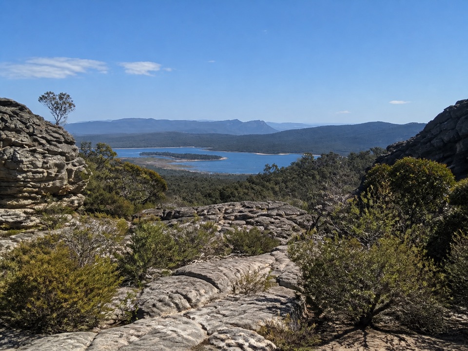
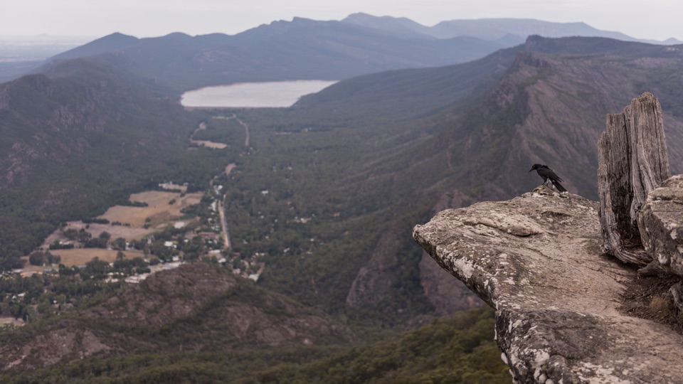
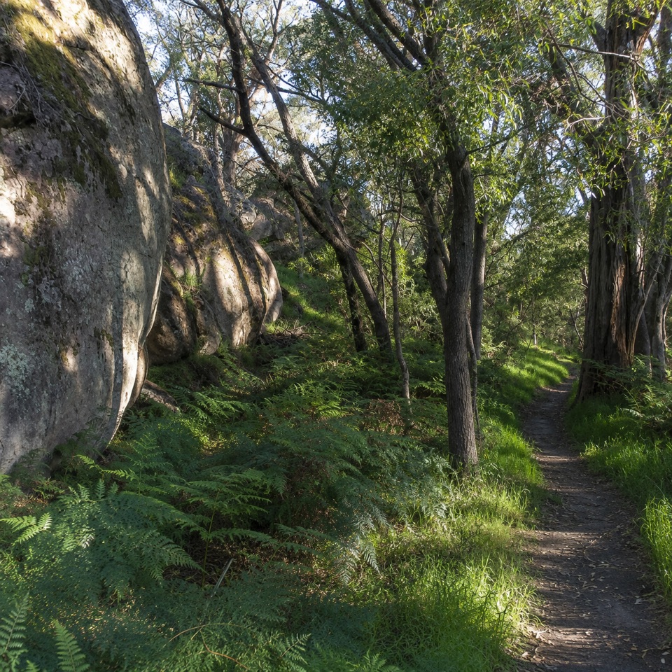
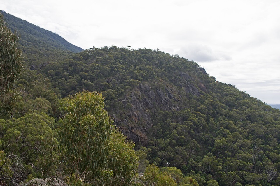
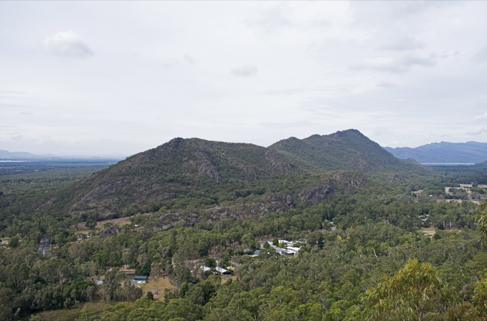
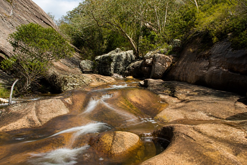
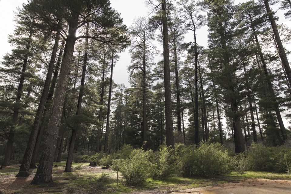
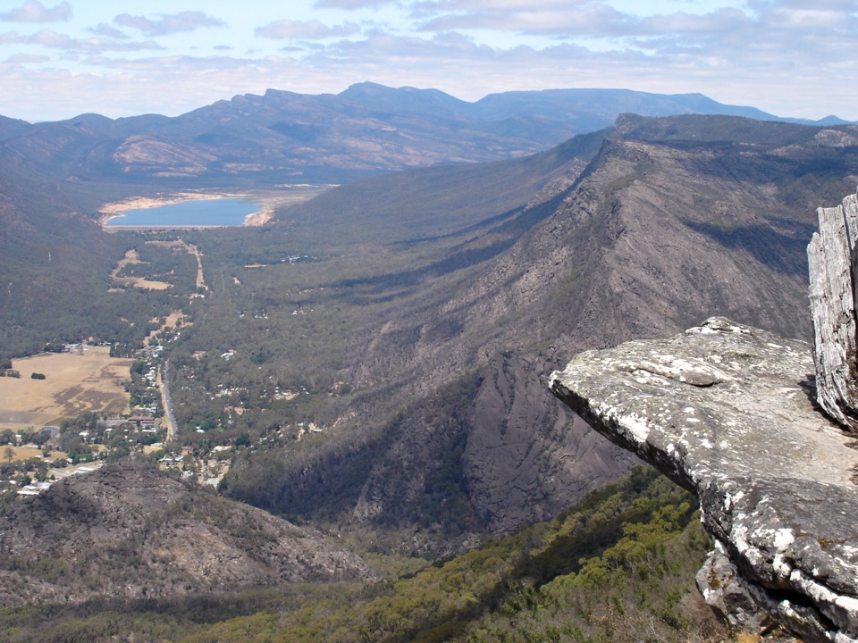
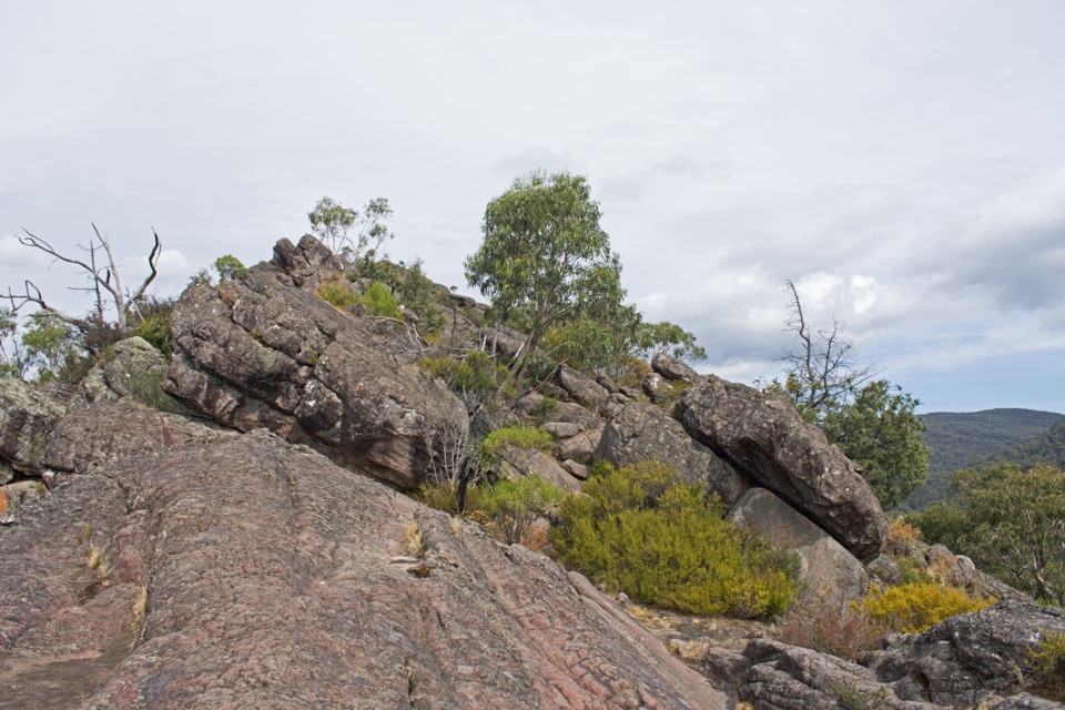
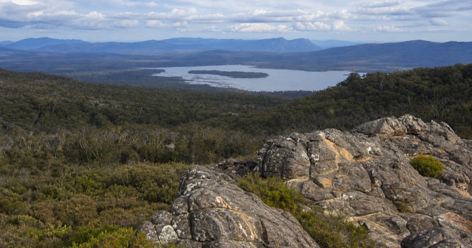
The opening kilometres are the scenic heart of the walk: weathered pale and orange-streaked sandstone slabs, low heath, Lake Wartook sitting below, and layers of blue Grampians ridges running into the distance. Later the character changes completely as low windswept forest gives way to taller, shadier forest, with panoramic views again from the Chatauqua Peak area before the drop past Clematis Falls to town.
Parkwolf’s verdictThe payoff

Map & elevation

The route

Loading the Grampians map
Full map
Elevation237–821 m
TrailheadLake Wartook Lookout, Mount Difficult Road-37.08189, 142.50220
Keep this map with you offline in the Parkwolf app

Plan your hike

Before you go

Parking

Start at the Lake Wartook Lookout roadside access on Mount Difficult Road, about 4.5 km north of Boroka Lookout car park. The access road is unsealed, higher clearance is recommended and parking is limited. Arrange a vehicle or pickup in Halls Gap before starting.

Safety

Grade 4 terrain includes steep steps, rock hopping, slippery surfaces and exposed rocky outcrops. The route is long and one way, with limited parking at the remote start.

5 active Grampians alerts

  • ClosureBushfire-damaged walks and picnic area remain closedThe Fortress, Red Gum, Billimina, Chimney Pots and Brownings Loop walks, plus Mafeking Picnic Area, remain closed because of track or site damage from the 2024/25 summer bushfires.Official details
  • ClosureMackenzie Falls precinct closed during constructionThe Mackenzie Falls (Migunang wirab) Precinct has no vehicle or visitor access during major construction works expected to finish by the end of 2026.Official details
See all 5 alerts
A park ranger sits on a dash-mounted phone, talking, as Parkwolf’s Tour Guide plays “Army Cutworm Moths: A Grizzly Bear Buffet” on Grand Loop Road below Dunraven Pass in Yellowstone
Parkwolf Tour GuideThe highest, rockiest slopes around here are a summer buffet for grizzly bears.

Grampians Tour Guide

Your drive to Lake Wartook Lookout to Halls Gap, narrated.

Parkwolf is a GPS audio tour guide for Grampians National Park. As you drive, it chimes in with what’s ahead: hidden gems, upcoming stops, history, geology, and wildlife, right through your car’s speakers.

Recorded for this trailhead

Lake Wartook Lookout: Through the Rock Slot
0:00 / 0:50
“Ahead is the roadside starting point for Lake Wartook Lookout, where a short, rocky climb leads to a wide lake-and-mountain view. I'd allow about 40 minutes for the 1.”

Plays as you drive up to this trailhead in the Parkwolf Grampians Tour Guide.

More stories near here in the app

  • Tiny Leaves That Catch Insects
  • The Cherry That’s Really a Stalk
  • Plantation Campground: Beneath the Pines
  • The Kookaburra Family Chorus
  • 233 audio storiesacross Grampians’s roads, triggered by GPS as you drive
  • Wildlife heatmapsfor Short-beaked Echidna, Powerful Owl, Wedge-tailed Eagle, and 13 more
  • Works offlinemaps, 81 trails, 62 places, and audio download before you lose signal
  • CarPlay readysimple controls built for the drive
★★★★★
“Fantastic app with many points of information… It’s great to just turn on while you’re driving and it gives you an audio tour of the national Park. We love it!!!!”
JMJamesApp Store review
Download Parkwolf on the App StoreGet Parkwolf on Google Play

4.7 from 8,600+ ratings

Trail guide

Hiking Lake Wartook Lookout to Halls Gap

The walk in shortThis is a point-to-point walk of 10.

This is a point-to-point walk of 10.9 km one way, taking around 3 to 4 hours, running south along the Grampians Peaks Trail from the Lake Wartook Lookout access on Mount Difficult Road down into Halls Gap. All distances and times here are for the one-way direction. If you cannot arrange transport at the far end, the same route walked out and back is about 20.7 km and 6 to 7 hours, which is a much bigger day and a separate decision rather than the normal way to do this walk.

How the route unfoldsFollow the Grampians Peaks Trail south for about 1.1 km, then cross Mount Difficult Road.
  • Follow the Grampians Peaks Trail south for about 1.1 km, then cross Mount Difficult Road.
  • Continue roughly 2 km through low forest along the high ground.
  • Descend a steep set of steps into taller forest.
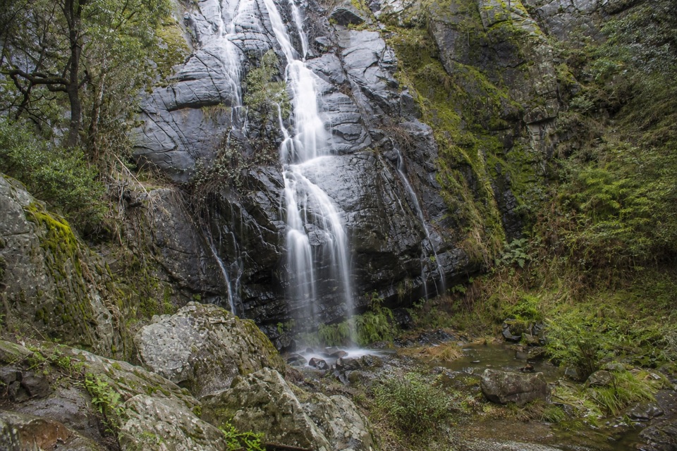
  • Keep heading gradually downhill through the Chatauqua Peak saddle, past Clematis Falls, and into the Botanic Gardens on the edge of Halls Gap.
Difficulty and footingRated Grade 4, hard.

Rated Grade 4, hard. Expect challenging steep sections, rock hopping, surfaces that turn slippery when wet, and exposed rocky outcrops where a slip matters. The profile starts high on the range near 800 m and finishes around 240 m in Halls Gap, so this is a long, sustained descent with undulations along the ridge, and it works your knees more than your lungs. It suits fit, experienced and properly prepared walkers with sturdy footwear, sun protection and plenty of water. For a taste of the same view with none of the commitment, the short return walk at Lake Wartook Lookout is a far easier and much briefer outing.

Access and logisticsThe biggest planning problem is the ends, not the terrain.

The biggest planning problem is the ends, not the terrain. The start is a roadside access point on Mount Difficult Road about 4.5 km north of Boroka Lookout car park, reached by unsealed road where a higher clearance vehicle is recommended and parking is very limited. Because the walk finishes in Halls Gap, you need a car shuffle, a second vehicle, or a pickup arranged in advance. Walking downhill to Halls Gap is the sensible direction, so leave a vehicle or a lift waiting there and start early enough to have the descent done in good light.

PetsDogs and other pets are not permitted in Victorian national parks, so leave them at home.

Dogs and other pets are not permitted in Victorian national parks, so leave them at home. Assistance dogs are covered by separate entry requirements, which should be checked before you travel.

Wildlife

Wildlife in Grampians

All Grampians wildlife maps

Sighting maps show where each species has been reported across Grampians. Wildlife moves, so no sighting is guaranteed.

Keep exploring

Near Lake Wartook Lookout to Halls Gap

See it all on the map

Trails that start nearby

Places near the trailhead

Parkwolf’s Grampians ranking

Top-rated trails in Grampians

All 81 trails
  1. 1Grampians Peaks TrailChallenging · 164 km
  2. 2The Pinnacle via Wonderland CarparkModerate · 4 km
  3. 3Mackenzie Falls WalkModerate · 2 km
  4. 4Mt Stapylton (Gunigalg) Loop WalkChallenging · 4.6 km
  5. 5Mt Abrupt (Mud-dadjug) WalkChallenging · 6.5 km
  6. 6The Balconies WalkEasy · 2.2 km

Take Parkwolf to Grampians.

The audio tour guide for the drive, plus offline maps, trails, and wildlife heatmaps for when the signal drops.

4.7 from 8,600+ ratings

Download Parkwolf on the App StoreGet Parkwolf on Google Play