Deer Creek Trail to Deer Creek Falls in Grand Canyon National Park

Grand Canyon National Park, AZ

Deer Creek Trail to Deer Creek Falls

A long rim-to-river hike to Deer Creek Falls

Photo: Wikimedia Commons
Length
20.4mi
Time
13.5hr
Elev. change
5,174ft
Difficulty
Challenging
  • No dogs
  • High point 7,192 ft
  • #25 of 73 in Grand Canyon
Parkwolf audio tour79 stories across Grand Canyon’s roads

Overview

About Deer Creek Trail to Deer Creek Falls

Why go

  • Deer Spring, the Patio and Deer Creek Falls make a vivid reward for the long canyon descent.

Heads up

  • A 20.4-mile day, roughly 5,250 feet of vertical change and a remote forest-road approach make this a serious undertaking.

Map & elevation

The route

Loading the Grand Canyon map
Full map
Elevation2,018–7,192 ft
TrailheadMonument Point (Bill Hall Trailhead)36.43471, -112.42981
Keep this map with you offline in the Parkwolf app

Plan your hike

Before you go

Parking

Park at Monument Point (Bill Hall Trailhead) at the end of FSR 292A. From Jacob Lake the drive is about 34 miles via Forest Roads 461, 22, 423, 427, 425 and 292; from Fredonia it is about 48 miles via 22, 423, 427, 425 and 292. Winter and spring access can be unreliable, so get a current road update before driving out. Bring all food and supplies; there are no services at the trailhead.

Safety

Steep, rough and exposed canyon travel with a 15-foot scramble on Bill Hall Trail. The Esplanade and Surprise Valley are dry and very hot; avoid Surprise Valley after 10 a.m. in warm weather. Pets are prohibited below the rim. Overnight camping below the rim requires a backcountry permit. Climbing and rappelling in the creek narrows below the Patio are prohibited.

4 active Grand Canyon alerts

  • ClosureInner Canyon and North Rim trail closuresMentions North Rim, referenced in this guideDo not enter the closed trails, bridges, campgrounds, and inner-canyon areas.Official details
  • ClosureNorth Rim scenic roads closed for repairsMentions North Rim, referenced in this guideCape Royal Road and Point Imperial Road are closed from sunset October 15 through sunrise November 3, 2026. - The roads are closed to accommodate critical road repair and rehabilitation work.Official details
See all 4 alerts
A park ranger sits on a dash-mounted phone, talking, as Parkwolf’s Tour Guide plays “Army Cutworm Moths: A Grizzly Bear Buffet” on Grand Loop Road below Dunraven Pass in Yellowstone
Parkwolf Tour GuideThe highest, rockiest slopes around here are a summer buffet for grizzly bears.

Grand Canyon Tour Guide

Your drive to Deer Creek Trail to Deer Creek Falls, narrated.

Parkwolf is a GPS audio tour guide for Grand Canyon National Park. As you drive, it chimes in with what’s ahead: hidden gems, upcoming stops, history, geology, and wildlife, right through your car’s speakers.

See the Grand Canyon audio tour
  • 79 audio storiesacross Grand Canyon’s roads, triggered by GPS as you drive
  • Wildlife heatmapsfor California Condor, Bighorn Sheep, American Bison, and 13 more
  • Works offlinemaps, 73 trails, 96 places, and audio download before you lose signal
  • CarPlay readysimple controls built for the drive
★★★★★
“Fantastic app with many points of information… It’s great to just turn on while you’re driving and it gives you an audio tour of the national Park. We love it!!!!”
JMJamesApp Store review
Download Parkwolf on the App StoreGet Parkwolf on Google Play

4.7 from 8,600+ ratings

Trail guide

Hiking Deer Creek Trail to Deer Creek Falls

The full hikeDeer Creek Trail to Deer Creek Falls is a rugged out-and-back from Monument Point on the North…

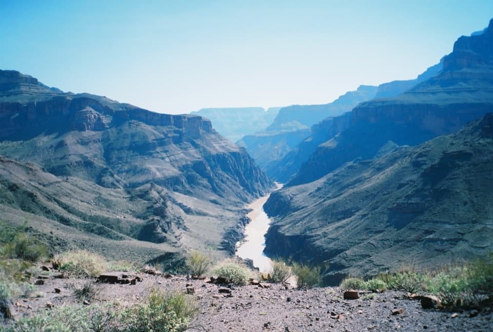
Deer Creek Trail to Deer Creek Falls is a rugged out-and-back from Monument Point on the North Rim. The route uses the Bill Hall Trail and Thunder River Trail to reach the west branch at Surprise Valley, then follows Deer Creek to the Colorado River. Plan on about 20.4 miles round trip and roughly 13 to 14 hours with stops. It drops from about 7,200 feet to 1,950 feet, then climbs all the way back. This is a serious canyon hike for experienced hikers, not a quick waterfall walk.

Start early and follow the cairnsFrom Monument Point, the Bill Hall Trail contours along the rim before dropping steeply toward…

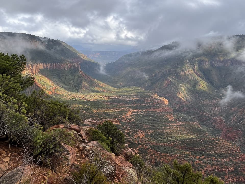
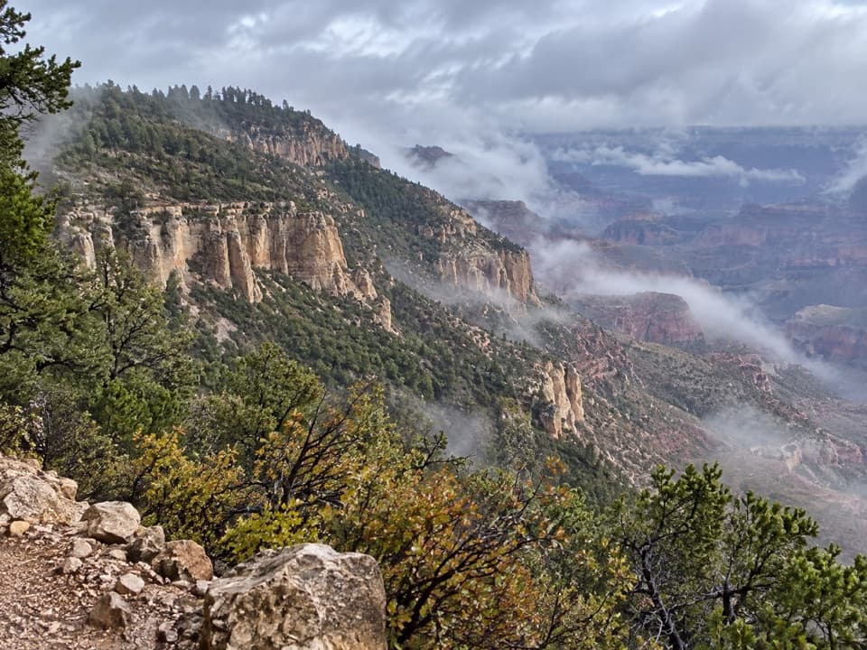
From Monument Point, the Bill Hall Trail contours along the rim before dropping steeply toward the Esplanade. A short 15-foot scramble is part of the route. On the Thunder River Trail, open slickrock and small drainages make the track easy to lose; keep the next cairn in view before leaving the last one behind. After about 2.5 miles of mostly level walking, the southern edge of the Esplanade opens to a broad canyon view, followed by long switchbacks through the Supai and Redwall layers into Surprise Valley.

That descent faces south and gets very hot. In warm weather, avoid being in Surprise Valley after 10 a.m. The canyon approach is long, dry and exposed, so a late start leaves little margin for the climb back to the rim.

Take the west branchAt the large cairn in Surprise Valley, go west/right for Deer Creek.

At the large cairn in Surprise Valley, go west/right for Deer Creek. East/left leads to Thunder River and Tapeats Creek, a different route. Deer Creek's trail is rocky, loose and somewhat exposed as it drops into the drainage. Deer Spring is a welcome water stop; the designated campsite is about 20 minutes farther along.

The Patio and the fallsBelow camp, Deer Creek spreads across broad rock ledges called the Patio, then plunges into a…

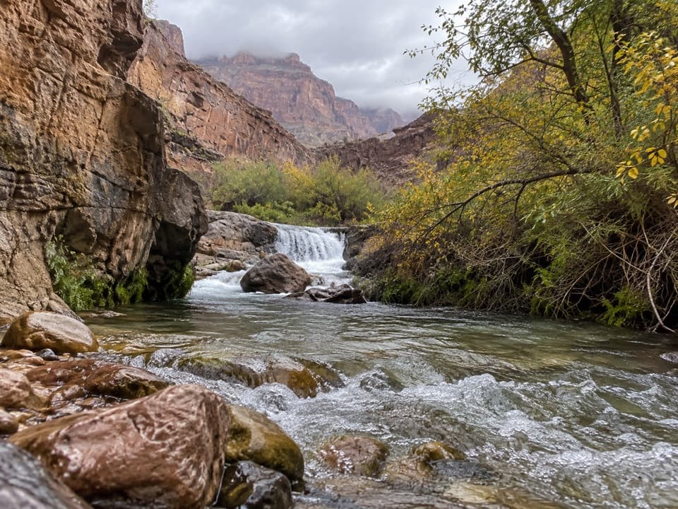
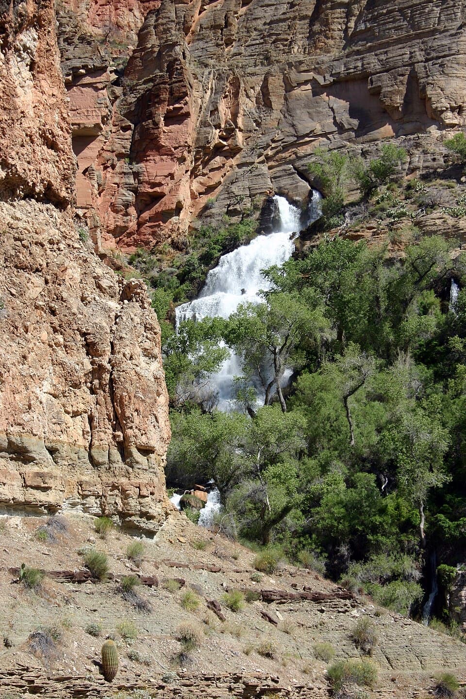
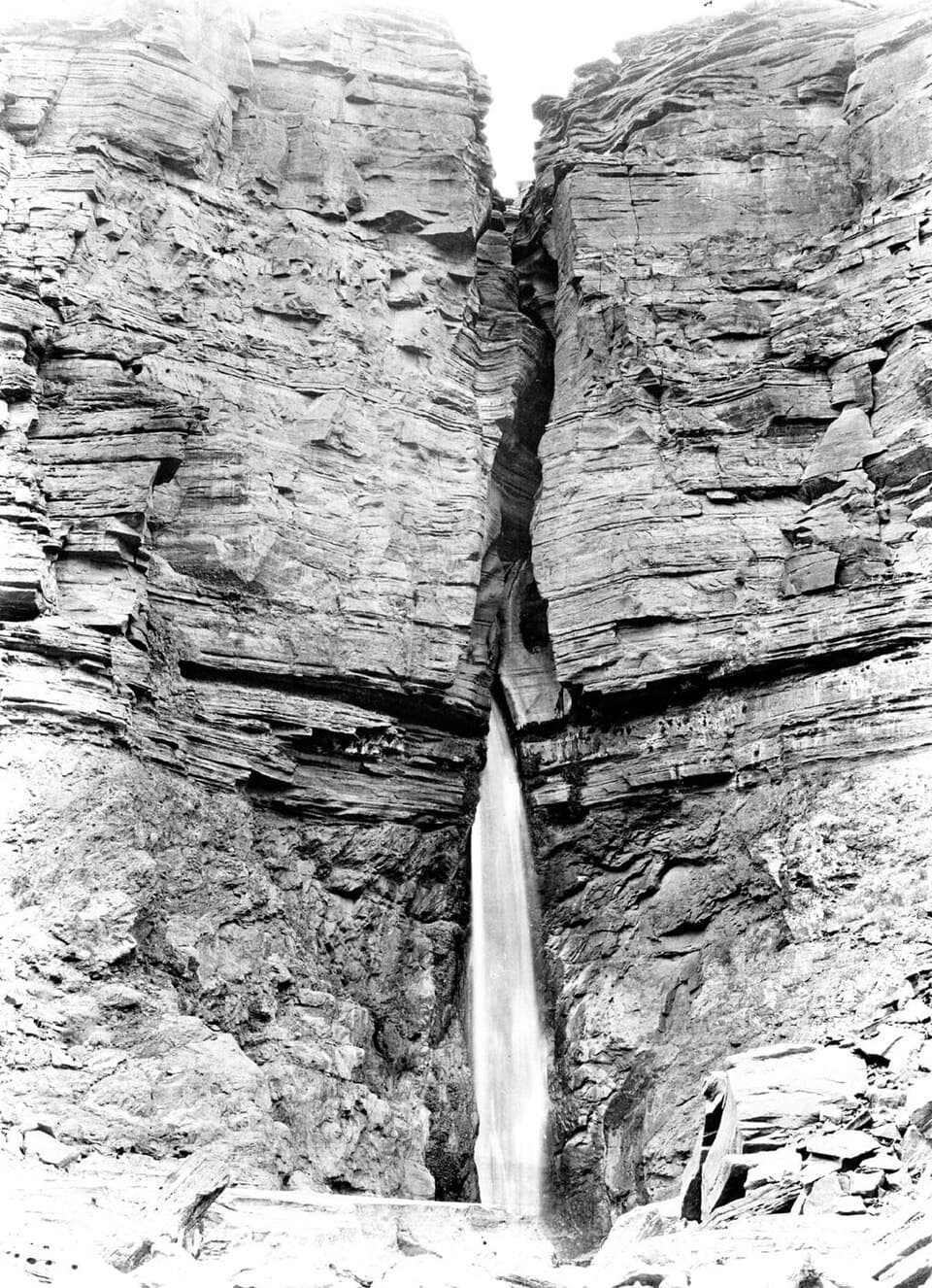
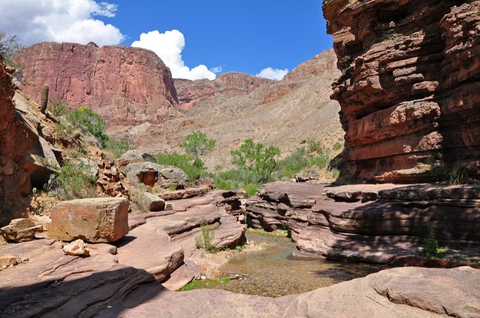
Below camp, Deer Creek spreads across broad rock ledges called the Patio, then plunges into a narrow gorge. The established trail stays on the west side of the narrows and reaches the Colorado River beside Deer Creek Falls. The creek channel below the Patio is closed to climbing and rappelling; stay on the hiking route. The broad shelves are the best place for a close view of the creek, while a wider frame that includes the canyon walls shows the scale of this green pocket in the dry canyon.

Water and campingDeer Spring, Tapeats Creek, Thunder River and the Colorado River are listed as permanent water…

Deer Spring, Tapeats Creek, Thunder River and the Colorado River are listed as permanent water sources, but much of the approach is dry. Many hikers cache water on the Esplanade or in Surprise Valley for the return; date any cache, hide it from view and remove it when you pass back through. Treat natural water before drinking it.

Overnight camping below the rim requires a backcountry permit. Deer Creek's designated use area has campsites for two groups and a toilet. No food or services are available at the remote trailhead, so bring what you need from town.

Reaching Monument PointThe Bill Hall Trailhead is at Monument Point, reached by a long drive on Forest Service roads…

The Bill Hall Trailhead is at Monument Point, reached by a long drive on Forest Service roads via FSR 22, 423/427, 425, 292 and 292A. Winter and spring access can be unreliable; get a current road update before heading out. This record uses the shorter Bill Hall approach. Indian Hollow is another access, but its longer Thunder River route is a different starting itinerary.

Why water appears hereDeer Spring and the neighboring canyon springs emerge from caves, turning an otherwise dry…

Deer Spring and the neighboring canyon springs emerge from caves, turning an otherwise dry stretch into a green oasis. The contrast is part of the reward: after the open, sunbaked Esplanade and Surprise Valley, the Patio brings trees, flowing water and shade beneath steep red walls.

The rock wallsThe Deer Creek Narrows are cut into the hard Tapeats Formation.

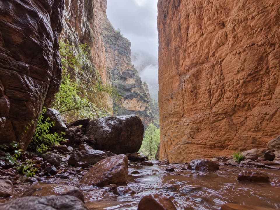
The Deer Creek Narrows are cut into the hard Tapeats Formation. Those resistant layers hold the narrow gorge while the creek drops from the Patio toward the river. The route gives you the view from the permitted west-side trail without requiring a descent into the closed creek channel.

Bill Hall's nameThe shortcut to the canyon is named for Bill Hall, a seasonal North Rim ranger who died in a…

The shortcut to the canyon is named for Bill Hall, a seasonal North Rim ranger who died in a line-of-duty car accident in 1979. His trail is the primary access for this version of Deer Creek, but it is steep and includes the scramble described above.

Wildlife

Wildlife in Grand Canyon

All Grand Canyon wildlife maps

Sighting maps show where each species has been reported across Grand Canyon. Wildlife moves, so no sighting is guaranteed.

Parkwolf’s Grand Canyon ranking

Top-rated trails in Grand Canyon

All 73 trails
  1. 1Rim-to-Rim: North Kaibab to Bright AngelChallenging · 23.5 mi
  2. 2South Kaibab TrailChallenging · 6.3 mi
  3. 3Bright Angel TrailChallenging · 7.8 mi
  4. 4Rim TrailModerate · 12.8 mi
  5. 5Rim-to-Rim: South Kaibab to North KaibabChallenging · 21 mi
  6. 6Cape Royal TrailEasy · 0.8 mi

Take Parkwolf to Grand Canyon.

The audio tour guide for the drive, plus offline maps, trails, and wildlife heatmaps for when the signal drops.

4.7 from 8,600+ ratings

Download Parkwolf on the App StoreGet Parkwolf on Google Play