Glade Creek Trail in Grand Teton National Park

Grand Teton National Park, WY

Glade Creek Trail

Meadow birds and a creek crossing reward this remote walk.

Length
7mi
Time
3.5hr
Elev. change
285ft
Difficulty
Moderate
  • No dogs
  • High point 7,080 ft
Parkwolf audio tour118 stories across Grand Teton’s roads

Overview

About Glade Creek Trail

Why go

  • The route changes from post-fire forest to creek drainage and open meadow.
  • A clear creek-bridge turnaround makes a shorter walk possible.

Heads up

  • Access depends on the seasonal, condition-based Grassy Lake Road opening.
  • There are no facilities at the trailhead, and the route sits in remote bear country.

Map & elevation

The route

Loading the Grand Teton map
Full map
Elevation6,795–7,080 ft
TrailheadGlade Creek Trailhead44.08970, -110.72429
Keep this map with you offline in the Parkwolf app

Plan your hike

Before you go

Parking

Use the small south-side parking area off Grassy Lake Road, between signed campsites 5 and 6, about 4.5 miles west of Flagg Ranch. The trailhead sign is small and set back from the road. Grassy Lake Road opens seasonally according to conditions, typically after June 1; check access before setting out.

Safety

Remote grizzly country with few other visitors; travel in a group, make noise and carry bear spray. Smaller streams can wet boots earlier in the season. There is no water or restroom at the trailhead, and pets are prohibited on park trails.

2 active Grand Teton alerts

  • ClosureJackson Lake boat ramps closed; Signal launch riskMentions Jackson Lake, referenced in this guideColter Bay and Leeks boat ramps are closed; Signal Mountain Boat Ramp is open, but water is below the ramp edge and loose cobbles make launching risky.Official details
  • ClosureConstruction closures and delaysConstruction is causing current road and area closures and delays across Grand Teton; use the signed Taggart Trail detour. - Moose-Wilson Road is closed between Moose and Laurance S.Official details
Grand Teton alerts
A park ranger sits on a dash-mounted phone, talking, as Parkwolf’s Tour Guide plays “Army Cutworm Moths: A Grizzly Bear Buffet” on Grand Loop Road below Dunraven Pass in Yellowstone
Parkwolf Tour GuideThe highest, rockiest slopes around here are a summer buffet for grizzly bears.

Grand Teton Tour Guide

Your drive to Glade Creek Trail, narrated.

Parkwolf is a GPS audio tour guide for Grand Teton National Park. As you drive, it chimes in with what’s ahead: hidden gems, upcoming stops, history, geology, and wildlife, right through your car’s speakers.

See the Grand Teton audio tour

More stories near here in the app

  • A Pika’s Winter Hay
  • Flagg Ranch Boat Launch: Plan the River Trip
  • Flagg Ranch: A Meal Between the Parks
  • Huck Fire Turnout: The 1988 Spark
  • 118 audio storiesacross Grand Teton’s roads, triggered by GPS as you drive
  • Wildlife heatmapsfor Grizzly Bear, Brown Bear, Gray Wolf, and 13 more
  • Works offlinemaps, 70 trails, 121 places, and audio download before you lose signal
  • CarPlay readysimple controls built for the drive
★★★★★
“…We have been driving around with the audio tour and it has been informational and spot on. The whole family has been impressed. We used it for Yellowstone and Grand Teton.”
KWaz1122App Store review
Download Parkwolf on the App StoreGet Parkwolf on Google Play

4.7 from 8,600+ ratings

Trail guide

Hiking Glade Creek Trail

A creek-to-meadow day hikeGlade Creek Trail is a 7-mile out-and-back from the Grassy Lake Road trailhead to the Grand…

Glade Creek Trail is a 7-mile out-and-back from the Grassy Lake Road trailhead to the Grand Teton boundary, about 3.5 miles each way. It starts in the 1988 Huck Fire burn area, moves through conifer forest and the Glade Creek drainage, then opens into a meadow where the Snake River widens into Jackson Lake. Allow about 3.5 hours. Go for the changing landscape and remote feel, not a summit climb or a quick roadside stop.

Getting to the trailheadFollow Grassy Lake Road west from Flagg Ranch for about 4.5 miles.

Follow Grassy Lake Road west from Flagg Ranch for about 4.5 miles. The small parking area is on the south side of the road between signed campsites 5 and 6; the trailhead sign is easy to miss because it sits back from the road. Access is seasonal and depends on road conditions; the road typically does not open until after June 1 because of grizzly bear migration. Check current access before driving out. There are no facilities at the trailhead, so use a restroom beforehand and bring your water. Pets are not allowed on park trails.

From burn area to creekThe trail begins in the open Huck Fire burn area, where young pines and grasses are growing…

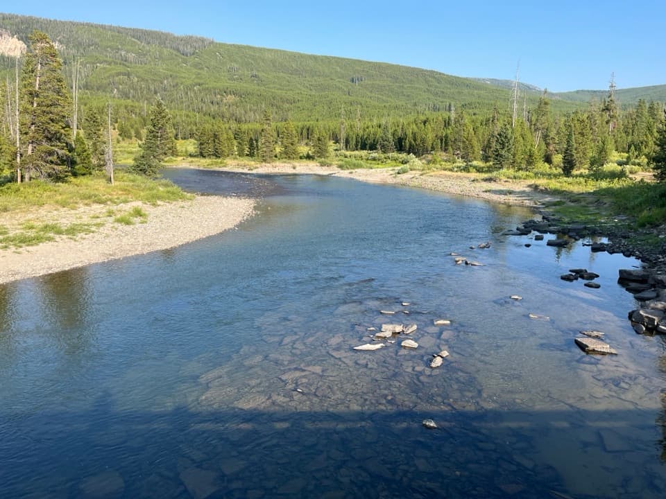
The trail begins in the open Huck Fire burn area, where young pines and grasses are growing among standing snags and fallen trunks. In less than a quarter mile it enters mixed conifer forest. Around a mile in, it drops into the greener Glade Creek drainage, where wildflowers can last late into the season. At about 1.5 miles, the route crosses Glade Creek on a small footbridge; smaller streams farther along can wet your boots earlier in the season.

The meadow turnaroundPast the creek, more forest gives way to a broad meadow.

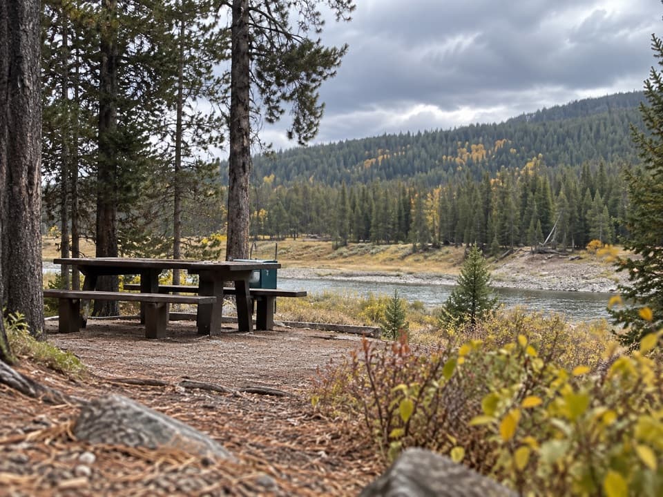
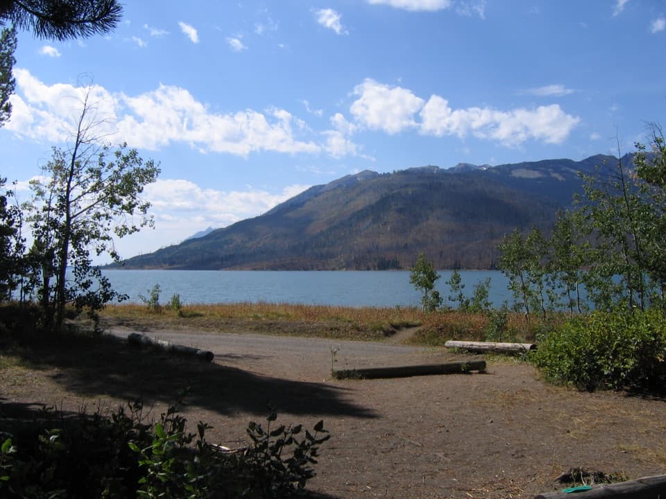
Past the creek, more forest gives way to a broad meadow. This is the open stretch where the Snake River widens into Jackson Lake; scan for osprey, eagles and sandhill cranes. Another half mile brings you to the park boundary at about 3.5 miles from the trailhead. Turn around here for the mapped 7-mile day hike. If you want a shorter walk, the creek bridge makes a natural turnaround for roughly 3 miles round trip.

Beyond the boundaryThe trail continues toward the Berry Creek and Owl Creek routes in remote northern canyons.

The trail continues toward the Berry Creek and Owl Creek routes in remote northern canyons. That longer backcountry outing is outside the route mapped here, and the farther creeks include swift water without bridges. Treat it as a separate trip; overnight camping requires a backcountry permit. This is grizzly country with few visitors, so travel in a group, make noise and carry bear spray.

Wildlife

Wildlife in Grand Teton

All Grand Teton wildlife maps

Sighting maps show where each species has been reported across Grand Teton. Wildlife moves, so no sighting is guaranteed.

Keep exploring

Near Glade Creek Trail

See it all on the map

Trails that start nearby

Places near the trailhead

Parkwolf’s Grand Teton ranking

Top-rated trails in Grand Teton

All 70 trails
  1. 1Teton Crest TrailChallenging · 39 mi
  2. 2Paintbrush Canyon - Cascade Canyon LoopChallenging · 19.9 mi
  3. 3Lake Solitude TrailChallenging · 15.1 mi
  4. 4Inspiration Point TrailModerate · 1.8 mi
  5. 5Taggart Lake TrailEasy · 3 mi
  6. 6Delta Lake TrailChallenging · 7.6 mi

Take Parkwolf to Grand Teton.

The audio tour guide for the drive, plus offline maps, trails, and wildlife heatmaps for when the signal drops.

4.7 from 8,600+ ratings

Download Parkwolf on the App StoreGet Parkwolf on Google Play