Parking
No roadside trailhead or parking at either end. Reach the west start at the South Boone–Teton Crest junction through a separate backcountry route; arrange a continuation beyond the Berry Creek end.

Grand Teton National Park, WY
A remote backcountry link that passes below the peak it’s named for.
Overview
Map & elevation
Plan your hike

The highest, rockiest slopes around here are a summer buffet for grizzly bears.
Grand Teton Tour Guide
Parkwolf is a GPS audio tour guide for Grand Teton National Park. As you drive, it chimes in with what’s ahead: hidden gems, upcoming stops, history, geology, and wildlife, right through your car’s speakers.
See the Grand Teton audio tour“…We have been driving around with the audio tour and it has been informational and spot on. The whole family has been impressed. We used it for Yellowstone and Grand Teton.”


Trail guide
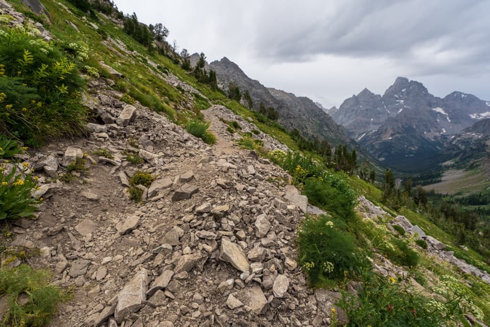
Survey Peak Trail is a 2.5-mile, one-way backcountry connector from the South Boone–Teton Crest junction toward Berry Creek. It follows part of the Teton Crest Trail before turning southeast onto the named Survey Peak path. The route passes below Survey Peak; it does not climb the 9,277-foot summit. This is a link for hikers already on a longer wilderness itinerary, not a standalone day hike.
The west-to-east line drops about 860 feet overall, with short climbs, and its steepest mapped grade is roughly 26%. Treat it as a difficult backcountry descent, not a quick connector. Allow about 2.5 hours for this segment itself as a planning estimate; the approach and continuation beyond it take much longer. Recent surface and maintenance details were not found, so check the full itinerary and carry reliable navigation.
There is no road or parking access at either end. The west start is a trail junction in Jedediah Smith Wilderness, and the eastern finish remains in the Berry Creek backcountry; plan a longer route on both sides. The NPS backcountry map warns of difficult, unbridged stream crossings in Berry Creek and nearby canyons. Overnight camping in park backcountry requires a permit, and pets are prohibited on park trails and in the backcountry.
Wildlife
 172 sightingsGrizzly BearMost seen around 7 PMSighting map
 195 sightingsBrown BearMost seen around 6 AMSighting map
 32 sightingsGray WolfMost seen around 7 PMSighting map
 1,816 sightingsMooseMost seen around 7 AMSighting map
 614 sightingsBisonMost seen around 6 AMSighting map
 738 sightingsElkMost seen around 7 PMSighting map
Sighting maps show where each species has been reported across Grand Teton. Wildlife moves, so no sighting is guaranteed.
Keep exploring
 ChallengingOwl Creek Trail7.4 mi · 7.5 hr · 5.2 mi awayA remote canyon route ending at a rocky alpine divide.
 ChallengingBerry Creek Trail6.6 mi · 4.5 hr · 6.9 mi awayA remote canyon walk for practiced, self-reliant hikers.
 ModerateGlade Creek Trail7 mi · 3.5 hr · 7.1 mi awayMeadow birds and a creek crossing reward this remote walk.
 ChallengingBerry-Webb Canyon Loop34.2 mi · 1 day · 7.1 mi awayThree remote canyons, a high divide, and a serious backcountry commitment.
 ChallengingBerry Creek–Owl Creek Loop20.1 mi · 9 hr · 7.1 mi awayA full-day loop through Grand Teton’s remote northern canyons.
 ChallengingWebb Canyon Trail9.9 mi · 10 hr · 8.1 mi awayA remote creek canyon that climbs steeply to Moose Basin Divide.
 EasyFlagg Canyon Trail5 mi · 2.5 hr · 9.8 mi awayEasy 5-mile out-and-back along the Snake River's basalt canyon.
 EasyPolecat Creek Loop2.5 mi · 1.8 hr · 10.1 mi awayAn easy loop for creek-side wetlands and forest regrowth.
 Scenic pullout · 8.2 mi awayGrand Teton North Boundary TurnoutSnap the wooden boundary sign on pine-covered Huckleberry Hill.
 Scenic pullout · 8.3 mi awayHuck Fire TurnoutSee the forest patchwork left by the 1988 Huck Fire.
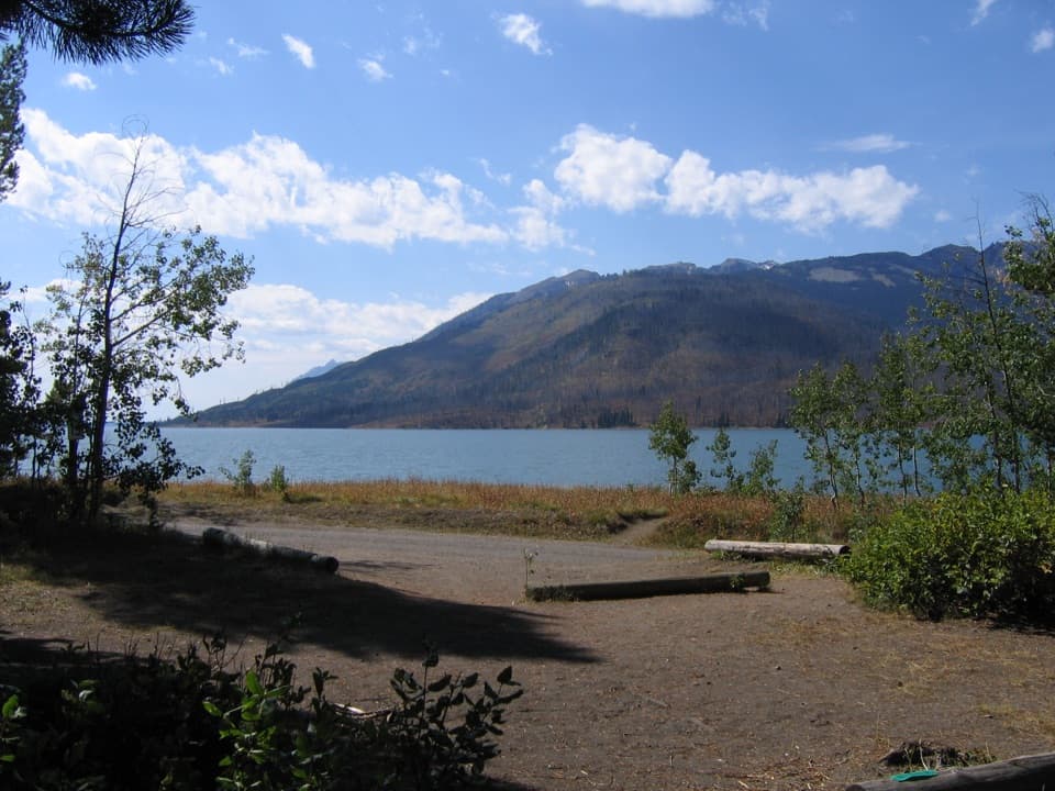 Campground · 9.1 mi awayLizard Creek CampgroundA forested basecamp on Jackson Lake near two national parks.
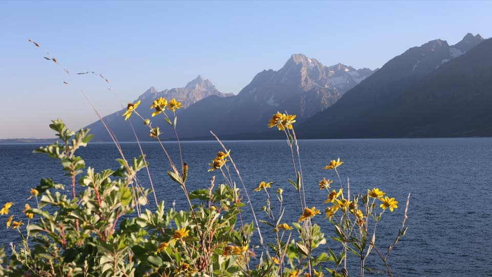 Picnic area · 9.7 mi awayMud Flats Picnic AreaOne table, a Teton view, and a changing Jackson Lake shoreline.
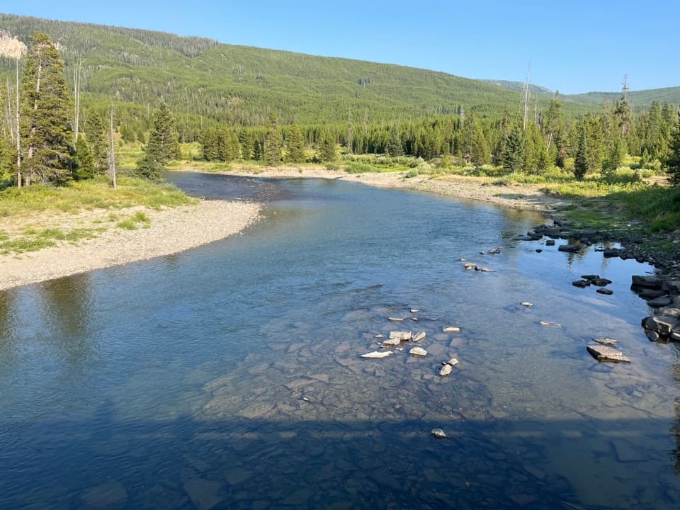 Sight · 10 mi awayFlagg Ranch Boat LaunchA simple ramp for putting a small boat on the upper Snake.
Parkwolf’s Grand Teton ranking

The audio tour guide for the drive, plus offline maps, trails, and wildlife heatmaps for when the signal drops.