Moggs Creek to Coalmine Creek Walk in Great Ocean Road

Great Ocean Road, VIC

Moggs Creek to Coalmine Creek Walk

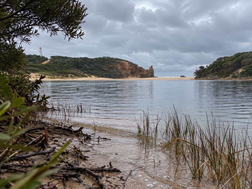
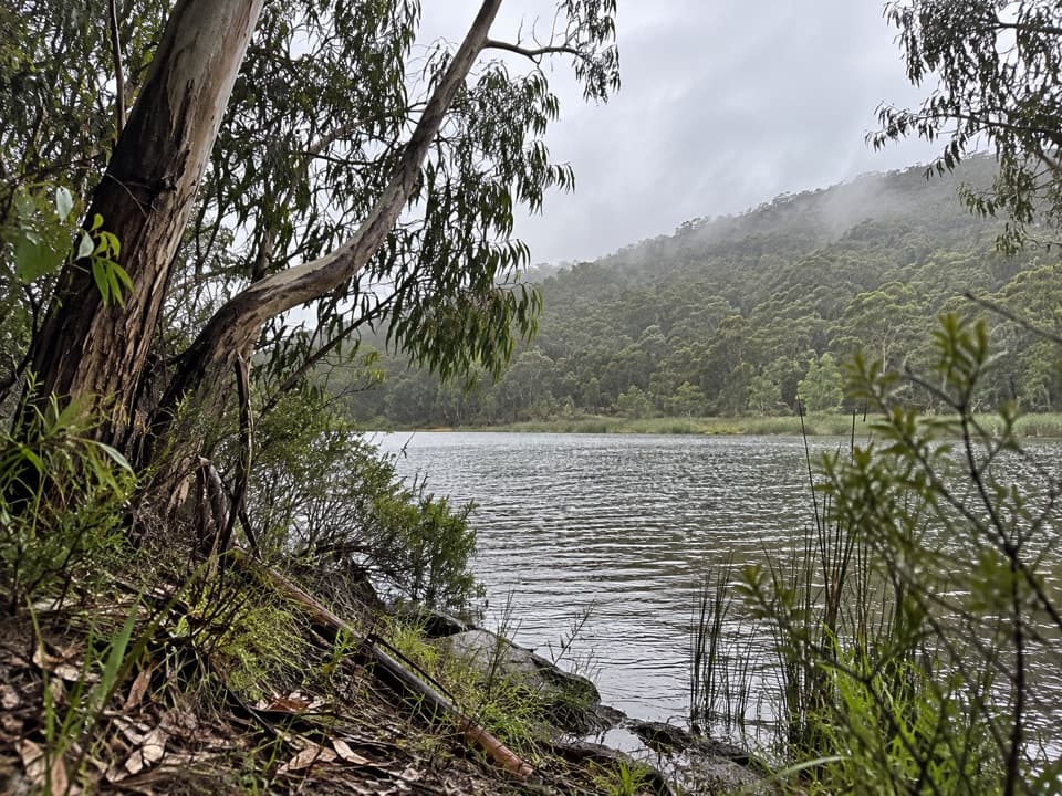
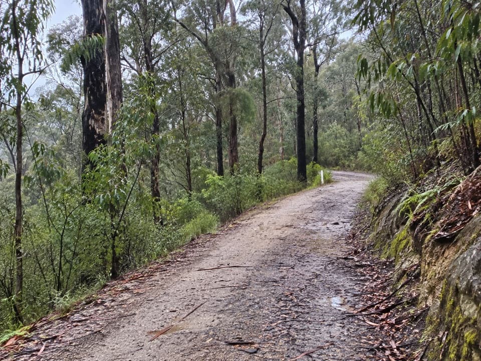
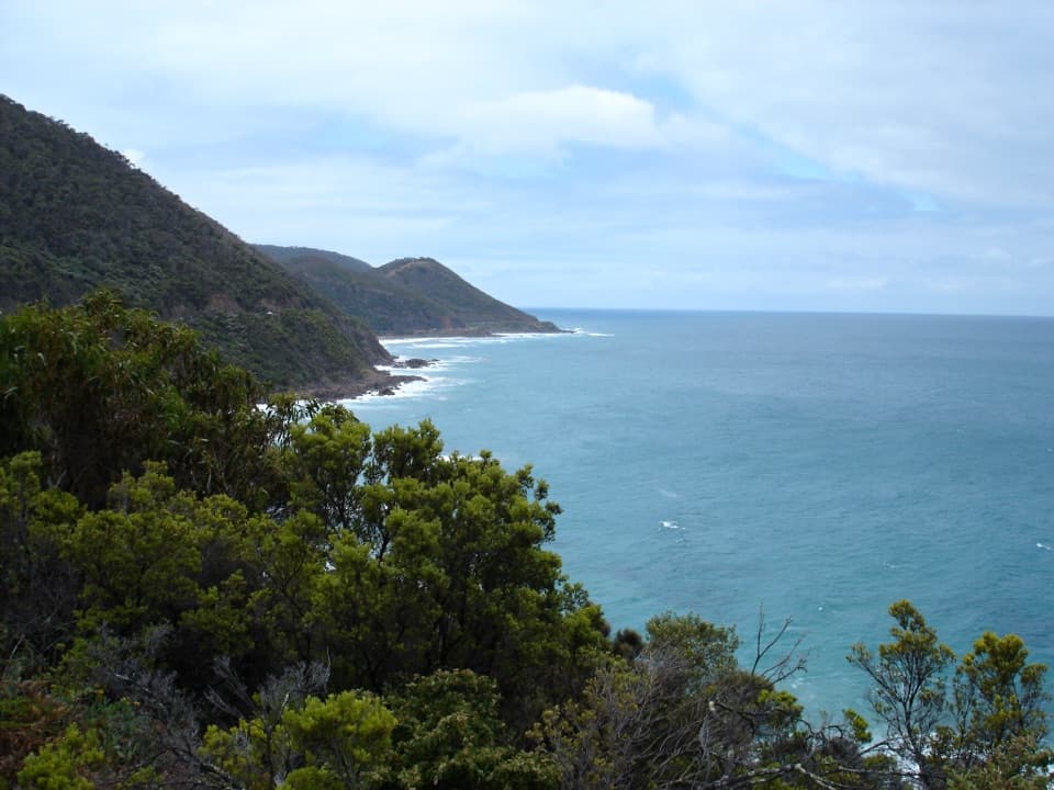
Ironbark and messmate forest, with a ridge crossing to the coast.

Photo: Wikimedia Commons
Length
10.1km
Time
3.5hr
Elev. change
277m
Difficulty
Moderate
  • No dogs
  • High point 304 m

Hear the audio tour

Moggs Creek Picnic Area

Overview

About Moggs Creek to Coalmine Creek Walk

Why go

  • A forest-to-coast traverse through ironbark and messmate country.
  • Late-summer wildflowers and forest bird calls add to the walk.

Heads up

  • The one-way route needs a two-car shuttle.
  • The mapped line is about 1.5 km longer than the printed figure and has steep grades.

Map & elevation

The route

Loading the Great Ocean Road map
Full map
Elevation27–304 m
TrailheadMoggs Creek Picnic Ground-38.45848, 144.06032
Keep this map with you offline in the Parkwolf app

Plan your hike

Before you go

Parking

Turn off Great Ocean Road onto Old Coach Road east of Moggs Creek Bridge; follow signs via Old Neuk Road and the final unsealed access road to Moggs Creek Picnic Ground. Start at the western end of its car park. This is one-way: leave the pickup at Archway Car Park in Eastern View. Toilets, picnic tables and wood-fired barbecues are at Moggs Creek; bring wood.

Safety

Expect steep climbs and descents on unpaved tracks. The route exits onto Great Ocean Road at Eastern View, so arrange the shuttle before setting out. Dogs are prohibited in the national park; assistance dogs follow Parks Victoria access requirements.

7 active Great Ocean Road alerts

  • ClosureLorne-area walking trails closed after flood and storm damageSeveral walking trails near Lorne remain closed; do not enter closed tracks. - Phantom Falls Walk is temporarily closed because flood and storm damage affected the trail and structures.Official details
  • ClosureWye Road closed after storm and flood damageWye Road is closed until further notice for road maintenance and repairs following storm and flood damage; do not use the road. Check current Great Otway National Park conditions before travelling.Official details
See all 7 alerts
A park ranger sits on a dash-mounted phone, talking, as Parkwolf’s Tour Guide plays “Army Cutworm Moths: A Grizzly Bear Buffet” on Grand Loop Road below Dunraven Pass in Yellowstone
Parkwolf Tour GuideThe highest, rockiest slopes around here are a summer buffet for grizzly bears.

Great Ocean Road Tour Guide

Your drive to Moggs Creek to Coalmine Creek Walk, narrated.

Parkwolf is a GPS audio tour guide for Great Ocean Road. As you drive, it chimes in with what’s ahead: hidden gems, upcoming stops, history, geology, and wildlife, right through your car’s speakers.

See the Great Ocean Road audio tour

Recorded for this trailhead

Moggs Creek Picnic Area
0:00 / 0:29
“Up ahead is Old Coach Road, the turnoff for Moggs Creek Picnic Area. The clearing is farther inland, with an unsealed final approach, so choose it if you'd like to settle into the eucalypt forest for lunch.”

Plays as you drive up to this trailhead in the Parkwolf Great Ocean Road Tour Guide.

More stories near here in the app

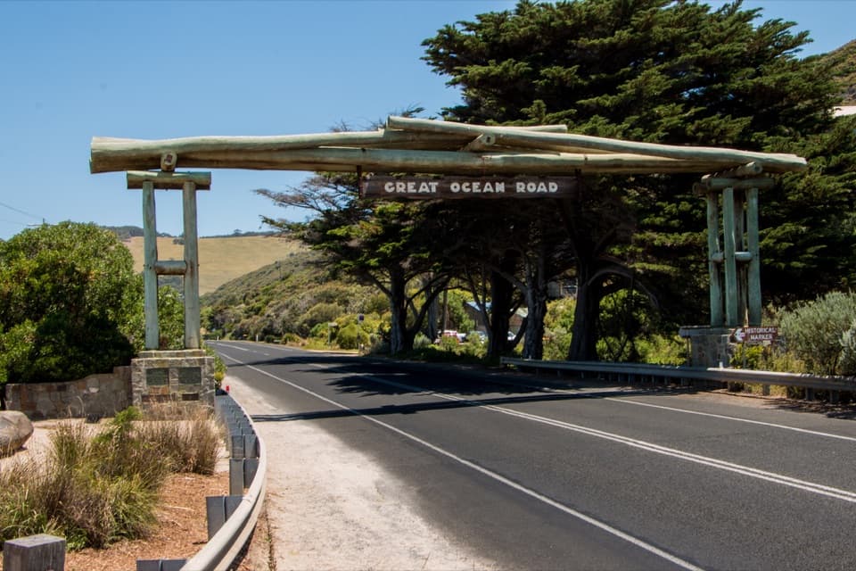
  • Great Ocean Road Memorial Arch
  • Fairhaven Beach
  • Painkalac Creek Nature Walk
  • Distillery Creek Picnic Area
  • 181 audio storiesacross Great Ocean Road’s roads, triggered by GPS as you drive
  • Wildlife heatmapsfor Koala, Kangaroo, Little Penguin, and 13 more
  • Works offlinemaps, 109 trails, 99 places, and audio download before you lose signal
  • CarPlay readysimple controls built for the drive
★★★★★
“Fantastic app with many points of information… It’s great to just turn on while you’re driving and it gives you an audio tour of the national Park. We love it!!!!”
JMJamesApp Store review
Download Parkwolf on the App StoreGet Parkwolf on Google Play

4.7 from 8,600+ ratings

Trail guide

Hiking Moggs Creek to Coalmine Creek Walk

The crossingMoggs Creek to Coalmine Creek Walk is a point-to-point forest route from Moggs Creek Picnic…

Moggs Creek to Coalmine Creek Walk is a point-to-point forest route from Moggs Creek Picnic Ground to the Great Ocean Road at Eastern View. The mapped line is about 10.1 km (6.25 miles) one way; the available walking directions give 8.5 km, so use the longer figure for planning. Allow about 3½ hours for the climbs, descents and a few pauses. Arrange a car shuttle in advance: this isn’t a loop.

The uphill startBegin at the western end of the picnic-ground car park, by the Ocean View Track sign.

Begin at the western end of the picnic-ground car park, by the Ocean View Track sign. The narrow path climbs through tall ironbarks and messmates. At the management track, turn right and climb to the ridge, then follow Moggs Creek Track west and downhill. Most of the route is on unpaved, well-graded management tracks, but the climbs are real and some descents are steep.

Take the Coalmine Creek turnAt the clearly marked junction, turn left onto Coalmine Creek Track and descend toward the…

At the clearly marked junction, turn left onto Coalmine Creek Track and descend toward the coast. Don’t continue straight on Moggs Creek Track. The directions place this turn about 5 km from the start; the mapped alignment puts it closer to 6 km. Coalmine Creek Track leads to the management gate and the road through the old development to Great Ocean Road, near the Eastern View pickup area.

A forest with a pastThe area was surveyed for coal, but the coal found was low quality.

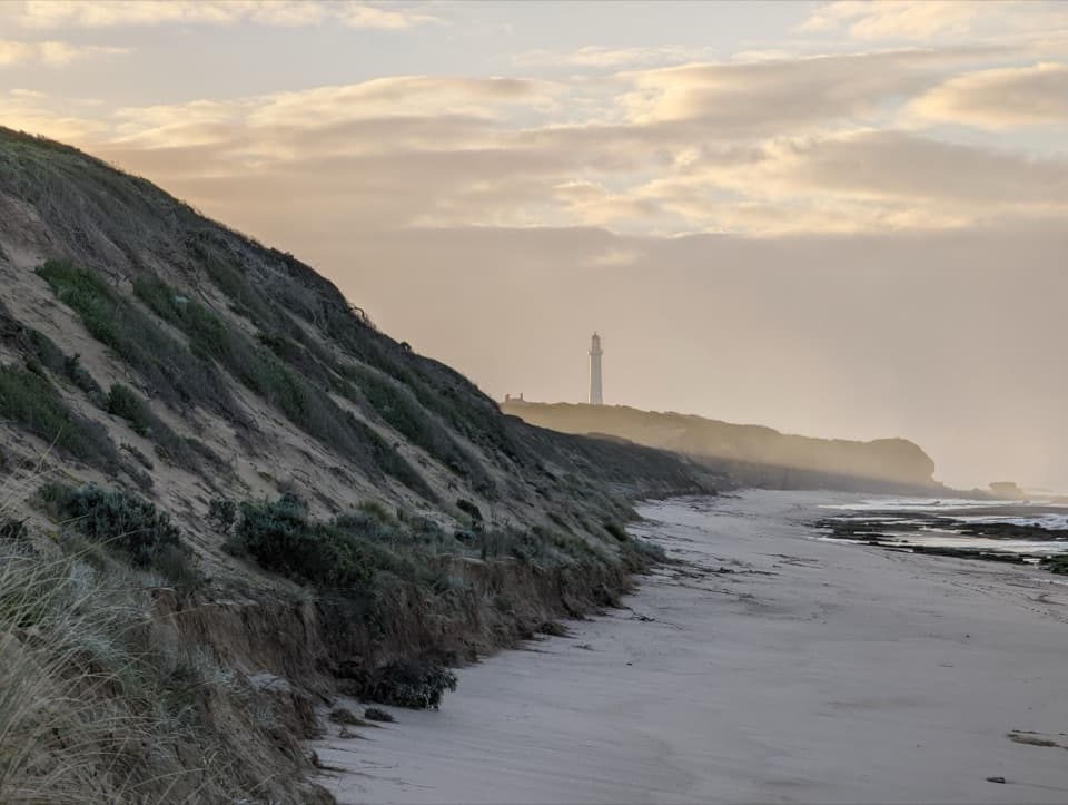
The area was surveyed for coal, but the coal found was low quality. A nine-hole golf course near the coast later reverted to native vegetation. Along the walk, wattles and heath grow beneath the eucalypts, and the forest gives way to occasional ocean sounds and views near the coast.

Flowers, birds and signsWrinkled Buttons flower along both tracks in late summer.

Wrinkled Buttons flower along both tracks in late summer. The rare Black-tongue Caladenia sometimes grows beside Coalmine Creek Track. Listen for kookaburras, grey fantails and white-plumed honeyeaters; echidna diggings may show along the track edges, though seeing one is luck.

Start, finish and dogsMoggs Creek Picnic Ground has toilets, picnic tables and wood-fired barbecues; bring your own…

Moggs Creek Picnic Ground has toilets, picnic tables and wood-fired barbecues; bring your own wood. Leave a pickup car at Archway Car Park in Eastern View before starting. Dogs aren’t permitted in the national park; assistance dogs are allowed under Parks Victoria’s requirements.

Wildlife

Wildlife in Great Ocean Road

All Great Ocean Road wildlife maps

Sighting maps show where each species has been reported across Great Ocean Road. Wildlife moves, so no sighting is guaranteed.

Keep exploring

Near Moggs Creek to Coalmine Creek Walk

See it all on the map

Trails that start nearby

Places near the trailhead

Parkwolf’s Great Ocean Road ranking

Top-rated trails in Great Ocean Road

All 109 trails
  1. 1Great Ocean WalkChallenging · 100 km
  2. 2Maits Rest Rainforest WalkEasy · 0.8 km
  3. 3Triplet Falls WalkModerate · 2 km
  4. 4Hopetoun Falls WalkModerate · 0.8 km
  5. 5Erskine Falls WalkModerate · 0.7 km
  6. 6Surf Coast WalkChallenging · 41.5 km

Take Parkwolf to Great Ocean Road.

The audio tour guide for the drive, plus offline maps, trails, and wildlife heatmaps for when the signal drops.

4.7 from 8,600+ ratings

Download Parkwolf on the App StoreGet Parkwolf on Google Play