
Place · 0.8 mi away
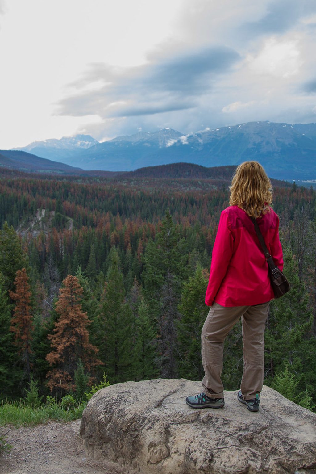
Old Fort Point is the rounded bedrock hill just across the Athabasca River from town, delivering some of the best near-town panoramas for relatively modest effort. Expect a short, punchy climb, a broad summit with sweeping views, and a classic Jasper warm‑up hike that feels bigger than it looks on the map.
From the top, you’ll spin through a who’s‑who of the local skyline: Mt. Edith Cavell and The Whistlers to the south/southwest; the Miette River Valley to the west; Pyramid Mountain and the Victoria Cross Range to the northwest; Lac Beauvert and the string of nearby lakes to the north; the Colin Range to the northeast; and Signal Mountain, Mt. Tekarra, Mt. Hardisty and Mt. Kerkeslin wrapping the east and southeast. The townsite and the Athabasca River are laid out below, and there’s a side viewpoint with the iconic red chairs.
Most people do the loop (about 4 km, 1–2 hours) for variety. It starts with a stout burst of elevation and mixes forest, rocky outcrops, wooden stairs, and airy viewpoints. It’s rated moderate: short but with steep grades, loose footing in places, and sections that feel slippery after rain. It’s popular—expect company in summer—and you may meet mountain bikers on multi‑use stretches.
Bighorn sheep are often seen right up at the summit. Elk show up near the trailhead. Bears (both black and grizzly) travel the valley and occasionally use the area—people report scat and sightings—so be bear‑aware and prepared.
The hill is made of ancient Precambrian breccia—angular chunks of pink limestone from roughly 750 million years ago—among the oldest exposed rocks in the park. Despite the name, there’s no fort here; the prominence simply looks like the kind of place you’d guard a river crossing from.
Parking sits just across the bridge from town with a clearly marked trailhead. There’s a pit toilet at the lot but no water or other services on the trail. Bring your own water, snacks, layers, and grippy footwear. Check the current trail status before you go; temporary closures and reroutes do happen.
Sunrise and sunset give the best light on the ranges and fewer crowds. Midday can be harsh for photos and busier, especially in summer. Weekdays are quieter than weekends. Go early if you want easy parking and calmer conditions.
Place · 0.8 mi away
Place · 0.9 mi away
Place · 0.9 mi away
Place · 1.1 mi away
Easy · 1.4 mi away
Moderate · 1.7 mi away
Moderate · 1.7 mi away
Easy · 2.5 mi away

Parkwolf Tour Guide
