Whistlers Mountain in Jasper National Park

Sight · Jasper National Park

Whistlers Mountain

SkyTram-served alpine summit with sweeping views and whistling marmots

Photo: Wikimedia Commons
Type
Sight
Nearest trail
1.1 km
Audio stories
2 nearby
  • Trailhead
  • Parking
  • Scenic viewpoint
  • Restrooms
  • #12 of 81 sights

Hear the audio tour

Jasper SkyTram: Ride to the Rooftop of Jasper

Overview

About Whistlers Mountain

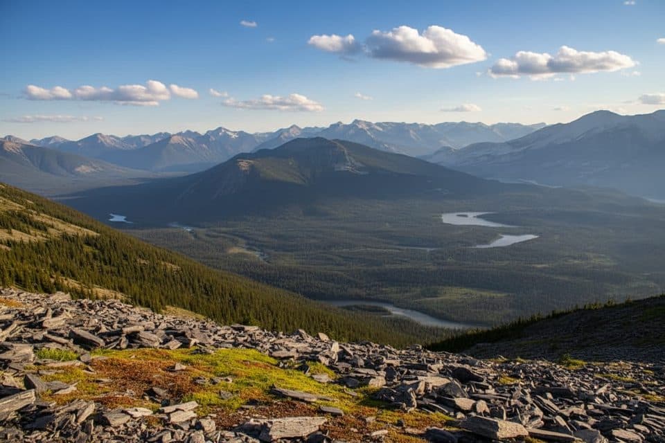
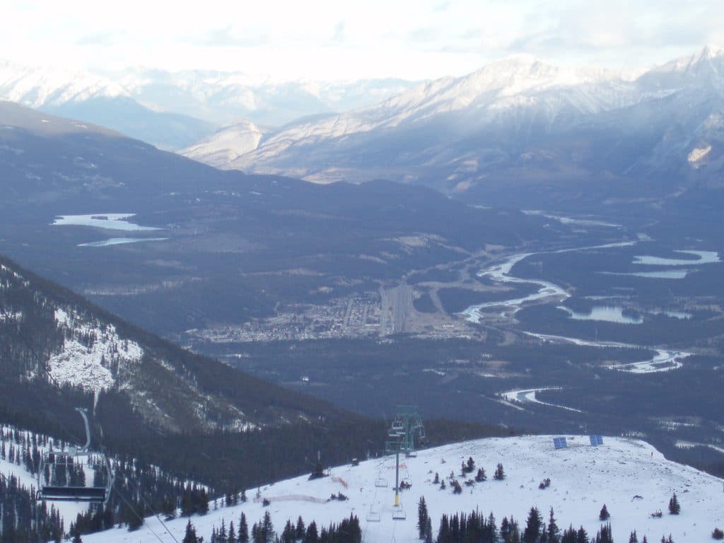
Whistlers Mountain is the easy-to-love summit just south of town, famous for its sweeping views and the Jasper SkyTram that zips you into the alpine in minutes. The mountain’s name nods to the hoary marmots whose sharp whistles carry across the rocks.

Why stop

  • SkyTram whisks you to high-alpine terrain with a short summit walk
  • Vast 360° views over Jasper and multiple ranges; Mount Robson on clear days
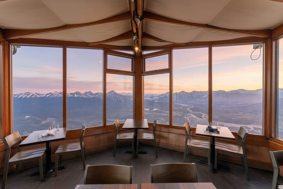
  • On-mountain café and restrooms at the upper station

Heads up

  • Ticketed ride is pricey and seasonal
  • Crowded in peak summer; lines for the tram and busy summit path
Few peaks in the Rockies give you this caliber of panorama with so little effort. The tram makes true alpine terrain accessible to almost everyone, but you can still put in a proper hike if you want.
Parkwolf’s verdictWhat Makes It Special

Map

Where it is

Loading the Jasper map
Full map
SightWhistlers Mountain52.82667, -118.13223
Keep this map with you offline in the Parkwolf app

Local know-how

Tips for visiting Whistlers Mountain

  1. Arrive early for the SkyTram to avoid queues and packed cars.

  2. Confirm the last download time—missing it means a long hike down.

  3. Pack layers and a wind shell; it’s much colder and windier up top.

  4. Wear sturdy shoes; the summit path is steep, rocky, and can hold snow.

  5. Bring water; there’s none on the trail beyond the tram stations.

Plan your stop

Before you go

Best time to visit

Summer into early fall is prime; snow can linger into June and weather flips fast up top. Mornings see fewer crowds and steadier visibility; afternoons can be busier. The SkyTram typically operates from spring through October—check hours before you go.

Facilities & Food

At the upper station you’ll find restrooms, interpretive signs, and the Summit Café/Restaurant—handy for a warm drink or meal with a view. Note the café can close earlier than the last tram on some days.

8 active Jasper alerts

  • ClosureWildfire-impacted areas and facilities closedStay out of closed wildfire-impacted areas and facilities in Jasper National Park; closures protect public safety after the 2024 wildfire and remain in effect while recovery and safety work continues.Official details
  • Closure93A (Wabasso Road) no through travel during roadworkFrom mid-October to early November 2026, plan for 93A (Wabasso Road) to be accessible from the south entrance only; no through travel is expected during roadwork.Official details
See all 8 alerts
A park ranger sits on a dash-mounted phone, talking, as Parkwolf’s Tour Guide plays “Army Cutworm Moths: A Grizzly Bear Buffet” on Grand Loop Road below Dunraven Pass in Yellowstone
Parkwolf Tour GuideThe highest, rockiest slopes around here are a summer buffet for grizzly bears.

Jasper Tour Guide

Your drive to Whistlers Mountain, narrated.

Parkwolf is a GPS audio tour guide for Jasper National Park. As you drive, it chimes in with what’s ahead: hidden gems, upcoming stops, history, geology, and wildlife, right through your car’s speakers.

See the Jasper audio tour

Recorded for this area

Jasper SkyTram: Ride to the Rooftop of Jasper
Listen
“Up ahead is the road for the Jasper SkyTram, which is Canada's highest and longest aerial tramway. It’s a quick seven-minute ride that takes you right up into the alpine zone of Whistlers Mountain.”

Plays on the road 2.8 km from Whistlers Mountain in the Parkwolf Jasper Tour Guide.

More stories near here in the app

  • Whistlers Peak Trail: Hike Up, Ride Down
  • Reading the Rocks: How the Rockies Were Built
  • Beavers of Wynd Road
  • Marmot Basin Ski Area
  • 157 audio storiesacross Jasper’s roads, triggered by GPS as you drive
  • Wildlife heatmapsfor Grizzly Bear, Caribou, Gray Wolf, and 13 more
  • Works offlinemaps, 91 trails, 129 places, and audio download before you lose signal
  • CarPlay readysimple controls built for the drive
★★★★★
“Fantastic app with many points of information… It’s great to just turn on while you’re driving and it gives you an audio tour of the national Park. We love it!!!!”
JMJamesApp Store review
Download Parkwolf on the App StoreGet Parkwolf on Google Play

4.7 from 8,600+ ratings

Guide

More about Whistlers Mountain

What You’ll SeeFrom the upper station and summit you get big, wraparound views of Jasper, the Athabasca…

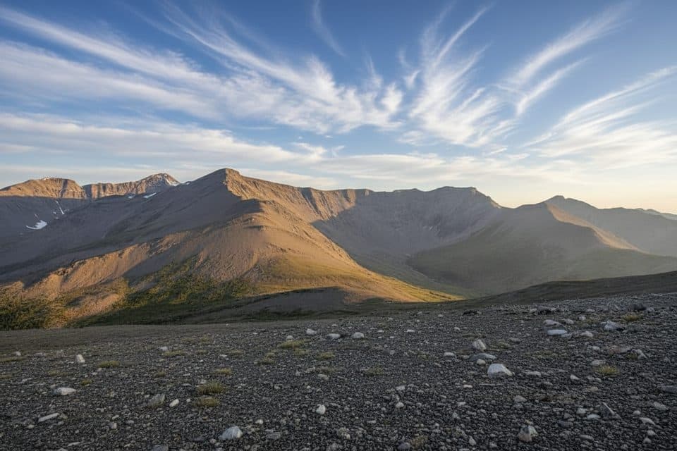
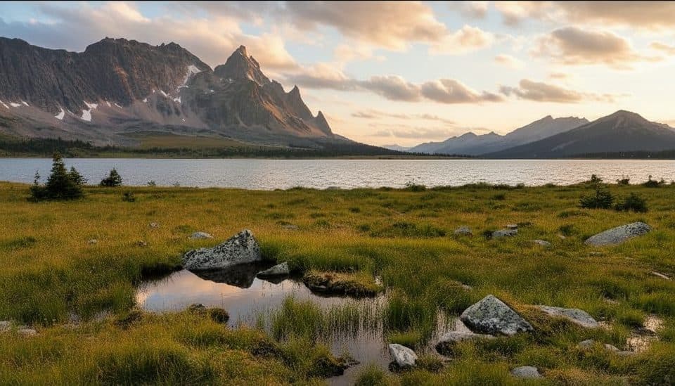
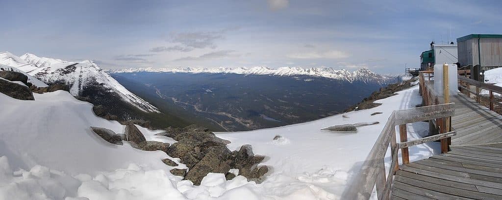
From the upper station and summit you get big, wraparound views of Jasper, the Athabasca Valley, and multiple mountain ranges. On clear days, you can pick out Mount Robson on the horizon. Expect alpine meadows, rocky slopes, and even lingering snow patches early summer. There’s interpretive signage and a peak-finder to help name the skyline.

Getting Up ThereSkyTram: A ~7‑minute ride climbs to the upper station at about 2,263 m.
  • SkyTram: A ~7‑minute ride climbs to the upper station at about 2,263 m. From there, it’s roughly 1.4 km to the true summit with ~200 m of gain—short, but it feels high and can be windy.
  • Full hike: Prefer to earn it? The hike from the base to the summit is about 6.8 km, steep in places with some loose rock. Many people hike one way and tram the other.
WildlifeKeep an eye (and ear) out for hoary marmots—this is their turf.

Keep an eye (and ear) out for hoary marmots—this is their turf. You may also spot pikas, ground squirrels, and alpine birds around the rocks and meadows.

Good to KnowIt’s colder and windier up high—layers and sturdy footwear are smart.
  • It’s colder and windier up high—layers and sturdy footwear are smart.
  • Trail surfaces can be rocky and slippery when snowy.
  • Dog-friendly tram policies exist; confirm current rules before bringing pets.
  • Don’t miss the last tram down if you’re not hiking—double-check the day’s schedule.

Wildlife

Wildlife in Jasper

All Jasper wildlife maps

Sighting maps show where each species has been reported across Jasper. Wildlife moves, so no sighting is guaranteed.

Keep exploring

Near Whistlers Mountain

See it all on the map

Trails nearby

More stops nearby

Parkwolf’s Jasper ranking

Top sights in Jasper

All 129 places
  1. 1Maligne LakeSight
  2. 2Mount Edith CavellSight
  3. 3Spirit IslandSight
  4. 4Athabasca FallsSight
  5. 5Columbia IcefieldSight
  6. 6Athabasca GlacierSight

Take Parkwolf to Jasper.

The audio tour guide for the drive, plus offline maps, trails, and wildlife heatmaps for when the signal drops.

4.7 from 8,600+ ratings

Download Parkwolf on the App StoreGet Parkwolf on Google Play