
Place · 0.5 mi away
Challenging
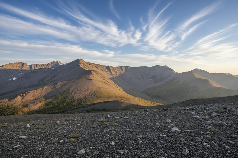
If you want to earn Jasper’s high-alpine panorama on foot, this is the classic line. The Whistlers Trail climbs steeply from the Jasper SkyTram lower station on Whistlers Road through dense montane forest, then thins into subalpine before breaking into rocky alpine terrain near the top. Expect relentless switchbacks, rough tread in places, and a satisfying big-mountain finish.
Distance-wise, plan on about 13.6 km/8.5 miles total (out-and-back) between the lower station and the upper station area. That’s roughly 6.8 km one way. Many hikers then add the short, separate 1.4 km summit spur from the upper station to the true summit—tack that on if conditions and legs allow. Elevation gain is substantial either way, around 1,200 m/3,900+ ft.
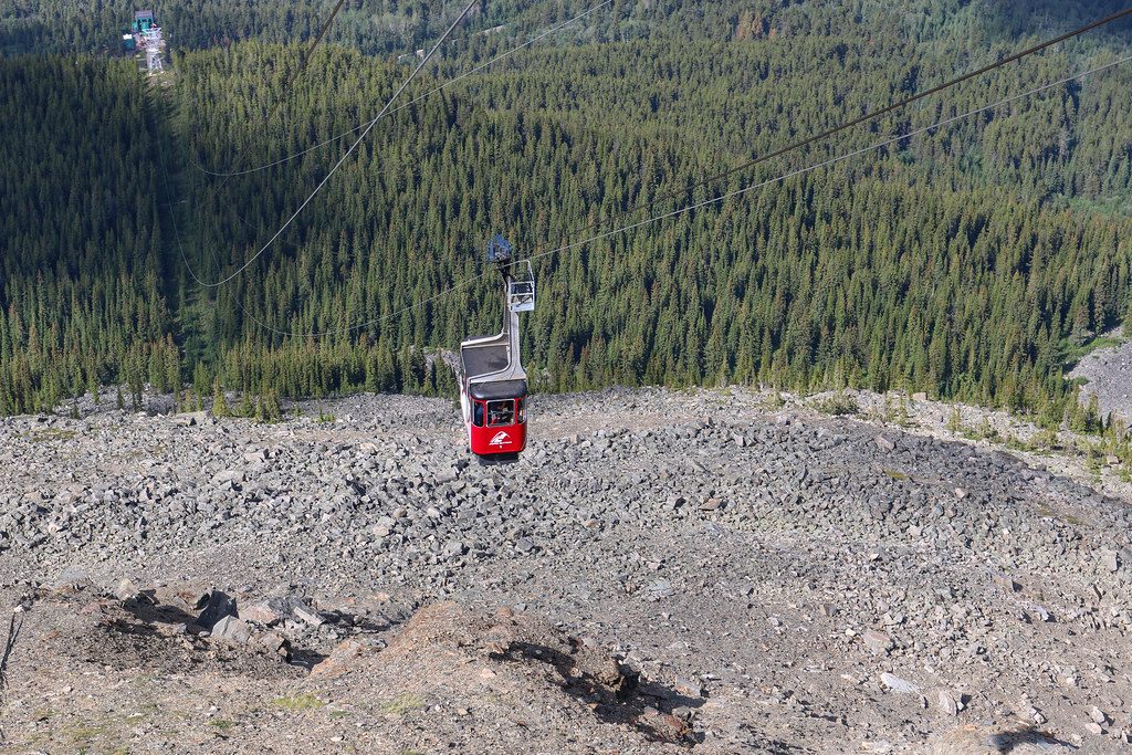
The ascent is straightforward but sustained. Around 2.6 km in, you’ll pass under the tram line—a fun mid-climb novelty before the trees thin and the views start opening. Higher up, footing can be rocky with lingering snow even in summer. Above the tram area, markings can be sparse if snow covers the track, so keep your head on a swivel in shoulder season.
Scenery is the payoff: a full tour of Jasper’s life zones—montane to subalpine to alpine—and sweeping views from the top that can include the Jasper townsite, surrounding valleys, and, on crystal-clear days, even Mount Robson. Keep an ear out for hoary marmots (the mountain’s namesake “whistlers”).
Logistics are flexible. Many hikers grind up and ride the SkyTram down (one-way tickets are available at the top), which saves your knees. There’s no reliable water above the tram, so carry what you need. This trail is steep, long, and not a good pick for young kids. Pets are not allowed.
Best time to hike: June–September. Snow lingers into early summer and can return early in fall; upper slopes are considered avalanche-prone until late June. Start early for cooler temps, steadier footing, and calmer weather. Afternoon storms and crowds near the tram are common. Bring layers, rain protection, and poles—especially if you’re hiking down.
Bottom line: A stout climb with first-rate views and a built-in bailout via the tram. If you want the alpine feel with less effort, ride up and just do the short summit path. If you want the full-value ascent from valley to skyline, this trail delivers.
Park at the Jasper SkyTram lower station lot on Whistlers Road; the trailhead is adjacent.
Steep sustained grade with loose, rocky sections; lingering snow and early-season avalanche risk; rapidly changing mountain weather; sparse markings high up if snow-covered; no water above the tram—carry all you need; the descent is punishing on knees.
Place · 0.5 mi away
Place · 1.2 mi away
Place · 1.4 mi away
Place · 1.8 mi away
Challenging · 1.2 mi away
Moderate · 1.2 mi away
Easy · 2.2 mi away
Moderate · 2.3 mi away

Parkwolf Tour Guide
