Parking
Use the designated Cabin Creek Drive trailhead near the southwest end of Jasper, following the signed access from town. Do not use Cottonwood Slough or Pyramid Bench parking as the trailhead for this route; those are different access points.

Jasper National Park, AB
A long multi-use loop from Jasper through Marjorie, Minnow, High, and Saturday Night lakes
Overview
This is a long, scenic backcountry loop that starts close to Jasper and links a chain of small lakes and quiet forest. It is a good choice for a full-day push or a relaxed overnight, with the route’s distance and elevation making it a substantial outing rather than a short town walk.
 Parkwolf’s verdictWhy this loop
Map & elevation
Plan your hike

The highest, rockiest slopes around here are a summer buffet for grizzly bears.
Jasper Tour Guide
Parkwolf is a GPS audio tour guide for Jasper National Park. As you drive, it chimes in with what’s ahead: hidden gems, upcoming stops, history, geology, and wildlife, right through your car’s speakers.
See the Jasper audio tourRecorded for this trailhead
Cottonwood Slough: A Peaceful Wetland Walk“You're approaching the turnoff for Cottonwood Slough. This is an excellent choice for a quick, flat walk around a wetland, and it's known for having some of the best birdwatching so close to town.”
Plays as you drive up to this trailhead in the Parkwolf Jasper Tour Guide.
More stories near here in the app
“Fantastic app with many points of information… It’s great to just turn on while you’re driving and it gives you an audio tour of the national Park. We love it!!!!”


Trail guide
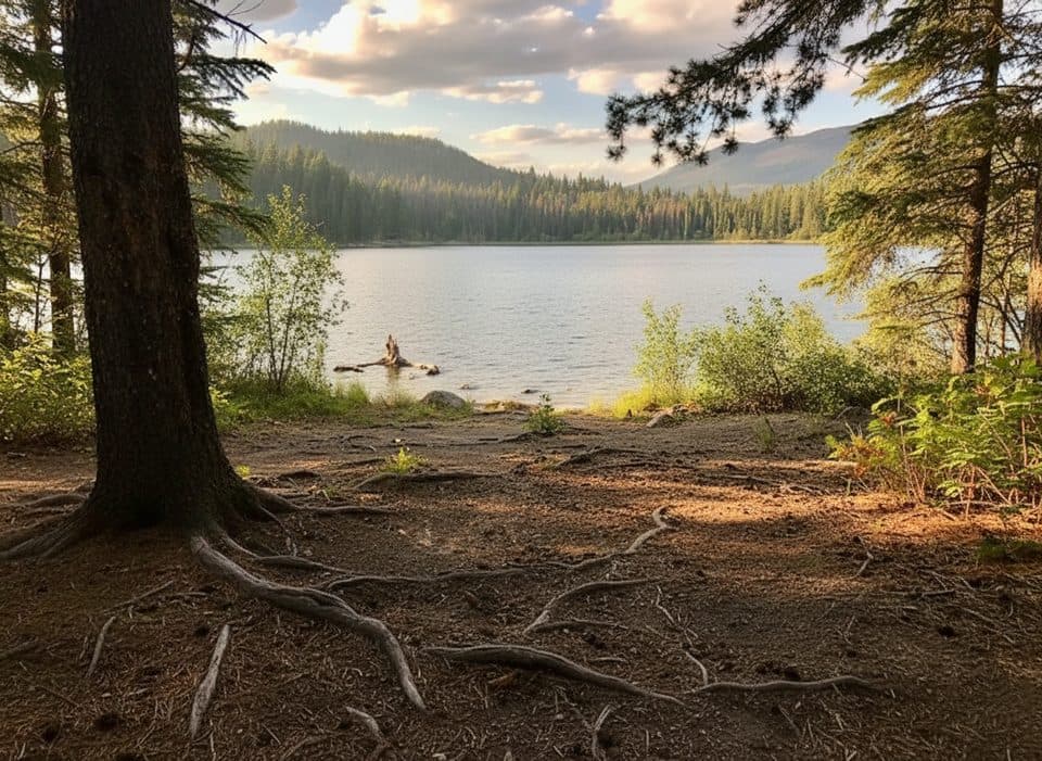
From the Cabin Creek Drive trailhead, Trail 3 climbs through the Marjorie and Caledonia Lake area toward Minnow Lake and High Lakes. The loop then turns back through the Saturday Night Lake section before returning toward town on the Trail 3 branch. Expect montane forest, open benchlands, lakeshore views, and some muddy or wet footing. The line follows the mapped Trail 3 family and includes the short signed access spur to Saturday Night Lake.
This is a multi-use route open to hikers, mountain bikers, and horse users where permitted. Day hikers should carry water, navigation, and food for a long outing. Overnight use requires the appropriate Jasper backcountry permit and campground reservation; check Parks Canada before setting out.
Allow about 7–9 hours of moving/travel time for the complete 24.6 km (15.3 mile) loop, or plan on 2–3 days if camping. Expect about 540 m of cumulative elevation gain, with steepening climbing toward the lake section. Trail conditions and wayfinding can be variable, so carry a current map/GPS, prepare for bears and other wildlife, and be considerate around bikes and horses. Dogs are not permitted on this backcountry route.
Wildlife
 174 sightingsGrizzly BearMost seen around 8 PMSighting map
 43 sightingsCaribouMost seen around 7 AMSighting map
 40 sightingsGray WolfMost seen around 6 AMSighting map
 12 sightingsCanada LynxMost seen around 8 PMSighting map
 315 sightingsMooseMost seen around 6 AMSighting map
 1,028 sightingsElkMost seen around 7 AMSighting map
Sighting maps show where each species has been reported across Jasper. Wildlife moves, so no sighting is guaranteed.
Keep exploring
 Easy11 Town trail8.4 km · 2.5 hr · 1.4 km awayModerate loop around Jasper with mountain views, town access, and bear-marker wayfindingModeratePyramid Bench Loop14.5 km · 5 hr · 1.5 km awayModerate multi-use loop from Jasper to Pyramid Lake with bench-top views over the Athabasca Valley.
 ChallengingGreat Divide Trail102 km · 1.7 days · 1.5 km awayA demanding 102 km Jasper-to-Mount-Robson wilderness traverse over three high passes.ModerateCabin Lake Trail6.8 km · 2.3 hr · 1.5 km awayForest-and-lake loop from Jasper's Pyramid Bench
 EasyTrail 8 (MinaLake)9 km · 3.5 hr · 1.6 km awayA moderate lake loop through Jasper's Pyramid Bench forest.
 ModerateMina and Riley Lakes Loop9 km · 3.5 hr · 1.6 km awayQuiet lakes-and-forest loop steps from Jasper’s townsite.ModerateCottonwood Creek Loop5.1 km · 1.5 hr · 1.6 km awayA 5.1 km moderate loop from Jasper’s Activity Centre through forest, creek, wetland, and Pyramid Bench views.EasyJasper Discovery Trail8.4 km · 2.5 hr · 1.7 km away8.3 km loop around Jasper with mountain views, interpretive stops, and gentle rolling terrain
 Sight · 1.3 km awayChargePoint - Hi JasperChargePoint EV charging at HI Jasper, walkable to town
 Lodging · 1.3 km awayHI JasperModern hostel near town with kitchen, sauna, and cafe
 Sight · 1.4 km awaySt. Mary & St. George Anglican ChurchQuaint 1927 stone church with luminous stained glass on Miette Ave
 Gas station · 1.4 km awayShell Jasper24/7 fuel stop in town with diesel and propane exchange
 Sight · 1.4 km awayJasper Yellowhead Museum and ArchivesSmall museum packed with Jasper stories, artifacts, and archives
 Gas station · 1.5 km awayFlo Charging Station - Jasper LibraryTownsite Level 2 FLO charger beside the library
 Sight · 1.5 km awayJasper Library (Flo)Cozy library with free WiFi, kids area and an EV charger
 Restaurant · 1.5 km awayJasper Brewing CompanyCanada’s first national park brewery with house-made beers and patio
Parkwolf’s Jasper ranking
The audio tour guide for the drive, plus offline maps, trails, and wildlife heatmaps for when the signal drops.





