Scafell Pike via the Corridor Route from Wasdale in Lake District National Park

Lake District National Park, EN

Scafell Pike via the Corridor Route from Wasdale

Quiet high traverse up, boulder summit, fast Hollow Stones descent

Photo: Flickr
Length
12.2km
Time
6hr
Elev. change
828m
Difficulty
Challenging
  • Loop
  • Dogs allowed
  • High point 904 m
  • #40 of 265 in Lake District

Hear the audio tour

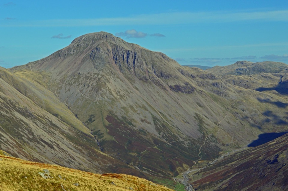
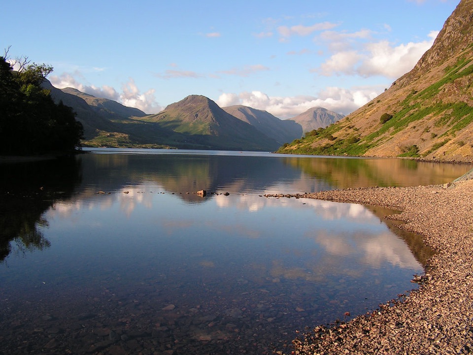
Wasdale Head and Great Gable

Overview

About Scafell Pike via the Corridor Route from Wasdale

Why go

  • Quieter, more varied Corridor Route traverse than the direct ascent
  • Big views of Great Gable, Lingmell and Wastwater

Heads up

  • Long, steep day with loose boulders and a rocky downclimb
  • Narrow valley access and recurring parking pressure reward an early start

Map & elevation

The route

Loading the Lake District map
Full map
Elevation76–904 m
TrailheadWasdale Head Green54.46543, -3.25598
Keep this map with you offline in the Parkwolf app

Plan your hike

Before you go

Parking

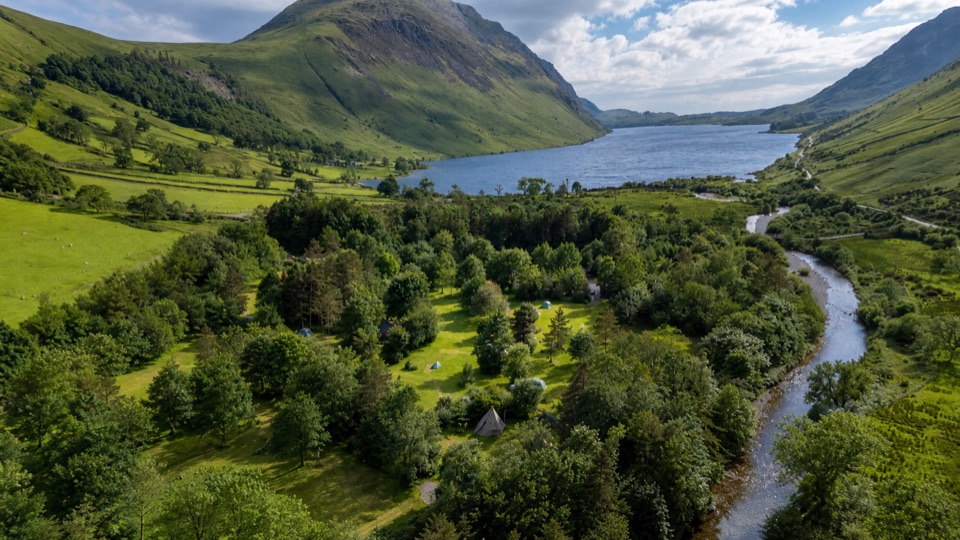
Use the signed parking and access by Wasdale Head Green for this route. Do not confuse it with Lake Head car park, the separate main Scafell Pike access for the shorter direct route. Overnight parking is not permitted in the managed Wasdale car parks.


Best time to go

The summit and the direct Hollow Stones approach are heavily visited; the Corridor traverse is generally quieter. Wasdale valley roads are narrow and parking pressure recurs, so an early start is sensible. It also helps with photography, giving softer light over upper Wasdale and Piers Gill before the summit fills up, plus a margin of daylight for the descent.

Safety

Hard mountain terrain, an unwaymarked route, poor-visibility navigation, steep ground beside Piers Gill, a short rocky downclimb, and slippery or high-water crossings at Lingmell Gill. Snow and ice can make the rocky sections hazardous, with avalanche risk outside summer.

8 active Lake District alerts

  • ClosureChapel Stile footpath closed for retaining-wall riskPart of Footpath 543030 between Chapel Stile and Baysbrown campsite is closed because a retaining wall beside the path could collapse and material it supports could fall across the footpath.Official details
  • ClosureStanley Ghyll Lower Falls footpath closed for rockfallThe section of Footpath 408037 leading towards Stanley Ghyll Lower Falls is closed because severe rockfall damage has made the path unstable and further rockfall remains a danger.Official details
See all 8 alerts
A park ranger sits on a dash-mounted phone, talking, as Parkwolf’s Tour Guide plays “Army Cutworm Moths: A Grizzly Bear Buffet” on Grand Loop Road below Dunraven Pass in Yellowstone
Parkwolf Tour GuideThe highest, rockiest slopes around here are a summer buffet for grizzly bears.

Lake District Tour Guide

Your drive to Scafell Pike via the Corridor Route from Wasdale, narrated.

Parkwolf is a GPS audio tour guide for Lake District National Park. As you drive, it chimes in with what’s ahead: hidden gems, upcoming stops, history, geology, and wildlife, right through your car’s speakers.

Recorded for this trailhead

Wasdale Head and Great Gable
0:00 / 1:24
“Up ahead is Wasdale Head, the starting point for a demanding walk up Great Gable or a much shorter wander beneath the mountains.”

Plays as you drive up to this trailhead in the Parkwolf Lake District Tour Guide.

More stories near here in the app

  • Scafell Pike from Lake Head
  • Wast Water at Overbeck
  • Greendale: Middle Fell or Three Summits
  • Seathwaite and the Corridor Route
  • 298 audio storiesacross Lake District’s roads, triggered by GPS as you drive
  • Wildlife heatmapsfor Red Deer, Eurasian Otter, Osprey, and 13 more
  • Works offlinemaps, 265 trails, 89 places, and audio download before you lose signal
  • CarPlay readysimple controls built for the drive
★★★★★
“Fantastic app with many points of information… It’s great to just turn on while you’re driving and it gives you an audio tour of the national Park. We love it!!!!”
JMJamesApp Store review
Download Parkwolf on the App StoreGet Parkwolf on Google Play

4.7 from 8,600+ ratings

Trail guide

Hiking Scafell Pike via the Corridor Route from Wasdale

The shape of the dayThis is a circular loop of 12.2 km / 7.

This is a circular loop of 12.2 km / 7.6 miles in total, starting and finishing at Wasdale Head Green. It climbs by the Corridor Route from Sty Head to Lingmell Col, takes in the Scafell Pike summit, then drops directly through Hollow Stones and Brown Tongue for the return. Total ascent is roughly 1,000 m.

A typical point estimate is 6 hours. Allow at least 5 to 6 hours from Wasdale even in good weather; a fast, experienced pace comes in around 4.5 hours.

How it unfoldsThe payoff is variety: a quieter, terrace-like high traverse on the way up, then a…

The payoff is variety: a quieter, terrace-like high traverse on the way up, then a straightforward, well-trodden descent that gets you down quickly.

  • Take the lane beside Lingmell House, past St Olaf's Church and Burnthwaite Farm.
  • Rough track and fields lead to the footbridge over Gable Beck, then a climb beside Lingmell Beck to Sty Head.
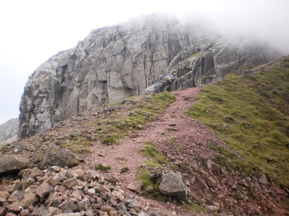
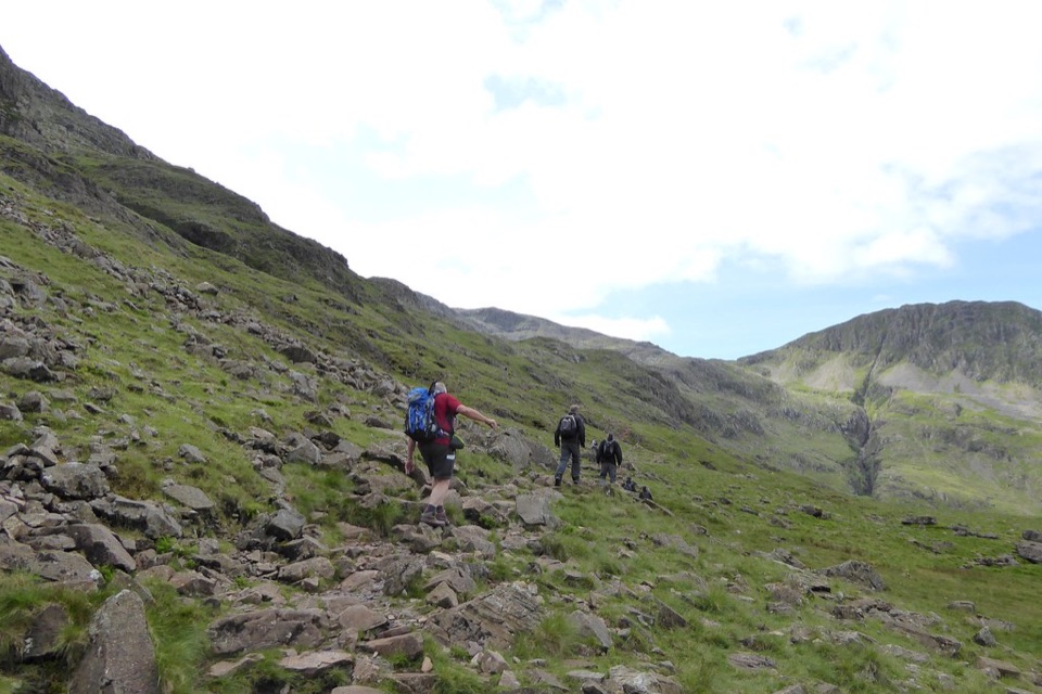
  • From Sty Head the Corridor Route starts faint, crossing boggy ground and stepping stones past Skew Gill, over a short rocky downclimb known as the Bad Step, around the head of Piers Gill and below the Great End and Broad Crag ground to Lingmell Col.
  • Turn left for the loose, boulder-strewn pull to the summit.
  • Return to Lingmell Col, pick up the direct cairned line through Hollow Stones and Brown Tongue, cross Lingmell Gill and drop around Lingmell back through the fields.
Difficulty and footingRated 8/10, a hard mountain day.

Rated 8/10, a hard mountain day. Paths are mostly rocky, with stone pitching, rough broken ground, loose scree and large boulders near the top. Add boggy sections and stepping stones on the Corridor, the short rocky downclimb, and a potentially slippery crossing at Lingmell Gill.

Hazards and navigationThe route is not consistently waymarked, and route finding is a real part of the challenge.

The route is not consistently waymarked, and route finding is a real part of the challenge. In poor visibility or fading light, the summit plateau and the return junctions get confusing fast.

  • Piers Gill is a deep ravine. Do not descend its bed. Stay on the correct path and keep going around the corner and uphill.
  • Sections of path run on steep ground beside drops near the gill.
  • The rocky step is harder when wet, icy or snowy.
  • Snow and ice are possible from autumn through spring, and this exposed high ground brings windchill, cloud, rain and avalanche risk outside summer.
Views and rockGreat Gable and Lingmell dominate early, with Styhead Tarn below and the upper Wasdale valley…

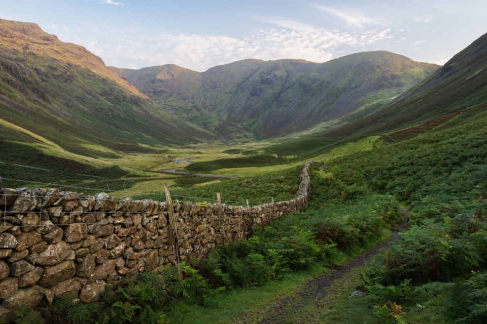
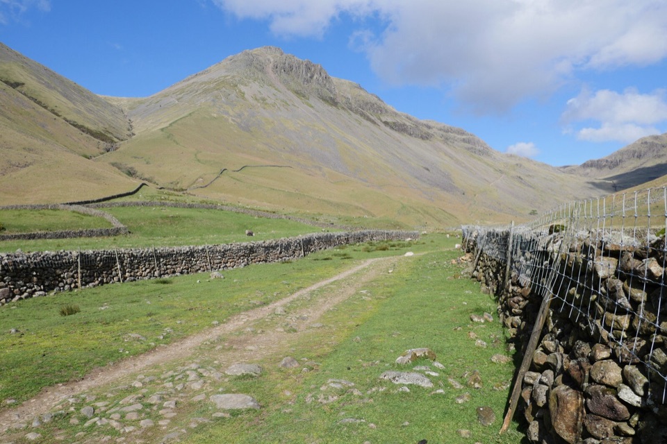
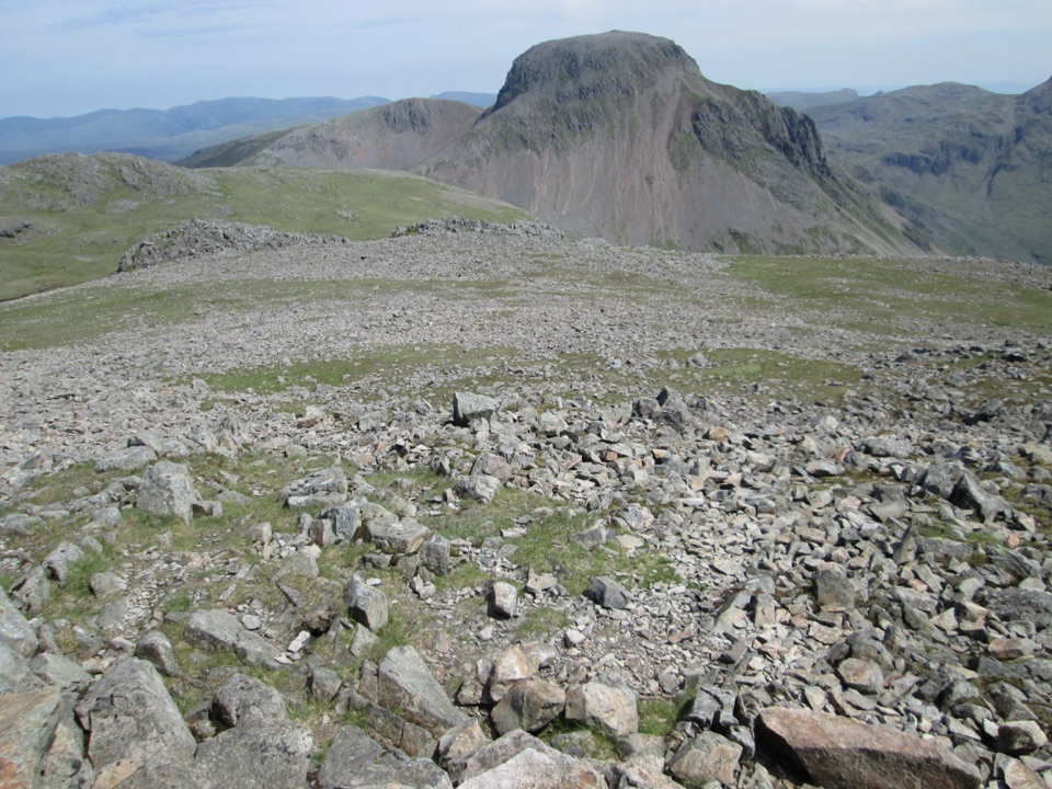
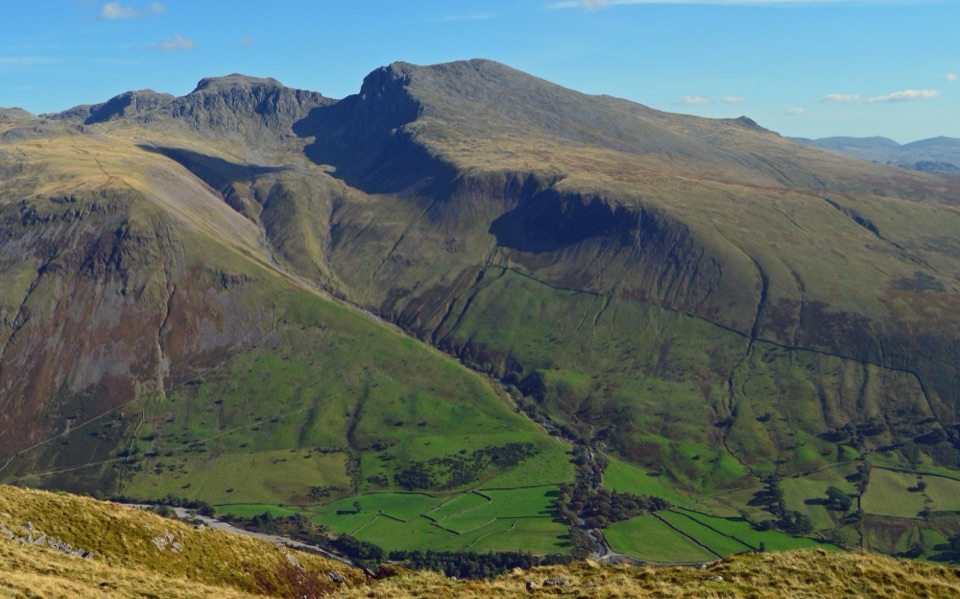
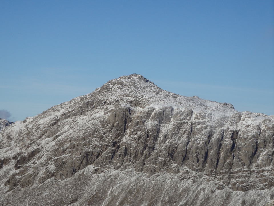
Great Gable and Lingmell dominate early, with Styhead Tarn below and the upper Wasdale valley opening out. The Corridor gives terraced traverses between rock bands, small tarns and becks, and a quiet high-level feel above the Piers Gill ravine. Higher up you get Wastwater views, the summit boulder field of shattered Borrowdale volcanic rock, and the summit war memorial.

Access and dogsStart at Wasdale Head Green, using the signed parking and access by the green.

Start at Wasdale Head Green, using the signed parking and access by the green. This is about 1 km north and east of the Lake Head car park, the main Scafell Pike access point, which has toilets and visitor facilities. Do not confuse the two starts. Overnight parking is not allowed in the managed Wasdale car parks.

Dogs are legally welcome on the route, but keep them on a short lead around livestock and in the car park. Only bring dogs already used to long, rough fell walks.

If you want a shorter dayThe Hollow Stones route from Lake Head is the shorter, more direct ascent and the better fit if…

The Hollow Stones route from Lake Head is the shorter, more direct ascent and the better fit if time or energy is limited. It misses the Corridor traverse entirely, which is what makes this loop the more varied option for experienced fell walkers.

Wildlife

Wildlife in Lake District

All Lake District wildlife maps

Sighting maps show where each species has been reported across Lake District. Wildlife moves, so no sighting is guaranteed.

Keep exploring

Near Scafell Pike via the Corridor Route from Wasdale

See it all on the map

Trails that start nearby

Places near the trailhead

Parkwolf’s Lake District ranking

Top-rated trails in Lake District

All 265 trails
  1. 1Scafell Pike via Hollow Stones from WasdaleChallenging · 9 km
  2. 2Helvellyn via Striding Edge and Swirral EdgeChallenging · 12.4 km
  3. 3CatbellsModerate · 6.6 km
  4. 4The Old Man of ConistonChallenging · 9 km
  5. 5Buttermere CircularEasy · 7.6 km
  6. 6The Fairfield HorseshoeChallenging · 17.2 km

Take Parkwolf to Lake District.

The audio tour guide for the drive, plus offline maps, trails, and wildlife heatmaps for when the signal drops.

4.7 from 8,600+ ratings

Download Parkwolf on the App StoreGet Parkwolf on Google Play