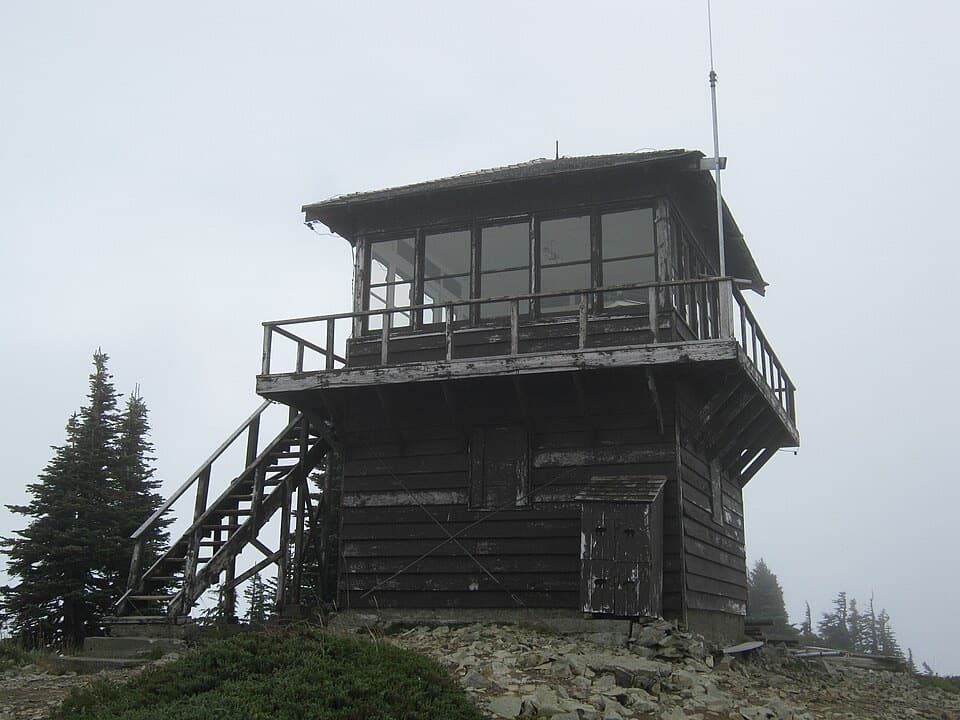
Carbon Glacier and Moraine Park Trail in Mount Rainier National Park

Mount Rainier National Park, WA

Carbon Glacier and Moraine Park Trail

A glacier overlook and wildflower meadow reward a long river walk

Photo: National Park Service
Length
21mi
Time
11hr
Elev. change
3,622ft
Difficulty
Challenging
  • No dogs
  • High point 5,440 ft
  • #38 of 99 in Mount Rainier

Hear the audio tour

An Alder's Underground Helpers

Overview

About Carbon Glacier and Moraine Park Trail

Why go

  • Follows the Carbon River from rainforest to a low glacier terminus.
  • Adds a wildflower meadow and Mount Rainier views beyond the glacier overlook.

Heads up

  • A 21-mile outing with 3,740 feet of climbing.
  • No public road approach; access requires a long-distance route from inside the park.

Map & elevation

The route

Loading the Mount Rainier map
Full map
Elevation1,818–5,440 ft
TrailheadCarbon River Entrance46.99496, -121.91550
Keep this map with you offline in the Parkwolf app

Plan your hike

Before you go

Parking

There is no public vehicle access to the Carbon River Entrance. The SR 165 Carbon River/Fairfax Bridge is permanently closed to public traffic, and the former Carbon River Road is closed to motor vehicles. The named start is reached by long-distance trails from within the park; it is not a drive-up parking area.

Safety

Rock and ice can fall from the glacier snout; stay on the constructed overlook trail. The Carbon River crossing relies on footlogs over a flood-shaped channel, so check current conditions and do not improvise a ford. The 21-mile route and 3,740 feet of climbing make this a remote, full-day commitment.

7 active Mount Rainier alerts

  • ClosureSR 165 bridge closed: no public access to Carbon River or Mowich LakeMentions Carbon River, referenced in this guideThe SR 165 Carbon River/Fairfax Bridge is closed to vehicles, bicycles, and pedestrians; there is no public access or alternate route to Carbon River or Mowich Lake.Official details
  • ClosureWildfire closures in the northern parkGrand Park 2 and Wonderland Complex fire closures affect trails, backcountry camps, and Sunrise access; stay out of closed areas.Official details
See all 7 alerts
A park ranger sits on a dash-mounted phone, talking, as Parkwolf’s Tour Guide plays “Army Cutworm Moths: A Grizzly Bear Buffet” on Grand Loop Road below Dunraven Pass in Yellowstone
Parkwolf Tour GuideThe highest, rockiest slopes around here are a summer buffet for grizzly bears.

Mount Rainier Tour Guide

Your drive to Carbon Glacier and Moraine Park Trail, narrated.

Parkwolf is a GPS audio tour guide for Mount Rainier National Park. As you drive, it chimes in with what’s ahead: hidden gems, upcoming stops, history, geology, and wildlife, right through your car’s speakers.

See the Mount Rainier audio tour

Recorded for this area

An Alder's Underground Helpers
0:00 / 0:30
“Red alders can get a start on rocky river margins where many other trees struggle. Part of their advantage is underground.”

Plays near this trailhead in the Parkwolf Mount Rainier Tour Guide.

More stories near here in the app

  • A Small Wren's Big Song
  • Carbon River Ranger Station: The Farmhouse Desk
  • The Bee That Shakes the Flower
  • Tolmie's Botanical Journey
  • 77 audio storiesacross Mount Rainier’s roads, triggered by GPS as you drive
  • Wildlife heatmapsfor Mountain Goat, Black Bear, Wolverine, and 13 more
  • Works offlinemaps, 99 trails, 87 places, and audio download before you lose signal
  • CarPlay readysimple controls built for the drive
★★★★★
“Fantastic app with many points of information… It’s great to just turn on while you’re driving and it gives you an audio tour of the national Park. We love it!!!!”
JMJamesApp Store review
Download Parkwolf on the App StoreGet Parkwolf on Google Play

4.7 from 8,600+ ratings

Trail guide

Hiking Carbon Glacier and Moraine Park Trail

The longer Moraine Park outingThe full Carbon Glacier and Moraine Park route is a 21-mile out-and-back from Carbon River…

The full Carbon Glacier and Moraine Park route is a 21-mile out-and-back from Carbon River Entrance, with 3,740 feet of climbing. Allow about 11 hours on the trail; the long internal approach to this remote corner of the park is additional. It follows the river toward Carbon Glacier, then climbs through forest to a high meadow with Mount Rainier views. If 21 miles is too much, Carbon Glacier Overlook is a shorter established turnaround at 17 miles round trip.

Reaching Carbon RiverCarbon River Entrance is the mapped starting point, but this is no longer a drive-up trail.

Carbon River Entrance is the mapped starting point, but this is no longer a drive-up trail. The SR 165 Carbon River/Fairfax Bridge is permanently closed to vehicles, bikes and pedestrians, and the old Carbon River Road is closed to cars after flood damage. The area can be reached only by a long-distance route from within the park. From the entrance, the hike itself begins with five miles on the former roadbed to Ipsut Creek Campground; it climbs gently beside the river and the surface varies from dirt to rock. Bikes are permitted on this road section as far as camp, but not on the hiking trails beyond it.

Along the riverA short connector from Ipsut Creek joins the Wonderland Trail.

A short connector from Ipsut Creek joins the Wonderland Trail. The route crosses the Carbon River on footlogs and passes flood-shaped ground where the tread can change. Check current conditions before planning the crossing; use the constructed crossings rather than improvising a ford. The northwest corner of the park is unusually wet, with rainforest-like vegetation along the lower river. The river has repeatedly shifted its channel through the valley, moving across old forest and fresh glacial deposits.

The glacier overlookAt the Carbon River Suspension Bridge and Spray Park junction, do not cross the bridge;…

At the Carbon River Suspension Bridge and Spray Park junction, do not cross the bridge; continue about 0.4 mile to the constructed glacier overlook. Carbon Glacier extends more than five miles down the mountain to a terminus around 3,500 feet, the lowest glacier terminus in the contiguous states. The front is dark with rock debris, and meltwater emerges beside the ice. Rock and ice can fall from the snout, so stay on the overlook trail. For a destination photo, keep some of the rocky river bar in the foreground to show the glacier's scale.

Continue to Moraine ParkThe Moraine Park version continues beyond the glacier view on the Wonderland Trail.

The Moraine Park version continues beyond the glacier view on the Wonderland Trail. A steep run of forest switchbacks leads to the open meadow, where mid-summer wildflowers and broad views of Mount Rainier are the payoff. Turn around at this first reach of Moraine Park; the Wonderland Trail continues farther into the backcountry beyond this hike.

Backcountry rulesThis is a long, remote route rather than a casual river walk.

This is a long, remote route rather than a casual river walk. Pets are prohibited on park trails. Natural water needs treatment, and overnight camping at Ipsut Creek, Carbon River or Dick Creek requires a wilderness permit. The Carbon River gets its name from coal deposits found in the area; the glacier-fed river and floodplain explain why the trail corridor alternates between forest and exposed, recently reshaped ground.

Wildlife

Wildlife in Mount Rainier

All Mount Rainier wildlife maps

Sighting maps show where each species has been reported across Mount Rainier. Wildlife moves, so no sighting is guaranteed.

Keep exploring

Near Carbon Glacier and Moraine Park Trail

See it all on the map

Trails that start nearby

Places near the trailhead

Parkwolf’s Mount Rainier ranking

Top-rated trails in Mount Rainier

All 99 trails
  1. 1Wonderland TrailChallenging · 93 mi
  2. 2Skyline Trail LoopChallenging · 5.5 mi
  3. 3Mount Fremont Lookout TrailModerate · 5.6 mi
  4. 4Burroughs Mountain TrailModerate · 6.2 mi
  5. 5Summerland TrailModerate · 8.4 mi
  6. 6Naches Peak Loop TrailModerate · 3.5 mi

Take Parkwolf to Mount Rainier.

The audio tour guide for the drive, plus offline maps, trails, and wildlife heatmaps for when the signal drops.

4.7 from 8,600+ ratings

Download Parkwolf on the App StoreGet Parkwolf on Google Play