Carbon River Old Mine in Mount Rainier National Park

Sight · Mount Rainier National Park

Carbon River Old Mine

A fern-framed mine entrance from Rainier’s short mining boom.

Photo: National Park Service
Type
Sight
Nearest trail
1 mi
Audio stories
1 nearby
  • Trailhead
  • Restrooms
  • Picnic tables

Hear the audio tour

An Alder's Underground Helpers

Overview

About Carbon River Old Mine

Why stop

  • A real mine entrance and ore rails make the area’s mining history tangible.

Heads up

  • The mine is a small payoff for a few miles of walking and a steep final spur.

Map

Where it is

Loading the Mount Rainier map
Full map
SightCarbon River Old Mine46.99320, -121.89104
Keep this map with you offline in the Parkwolf app

Plan your stop

Before you go

7 active Mount Rainier alerts

  • ClosureSR 165 bridge closed: no public access to Carbon River or Mowich LakeMentions Carbon River, referenced in this guideThe SR 165 Carbon River/Fairfax Bridge is closed to vehicles, bicycles, and pedestrians; there is no public access or alternate route to Carbon River or Mowich Lake.Official details
  • ClosureWildfire closures in the northern parkGrand Park 2 and Wonderland Complex fire closures affect trails, backcountry camps, and Sunrise access; stay out of closed areas.Official details
See all 7 alerts
A park ranger sits on a dash-mounted phone, talking, as Parkwolf’s Tour Guide plays “Army Cutworm Moths: A Grizzly Bear Buffet” on Grand Loop Road below Dunraven Pass in Yellowstone
Parkwolf Tour GuideThe highest, rockiest slopes around here are a summer buffet for grizzly bears.

Mount Rainier Tour Guide

Your drive to Carbon River Old Mine, narrated.

Parkwolf is a GPS audio tour guide for Mount Rainier National Park. As you drive, it chimes in with what’s ahead: hidden gems, upcoming stops, history, geology, and wildlife, right through your car’s speakers.

See the Mount Rainier audio tour

Recorded for this area

An Alder's Underground Helpers
0:00 / 0:30
“Red alders can get a start on rocky river margins where many other trees struggle. Part of their advantage is underground.”

Plays on the road 1.2 mi from Carbon River Old Mine in the Parkwolf Mount Rainier Tour Guide.

More stories near here in the app

  • A Small Wren's Big Song
  • Carbon River Ranger Station: The Farmhouse Desk
  • Tolmie's Botanical Journey
  • The Bee That Shakes the Flower
  • 77 audio storiesacross Mount Rainier’s roads, triggered by GPS as you drive
  • Wildlife heatmapsfor Mountain Goat, Black Bear, Wolverine, and 13 more
  • Works offlinemaps, 99 trails, 87 places, and audio download before you lose signal
  • CarPlay readysimple controls built for the drive
★★★★★
“Fantastic app with many points of information… It’s great to just turn on while you’re driving and it gives you an audio tour of the national Park. We love it!!!!”
JMJamesApp Store review
Download Parkwolf on the App StoreGet Parkwolf on Google Play

4.7 from 8,600+ ratings

Guide

More about Carbon River Old Mine

A small historic detourCarbon River Old Mine is a gated tunnel entrance tucked into the fern-covered hillside above…

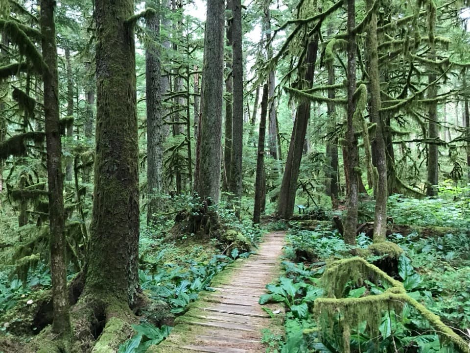
Carbon River Old Mine is a gated tunnel entrance tucked into the fern-covered hillside above the Carbon River Trail. It’s a small, history-focused stop rather than a major attraction; make the detour if you’re already walking the valley and would enjoy seeing a real piece of the park’s mining past.

Getting to itThe usual walk starts at the Carbon River Entrance and follows the broad former road, now the…

The usual walk starts at the Carbon River Entrance and follows the broad former road, now the Carbon River Trail, about 1.2 miles to the mine spur. Plan on roughly three miles round trip, with the last 0.3 mile climbing steeply to the entrance. Most of the approach is wide and fairly level beside the river; the spur is the hard part. A restroom and picnic table are listed at the entrance, before the walk, not at the mine. The old road closed to vehicles after the 2006 flood and now serves as a trail. Carbon River access has been affected by bridge and flood damage, so check current park conditions before planning this walk.

A brief mining boomThe mine is believed to have been part of the Washington Mining and Milling Company’s Carbon…

The mine is believed to have been part of the Washington Mining and Milling Company’s Carbon River operations. The company held 30 to 38 claims, with activity peaking in 1908 and 1909. Some claims may have been filed to get access to timber as much as to search for ore; by 1913 the company’s operations had ended or its claims had been declared invalid.

What the miners leftThe ore was described as a pale material dug from clay that hardened when exposed to air.

The ore was described as a pale material dug from clay that hardened when exposed to air. An incline railway carried it about 300 feet down toward the river or road. Today, the fern-framed opening and the rails near the entrance give you a sense of that operation’s scale. The tunnel is blocked for safety; stay outside the barrier and don’t try to go farther in.

Wildlife

Wildlife in Mount Rainier

All Mount Rainier wildlife maps

Sighting maps show where each species has been reported across Mount Rainier. Wildlife moves, so no sighting is guaranteed.

Keep exploring

Near Carbon River Old Mine

See it all on the map

Trails nearby

More stops nearby

Parkwolf’s Mount Rainier ranking

Top sights in Mount Rainier

All 87 places
  1. 1Reflection LakesSight
  2. 2Myrtle FallsSight
  3. 3Panorama PointSight
  4. 4Narada FallsSight
  5. 5Tipsoo LakeSight
  6. 6Sunrise Point OverlookSight

Take Parkwolf to Mount Rainier.

The audio tour guide for the drive, plus offline maps, trails, and wildlife heatmaps for when the signal drops.

4.7 from 8,600+ ratings

Download Parkwolf on the App StoreGet Parkwolf on Google Play