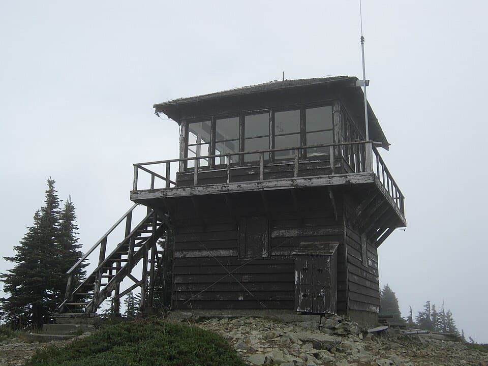
Tolmie Peak Fire Lookout in Mount Rainier National Park

Sight · Mount Rainier National Park

Tolmie Peak Fire Lookout

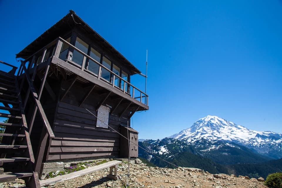
Rainier rises above Eunice Lake from this historic lookout's rocky perch.

Photo: Public Domain
Type
Sight
Nearest trail
1.8 mi
Audio stories
3 nearby
  • Scenic viewpoint
  • #14 of 61 sights

Hear the audio tour

Tolmie's Botanical Journey

Overview

About Tolmie Peak Fire Lookout

Why stop

  • A historic lookout frames Rainier above Eunice Lake.

Heads up

  • The steep final mile and rough seasonal road add effort.

Map

Where it is

Loading the Mount Rainier map
Full map
SightTolmie Peak Fire Lookout46.95755, -121.88091
Keep this map with you offline in the Parkwolf app

Plan your stop

Before you go

7 active Mount Rainier alerts

  • ClosureSR 165 bridge closed: no public access to Carbon River or Mowich LakeMentions Carbon River, referenced in this guideThe SR 165 Carbon River/Fairfax Bridge is closed to vehicles, bicycles, and pedestrians; there is no public access or alternate route to Carbon River or Mowich Lake.Official details
  • ClosureWildfire closures in the northern parkGrand Park 2 and Wonderland Complex fire closures affect trails, backcountry camps, and Sunrise access; stay out of closed areas.Official details

See all 7 alerts
A park ranger sits on a dash-mounted phone, talking, as Parkwolf’s Tour Guide plays “Army Cutworm Moths: A Grizzly Bear Buffet” on Grand Loop Road below Dunraven Pass in Yellowstone
Parkwolf Tour GuideThe highest, rockiest slopes around here are a summer buffet for grizzly bears.

Mount Rainier Tour Guide

Your drive to Tolmie Peak Fire Lookout, narrated.

Parkwolf is a GPS audio tour guide for Mount Rainier National Park. As you drive, it chimes in with what’s ahead: hidden gems, upcoming stops, history, geology, and wildlife, right through your car’s speakers.

See the Mount Rainier audio tour

Recorded for this area

Tolmie's Botanical Journey
0:00 / 0:27
“William Tolmie came to Rainier country in eighteen thirty-three to collect plants for medicine. He was twenty-one, traveling with five Indigenous guides into the mountain's northwest country.”

Plays on the road 0.9 mi from Tolmie Peak Fire Lookout in the Parkwolf Mount Rainier Tour Guide.

More stories near here in the app

  • The Bee That Shakes the Flower
  • When People Added the Fish
  • Paul Peak: Downhill Into the Forest
  • An Alder's Underground Helpers
  • 77 audio storiesacross Mount Rainier’s roads, triggered by GPS as you drive
  • Wildlife heatmapsfor Mountain Goat, Black Bear, Wolverine, and 13 more
  • Works offlinemaps, 99 trails, 87 places, and audio download before you lose signal
  • CarPlay readysimple controls built for the drive
★★★★★
“Fantastic app with many points of information… It’s great to just turn on while you’re driving and it gives you an audio tour of the national Park. We love it!!!!”
JMJamesApp Store review
Download Parkwolf on the App StoreGet Parkwolf on Google Play

4.7 from 8,600+ ratings

Guide

More about Tolmie Peak Fire Lookout

A real hike to a small summitTolmie Peak Fire Lookout is a two-story wooden fire tower on a rocky summit above Eunice Lake.

Tolmie Peak Fire Lookout is a two-story wooden fire tower on a rocky summit above Eunice Lake. It’s the reward at the end of a substantial backcountry hike, not a drive-up stop. The route is reported at 6.5 to 7.5 miles round trip, with roughly 1,000 feet of climbing; the last mile is steep.

How the route unfoldsFrom Mowich Lake, the trail follows the Wonderland Trail through forest for about 1.

From Mowich Lake, the trail follows the Wonderland Trail through forest for about 1.25 miles, then drops before climbing steeply to Eunice Lake. The final mile crosses a lava ridge to the lookout. The lakeside meadows are fragile, so stay on the constructed trail.

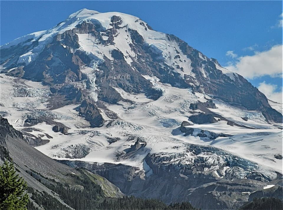
Rainier and the lake in one frameFrom the lookout, Mount Rainier rises above Eunice Lake.

From the lookout, Mount Rainier rises above Eunice Lake. The north side opens toward the Carbon River Valley; on a clear day, the wider panorama can include Mount St. Helens, the Olympic Mountains and Mount Baker. For the classic photo, line up Rainier above the lake rather than pointing straight at the peak.

Built to watch for fireThe National Park Service built the lookout in 1933.

The National Park Service built the lookout in 1933. Fire watchers scanned for smoke and lightning and reported what they saw by telephone. Aerial surveillance took over much of that work after World War II, but this is one of four surviving fire lookouts in the park, still used occasionally for ranger work and emergency fire detection.

A botanist left his nameTolmie Peak commemorates botanist William Tolmie.

Tolmie Peak commemorates botanist William Tolmie. In 1833, when he was 21, Tolmie and five Indigenous guides traveled toward Rainier to collect medicinal plants. The park now believes the peak they climbed was probably Hessong Rock in Spray Park, not this summit.

Plan around Mowich LakeThe usual trailhead is at Mowich Lake.

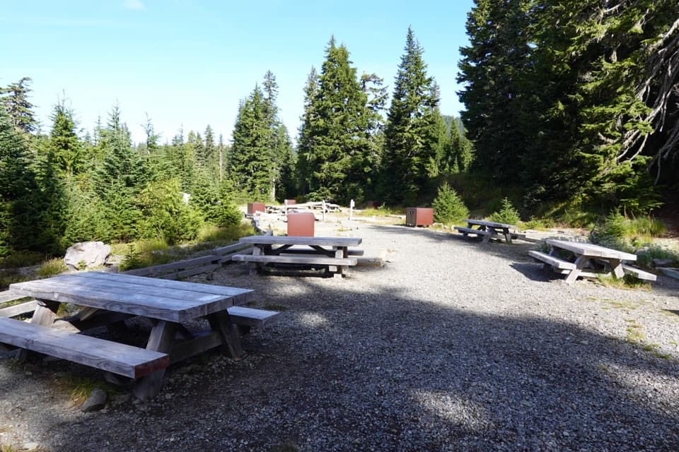
The usual trailhead is at Mowich Lake. Its road is normally open only in summer, typically from mid-July to mid-October, and is unpaved and rough beyond the first three miles; check road and trail conditions before setting out. The trailhead area has parking, seasonal restrooms and picnic tables. Pack food; no food service is listed along the trail. Treat natural water before drinking. Pets aren’t allowed on park trails. Neither Eunice Lake nor Tolmie Peak has a wilderness camp; the nearest camping is the walk-in campground at Mowich Lake, where permits are required.

Wildlife

Wildlife in Mount Rainier

All Mount Rainier wildlife maps

Sighting maps show where each species has been reported across Mount Rainier. Wildlife moves, so no sighting is guaranteed.

Keep exploring

Near Tolmie Peak Fire Lookout

See it all on the map

Trails nearby

More stops nearby

Parkwolf’s Mount Rainier ranking

Top sights in Mount Rainier

All 87 places
  1. 1Reflection LakesSight
  2. 2Myrtle FallsSight
  3. 3Panorama PointSight
  4. 4Narada FallsSight
  5. 5Tipsoo LakeSight
  6. 6Sunrise Point OverlookSight

Take Parkwolf to Mount Rainier.

The audio tour guide for the drive, plus offline maps, trails, and wildlife heatmaps for when the signal drops.

4.7 from 8,600+ ratings

Download Parkwolf on the App StoreGet Parkwolf on Google Play