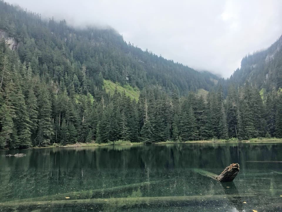
Green Lake Trail in Mount Rainier National Park

Mount Rainier National Park, WA

Green Lake Trail

A rainforest walk to a 172-foot waterfall and a tucked-away lake.

Photo: National Park Service
Length
10.5mi
Time
5hr
Elev. change
1,490ft
Difficulty
Moderate
  • No dogs
  • High point 3,307 ft

Hear the audio tour

An Alder's Underground Helpers

Overview

About Green Lake Trail

Why go

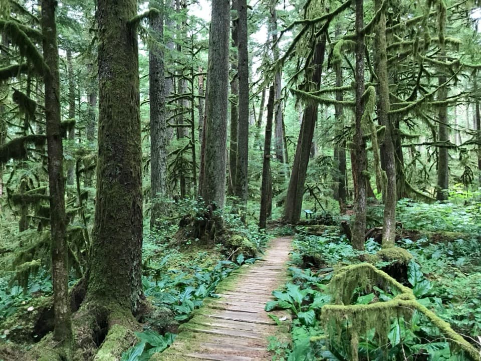
  • Old-growth rainforest and enormous Douglas-firs along the approach.
  • A three-tier waterfall before a forest-backed lake.

Heads up

  • A long, mostly steady approach comes before the steep final climb.
  • Wet roots, rocks, and flood-worn sections can slow the walk.

Map & elevation

The route

Loading the Mount Rainier map
Full map
Elevation1,818–3,307 ft
TrailheadCarbon River Entrance46.99496, -121.91550
Keep this map with you offline in the Parkwolf app

Plan your hike

Before you go

Parking

Start at the Carbon River Entrance and follow the former Carbon River Road toward Ipsut Creek. The signed Green Lake turnoff at Ranger Creek is about 3.6 miles along the approach. A bike rack is at the junction; bicycles may use the old roadbed but not the Green Lake Trail.

Safety

Expect uneven, sometimes washed-out roadbed and wet roots and rocks. The Green Lake branch climbs steeply above Ranger Creek; several unofficial paths below the signed Ranger Falls viewpoint lead toward the creek instead of the overlook. The stream log bridge can be slick.

7 active Mount Rainier alerts

  • ClosureSR 165 bridge closed: no public access to Carbon River or Mowich LakeMentions Carbon River, referenced in this guideThe SR 165 Carbon River/Fairfax Bridge is closed to vehicles, bicycles, and pedestrians; there is no public access or alternate route to Carbon River or Mowich Lake.Official details
  • ClosureWildfire closures in the northern parkGrand Park 2 and Wonderland Complex fire closures affect trails, backcountry camps, and Sunrise access; stay out of closed areas.Official details
See all 7 alerts
A park ranger sits on a dash-mounted phone, talking, as Parkwolf’s Tour Guide plays “Army Cutworm Moths: A Grizzly Bear Buffet” on Grand Loop Road below Dunraven Pass in Yellowstone
Parkwolf Tour GuideThe highest, rockiest slopes around here are a summer buffet for grizzly bears.

Mount Rainier Tour Guide

Your drive to Green Lake Trail, narrated.

Parkwolf is a GPS audio tour guide for Mount Rainier National Park. As you drive, it chimes in with what’s ahead: hidden gems, upcoming stops, history, geology, and wildlife, right through your car’s speakers.

See the Mount Rainier audio tour

Recorded for this area

An Alder's Underground Helpers
0:00 / 0:30
“Red alders can get a start on rocky river margins where many other trees struggle. Part of their advantage is underground.”

Plays near this trailhead in the Parkwolf Mount Rainier Tour Guide.

More stories near here in the app

  • A Small Wren's Big Song
  • Carbon River Ranger Station: The Farmhouse Desk
  • The Bee That Shakes the Flower
  • Tolmie's Botanical Journey
  • 77 audio storiesacross Mount Rainier’s roads, triggered by GPS as you drive
  • Wildlife heatmapsfor Mountain Goat, Black Bear, Wolverine, and 13 more
  • Works offlinemaps, 99 trails, 87 places, and audio download before you lose signal
  • CarPlay readysimple controls built for the drive
★★★★★
“Fantastic app with many points of information… It’s great to just turn on while you’re driving and it gives you an audio tour of the national Park. We love it!!!!”
JMJamesApp Store review
Download Parkwolf on the App StoreGet Parkwolf on Google Play

4.7 from 8,600+ ratings

Trail guide

Hiking Green Lake Trail

What you getGreen Lake Trail is a 10.

Green Lake Trail is a 10.5-mile out-and-back from the Carbon River Entrance, following a former roadbed before turning uphill through old-growth rainforest to a quiet lake. Ranger Falls makes a worthwhile detour on the climb. Allow about five hours; the approach is long and mostly gradual, while the last stretch to the lake is a sustained climb. This is a good choice if you want a full forest hike with a waterfall and lake at the end, not a quick lakeside stroll.

The Carbon River approachFrom the entrance, follow the old Carbon River Road for about 3.

From the entrance, follow the old Carbon River Road for about 3.6 miles to the signed Green Lake turnoff at Ranger Creek. The broad former roadbed is a gentler approach, but it is still a long walk before the climbing begins. The damp northwest forest holds enormous Douglas-firs; some are about 800 years old. Expect roots, rocks, and sections where floods have left the old road uneven.

Ranger Falls and the climbThe Green Lake branch climbs through forest.

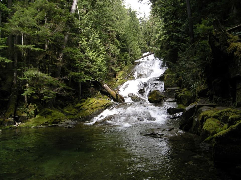
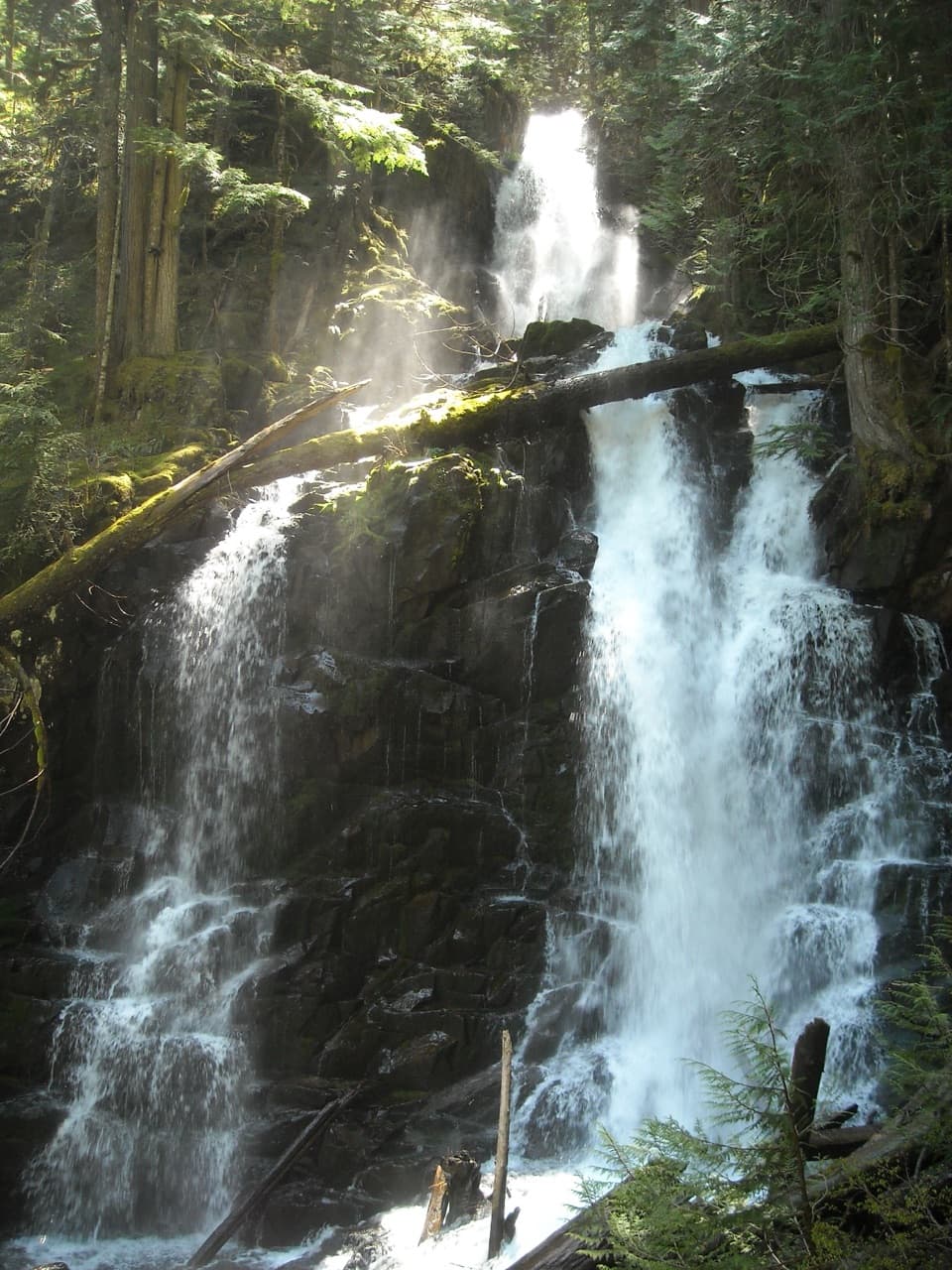
The Green Lake branch climbs through forest. About a mile in, take the short signed path to Ranger Falls; several informal paths drop toward the creek before the actual viewpoint, so keep to the main trail until you see the sign. The cascade falls in three sections, 172 feet in all, with its tallest drop measuring 73 feet. Beyond it, the trail keeps climbing for roughly 0.8 mile. A log bridge crosses a stream near the top.

At the lakeGreen Lake is enclosed by forest, with a partial view south toward Tolmie Park.

Green Lake is enclosed by forest, with a partial view south toward Tolmie Park. Logs gather at the outlet, a good place to sit and look back across the water; include them in the foreground for a photo that shows how tucked-in the lake is. There is no trail around the shore, so turn back the way you came. Treat water before drinking. Pets are prohibited, bikes must be left at the Green Lake junction, and camping is not allowed at the lake; Ipsut Creek Campground is a separate stop.

Wildlife

Wildlife in Mount Rainier

All Mount Rainier wildlife maps

Sighting maps show where each species has been reported across Mount Rainier. Wildlife moves, so no sighting is guaranteed.

Keep exploring

Near Green Lake Trail

See it all on the map

Trails that start nearby

Places near the trailhead

Parkwolf’s Mount Rainier ranking

Top-rated trails in Mount Rainier

All 99 trails
  1. 1Wonderland TrailChallenging · 93 mi
  2. 2Skyline Trail LoopChallenging · 5.5 mi
  3. 3Mount Fremont Lookout TrailModerate · 5.6 mi
  4. 4Burroughs Mountain TrailModerate · 6.2 mi
  5. 5Summerland TrailModerate · 8.4 mi
  6. 6Naches Peak Loop TrailModerate · 3.5 mi

Take Parkwolf to Mount Rainier.

The audio tour guide for the drive, plus offline maps, trails, and wildlife heatmaps for when the signal drops.

4.7 from 8,600+ ratings

Download Parkwolf on the App StoreGet Parkwolf on Google Play