Parking
From St Arnaud, follow SH 63 west for 2 km, then Mount Robert Road for 2.8 km to the Lakeside Track start. The saved pin marks the mapped access; the exact parking-bay center is not confirmed.
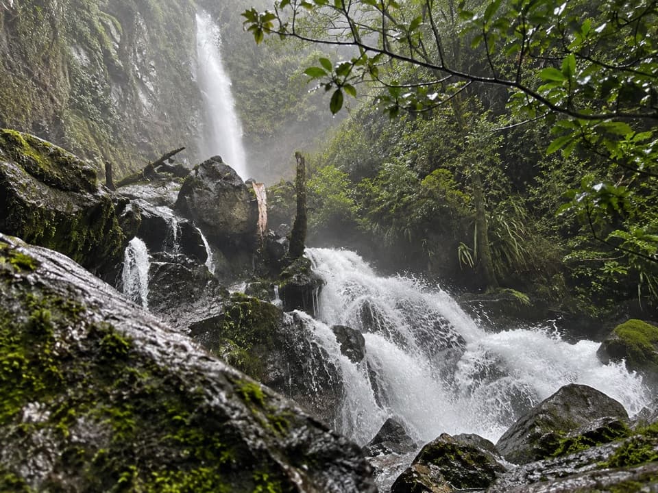
#7 of 57 trails in Nelson Lakes
Nelson Lakes National Park, TM
A nearly 40 m waterfall wrapped in moss and ferns.
Overview
Map & elevation
Plan your hike

The highest, rockiest slopes around here are a summer buffet for grizzly bears.
Nelson Lakes Tour Guide
Parkwolf is a GPS audio tour guide for Nelson Lakes National Park. As you drive, it chimes in with what’s ahead: hidden gems, upcoming stops, history, geology, and wildlife, right through your car’s speakers.
Recorded for this trailhead
Lakeside Track to Whisky Falls“You're approaching Lakeside Track, the walking access to Whisky Falls.”
Plays as you drive up to this trailhead in the Parkwolf Nelson Lakes Tour Guide.
More stories near here in the app
“Fantastic app with many points of information… It’s great to just turn on while you’re driving and it gives you an audio tour of the national Park. We love it!!!!”


Trail guide
This is the Mount Robert Road route to Whisky Falls: a 10.8 km (6.7 mi) out-and-back along the western shore of Lake Rotoiti, with the falls as its turnaround. Plan on about 3–4 hours at a comfortable pace. The Department of Conservation grades it easy to intermediate and estimates three hours, but the full distance and the stream crossing make it more than a quick waterfall stop. You return on the same track.
Lakeside Track starts through mānuka and kānuka before entering beech forest. It follows the lake’s western edge, with stretches of trees, glimpses back to Lake Rotoiti and several shingle fans where streams have spread stones across the shore. Follow Lakeside Track to the Whisky Falls branch, then take the spur to the waterfall; the mapped route stops there rather than continuing toward Coldwater Hut. Longer lake-circuit outings use different access and are not part of this distance.
The last approach crosses several stony fans and a wide stream with no bridge. Walkers have reported the water rising above boot height after rain, so expect wet feet and check conditions before committing to the crossing. The final rocks around the falls can be slippery. If water is running too high or fast to cross safely, turn back rather than forcing it.
Whisky Falls drops nearly 40 m through a damp rock cleft thick with moss and ferns. It’s the clear payoff of the walk, and worth slowing down for once you reach it. The close view is especially good for framing the water against the green rock walls; take care where you stand, since the rocks are slick.
The falls take their name from an illicit whisky still whose remains were found here in the 1880s. It’s an unexpectedly human story in a landscape shaped by water and ice.
Tributary glaciers once entered the main Travers glacier valley from higher side valleys. When the ice retreated, those side valleys were left hanging above the main one, sending water down toward the lake. Erosion at the waterfall’s lip and shingle fans building up below have gradually changed the drop. A large section of rock face fell at the base in 1995, a reminder that the cliffs are still changing.
From St Arnaud, follow SH 63 west for 2 km, turn onto Mount Robert Road and continue 2.8 km to the Lakeside Track start. The stored map point marks the mapped track access; the exact center of a parking bay has not been confirmed. This entry is specifically the Mount Robert Road out-and-back. No dogs are allowed on the track.
Wildlife
 20 sightingsNew Zealand FalconMost seen around 9 AMSighting map
 39 sightingsWekaMost seen around 7 AMSighting map
 11 sightingsKererūMost seen around 9 AMSighting map
 55 sightingsBlack SwanMost seen around 8 AMSighting map
 23 sightingsParadise ShelduckMost seen around 6 AMSighting map
 17 sightingsTūīMost seen around 7 AMSighting map
Sighting maps show where each species has been reported across Nelson Lakes. Wildlife moves, so no sighting is guaranteed.
Keep exploring
 EasyLakeside Track to Coldwater Hut8.2 km · 2.5 hr · At the trailheadA forested lakeshore walk to Coldwater Hut and its jetty.
 ChallengingMount Robert Circuit9 km · 5 hr · 1.1 km awayA 9 km alpine loop with Lake Rotoiti views and steep climbing.
 ChallengingAngelus Hut via Pinchgut Track and Robert Ridge Route12.2 km · 6 hr · 1.1 km awayA long, exposed ridge walk to an alpine lakeside hut.
 ChallengingAngelus Hut Circuit via Robert Ridge and Speargrass Track23.4 km · 12 hr · 1.1 km awayAn exposed ridge to a glacial lake, then back by Speargrass Creek.
 ModerateSpeargrass Track to Speargrass Hut14.6 km · 6 hr · 1.1 km awayBeech forest gives way to a hut in a tussock clearing.
 ChallengingAngelus Hut via Speargrass Track and Speargrass Creek Route11.2 km · 6 hr · 1.1 km awayA demanding creek route to a high alpine lake hut.
 ChallengingMount Robert–Julius Summit15.6 km · 7.5 hr · 1.1 km awayA big climb for Lake Rotoiti views and a high, exposed ridge.
 ChallengingBushline Hut via Paddy’s Track8.1 km · 4.5 hr · 1.1 km awayA steep climb to a high hut above Lake Rotoiti.
 Sight · 1.4 km awayLake Rotoiti ViewPinchgut climbs to a wide view of Lake Rotoiti’s two bays.
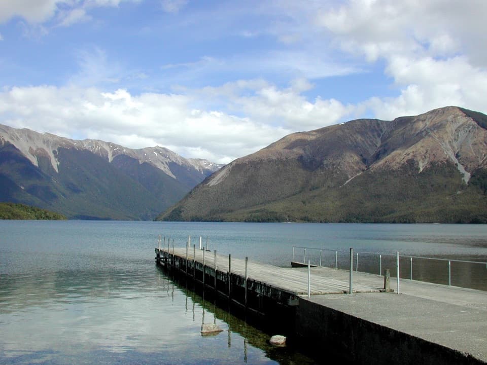 Sight · 1.8 km awayWest Bay, Lake RotoitiShort walks lead from lake views to glacier-shaped ponds.Campground · 2 km awayWest Bay CampsiteA quiet, tree-screened base beside Lake Rotoiti.
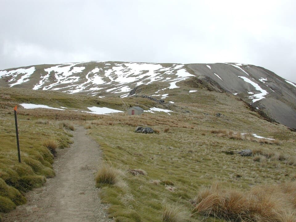 Sight · 2.6 km awayRelax ShelterA small ridge shelter reached above the bushline on Mount Robert.
 Sight · 2.7 km awayLake Rotoiti – Kerr Bay and JettyA mountain-framed jetty with eels beneath the water.
 Visitor center · 2.7 km awayNelson Lakes National Park Visitor CentreA good first stop for track advice, maps, and backcountry supplies.
 Campground · 2.8 km awayTeetotal CampsiteA quiet tent base beside Teetotal’s trails and winter skating pond.
 Sight · 2.8 km awayDuck PondA rare chance to skate on natural pond ice.
Parkwolf’s Nelson Lakes ranking

The audio tour guide for the drive, plus offline maps, trails, and wildlife heatmaps for when the signal drops.



