Mount Robert Circuit in Nelson Lakes National Park

#1 of 57 trails in Nelson Lakes

Nelson Lakes National Park, TM

Mount Robert Circuit

A 9 km alpine loop with Lake Rotoiti views and steep climbing.

Photo: Public Domain
Length
9km
Time
5hr
Elev. change
576m
Difficulty
Challenging
  • Loop
  • No dogs
  • High point 1,429 m

Hear the audio tour

Mount Robert: Views on Foot

Overview

About Mount Robert Circuit

Why go

  • A high ridge walk with broad Lake Rotoiti and St Arnaud Range views
  • Two distinct tracks make a satisfying half-day circuit

Heads up

  • The steep climb and exposed ridge take more effort than 9 km suggests
  • Scree and an icy road gate can complicate the walk

Map & elevation

The route

Loading the Nelson Lakes map
Full map
Elevation853–1,429 m
TrailheadMount Robert car park-41.82167, 172.80858
Keep this map with you offline in the Parkwolf app

Plan your hike

Before you go

Parking

From St Arnaud, follow SH 63 west for 2 km, turn onto Mount Robert Road, and continue 4.9 km to the car park at the end. Pinchgut Track starts at the lot; Paddy’s Track has another access about 500 m before the lot on the approach. This isolated car park is prone to vehicle theft, so leave valuables out of the vehicle; bag storage is available at the Nelson Lakes Visitor Centre.

Safety

DOC classifies this as an Advanced tramping track. The open face and ridge are exposed to wind, and freezing conditions can occur at any time of year. The gate at the bottom of Mount Robert Road is locked when the road is icy. Dogs are not allowed. Wasps are especially common from December through April. Water at Bushline Hut is untreated and must be boiled.

3 active Nelson Lakes alerts

  • ClosureRotoroa Route permanently closedThe Rotoroa Route is permanently closed along the eastern side of Lake Rotoroa between Rotoroa village and Sabine Hut.Official details
  • CautionUnbridged stream between Sabine and D’Urville hutsThe bridge on the track between Sabine Hut and D’Urville Hut has been removed; trampers must cross an unbridged stream at GR E1571366 N5359831.Official details
See all 3 alerts
A park ranger sits on a dash-mounted phone, talking, as Parkwolf’s Tour Guide plays “Army Cutworm Moths: A Grizzly Bear Buffet” on Grand Loop Road below Dunraven Pass in Yellowstone
Parkwolf Tour GuideThe highest, rockiest slopes around here are a summer buffet for grizzly bears.

Nelson Lakes Tour Guide

Your drive to Mount Robert Circuit, narrated.

Parkwolf is a GPS audio tour guide for Nelson Lakes National Park. As you drive, it chimes in with what’s ahead: hidden gems, upcoming stops, history, geology, and wildlife, right through your car’s speakers.

Recorded for this trailhead

Mount Robert: Views on Foot
0:00 / 0:27
“The Mount Robert trailheads are coming up, where the lake lookout takes an uphill walk from the car park.”

Plays as you drive up to this trailhead in the Parkwolf Nelson Lakes Tour Guide.

More stories near here in the app

  • Lakeside Track to Whisky Falls
  • Buller Bridge and Anglers Walk
  • West Bay, Lake Rotoiti
  • Lodge Road and Black Hill Walk
  • 26 audio storiesacross Nelson Lakes’s roads, triggered by GPS as you drive
  • Wildlife heatmapsfor New Zealand Falcon, Weka, Kererū, and 13 more
  • Works offlinemaps, 57 trails, 47 places, and audio download before you lose signal
  • CarPlay readysimple controls built for the drive
★★★★★
“Fantastic app with many points of information… It’s great to just turn on while you’re driving and it gives you an audio tour of the national Park. We love it!!!!”
JMJamesApp Store review
Download Parkwolf on the App StoreGet Parkwolf on Google Play

4.7 from 8,600+ ratings

Trail guide

Hiking Mount Robert Circuit

Is this the right loop?Mount Robert Circuit is a 9 km (5.

Mount Robert Circuit is a 9 km (5.6 mi) loop around the northern face of Pourangahau/Mount Robert. It climbs Pinchgut Track, crosses the open ridge by Relax Shelter and Bushline Hut, then descends Paddy’s Track and returns along a short stretch of Mount Robert Road. The Lake Rotoiti views are the payoff, but the climb makes this a proper half-day tramp rather than a casual lake walk. Allow about five hours, especially if you stop at the hut and viewpoints. Four hours is possible for a quick, fit walk; five is a better plan. The route gains roughly 540 m, and DOC classifies it as an Advanced tramping track.

The Pinchgut climbFrom the car park, Pinchgut zigzags up the steep, open northern face.

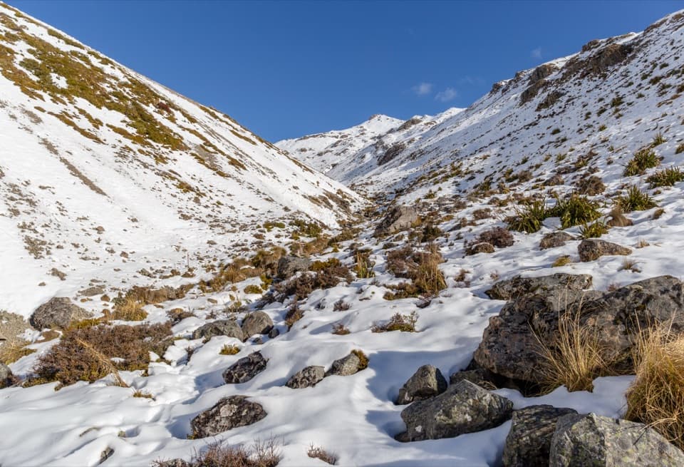
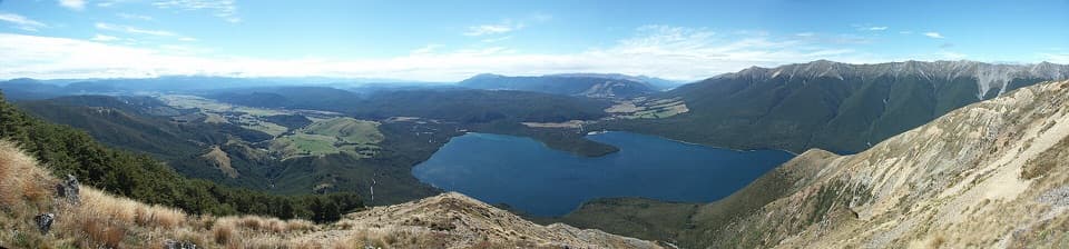
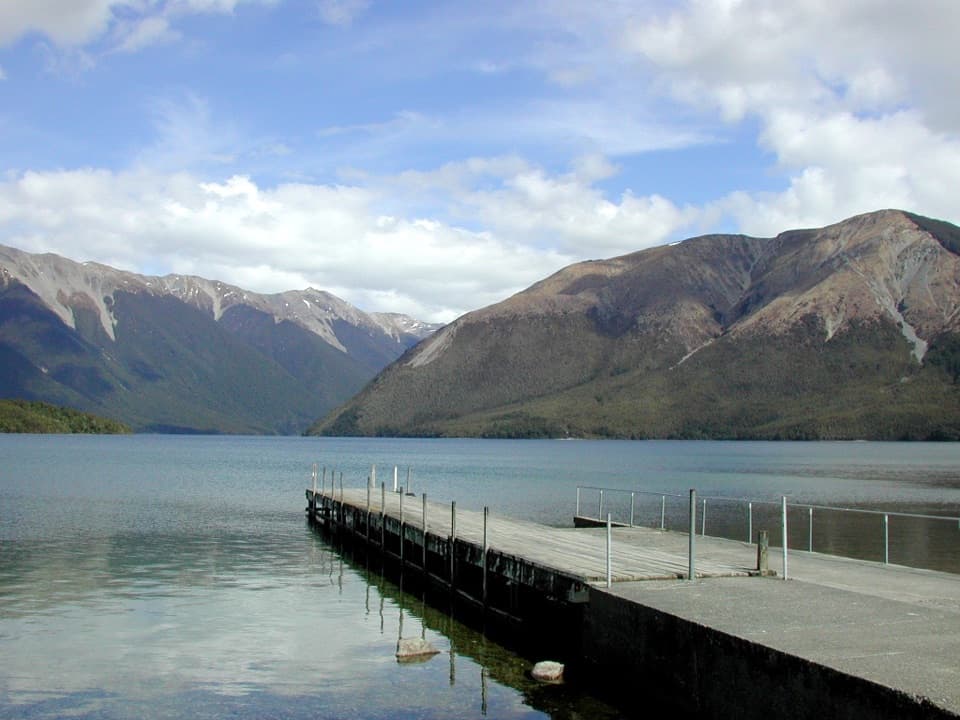
From the car park, Pinchgut zigzags up the steep, open northern face. The track is well graded, but it keeps climbing; the bare slope is exposed to sun and wind before you reach the beech forest. After about an hour and a half you come out near the bushline, where the forest gives way to alpine herbs and shrubs. The view of Lake Rotoiti opens as you gain height. For a photo that feels like the walk, keep some of the rocky tussock slope in the foreground instead of framing only the lake.

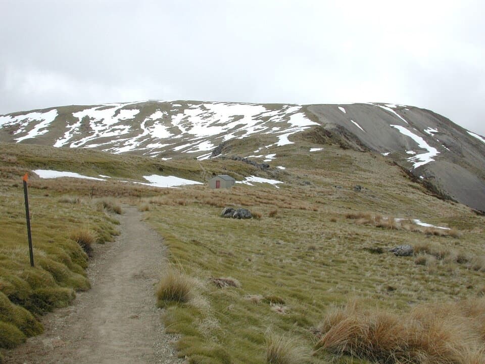
Open ridge and Bushline HutAbove the trees, the route follows open ridge country through tussock and alpine plants.

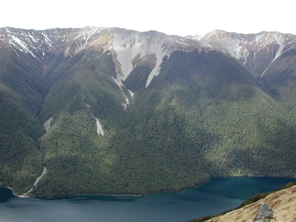
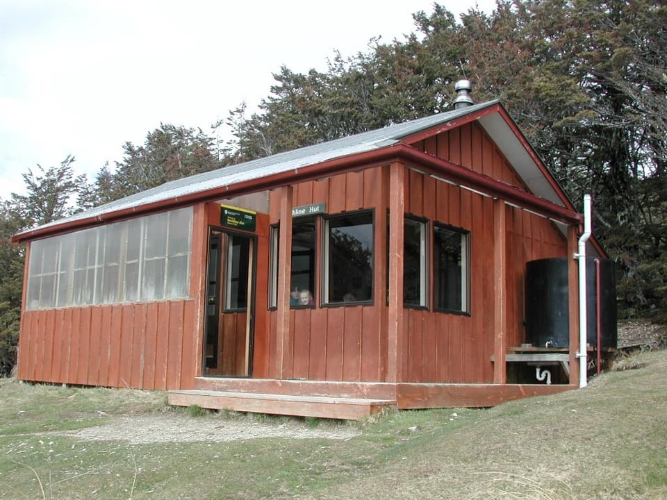
Above the trees, the route follows open ridge country through tussock and alpine plants. Relax Shelter is a useful landmark; at the junction just beyond it, take Paddy’s Track toward Bushline Hut. The Robert Ridge route continues toward Angelus Hut and is a different, much longer trip. Bushline Hut sits at about 1,280 m on the treeline, with Lake Rotoiti and the St Arnaud Range below and beyond it. It has 14 bunks, toilets and a rainwater tank, but bunks need to be booked and the water is untreated, so boil it. If you stay overnight, bring your own food and cooking gear.

Down Paddy’s TrackPaddy’s crosses the open mountainside and several scree-filled gullies before dropping toward…

Paddy’s crosses the open mountainside and several scree-filled gullies before dropping toward Mount Robert Road. The descent is long and can feel loose underfoot. Several hikers like doing the loop this way round: the lake and St Arnaud Range stay in front of you as you come down. At the road, follow the short connector back to the car park; the full loop includes it. Keep the junction at Relax Shelter in mind, since carrying on along Robert Ridge takes you away from the circuit.

Why the northern face is bareA major fire in 1887 killed the beech forest that once held the slope.

A major fire in 1887 killed the beech forest that once held the slope. Early settlers later kept the face open with sheep grazing and occasional controlled burns, so the scarred, tussock-covered mountainside is a lasting part of the view rather than a recent clearing. It may take centuries for forest to return. The upper Pinchgut beech escaped the fires, and red tussock grows around Bushline Hut and across the ridge, where native tussock butterflies live. In late spring and early summer, alpine herbs flower across the tops.

Weather, access and the trailheadFrom St Arnaud, follow SH 63 west for 2 km, turn onto Mount Robert Road and continue 4.

From St Arnaud, follow SH 63 west for 2 km, turn onto Mount Robert Road and continue 4.9 km to the car park at its end. Paddy’s Track has a separate access about 500 m before the lot, but starting at the car park makes the loop easy to follow. Freezing weather can occur at any time of year, and strong winds can make the open tops dangerous. The road gate is locked when the road is icy, and dogs aren’t allowed. Wasps are especially common from December through April; take that seriously if you’re allergic to stings. This is an isolated car park, so don’t leave valuables in the vehicle; bag storage is available at the Nelson Lakes Visitor Centre.

Wildlife

Wildlife in Nelson Lakes

All Nelson Lakes wildlife maps

Sighting maps show where each species has been reported across Nelson Lakes. Wildlife moves, so no sighting is guaranteed.

Keep exploring

Near Mount Robert Circuit

See it all on the map

Trails that start nearby

Places near the trailhead

Parkwolf’s Nelson Lakes ranking

Top-rated trails in Nelson Lakes

All 57 trails
  1. 2Angelus Hut via Pinchgut Track and Robert Ridge RouteChallenging · 12.2 km
  2. 3St Arnaud Range TrackChallenging · 10 km
  3. 4Rotomairewhenua/Blue Lake TrackChallenging · 15.4 km
  4. 5Travers-Sabine CircuitChallenging · 80 km
  5. 6Lake Rotoiti CircuitChallenging · 23.4 km
  6. 7Whisky Falls via Lakeside TrackModerate · 10.8 km

Take Parkwolf to Nelson Lakes.

The audio tour guide for the drive, plus offline maps, trails, and wildlife heatmaps for when the signal drops.

4.7 from 8,600+ ratings

Download Parkwolf on the App StoreGet Parkwolf on Google Play