Bushline Hut via Paddy’s Track in Nelson Lakes National Park

Nelson Lakes National Park, TM

Bushline Hut via Paddy’s Track

A steep climb to a high hut above Lake Rotoiti.

Photo: Public Domain
Length
8.1km
Time
4.5hr
Elev. change
461m
Difficulty
Challenging
  • No dogs
  • High point 1,290 m

Hear the audio tour

Mount Robert: Views on Foot

Overview

About Bushline Hut via Paddy’s Track

Why go

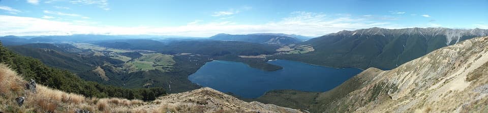
  • Bushline Hut makes a worthwhile overnight goal, with a wide view over Lake Rotoiti.
  • The route gives a direct half-day approach to the alpine edge and old ski country.

Heads up

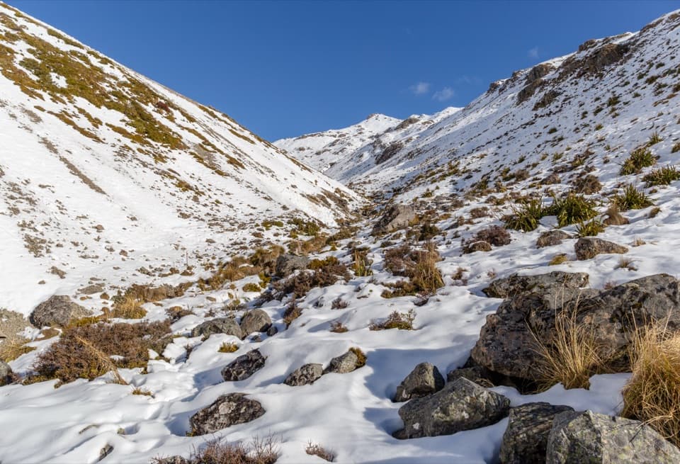
  • Several exposed scree gullies make the climb demanding.
  • The hut is booked accommodation and its rainwater must be boiled.

Map & elevation

The route

Loading the Nelson Lakes map
Full map
Elevation829–1,290 m
TrailheadPaddy’s Track access on Mount Robert Road-41.82210, 172.81151
Keep this map with you offline in the Parkwolf app

Plan your hike

Before you go

Parking

Mount Robert Road is unsealed to the road-end Mount Robert car park. Follow the Paddy’s Track sign on the road nearby; its access is roughly 100–500 m before the car park in DOC descriptions. The car park has a shelter and toilet and can fill on busy weekends. The trail mileage begins at the signed access, not the car park; the road connection is about 300 m each way.

Safety

No dogs. The open alpine face crosses several scree gullies and can be cold or icy in any season; the Mount Robert Road gate is locked when icy. Book the hut before relying on an overnight, boil its untreated rain-tank water, and carry water in winter in case the tank is frozen.

3 active Nelson Lakes alerts

  • ClosureRotoroa Route permanently closedThe Rotoroa Route is permanently closed along the eastern side of Lake Rotoroa between Rotoroa village and Sabine Hut.Official details
  • CautionUnbridged stream between Sabine and D’Urville hutsThe bridge on the track between Sabine Hut and D’Urville Hut has been removed; trampers must cross an unbridged stream at GR E1571366 N5359831.Official details
See all 3 alerts
A park ranger sits on a dash-mounted phone, talking, as Parkwolf’s Tour Guide plays “Army Cutworm Moths: A Grizzly Bear Buffet” on Grand Loop Road below Dunraven Pass in Yellowstone
Parkwolf Tour GuideThe highest, rockiest slopes around here are a summer buffet for grizzly bears.

Nelson Lakes Tour Guide

Your drive to Bushline Hut via Paddy’s Track, narrated.

Parkwolf is a GPS audio tour guide for Nelson Lakes National Park. As you drive, it chimes in with what’s ahead: hidden gems, upcoming stops, history, geology, and wildlife, right through your car’s speakers.

Recorded for this trailhead

Mount Robert: Views on Foot
0:00 / 0:27
“The Mount Robert trailheads are coming up, where the lake lookout takes an uphill walk from the car park.”

Plays as you drive up to this trailhead in the Parkwolf Nelson Lakes Tour Guide.

More stories near here in the app

  • Lakeside Track to Whisky Falls
  • Buller Bridge and Anglers Walk
  • West Bay, Lake Rotoiti
  • Lodge Road and Black Hill Walk
  • 26 audio storiesacross Nelson Lakes’s roads, triggered by GPS as you drive
  • Wildlife heatmapsfor New Zealand Falcon, Weka, Kererū, and 13 more
  • Works offlinemaps, 57 trails, 47 places, and audio download before you lose signal
  • CarPlay readysimple controls built for the drive
★★★★★
“Fantastic app with many points of information… It’s great to just turn on while you’re driving and it gives you an audio tour of the national Park. We love it!!!!”
JMJamesApp Store review
Download Parkwolf on the App StoreGet Parkwolf on Google Play

4.7 from 8,600+ ratings

Trail guide

Hiking Bushline Hut via Paddy’s Track

A hard hut walk, not the circuitThis is an 8.

This is an 8.1 km out-and-back from the signed Paddy’s Track access on Mount Robert Road to Bushline Hut and back. The track itself is about 4.0 km each way; allow four to five hours for the climb, hut stop and return. It’s a hard half-day, but the hut at the treeline is a satisfying goal and a good place to break the trip into an overnight. The Mount Robert Circuit is a different loop. If you park at the road-end car park, add the short walk along the road to Paddy’s signed start; published measurements vary with the start point.

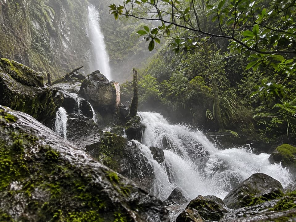
Through bush, then across the open faceThe lower section climbs through beech and kānuka bush.

The lower section climbs through beech and kānuka bush. As the trees thin, the route crosses the mountain’s open face and several scree-filled gullies, then zigzags uphill toward the hut. The open slopes bring the first wide views over Lake Rotoiti; the track is marked, but the scree and exposure make this a poor place to hurry. Take the loose crossings steadily and keep following the route markers rather than cutting across the gullies.

The hut and the old ski countryBushline Hut stands at about 1,280 m on the treeline, looking over Lake Rotoiti and the St…

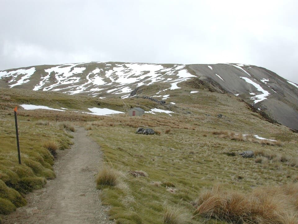
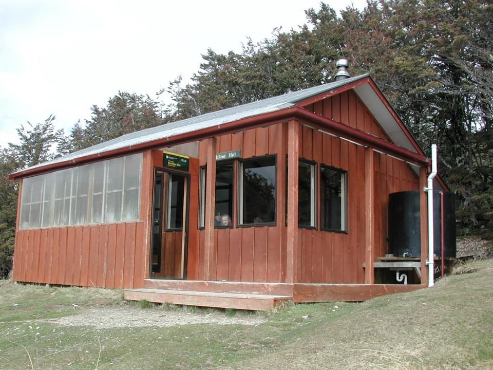
Bushline Hut stands at about 1,280 m on the treeline, looking over Lake Rotoiti and the St Arnaud Range. It has 14 bunks, mattresses, heating, a non-flush toilet and rain-tank water. The water is untreated, so boil it before drinking, and book a bunk before planning an overnight. The locked Kea Hut just above was built for the first skiers in the Mount Robert area; old ski-field buildings remain farther up at 2nd Basin, beyond the route stored here.

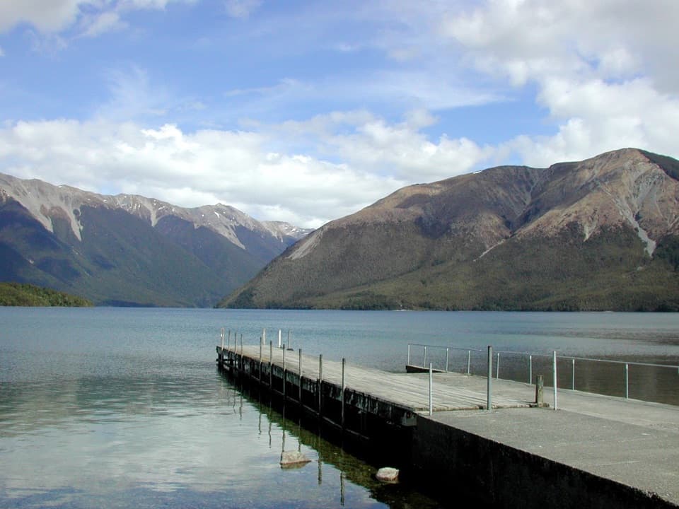
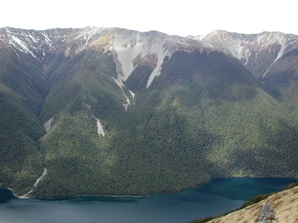
For the view, look back toward Lake Rotoiti from near the hut: the forested slopes and pale scree gullies make the lake’s narrow strip of blue stand out.

Access, weather and rulesMount Robert Road is unsealed to the road-end car park.

Mount Robert Road is unsealed to the road-end car park. Paddy’s Track starts nearby on the road, before the Pinchgut access; DOC’s descriptions put the signed start roughly 100–500 m short of the car park. There’s a shelter and toilet at the car park. No dogs are allowed. This is alpine country: cold, snow and ice can occur in any season, the hut’s water tank may freeze in winter, and the road gate is locked when icy. Bring warm waterproof layers even when the day starts mild.

Wildlife

Wildlife in Nelson Lakes

All Nelson Lakes wildlife maps

Sighting maps show where each species has been reported across Nelson Lakes. Wildlife moves, so no sighting is guaranteed.

Keep exploring

Near Bushline Hut via Paddy’s Track

See it all on the map

Trails that start nearby

Places near the trailhead

Parkwolf’s Nelson Lakes ranking

Top-rated trails in Nelson Lakes

All 57 trails
  1. 1Mount Robert CircuitChallenging · 9 km
  2. 2Angelus Hut via Pinchgut Track and Robert Ridge RouteChallenging · 12.2 km
  3. 3St Arnaud Range TrackChallenging · 10 km
  4. 4Rotomairewhenua/Blue Lake TrackChallenging · 15.4 km
  5. 5Travers-Sabine CircuitChallenging · 80 km
  6. 6Lake Rotoiti CircuitChallenging · 23.4 km

Take Parkwolf to Nelson Lakes.

The audio tour guide for the drive, plus offline maps, trails, and wildlife heatmaps for when the signal drops.

4.7 from 8,600+ ratings

Download Parkwolf on the App StoreGet Parkwolf on Google Play