Fayette Station River Access in New River Gorge National Park

Sight · New River Gorge National Park

Fayette Station River Access

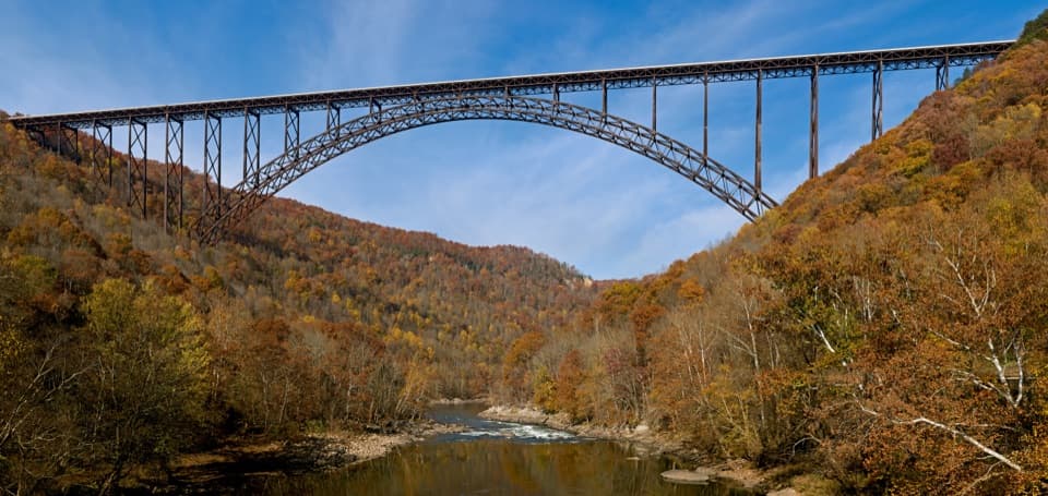
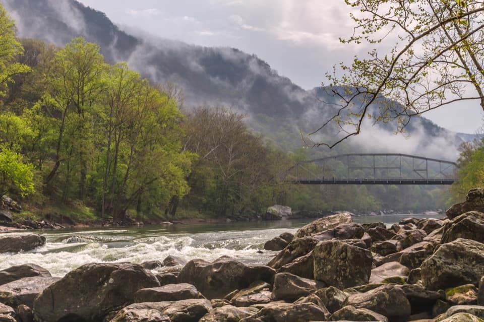
Rapids, two bridges, and the gorge from river level.

Photo: National Park Service
Type
Sight
Nearest trail
0.4 mi
Audio stories
15 nearby
  • Parking
  • Scenic viewpoint
  • Restrooms
  • #12 of 39 sights

Hear the audio tour

Fayette Station and the Boxer's Bridge

Overview

About Fayette Station River Access

Why stop

  • A river-level pause with a story tied to this exact crossing.

Heads up

  • The one-way approach excludes vehicles taller than 12 feet.

Map

Where it is

Loading the New River Gorge map
Full map
SightFayette Station River Access38.06687, -81.08114
Keep this map with you offline in the Parkwolf app

Plan your stop

Before you go

5 active New River Gorge alerts

  • ClosureRend and Church Loop trails closedRend Trail is closed from both trailheads through approximately December 2027; Church Loop Trail is also closed because its only access is from Rend.Official details
  • ClosureKaymoor Miners Trail weekday closureThe upper Kaymoor Miners Trail is closed Monday–Thursday through November 19 for trail rehabilitation.Official details

See all 5 alerts
A park ranger sits on a dash-mounted phone, talking, as Parkwolf’s Tour Guide plays “Army Cutworm Moths: A Grizzly Bear Buffet” on Grand Loop Road below Dunraven Pass in Yellowstone
Parkwolf Tour GuideThe highest, rockiest slopes around here are a summer buffet for grizzly bears.

New River Gorge Tour Guide

Your drive to Fayette Station River Access, narrated.

Parkwolf is a GPS audio tour guide for New River Gorge National Park. As you drive, it chimes in with what’s ahead: hidden gems, upcoming stops, history, geology, and wildlife, right through your car’s speakers.

See the New River Gorge audio tour

Recorded for this place

Fayette Station and the Boxer's Bridge
0:00 / 0:35
“Fayette Station is coming up at river level, where you can watch the rapids with the great steel arch towering overhead.”

Plays as you drive up to Fayette Station River Access in the Parkwolf New River Gorge Tour Guide.

More stories near here in the app

  • Canyon Rim and the Bridge
  • Wolf Creek and Kaymoor Mine Falls
  • Burnwood's Picnic Area and Old Trees
  • The Heron That Uses Bait
  • 92 audio storiesacross New River Gorge’s roads, triggered by GPS as you drive
  • Wildlife heatmapsfor Black Bear, White-tailed Deer, Pileated Woodpecker, and 13 more
  • Works offlinemaps, 49 trails, 55 places, and audio download before you lose signal
  • CarPlay readysimple controls built for the drive
★★★★★
“Fantastic app with many points of information… It’s great to just turn on while you’re driving and it gives you an audio tour of the national Park. We love it!!!!”
JMJamesApp Store review
Download Parkwolf on the App StoreGet Parkwolf on Google Play

4.7 from 8,600+ ratings

Guide

More about Fayette Station River Access

At river levelFayette Station is a public New River access and lower-river take-out at the bottom of Fayette…

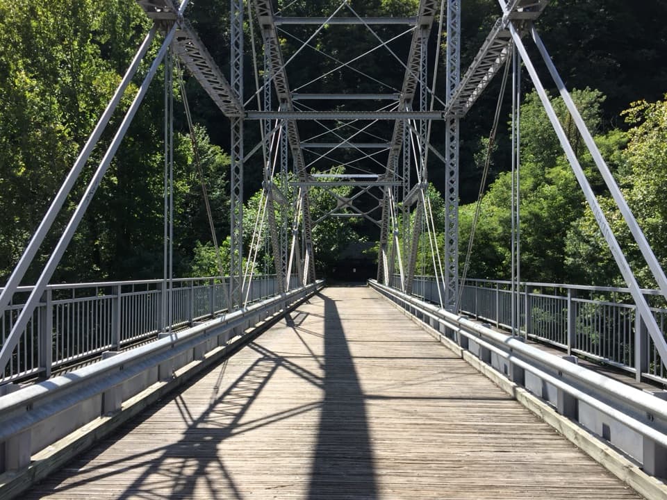
Fayette Station is a public New River access and lower-river take-out at the bottom of Fayette Station Road. Get out for the change in scale: the New River Gorge Bridge towers above the river, while the lower Tunney Hunsaker Bridge sits close to the water. Rapids and passing rafts make this an active river stop, not a quiet shoreline.

Make the drive workThis is the river-level stop on the 8-mile, one-way Fayette Station Road tour, which descends…

This is the river-level stop on the 8-mile, one-way Fayette Station Road tour, which descends through the gorge and passes beneath the New River Gorge Bridge three times. The road is narrow and winding. A low railroad bridge has a 12-foot clearance, and the National Park Service does not recommend large vehicles, RVs or trailers on the route. Download the road audio tour before you go; cell service is spotty. Anglers need a West Virginia fishing license.

A photo stop by the waterFrom the river-side rocks, include the New River Gorge Bridge above and the smaller Tunney…

From the river-side rocks, include the New River Gorge Bridge above and the smaller Tunney Hunsaker Bridge near the water. Leave some river and boulders in the frame so the bridge's height reads clearly. A passing raft adds motion when one comes through.

A crossing before the bridgesTownsend's Ferry crossed here from early colonial times through the Civil War and afterward.

Townsend's Ferry crossed here from early colonial times through the Civil War and afterward. The C&O Railroad arrived in 1873, and Fayette Station Bridge replaced the ferry in 1888. Fayette and South Fayette grew as coal towns; mining continued along the road into the mid-1990s. The New River Gorge Bridge opened in 1977, and the rebuilt river crossing reopened in 1998 as the Tunney Hunsaker Bridge. A historical marker by the parking area tells the ferry story.

Wildlife

Wildlife in New River Gorge

All New River Gorge wildlife maps

Sighting maps show where each species has been reported across New River Gorge. Wildlife moves, so no sighting is guaranteed.

Keep exploring

Near Fayette Station River Access

See it all on the map

Trails nearby

More stops nearby

Parkwolf’s New River Gorge ranking

Top sights in New River Gorge

All 55 places
  1. 1New River Gorge BridgeSight
  2. 2Sandstone FallsSight
  3. 3Grandview Main OverlookSight
  4. 4Diamond Point OverlookSight
  5. 5Long Point OverlookSight
  6. 6Nuttallburg Historic SiteSight

Take Parkwolf to New River Gorge.

The audio tour guide for the drive, plus offline maps, trails, and wildlife heatmaps for when the signal drops.

4.7 from 8,600+ ratings

Download Parkwolf on the App StoreGet Parkwolf on Google Play