Parking
Use the gravel lot in the Burnwood Day Use Area; the signed trail entrance is just before the picnic pavilion.

#10 of 49 trails in New River Gorge
New River Gorge National Park, WV
A short lollipop route through a pocket of old-growth forest.
Overview
Map & elevation
Plan your hike

The highest, rockiest slopes around here are a summer buffet for grizzly bears.
New River Gorge Tour Guide
Parkwolf is a GPS audio tour guide for New River Gorge National Park. As you drive, it chimes in with what’s ahead: hidden gems, upcoming stops, history, geology, and wildlife, right through your car’s speakers.
See the New River Gorge audio tourRecorded for this trailhead
Burnwood's Picnic Area and Old Trees“Burnwood's picnic area is up ahead, across the highway from Canyon Rim Visitor Center.”
Plays as you drive up to this trailhead in the Parkwolf New River Gorge Tour Guide.
More stories near here in the app
“Fantastic app with many points of information… It’s great to just turn on while you’re driving and it gives you an audio tour of the national Park. We love it!!!!”


Trail guide
Burnwood is a 1.2-mile round-trip lollipop: a single approach through younger woods to a loop around a 12-acre remnant of old-growth forest, then back on the same approach. It is a short walk built around looking closely at trees, fallen wood and the history of a forest patch that escaped the region’s heavy logging. Come for a shaded woodland walk, not a gorge overlook. Allow about an hour if you want to stop at the ten numbered interpretation points. The park describes the trail as easy, while its self-guided walk calls it easy to moderate.
Start from the signed entrance just before the picnic pavilion in the Burnwood Day Use Area. Numbered signs along the way correspond to a self-guided walk. At the old-growth junction, take the left branch for the clockwise loop; after it rejoins, retrace the approach to the lot. The return is part of the full distance, so this is not a complete circuit from parking.
Dogs are allowed on the park’s trails but must stay on a physical leash no longer than six feet. There is no drinking water at trailheads, so bring your own for people and pets. The gravel lot and picnic pavilion are beside the trailhead.
The first stretch passes through woods that were logged before the route reaches a former open field now filling with young trees. Tulip poplars, quick to take hold in sunlight, have grown where mowing stopped in the mid-2000s. The contrast is useful: this is an even-aged young stand, unlike the layered old forest ahead.
The land was once a small Laing family tract, partly cleared for pasture and a homesite. Remnant fencing along the route is one of the clues to that use. The family’s reason for leaving a patch of forest standing is unknown, so the walk offers evidence rather than a tidy story about their motives.
New River Gorge researchers worked with Concord University in 2022 to sample 50 trees here. Fourteen were at least 250 years old, and five dated to the 1670s. The oldest tree described along the route is a blackgum with an inner-ring date of 1674; it is at least 350 years old and may be older because the sample could have missed the tree’s center.
A large American beech is the stand’s biggest tree by diameter and volume, but it is hollow and could not be dated. It may not be the oldest. A chestnut oak on the loop, more than 160 years old, shows the blocky, thick-plated bark and high, twisting crown branches that make old trees look different from younger neighbors. Size alone is a poor age test.
Look down as well as up. Fallen trunks, standing snags, moss, lichens and mushrooms are part of the old-growth system, not debris to clear away. Decaying wood recycles nutrients and provides damp habitat used by salamanders and smaller animals; snags offer nesting and roosting sites for birds, bats and owls. These are habitat clues, not guaranteed wildlife sightings.
A large oak fell in a January 2024 snowstorm, leaving a root-ball pit and the uneven mound of an older fallen tree nearby. Small disturbances open gaps for new seedlings while older wood decomposes. Burnwood joined the Old-Growth Forest Network on August 4, 2023, recognizing the public protection of this remnant. A short trail can tell a long story if you take the numbered stops slowly.
Wildlife
 18 sightingsBlack BearMost seen around 7 PMSighting map
 126 sightingsWhite-tailed DeerMost seen around 6 AMSighting map
 25 sightingsPileated WoodpeckerMost seen around 8 AMSighting map
 15 sightingsBarred OwlMost seen around 7 PMSighting map
 14 sightingsWild TurkeyMost seen around 6 AMSighting map
 58 sightingsCopperheadMost seen around 7 PMSighting map
Sighting maps show where each species has been reported across New River Gorge. Wildlife moves, so no sighting is guaranteed.
Keep exploring
 ModerateCanyon Rim Boardwalk0.3 mi · 24 min · 0.3 mi awayA quick bridge view, with 178 strenuous steps below.
 ModerateHawks Nest Connector Trail7.4 mi · 2.8 hr · 0.5 mi awayA rocky link from Fayette Station to Hawks Nest rail trail.
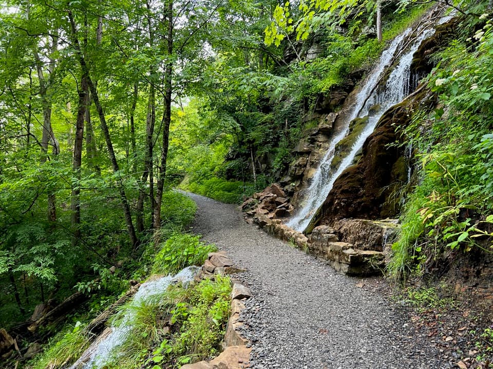 ModerateKaymoor Trail8.6 mi · 4.5 hr · 1 mi awayAn 8.6-mile one-way gorge route past Kaymoor's historic mine.
 ChallengingFayetteville Trail4 mi · 3 hr · 1 mi awayA creek crossing links Fayetteville’s trails to Kaymoor.
 ModerateBridge Trail0.9 mi · 45 min · 1.1 mi awayGet beneath the New River Gorge Bridge on a short, rocky hike.
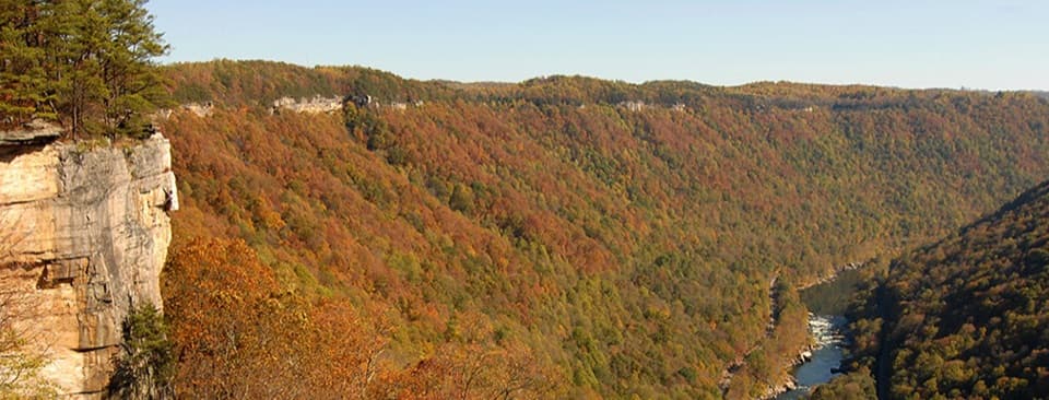 ModerateEndless Wall Trail2.4 mi · 1.8 hr · 1.4 mi awayWalk the New River rim to Diamond Point's high gorge view.
 EasyPark Loop Trail1.1 mi · 36 min · 1.4 mi awayAn easy wooded loop you can add at Town Park.
 EasyWorkman's Hollow Trail1 mi · 24 min · 1.7 mi awayA quick singletrack link to the Wolf Creek footbridge.
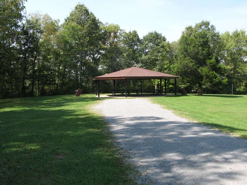 Picnic area · At the trailheadBurnwood Day Use Area and Group CampsiteA picnic pavilion by Canyon Rim with a permit-only group campsite.
 Sight · 0.2 mi awayCanyon Rim Bridge OverlookTwo decks put the full bridge arch above the river gorge.
 Sight · 0.3 mi awayBridge WalkA harnessed walk beneath the highway, 850 feet above the river.
 Visitor center · 0.3 mi awayCanyon Rim Visitor CenterPlan your park visit, then step out to the bridge view.
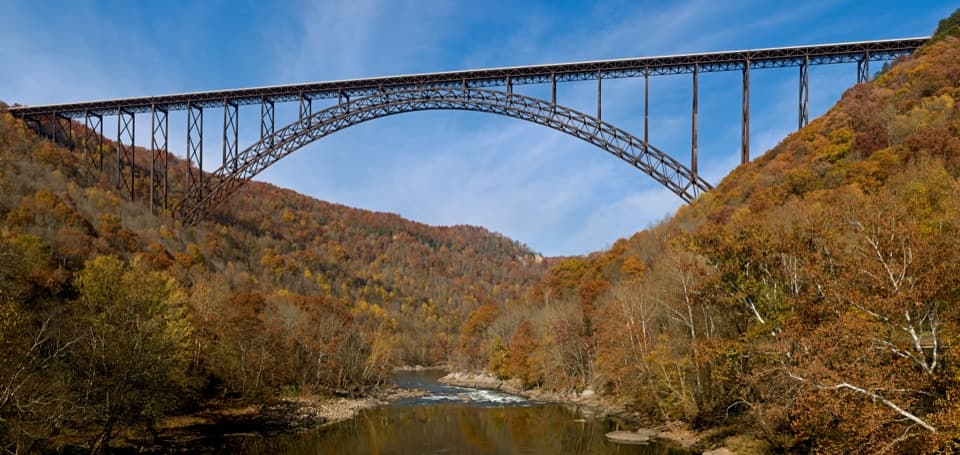 Sight · 0.5 mi awayNew River Gorge BridgeA 3,030-foot steel arch above a river 876 feet below.
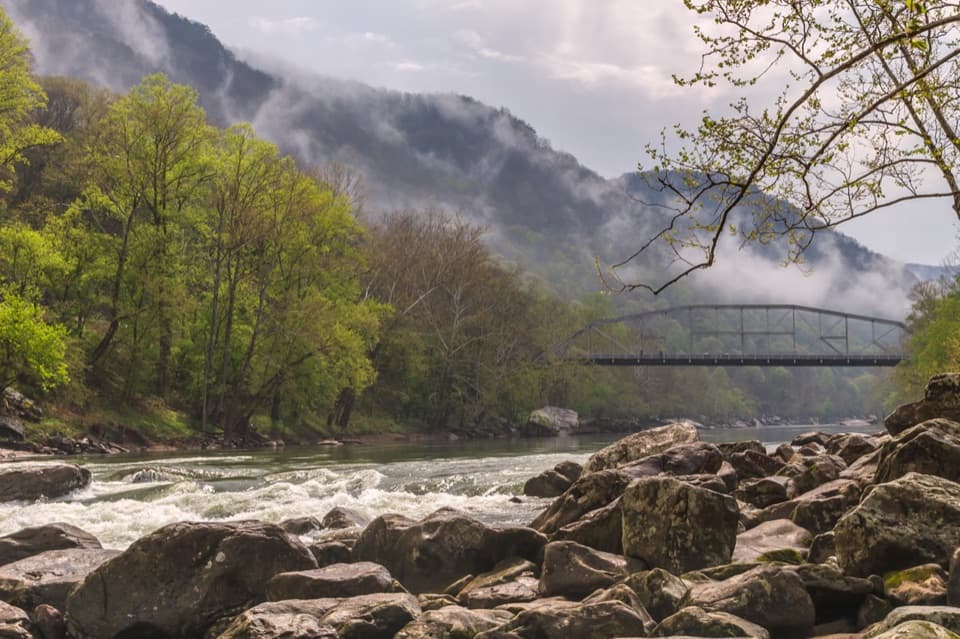 Sight · 0.5 mi awayFayette Station River AccessRapids, two bridges, and the gorge from river level.
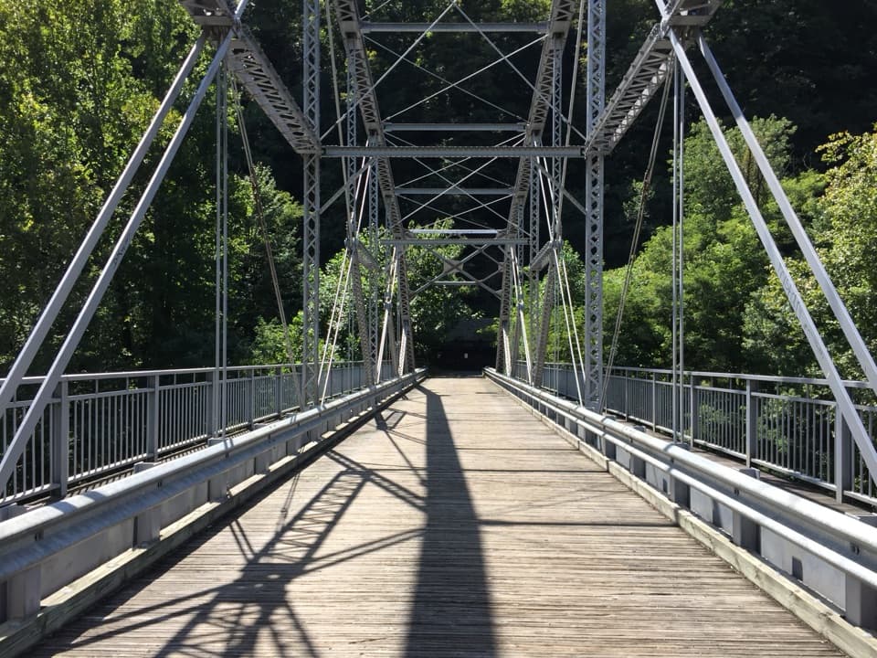 Sight · 0.6 mi awayTunney Hunsaker BridgeA historic lower crossing on Fayette Station Road's one-way gorge drive.
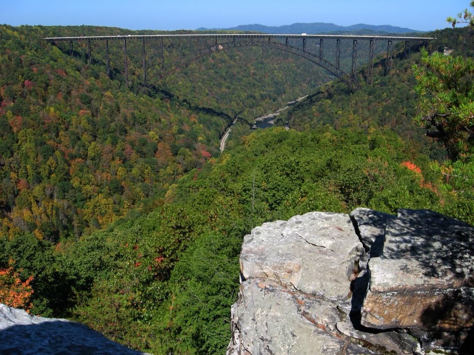 Sight · 1 mi awayLong Point OverlookA rough last pitch opens onto the park’s signature bridge view.
Parkwolf’s New River Gorge ranking

The audio tour guide for the drive, plus offline maps, trails, and wildlife heatmaps for when the signal drops.