Kaymoor Mine Falls in New River Gorge National Park

Sight · New River Gorge National Park

Kaymoor Mine Falls

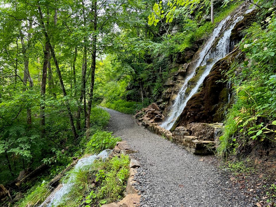
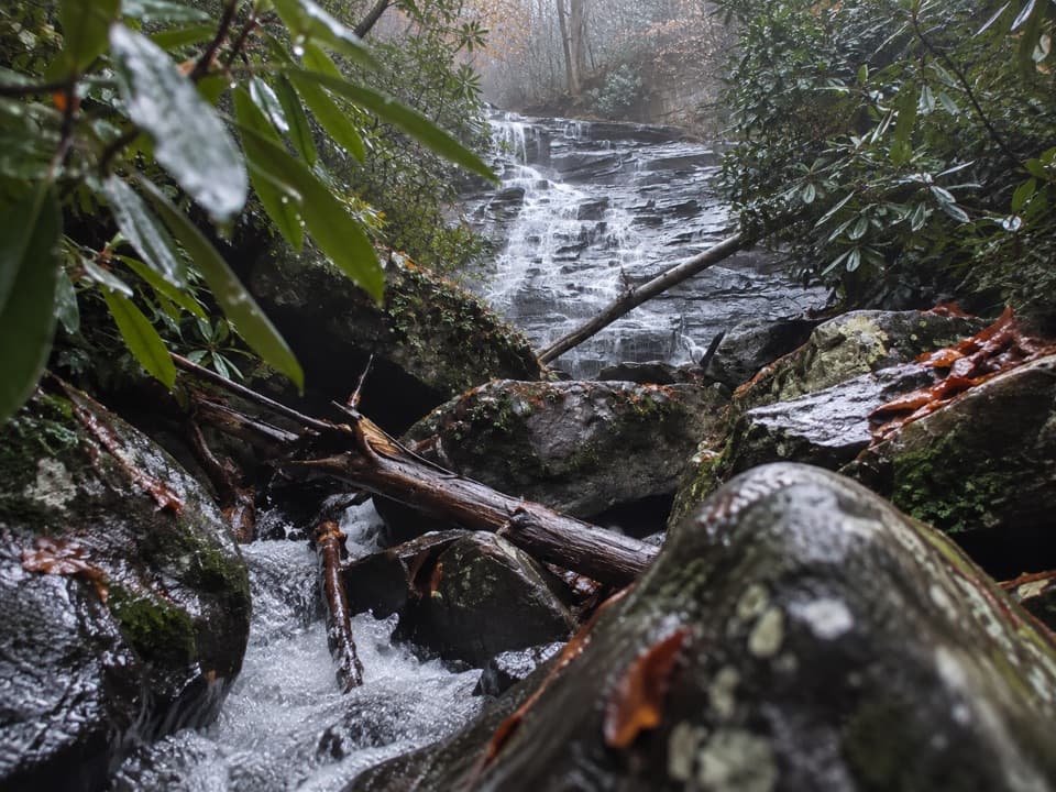
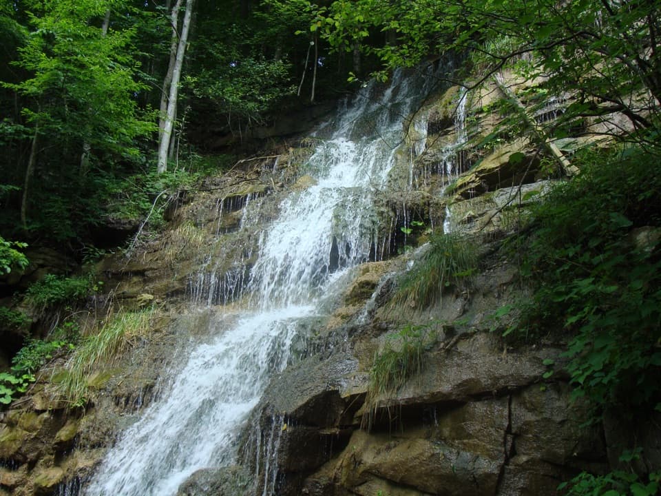
A mossy cascade where mine drainage meets Wolf Creek.

Photo: National Park Service
Type
Sight
Nearest trail
Right here
Audio stories
14 nearby
  • Parking
  • Trailhead

Hear the audio tour

Wolf Creek and Kaymoor Mine Falls

Overview

About Kaymoor Mine Falls

Why stop

  • A short walk reaches a mossy cascade with a distinctive mining story.

Heads up

  • The approach climbs beside gorge-side drop-offs, and the access road is narrow and one-way.

Map

Where it is

Loading the New River Gorge map
Full map
SightKaymoor Mine Falls38.05955, -81.07988
Keep this map with you offline in the Parkwolf app

Plan your stop

Before you go

5 active New River Gorge alerts

  • ClosureRend and Church Loop trails closedRend Trail is closed from both trailheads through approximately December 2027; Church Loop Trail is also closed because its only access is from Rend.Official details
  • ClosureKaymoor Miners Trail weekday closureThe upper Kaymoor Miners Trail is closed Monday–Thursday through November 19 for trail rehabilitation.Official details

See all 5 alerts
A park ranger sits on a dash-mounted phone, talking, as Parkwolf’s Tour Guide plays “Army Cutworm Moths: A Grizzly Bear Buffet” on Grand Loop Road below Dunraven Pass in Yellowstone
Parkwolf Tour GuideThe highest, rockiest slopes around here are a summer buffet for grizzly bears.

New River Gorge Tour Guide

Your drive to Kaymoor Mine Falls, narrated.

Parkwolf is a GPS audio tour guide for New River Gorge National Park. As you drive, it chimes in with what’s ahead: hidden gems, upcoming stops, history, geology, and wildlife, right through your car’s speakers.

See the New River Gorge audio tour

Recorded for this place

Wolf Creek and Kaymoor Mine Falls
0:00 / 0:26
“You're nearing Wolf Creek Trailhead, where a short walk reaches Kaymoor Mine Falls.”

Plays as you drive up to Kaymoor Mine Falls in the Parkwolf New River Gorge Tour Guide.

More stories near here in the app

  • Fayette Station and the Boxer's Bridge
  • Canyon Rim and the Bridge
  • Why the Bridge Is Brown
  • Bridge Walk Beneath the Highway
  • 92 audio storiesacross New River Gorge’s roads, triggered by GPS as you drive
  • Wildlife heatmapsfor Black Bear, White-tailed Deer, Pileated Woodpecker, and 13 more
  • Works offlinemaps, 49 trails, 55 places, and audio download before you lose signal
  • CarPlay readysimple controls built for the drive
★★★★★
“Fantastic app with many points of information… It’s great to just turn on while you’re driving and it gives you an audio tour of the national Park. We love it!!!!”
JMJamesApp Store review
Download Parkwolf on the App StoreGet Parkwolf on Google Play

4.7 from 8,600+ ratings

Guide

More about Kaymoor Mine Falls

A short stop with a mining storyKaymoor Mine Falls is a small cascade on the Kaymoor Trail, where drainage from the old mine…

Kaymoor Mine Falls is a small cascade on the Kaymoor Trail, where drainage from the old mine slips down the hillside into Wolf Creek. It is the third stop on the park's eight-waterfall tour and a worthwhile quick detour if you're already driving Fayette Station Road. The falls are about 0.1 mile from the Wolf Creek access. For a photo, get close enough to show the water stepping over layered rock, with the moss and forest around it for context.

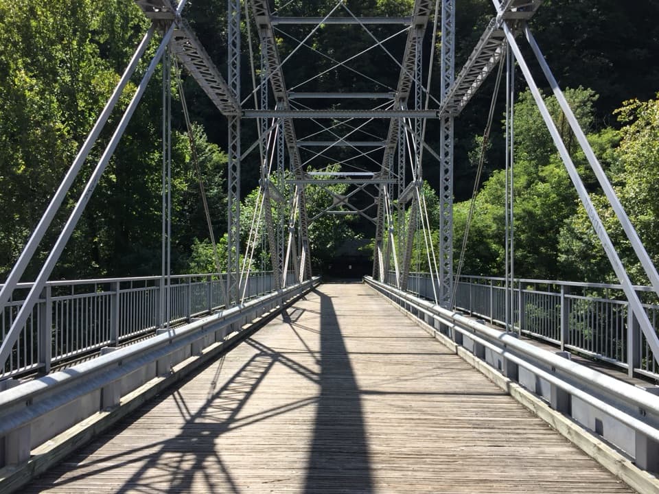
The walk and the road inFrom the Wolf Creek Trailhead, cross the bridge and climb the hill; the falls are on the right.

From the Wolf Creek Trailhead, cross the bridge and climb the hill; the falls are on the right. The trail runs along the gorge, so keep well back from steep edges. Parallel parking is on the right side of Fayette Station Road just past the sharp curve beyond the trailhead. That road is narrow and one-way, with sharp curves and low clearance; vehicles taller than 12 feet cannot use it, and vehicles over 25 feet long or trailers are unsuitable.

Water from KaymoorThe mine was established in 1899 to supply fuel for the Low Moor Iron Company's iron furnaces.

The mine was established in 1899 to supply fuel for the Low Moor Iron Company's iron furnaces. Its first coal shipments went out in 1900, when Kaymoor produced 28,074 long tons. The falls make that history visible in an unexpected way: the water itself is mine drainage flowing into Wolf Creek. On some autumn and winter days, the cascade may also be visible from the road, but the short walk is how to reach it.

Wildlife

Wildlife in New River Gorge

All New River Gorge wildlife maps

Sighting maps show where each species has been reported across New River Gorge. Wildlife moves, so no sighting is guaranteed.

Keep exploring

Near Kaymoor Mine Falls

See it all on the map

Trails nearby

More stops nearby

Parkwolf’s New River Gorge ranking

Top sights in New River Gorge

All 55 places
  1. 1New River Gorge BridgeSight
  2. 2Sandstone FallsSight
  3. 3Grandview Main OverlookSight
  4. 4Diamond Point OverlookSight
  5. 5Long Point OverlookSight
  6. 6Nuttallburg Historic SiteSight

Take Parkwolf to New River Gorge.

The audio tour guide for the drive, plus offline maps, trails, and wildlife heatmaps for when the signal drops.

4.7 from 8,600+ ratings

Download Parkwolf on the App StoreGet Parkwolf on Google Play