Easy Pass / Fisher Creek Trail in North Cascades National Park

North Cascades National Park, WA

Easy Pass / Fisher Creek Trail

High pass, flowered basin, then a long backcountry creek walk.

Length
14.8mi
Time
12hr
Elev. change
3,494ft
Difficulty
Challenging
  • No dogs
  • High point 6,562 ft

Hear the audio tour

Easy Pass: A Strenuous Climb to Fisher Basin Views

Overview

About Easy Pass / Fisher Creek Trail

Why go

  • Panoramic views across Fisher Basin toward Mount Logan, Mount Fisher and Mount Arriva.
  • The route changes from alpine meadows to creekside forest and a historic cabin.

Heads up

  • The one-way route ends at a remote junction, so you need a return or onward-exit plan.
  • Steep snow can linger into early summer and obscure the tread.

Map & elevation

The route

Loading the North Cascades map
Full map
Elevation3,068–6,562 ft
TrailheadEasy Pass Trailhead48.58790, -120.80290
Keep this map with you offline in the Parkwolf app

Plan your hike

Before you go

Parking

Easy Pass Trailhead is on the south side of SR 20 at mile 151, with about 10 roadside spaces. A Northwest Forest Pass or America the Beautiful pass is required. The route ends at Junction Camp, not a road, so arrange your return or downstream exit before starting.

Safety

The climb crosses steep avalanche slopes; snow on the north side can stay steep into July and lingering fields can hide the trail. An ice axe is needed to cross steep early-season snow safely. Overnight camping requires a limited backcountry permit; camping at Easy Pass and in the meadows is prohibited.

7 active North Cascades alerts

  • ClosureWildfire closures and Stehekin fire advisoryWildfire-related closures remain in effect; stay out of all closed trails, camps, and areas.Official details
  • CautionCampfires banned across the park complexCampfires and other ash-producing fires are banned throughout the North Cascades National Park Service Complex.Official details
See all 7 alerts
A park ranger sits on a dash-mounted phone, talking, as Parkwolf’s Tour Guide plays “Army Cutworm Moths: A Grizzly Bear Buffet” on Grand Loop Road below Dunraven Pass in Yellowstone
Parkwolf Tour GuideThe highest, rockiest slopes around here are a summer buffet for grizzly bears.

North Cascades Tour Guide

Your drive to Easy Pass / Fisher Creek Trail, narrated.

Parkwolf is a GPS audio tour guide for North Cascades National Park. As you drive, it chimes in with what’s ahead: hidden gems, upcoming stops, history, geology, and wildlife, right through your car’s speakers.

See the North Cascades audio tour

Recorded for this trailhead

Easy Pass: A Strenuous Climb to Fisher Basin Views
0:00 / 0:25
“Up ahead is the Easy Pass trailhead, where the name understates the climb. This is a strenuous seven-mile round trip, taking about six hours and gaining twenty-eight hundred feet.”

Plays as you drive up to this trailhead in the Parkwolf North Cascades Tour Guide.

More stories near here in the app

  • The Green Stripes Avalanches Leave
  • The Bird That Plants Pines
  • Why Larches Lose Their Needles
  • A Pika's Winter Pantry
  • 83 audio storiesacross North Cascades’s roads, triggered by GPS as you drive
  • Wildlife heatmapsfor Mountain Goat, Black Bear, Mule Deer, and 10 more
  • Works offlinemaps, 88 trails, 76 places, and audio download before you lose signal
  • CarPlay readysimple controls built for the drive
★★★★★
“Fantastic app with many points of information… It’s great to just turn on while you’re driving and it gives you an audio tour of the national Park. We love it!!!!”
JMJamesApp Store review
Download Parkwolf on the App StoreGet Parkwolf on Google Play

4.7 from 8,600+ ratings

Trail guide

Hiking Easy Pass / Fisher Creek Trail

The route and exitEasy Pass / Fisher Creek Trail is a 14.

Easy Pass / Fisher Creek Trail is a 14.8-mile, one-way backcountry traverse from the Easy Pass Trailhead on SR 20 to Junction Camp, where it meets Thunder Creek Trail. It is a point-to-point route, not a loop, and Junction Camp has no road access. You can retrace the route for a 29.6-mile round trip, continue about 10 miles down Thunder Creek to Colonial Creek and SR 20, or go 17 miles over Park Creek Pass toward Stehekin. The roughly 25-mile road-to-road itinerary adds the Thunder Creek exit, which is not part of this trail's 14.8 miles. I’d plan an overnight rather than count on a routine day hike; an NPS wilderness permit is required for all overnight stays, and permits are limited.

Climbing to Easy PassCross Granite Creek on a footlog about 300 yards from the trailhead, then climb through western…

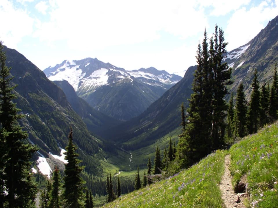
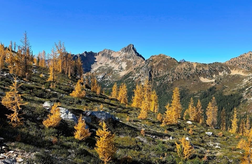
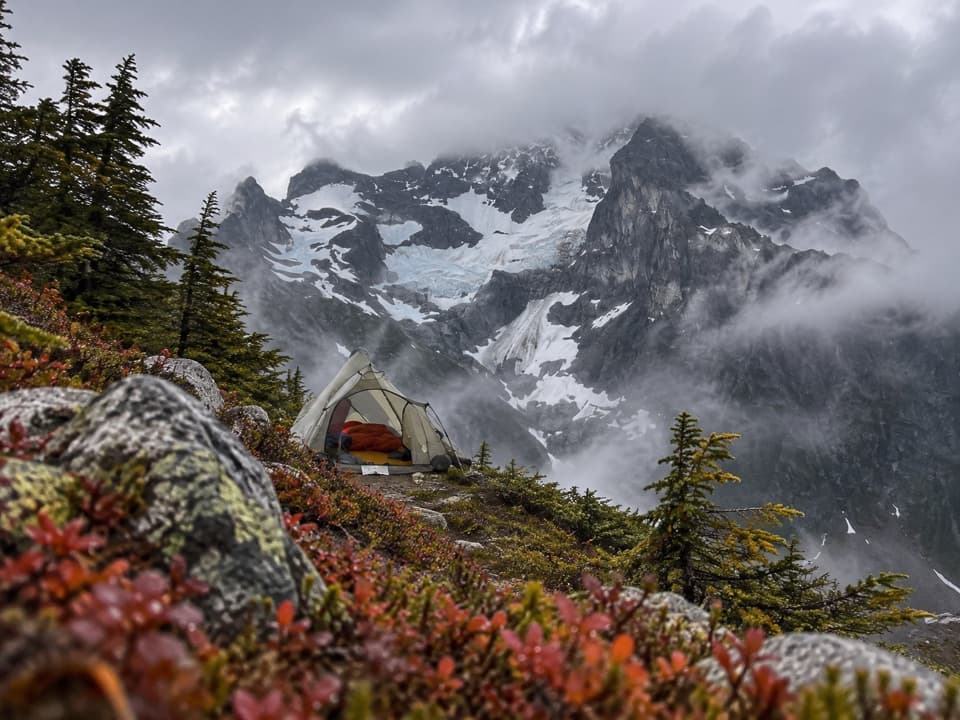
Cross Granite Creek on a footlog about 300 yards from the trailhead, then climb through western hemlock and Pacific silver fir for about two miles. The trail emerges onto avalanche slopes on Ragged Ridge and climbs steeply over rock and meadow, crossing Easy Pass Creek three times. Snow can stay steep on the north side into July and may hide the tread; the National Park Service advises an ice axe for early-season snow. The pass opens to Fisher Basin and views of Mount Logan, Mount Fisher and Mount Arriva. In fall, golden larches add color to the ridge. From the pass, frame the basin with the glacier-capped peaks beyond it.

Fisher BasinThe descent into Fisher Basin is steep.

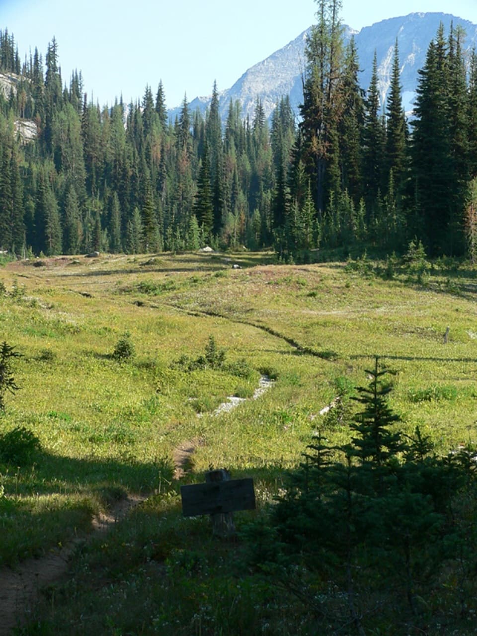
The descent into Fisher Basin is steep. About two miles beyond the pass, Fisher Camp sits at the edge of the meadows. The open slopes bloom with wildflowers in spring and early summer, and black bears often feed on huckleberries here. The vegetation is fragile, so stay on the trail or durable rock and snow; camping is prohibited at Easy Pass and in the meadows. Pikas and hoary marmots live among the rocky slopes.

Along Fisher CreekBelow the meadows, the grade eases into mature silver fir forest beside Fisher Creek.

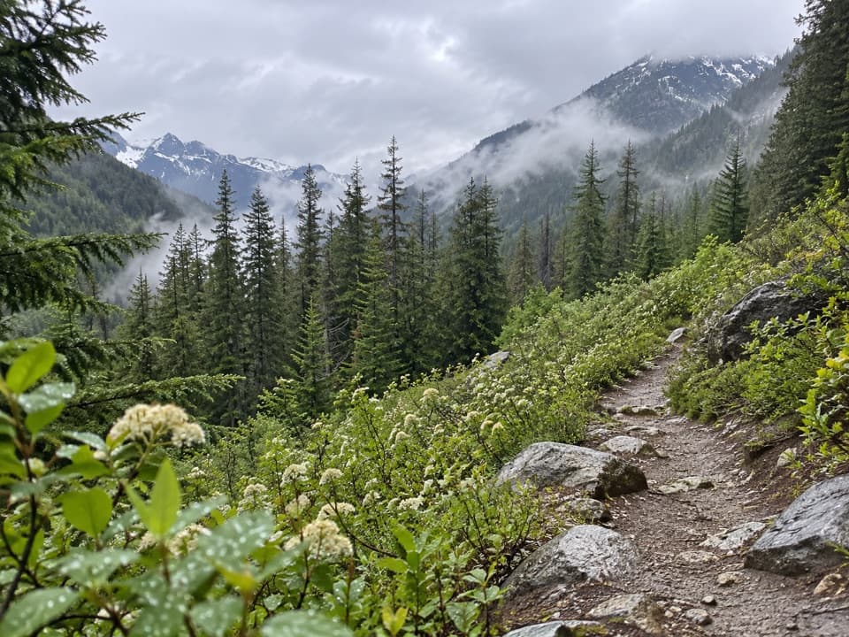
Below the meadows, the grade eases into mature silver fir forest beside Fisher Creek. Cosho Camp is creekside in deep forest, about six miles beyond the pass. Farther down, the forest shifts to western redcedar, western hemlock and cottonwood on stream flats. About a mile before Junction Camp, look for Rock Cabin just off the trail, built against a large boulder and later stabilized by the National Park Service. Junction Camp lies on a ridge above Thunder Creek Valley, with a distant glimpse of Boston Glacier.

A little valley historyThe Fisher name comes from the Fisher brothers, who ran a trap line here in the early 1900s.

The Fisher name comes from the Fisher brothers, who ran a trap line here in the early 1900s. Shortly before the park was protected in 1968, one of the last grizzly bears in the North Cascades was shot in this valley. The old cabin is a reminder of that earlier trapping history.

Wildlife

Wildlife in North Cascades

All North Cascades wildlife maps

Sighting maps show where each species has been reported across North Cascades. Wildlife moves, so no sighting is guaranteed.

Parkwolf’s North Cascades ranking

Top-rated trails in North Cascades

All 88 trails
  1. 1Sahale Arm TrailChallenging · 11.8 mi
  2. 2Cascade Pass TrailModerate · 7.4 mi
  3. 3Heather–Maple Pass LoopChallenging · 7.2 mi
  4. 4Hidden Lake TrailChallenging · 9 mi
  5. 5Copper Ridge / Chilliwack River LoopChallenging · 33.5 mi
  6. 6Thunder Knob TrailModerate · 3.8 mi

Take Parkwolf to North Cascades.

The audio tour guide for the drive, plus offline maps, trails, and wildlife heatmaps for when the signal drops.

4.7 from 8,600+ ratings

Download Parkwolf on the App StoreGet Parkwolf on Google Play