Happy Creek Falls Trail in North Cascades National Park

North Cascades National Park, WA

Happy Creek Falls Trail

Old sawmill relics and stepped falls reward a steep creekside climb.

Length
2.6mi
Time
2.5hr
Elev. change
589ft
Difficulty
Moderate
  • No dogs
  • High point 2,751 ft
  • #42 of 88 in North Cascades

Hear the audio tour

Happy Creek: Short Forest Loop or Falls Hike

Overview

About Happy Creek Falls Trail

Why go

  • Old sawmill remains beside a sequence of stepped cascades.
  • The shady creek and old forest make the approach more than a bare climb.

Heads up

  • The final approach is steep, rocky and uneven.
  • Traffic noise follows part of the early traverse above SR 20.

Map & elevation

The route

Loading the North Cascades map
Full map
Elevation2,162–2,751 ft
TrailheadHappy Creek Forest Walk parking area (SR 20 milepost 134)48.72862, -121.05563
Keep this map with you offline in the Parkwolf app

Plan your hike

Before you go

Parking

Start at the Happy Creek Forest Walk lot near State Route 20 milepost 134. Parking is limited, especially for larger vehicles; accessible parking and a toilet are available at the trailhead. SR 20 usually closes for snow and avalanche hazards in late November or early December and reopens in April or early May, depending on conditions.

Safety

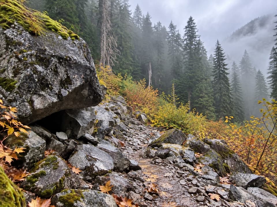
The falls spur becomes steep and rocky, with mossy outcrops and shallow streambed-like tread. Wet or frosty boardwalk and moss-covered rocks by the cascades can be slippery; avoid scrambling around the falls.

7 active North Cascades alerts

  • ClosureWildfire closures and Stehekin fire advisoryWildfire-related closures remain in effect; stay out of all closed trails, camps, and areas.Official details
  • CautionCampfires banned across the park complexCampfires and other ash-producing fires are banned throughout the North Cascades National Park Service Complex.Official details
See all 7 alerts
A park ranger sits on a dash-mounted phone, talking, as Parkwolf’s Tour Guide plays “Army Cutworm Moths: A Grizzly Bear Buffet” on Grand Loop Road below Dunraven Pass in Yellowstone
Parkwolf Tour GuideThe highest, rockiest slopes around here are a summer buffet for grizzly bears.

North Cascades Tour Guide

Your drive to Happy Creek Falls Trail, narrated.

Parkwolf is a GPS audio tour guide for North Cascades National Park. As you drive, it chimes in with what’s ahead: hidden gems, upcoming stops, history, geology, and wildlife, right through your car’s speakers.

See the North Cascades audio tour

Recorded for this trailhead

Happy Creek: Short Forest Loop or Falls Hike
0:00 / 0:25
“Happy Creek Forest Walk is coming up, a good choice for a short break among old-growth trees. Allow fifteen to twenty minutes for the gentle, wheelchair-accessible loop, mostly on boardwalk beside the creek.”

Plays as you drive up to this trailhead in the Parkwolf North Cascades Tour Guide.

More stories near here in the app

  • Ross Dam and the Floating Resort
  • Ross Lake Overlook: A Quick View Through the Trees
  • A Squirrel's Cone Store
  • The Log Beneath the Trees
  • 83 audio storiesacross North Cascades’s roads, triggered by GPS as you drive
  • Wildlife heatmapsfor Mountain Goat, Black Bear, Mule Deer, and 10 more
  • Works offlinemaps, 88 trails, 76 places, and audio download before you lose signal
  • CarPlay readysimple controls built for the drive
★★★★★
“Fantastic app with many points of information… It’s great to just turn on while you’re driving and it gives you an audio tour of the national Park. We love it!!!!”
JMJamesApp Store review
Download Parkwolf on the App StoreGet Parkwolf on Google Play

4.7 from 8,600+ ratings

Trail guide

Hiking Happy Creek Falls Trail

The falls hike, not the short walkThis is the longer walk to Happy Creek Falls: a 2.

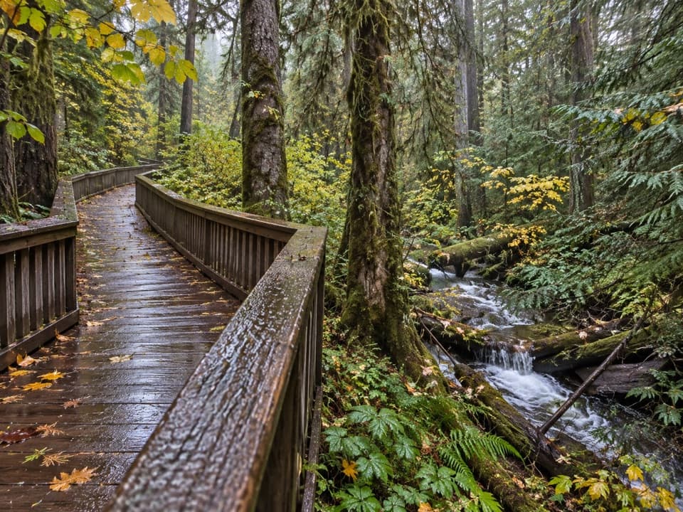
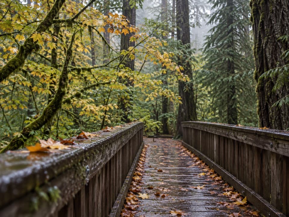
This is the longer walk to Happy Creek Falls: a 2.6-mile out-and-back from the Happy Creek Forest Walk parking area on State Route 20. Allow about two to three hours. Follow the boardwalk through the forest to the falls-trail junction, then continue on a rougher, steeper spur. The separate 0.3-mile boardwalk loop is an easy creekside stop; this row describes the extra climb to the falls.

Follow the creek, then turn uphillThe first stretch winds under tall trees beside Happy Creek.

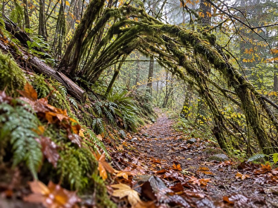
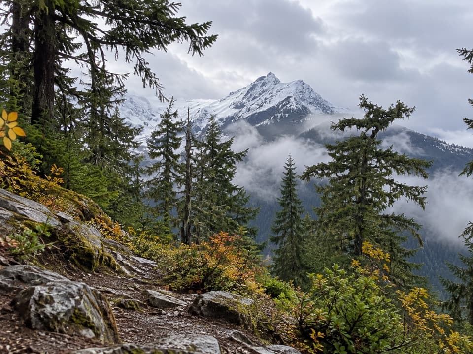
The first stretch winds under tall trees beside Happy Creek. About halfway around the loop, take the branch for the falls. The tread climbs through open forest above the highway, with occasional glimpses of Ross Lake and Jack Mountain; traffic noise carries along this stretch. A faint boot path from an SR 20 pullout joins around 0.4 mile, so stay on the main tread.

A rocky finishAround 0.9 mile, the grade steepens over mossy rock and shallow, streambed-like sections.

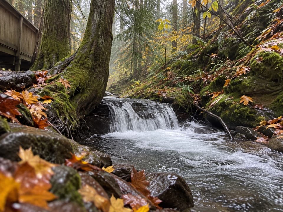
Around 0.9 mile, the grade steepens over mossy rock and shallow, streambed-like sections. It eases again in older forest, then the path draws near the creek and passes old sawmill equipment before reaching the falls. The cascades descend in several short steps through a steep gully rather than dropping as one tall curtain. Flow is generally stronger in spring and late fall; by late summer it can shrink to a trickle.

What the climb asks of youThe payoff comes after a sustained, uneven climb.

The payoff comes after a sustained, uneven climb. Published ascent figures differ—570 feet in one detailed route description and 712 feet in the park's day-hiking listing—so treat them as estimates; the steep, rocky stretch is clear either way. Wet or frosty boardwalk and mossy rocks beside the falls can be slippery. The low creek-level view of the cascades and the weathered mill structure makes the best photo; there is no need to scramble around the rocks for a better angle.

Access and the shorter choiceStart at the Happy Creek Forest Walk lot near milepost 134.

Start at the Happy Creek Forest Walk lot near milepost 134. Parking is limited, especially for larger vehicles; accessible parking and a toilet are at the trailhead. State Route 20 usually closes in late November or early December for snow and avalanche hazards and reopens in April or early May, depending on conditions. Pets are not allowed on trails in the national park. If you want only a brief stop, take the separate boardwalk loop and leave the falls spur for another day.

Wildlife

Wildlife in North Cascades

All North Cascades wildlife maps

Sighting maps show where each species has been reported across North Cascades. Wildlife moves, so no sighting is guaranteed.

Keep exploring

Near Happy Creek Falls Trail

See it all on the map

Trails that start nearby

Places near the trailhead

Parkwolf’s North Cascades ranking

Top-rated trails in North Cascades

All 88 trails
  1. 1Sahale Arm TrailChallenging · 11.8 mi
  2. 2Cascade Pass TrailModerate · 7.4 mi
  3. 3Heather–Maple Pass LoopChallenging · 7.2 mi
  4. 4Hidden Lake TrailChallenging · 9 mi
  5. 5Copper Ridge / Chilliwack River LoopChallenging · 33.5 mi
  6. 6Thunder Knob TrailModerate · 3.8 mi

Take Parkwolf to North Cascades.

The audio tour guide for the drive, plus offline maps, trails, and wildlife heatmaps for when the signal drops.

4.7 from 8,600+ ratings

Download Parkwolf on the App StoreGet Parkwolf on Google Play