Redmires Conduit Miles without Stiles in Peak District National Park

Peak District National Park, EN

Redmires Conduit Miles without Stiles

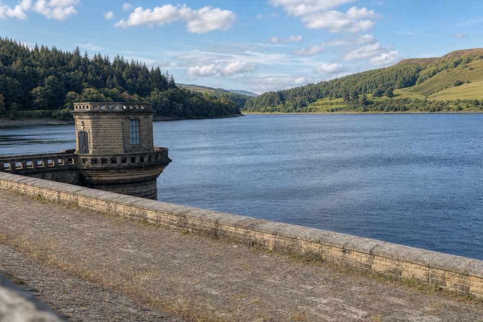
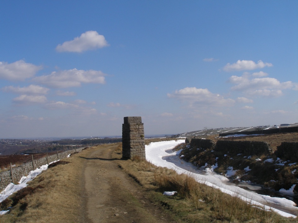
A short level walk to a Victorian waterworks tower

Photo: Wikimedia Commons
Length
1.6km
Time
45min
Elev. change
12m
Difficulty
Easy
  • High point 362 m

Hear the audio tour

Redmires Reservoir and Moorland Walks

Overview

About Redmires Conduit Miles without Stiles

Why go

  • Level, compacted route with an Access for All designation
  • A short walk through Sheffield's waterworks history

Heads up

  • No confirmed on-site facilities or parking details
  • More heritage walk than big landscape outing

Map & elevation

The route

Loading the Peak District map
Full map
Elevation350–362 m
TrailheadRoadside gate opposite Redmires Upper Reservoir53.36843, -1.61042
Keep this map with you offline in the Parkwolf app

Plan your hike

Before you go

Parking

Start at the roadside gate opposite Redmires Upper Reservoir, S10 4QZ, OS grid SK 2602 8580. The route information does not establish a dedicated car park, capacity, or legal parking arrangement at the gate; nearby map listings are not confirmed as this trailhead.


Safety

The route has a compacted surface and three gates. No route facilities were identified in the available official information, so plan for toilets and drinking water before arriving.

5 active Peak District alerts

  • ClosureA54 Cat and Fiddle road closureThe A54 Macclesfield Main Road (Cat and Fiddle) is fully closed to all traffic from 27 July through 30 October 2026 during phase 1 improvement works.Official details
  • ClosureHooks Carr (Stanage Popular) car park closureHooks Carr (Stanage Popular) car park will be partially or fully closed from 6 October for four weeks.Official details
See all 5 alerts
A park ranger sits on a dash-mounted phone, talking, as Parkwolf’s Tour Guide plays “Army Cutworm Moths: A Grizzly Bear Buffet” on Grand Loop Road below Dunraven Pass in Yellowstone
Parkwolf Tour GuideThe highest, rockiest slopes around here are a summer buffet for grizzly bears.

Peak District Tour Guide

Your drive to Redmires Conduit Miles without Stiles, narrated.

Parkwolf is a GPS audio tour guide for Peak District National Park. As you drive, it chimes in with what’s ahead: hidden gems, upcoming stops, history, geology, and wildlife, right through your car’s speakers.

Recorded for this trailhead

Redmires Reservoir and Moorland Walks
0:00 / 0:29
“You're approaching Redmires Upper Reservoir, where two very different walks head out across the moors.”

Plays as you drive up to this trailhead in the Parkwolf Peak District Tour Guide.

More stories near here in the app

  • Wyming Brook Nature Trail
  • Practice Trenches above Redmires
  • The Little Gardens at Lodge Moor
  • Stanage Edge
  • 298 audio storiesacross Peak District’s roads, triggered by GPS as you drive
  • Wildlife heatmapsfor Red Deer, Red Fox, Eurasian Otter, and 13 more
  • Works offlinemaps, 88 trails, 76 places, and audio download before you lose signal
  • CarPlay readysimple controls built for the drive
★★★★★
“Fantastic app with many points of information… It’s great to just turn on while you’re driving and it gives you an audio tour of the national Park. We love it!!!!”
JMJamesApp Store review
Download Parkwolf on the App StoreGet Parkwolf on Google Play

4.7 from 8,600+ ratings

Trail guide

Hiking Redmires Conduit Miles without Stiles

A short accessible walkRedmires Conduit Miles without Stiles is a level 1.

Redmires Conduit Miles without Stiles is a level 1.6 km out-and-back from the roadside gate opposite Redmires Upper Reservoir to a Victorian surveying tower, then back. The route is labelled Access for All, with a compacted path through open fields intended for pushchairs and unassisted wheelchairs. Allow 30 to 60 minutes. It is a short heritage outing, not a summit walk.

Follow the conduitFrom the gate, follow the conduit through a double gate and another gate to the tower.

From the gate, follow the conduit through a double gate and another gate to the tower. The open path runs beside stone walls and the water channel, with small bridges and old masonry along the way. The Rivelin Tunnel Sighting Tower is the turning point. Keep the Redmires and Rivelin circuits separate: they add miles and different terrain.

A waterworks storyThe conduit was built in the 1830s to carry drinking water from Redmires to Sheffield’s Crookes…

The conduit was built in the 1830s to carry drinking water from Redmires to Sheffield’s Crookes area. The reservoirs and surveying tower followed the city’s 1832 cholera epidemic, so the walk is a glimpse of public-health history. The park also notes water voles in the conduit. Frame the tower with the channel and path to show what makes this route distinct.

Before you goStart at the roadside gate opposite Redmires Upper Reservoir, postcode S10 4QZ, OS grid SK 2602…

Start at the roadside gate opposite Redmires Upper Reservoir, postcode S10 4QZ, OS grid SK 2602 8580. No dedicated car park, capacity, toilets, drinking water, food, or dog rule was established in the available route information, so do not assume a nearby map listing is the official access. No permit or fee was listed. Three gates may matter for some mobility devices.

Wildlife

Wildlife in Peak District

All Peak District wildlife maps

Sighting maps show where each species has been reported across Peak District. Wildlife moves, so no sighting is guaranteed.

Keep exploring

Near Redmires Conduit Miles without Stiles

See it all on the map

Trails that start nearby

Places near the trailhead

Parkwolf’s Peak District ranking

Top-rated trails in Peak District

All 88 trails
  1. 1The Roaches and Lud’s Church Circular from Hen CloudModerate · 12.2 km
  2. 2Mam Tor Circular WalkModerate · 4.8 km
  3. 3Castleton, Mam Tor & the Great Ridge WalkModerate · 10.5 km
  4. 4Stanage Edge from HathersageModerate · 10.6 km
  5. 5Kinder Scout Circular via Jacob’s LadderChallenging · 12.1 km
  6. 6Padley Gorge and Burbage Brook WalkEasy · 3.7 km

Take Parkwolf to Peak District.

The audio tour guide for the drive, plus offline maps, trails, and wildlife heatmaps for when the signal drops.

4.7 from 8,600+ ratings

Download Parkwolf on the App StoreGet Parkwolf on Google Play