Rae Glacier Trail in Peter Lougheed Provincial Park

Peter Lougheed Provincial Park, AB

Rae Glacier Trail

A rugged, unsigned climb to Rae Glacier’s rocky basin.

Length
9.1km
Time
4hr
Elev. change
382m
Difficulty
Challenging
  • Dogs allowed
  • High point 2,348 m
  • #25 of 66 in Peter Lougheed

Hear the audio tour

Elbow Lake: A Short, Steep Lake Hike

Overview

About Rae Glacier Trail

Why go

  • A rocky glacier basin and broad alpine view make a bigger finish than the lake walk alone.

Heads up

  • The route loses its signs after Elbow Lake and becomes rough, loose, and harder to follow.

Map & elevation

The route

Loading the Peter Lougheed map
Full map
Elevation1,966–2,348 m
TrailheadElbow Pass Day Use Area50.63512, -115.02286
Keep this map with you offline in the Parkwolf app

Plan your hike

Before you go

Parking

Start at Elbow Pass Day Use Area on Highway 40. Use the signed day-use lot; equestrian and backpacking parking are separate. A Kananaskis Conservation Pass is required for parked vehicles. The lot can fill on busy summer mornings, though pressure varies. Highway 40 access is seasonal.

Safety

The Rae Glacier extension is unofficial and unsigned. Above Elbow Lake, the path can fade among creek-bed rocks and unclear junctions; loose boulders and a snowmelt stream crossing can be challenging, especially in midsummer. The mapped endpoint is on the moraine. Gravel can hide ice and crevasses, and the upper basin has avalanche terrain. Do not step onto the glacier. Dogs must remain leashed within 2 m in Alberta parks.

4 active Peter Lougheed alerts

  • ClosureTrail closures and Three Isle detourThree trail sections remain closed; stay out of closed areas and follow the signed Three Isle detour to reach the open backcountry campgrounds.Official details
  • CautionBear activity near Elpoca and ValleyviewFrequent bear activity has been noted along Valleyview Road from Elpoca Day Use Area south to Highway 40, near Little Highwood Pass and Valleyview Day Use Areas; use bear precautions.Official details
See all 4 alerts
A park ranger sits on a dash-mounted phone, talking, as Parkwolf’s Tour Guide plays “Army Cutworm Moths: A Grizzly Bear Buffet” on Grand Loop Road below Dunraven Pass in Yellowstone
Parkwolf Tour GuideThe highest, rockiest slopes around here are a summer buffet for grizzly bears.

Peter Lougheed Tour Guide

Your drive to Rae Glacier Trail, narrated.

Parkwolf is a GPS audio tour guide for Peter Lougheed Provincial Park. As you drive, it chimes in with what’s ahead: hidden gems, upcoming stops, history, geology, and wildlife, right through your car’s speakers.

See the Peter Lougheed audio tour

Recorded for this trailhead

Elbow Lake: A Short, Steep Lake Hike
0:00 / 0:24
“You're nearing Elbow Pass Day Use Area, the starting point for a short, steep hike to Elbow Lake.”

Plays as you drive up to this trailhead in the Parkwolf Peter Lougheed Tour Guide.

More stories near here in the app

  • Little Highwood: Mount Roberta and Ridge Access
  • Rock Glacier: A Short Walk and Pikas
  • Follow a Fold in the Rock
  • Highwood Pass and the Meadow Walk
  • 41 audio storiesacross Peter Lougheed’s roads, triggered by GPS as you drive
  • Wildlife heatmapsfor Grizzly Bear, Canada Lynx, Black Bear, and 13 more
  • Works offlinemaps, 66 trails, 41 places, and audio download before you lose signal
  • CarPlay readysimple controls built for the drive
★★★★★
“Fantastic app with many points of information… It’s great to just turn on while you’re driving and it gives you an audio tour of the national Park. We love it!!!!”
JMJamesApp Store review
Download Parkwolf on the App StoreGet Parkwolf on Google Play

4.7 from 8,600+ ratings

Trail guide

Hiking Rae Glacier Trail

The full outingRae Glacier Trail is an out-and-back of about 5.7 mi (9.

Rae Glacier Trail is an out-and-back of about 5.7 mi (9.1 km) from Elbow Pass Day Use Area to the moraine below Rae Glacier. The mapped line counts the Elbow Lake approach each way and draws the upper route once; it skips the optional shoreline circuit around the lake. Published routes range from about 8.1 to 9.3 km depending on the line and return they use. Allow about four hours and roughly 424 m of cumulative climb. Choose it for the glacier basin and broad mountain view; if you want a signed walk, make Elbow Lake your turnaround instead.

Climb to Elbow LakeThe first roughly 1.

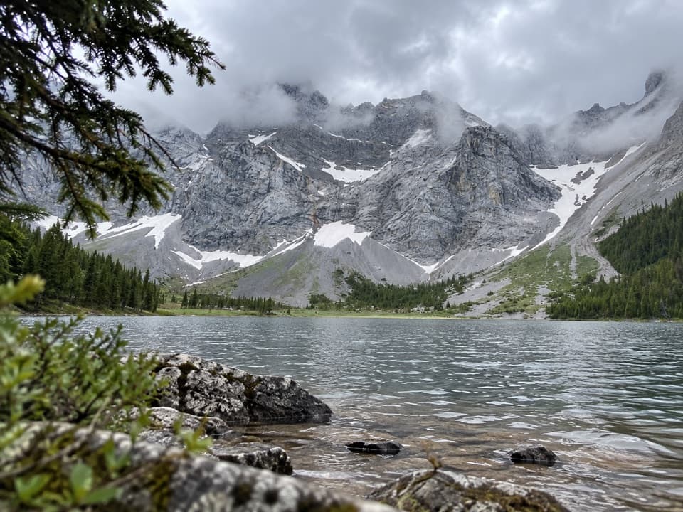
The first roughly 1.4 km climbs steeply on a wide, old road through forest to Elbow Lake and its backcountry campground. The approach is shared with horses, so leave room for them. Pit toilets are available at the campground beside the lake; no food service was found on the route.

Find the glacier routePast the campground, continue around the lake to its east or northeast shore and pick up the…

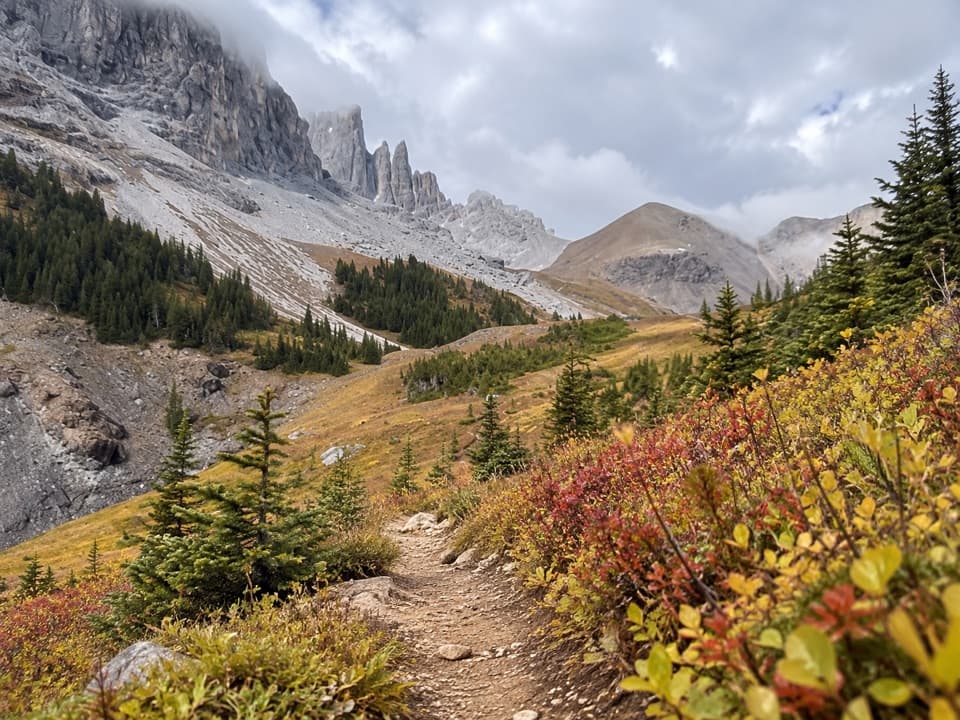
Past the campground, continue around the lake to its east or northeast shore and pick up the unsigned path that follows a creek upstream. The upper route is much harder to read than the lake trail. It can fade among creek rocks and unclear junctions; occasional cairns or flagging are not continuous markers.

Rock field and moraineThe path crosses a rocky creek bed, then climbs a rib and terminal moraine.

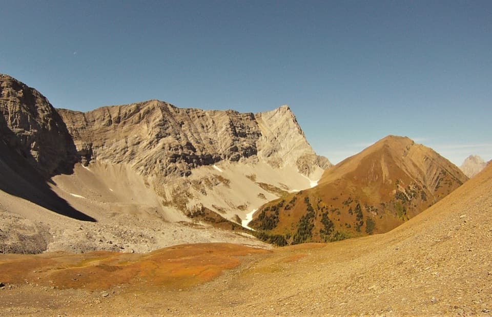
The path crosses a rocky creek bed, then climbs a rib and terminal moraine. Expect loose footing and sustained rock hopping. A stream fed by nearby snowmelt can be difficult to cross in midsummer. Stop on stable ground at the moraine: gravel can cover ice, and the basin has crevasse and avalanche hazards. Do not walk onto the glacier.

What you reachThe open rock rib gives a wide view over surrounding peaks and the glacier basin; near the toe,…

The open rock rib gives a wide view over surrounding peaks and the glacier basin; near the toe, turn back for the valley behind you. Rae Glacier grew during the Little Ice Age and has been retreating over the long term. Research groups have studied it for years. It supplies only a small share of the Elbow River’s water; Elbow Lake and a neighbouring snow-fed basin contribute more.

Before you goUse the signed day-use lot at Elbow Pass, not the separate equestrian or backpacking lots.

Use the signed day-use lot at Elbow Pass, not the separate equestrian or backpacking lots. A Kananaskis Conservation Pass is required for a vehicle parked there, and Highway 40 access is seasonal. The lot can fill on busy summer mornings, though parking pressure varies. Dogs are allowed on the route but must stay leashed within 2 m in provincial parks.

Wildlife

Wildlife in Peter Lougheed

All Peter Lougheed wildlife maps

Sighting maps show where each species has been reported across Peter Lougheed. Wildlife moves, so no sighting is guaranteed.

Keep exploring

Near Rae Glacier Trail

See it all on the map

Trails that start nearby

Places near the trailhead

Parkwolf’s Peter Lougheed ranking

Top-rated trails in Peter Lougheed

All 66 trails
  1. 1Rawson Lake TrailModerate · 7.8 km
  2. 2Ptarmigan Cirque Interpretive TrailModerate · 4.5 km
  3. 3Burstall Pass TrailChallenging · 14.8 km
  4. 4Chester Lake TrailModerate · 9.2 km
  5. 5Upper Kananaskis Lake LoopModerate · 15.7 km
  6. 6Sarrail Ridge via Rawson LakeChallenging · 11.7 km

Take Parkwolf to Peter Lougheed.

The audio tour guide for the drive, plus offline maps, trails, and wildlife heatmaps for when the signal drops.

4.7 from 8,600+ ratings

Download Parkwolf on the App StoreGet Parkwolf on Google Play