Overview
About Garie Beach
Why stop
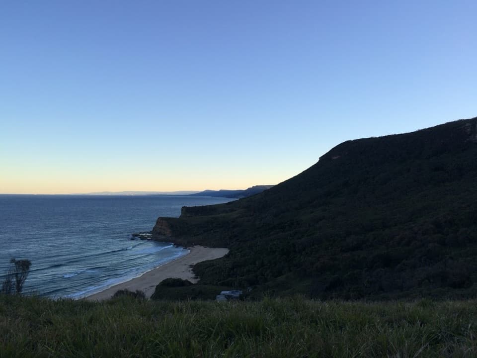
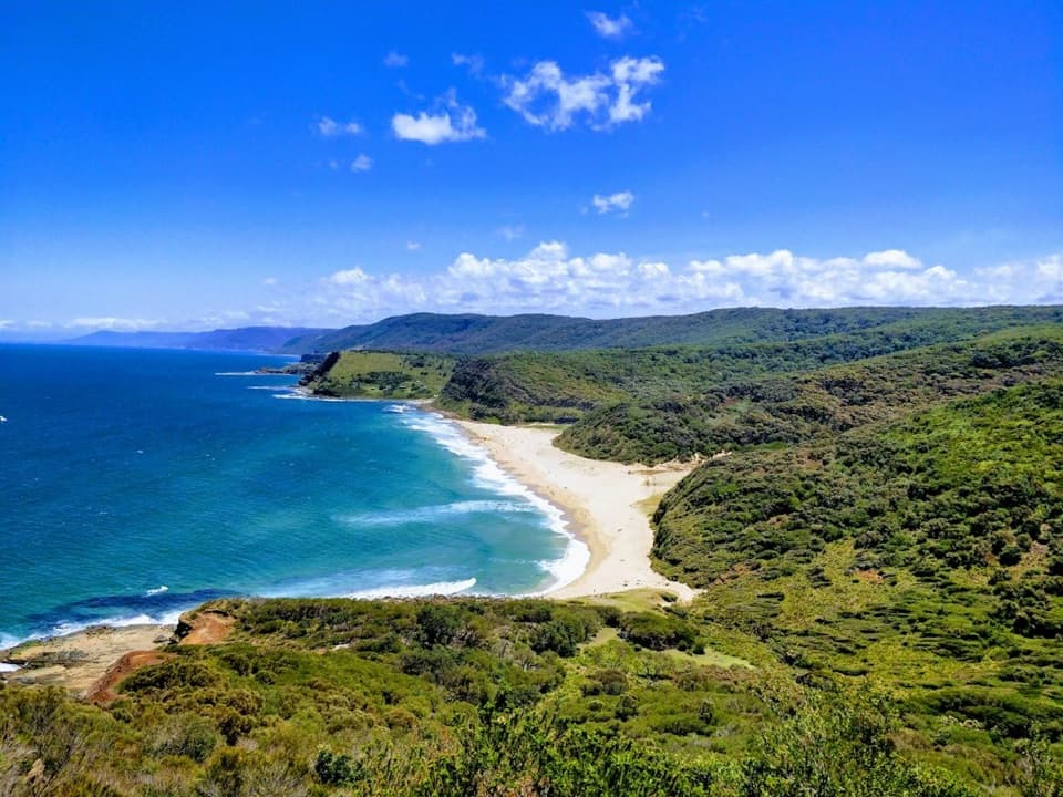
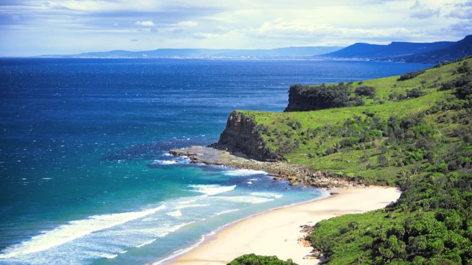
- An elevated view from Governor Game Lookout takes in the full sweep of coast.
Heads up
- Strong surf and rips can make swimming unsuitable.
Map
Where it is

The highest, rockiest slopes around here are a summer buffet for grizzly bears.
Royal Tour Guide
Your drive to Garie Beach, narrated.
Parkwolf is a GPS audio tour guide for Royal National Park. As you drive, it chimes in with what’s ahead: hidden gems, upcoming stops, history, geology, and wildlife, right through your car’s speakers.
See the Royal audio tourRecorded for this place
Garie Beach and Its Surf Lifesavers“Garie Beach is coming up, a long sweep of sand beneath green headlands. I'd stop for a picnic and a shoreline walk, rather than count on a gentle swim: the exposed surf has strong rips, and patrols are seasonal.”
Plays as you drive up to Garie Beach in the Parkwolf Royal Tour Guide.
More stories near here in the app
- Curra Moors Heath and Coastal Loop
- Governor Game Lookout and Spring Heath
- Wallumarra Track to Bola Creek
- Garawarra Farm and Figure Eight Pools
- 43 audio storiesacross Royal’s roads, triggered by GPS as you drive
- Wildlife heatmapsfor Humpback Whale, White-bellied Sea-Eagle, Koala, and 13 more
- Works offlinemaps, 69 trails, 58 places, and audio download before you lose signal
- CarPlay readysimple controls built for the drive
“Fantastic app with many points of information… It’s great to just turn on while you’re driving and it gives you an audio tour of the national Park. We love it!!!!”


Guide
More about Garie Beach
The long curve of GarieGarie Beach is roughly a kilometre of southeast-facing sand on the southern coast of Royal…
Garie Beach is roughly a kilometre of southeast-facing sand on the southern coast of Royal National Park. The open surf runs below green headlands, with Garie North Head rising about 110 metres at the northern end. It’s a good stop for a picnic, a walk on the shore or an open-coast view; choose another beach if you need reliably gentle swimming.
Arrive early, bring lunchGarie Road brings you to a picnic area and carpark right beside the beach, on a sealed road…
Garie Road brings you to a picnic area and carpark right beside the beach, on a sealed road suitable for 2WD vehicles. Parking can be limited on busy weekends, so carpool and arrive early if you want a picnic table. Flush toilets and tables are here; bring drinking water. A small kiosk is sometimes available, but current hours and menu aren’t confirmed, so bring lunch if a meal matters. Dogs aren’t allowed in the park except certified assistance animals. The carpark locks overnight, so plan to leave before sunset.
Take the surf seriouslyThis is an exposed beach with powerful waves and several rips along the shore.
This is an exposed beach with powerful waves and several rips along the shore. Patrol cover is seasonal and not daily; check current patrol information before you swim and use a flagged patrolled area. Conditions can be too rough for a casual dip, especially away from the flags.
Look from aboveFor the beach’s full curve, stop at nearby Governor Game Lookout before heading out.
For the beach’s full curve, stop at nearby Governor Game Lookout before heading out. It gives an elevated view where sand, blue water and green headlands fit together, making the clearest spot for a photo of the coast’s shape. Winter is the season for whale watching here, though sightings are never guaranteed.
Follow the Coast TrackGarie is a common exit point for the 27-kilometre Coast Track, the multi-day coastal route…
Garie is a common exit point for the 27-kilometre Coast Track, the multi-day coastal route between Bundeena and Otford. A walk along the sand gives you the open ocean; the higher beach views come from the longer route above the shore.
Watch the updraftsLook for albatross, sea eagles and peregrine falcons riding the coastal updrafts.
Look for albatross, sea eagles and peregrine falcons riding the coastal updrafts. Behind the exposed headlands, nearby rainforest gullies hold cabbage-tree palms and ferns, a sheltered contrast to open sand and surf.
A long beach to watchGarie Beach lies on the traditional lands of the Dharawal People.
Garie Beach lies on the traditional lands of the Dharawal People. As beach visits grew, the National Park Trust sought regular patrols at Garie and Wattamolla. Garie’s surf lifesaving club held its inaugural meeting at the beach kiosk on 18 December 1938 and dates its establishment to 1939.
Wildlife
Wildlife in Royal
 56 sightingsHumpback WhaleMost seen around 11 AMSighting map
 70 sightingsWhite-bellied Sea-EagleMost seen around 9 AMSighting map
 12 sightingsKoalaMost seen around 6 PMSighting map
 34 sightingsJavan RusaMost seen around 6 PMSighting map
 70 sightingsShort-beaked EchidnaMost seen around 5 PMSighting map
 11 sightingsRed FoxMost seen around 5 PMSighting map
Sighting maps show where each species has been reported across Royal. Wildlife moves, so no sighting is guaranteed.