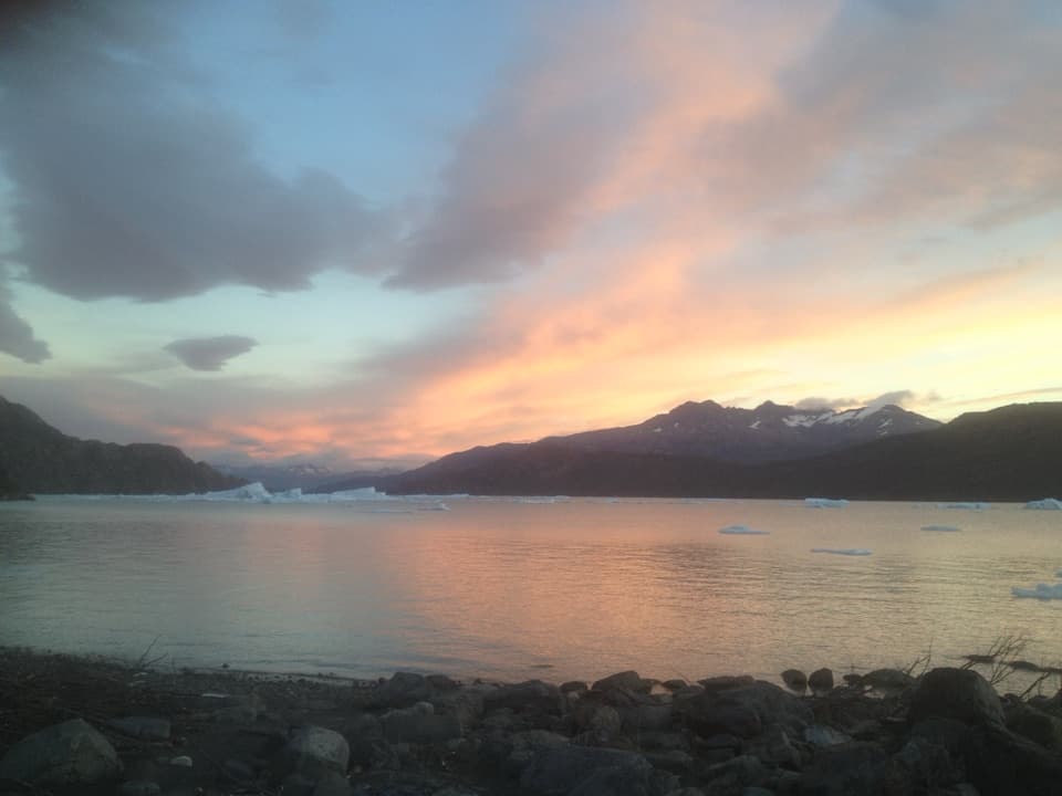
Playa Grey in Torres del Paine National Park

#4 of 32 sights in Torres del Paine

Beach · Torres del Paine National Park

Playa Grey

Walk the south shore for icebergs and a far-off Grey Glacier.

Photo: Wikimedia Commons
Type
Beach
Nearest trail
1.8 km
Audio stories
3 nearby
  • Scenic viewpoint

Hear the audio tour

Playa Grey: Ice Across the Lake

Overview

About Playa Grey

Why stop

  • Ice, dark shore and a broad view across Lago Grey.

Heads up

  • Wind and loose sand can make the shore walk harder.

Map

Where it is

Loading the Torres del Paine map
Full map
BeachPlaya Grey-51.11098, -73.11594
Keep this map with you offline in the Parkwolf app

Plan your stop

Before you go

2 active Torres del Paine alerts

  • ClosureInternal Y-150 road closedThe internal Y-150 road between Sarmiento and Laguna Los Cisnes is closed. - This is the internal road segment; CONAF lists the separate Y-150 access road to Sarmiento as open.Official details
  • CautionOne-way and guide-only trail restrictionsPlan around CONAF’s current one-way and guide-only trail restrictions.Official details

Torres del Paine alerts
A park ranger sits on a dash-mounted phone, talking, as Parkwolf’s Tour Guide plays “Army Cutworm Moths: A Grizzly Bear Buffet” on Grand Loop Road below Dunraven Pass in Yellowstone
Parkwolf Tour GuideThe highest, rockiest slopes around here are a summer buffet for grizzly bears.

Torres del Paine Tour Guide

Your drive to Playa Grey, narrated.

Parkwolf is a GPS audio tour guide for Torres del Paine National Park. As you drive, it chimes in with what’s ahead: hidden gems, upcoming stops, history, geology, and wildlife, right through your car’s speakers.

See the Torres del Paine audio tour

Recorded for this place

Playa Grey: Ice Across the Lake
0:00 / 0:32
“You're coming up on the Pingo starting area for Playa Grey, where a walk through forest leads to an open shore. Choose this for the lake and drifting ice, with Grey Glacier far away across the water.”

Plays as you drive up to Playa Grey in the Parkwolf Torres del Paine Tour Guide.

More stories near here in the app

  • Hotel Lago Grey: Before You Board
  • Why Glacier Ice Looks Blue
  • Rock Flour in the Water
  • What a Peat Bog Keeps
  • 81 audio storiesacross Torres del Paine’s roads, triggered by GPS as you drive
  • Wildlife heatmapsfor Puma, Andean Condor, Guanaco, and 13 more
  • Works offlinemaps, 35 trails, 56 places, and audio download before you lose signal
  • CarPlay readysimple controls built for the drive
★★★★★
“Fantastic app with many points of information… It’s great to just turn on while you’re driving and it gives you an audio tour of the national Park. We love it!!!!”
JMJamesApp Store review
Download Parkwolf on the App StoreGet Parkwolf on Google Play

4.7 from 8,600+ ratings

Guide

More about Playa Grey

A wild shore on Lago GreyPlaya Grey is a dark-sand beach on the lake’s southern shore, paired with a natural lookout…

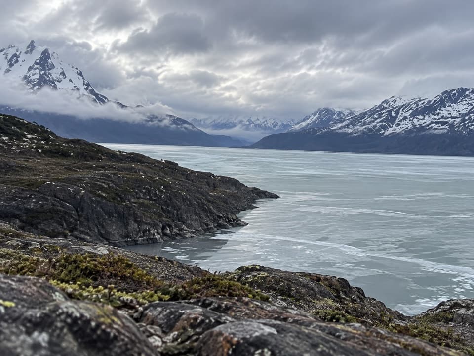
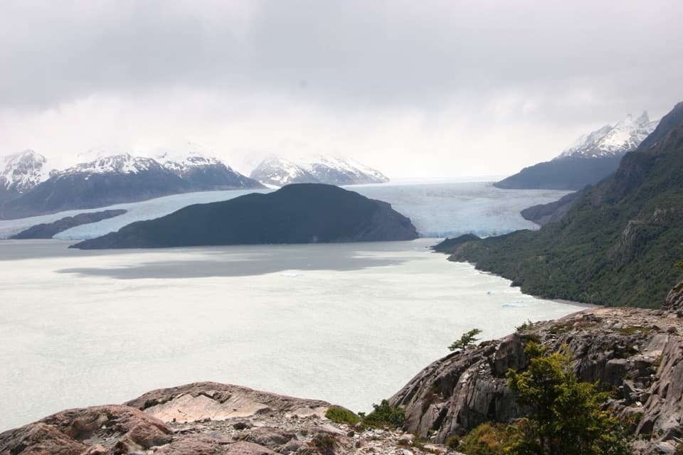
Playa Grey is a dark-sand beach on the lake’s southern shore, paired with a natural lookout across the water toward Grey Glacier. Keep it on your list if you want the lake, icebergs and the broad mountain view together. The glacier is visible at the far end of Lago Grey, so this is a distant look rather than a walk up to the ice face.

The walk inThe approach crosses a bridge over the Río Pingo, passes through lenga and coigüe forest, then…

The approach crosses a bridge over the Río Pingo, passes through lenga and coigüe forest, then follows the south shore toward a small islet and lookout. The mapped viewpoint route is a 5.5-kilometre moderate loop. Count this as a proper walk; it isn’t just a pullout beside the road. The final shore can be sandy and rocky underfoot.

Look out across the lakeFrom the shore and lookout, Lago Grey fills the foreground, with Grey Glacier and the…

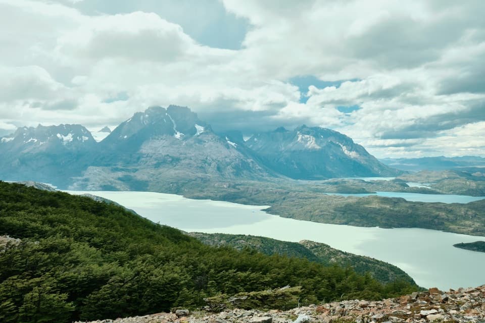
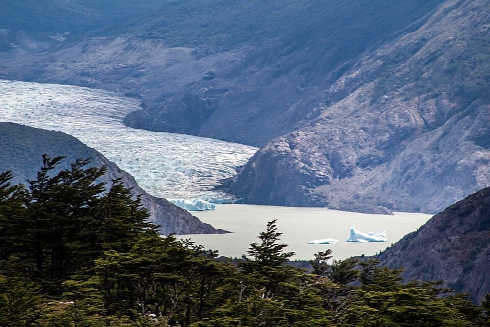
From the shore and lookout, Lago Grey fills the foreground, with Grey Glacier and the snow-covered peaks Francés and Olguín in the distance. Icebergs calved from the glacier drift across the lake and sometimes pass near the beach, but their presence and position change. If you want a much closer view of the glacier, that takes a separate boat navigation.

Where the ice comes fromGrey Glacier is part of the Southern Patagonian Icefield.

Grey Glacier is part of the Southern Patagonian Icefield. Pieces break off and travel down Lago Grey as icebergs, giving the southern beach a glimpse of the glacier’s long journey across the lake. Glacial sediment suspended in the park’s water scatters the light and helps produce the lake’s gray-blue color.

Wind on an open shoreThis is an exposed Patagonian lakeshore.

This is an exposed Patagonian lakeshore. Visitors repeatedly describe strong wind and cold conditions even in summer; sand and loose rock can also slow the walk. Bring a windproof layer, especially if you plan to stay by the water rather than just visit the lookout.

A photo with distance in itUse the dark shore or a nearby iceberg as foreground, then leave room for the lake and far-off…

Use the dark shore or a nearby iceberg as foreground, then leave room for the lake and far-off glacier behind it. That gives the picture the scale of the view. Ice can make a striking foreground when it is there, but the glacier remains distant from this side of the lake.

Wildlife

Wildlife in Torres del Paine

All Torres del Paine wildlife maps

Sighting maps show where each species has been reported across Torres del Paine. Wildlife moves, so no sighting is guaranteed.

Keep exploring

Near Playa Grey

See it all on the map

Trails nearby

More stops nearby

Parkwolf’s Torres del Paine ranking

Top sights in Torres del Paine

All 56 places
  1. 1Mirador Base TorresSight
  2. 2Salto Grande WaterfallSight
  3. 3Mirador CuernosSight
  4. 5Mirador BritánicoSight
  5. 6Mirador Glaciar GreySight
  6. 7Mirador CóndorSight

Take Parkwolf to Torres del Paine.

The audio tour guide for the drive, plus offline maps, trails, and wildlife heatmaps for when the signal drops.

4.7 from 8,600+ ratings

Download Parkwolf on the App StoreGet Parkwolf on Google Play