Lazo–Weber Trail in Torres del Paine National Park

Torres del Paine National Park, MA

Lazo–Weber Trail

Lenga forest, open lakes, and a big Lago Toro finish.

Length
12.9km
Time
5.5hr
Elev. change
351m
Difficulty
Moderate
  • No dogs
  • High point 388 m
  • #14 of 35 in Torres del Paine

Hear the audio tour

Lazo–Weber from Laguna Verde

Overview

About Lazo–Weber Trail

Why go

  • Lenga forest, wetlands and lakes keep the long traverse varied.
  • A broad Lago Toro panorama opens near the finish.

Heads up

  • Guide and pickup logistics need to be arranged in advance.
  • Wind exposure, wet footing and a steep final descent can slow the crossing.

Map & elevation

The route

Loading the Torres del Paine map
Full map
Elevation37–388 m
TrailheadGuardería Laguna Verde-51.12345, -72.82260
Keep this map with you offline in the Parkwolf app

Plan your hike

Before you go

Parking

Meet at Guardería Laguna Verde on Ruta Y-180. This is a point-to-point hike; arrange an accredited guide and pickup where the path meets Y-150 north of Puente Weber. The bridge is a separate road walk farther south. Parking capacity and shuttle service were not confirmed, so settle both access points with your guide.

Safety

The 2026 CONAF route map marks this corridor as guided or restricted and for an accredited guide; confirm access and the exact pickup before setting out. The open ridge is windy, rain can make the ground muddy, and the final descent is steep. A stream crossing may be rough after storms. There is no mobile coverage in the park, and pets are prohibited.

2 active Torres del Paine alerts

  • ClosureInternal Y-150 road closedThe internal Y-150 road between Sarmiento and Laguna Los Cisnes is closed. - This is the internal road segment; CONAF lists the separate Y-150 access road to Sarmiento as open.Official details
  • CautionOne-way and guide-only trail restrictionsPlan around CONAF’s current one-way and guide-only trail restrictions.Official details
Torres del Paine alerts
A park ranger sits on a dash-mounted phone, talking, as Parkwolf’s Tour Guide plays “Army Cutworm Moths: A Grizzly Bear Buffet” on Grand Loop Road below Dunraven Pass in Yellowstone
Parkwolf Tour GuideThe highest, rockiest slopes around here are a summer buffet for grizzly bears.

Torres del Paine Tour Guide

Your drive to Lazo–Weber Trail, narrated.

Parkwolf is a GPS audio tour guide for Torres del Paine National Park. As you drive, it chimes in with what’s ahead: hidden gems, upcoming stops, history, geology, and wildlife, right through your car’s speakers.

See the Torres del Paine audio tour

Recorded for this trailhead

Lazo–Weber from Laguna Verde
0:00 / 0:26
“You're nearing Guardería Laguna Verde, the starting point for the Lazo–Weber crossing.”

Plays as you drive up to this trailhead in the Parkwolf Torres del Paine Tour Guide.

More stories near here in the app

  • Ice Working in the Cracks
  • An Orchid Starts with a Fungus
  • A Coot's Lobed Toes
  • 81 audio storiesacross Torres del Paine’s roads, triggered by GPS as you drive
  • Wildlife heatmapsfor Puma, Andean Condor, Guanaco, and 13 more
  • Works offlinemaps, 35 trails, 56 places, and audio download before you lose signal
  • CarPlay readysimple controls built for the drive
★★★★★
“Fantastic app with many points of information… It’s great to just turn on while you’re driving and it gives you an audio tour of the national Park. We love it!!!!”
JMJamesApp Store review
Download Parkwolf on the App StoreGet Parkwolf on Google Play

4.7 from 8,600+ ratings

Trail guide

Hiking Lazo–Weber Trail

One way across the parkLazo–Weber is an 8-mile (12.

Lazo–Weber is an 8-mile (12.9 km) point-to-point walk from Guardería Laguna Verde to the Y-150 road exit north of Puente Weber, through forest, lagoons and open lake country. It is a medium, roughly five-hour hike; allow five to six hours for hiking with stops, then budget separately for the transfer. The official map marks this corridor for guided or restricted use, including an accredited-guide requirement, so arrange access before planning around it. It is listed as a September–April route, not a year-round outing.

From exposed ground into forestThe start is open and wind-exposed, then the path enters lenga and coihue forest, which offers…

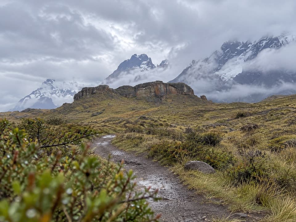
The start is open and wind-exposed, then the path enters lenga and coihue forest, which offers more shelter. Much of the middle rolls gently through wet ground and small lagoons rather than climbing continuously. Rain can leave muddy patches. A stream crossing has been reported without its small footbridge after a storm, so ask your guide about the crossing if recent rain is heavy.

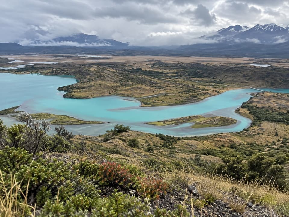
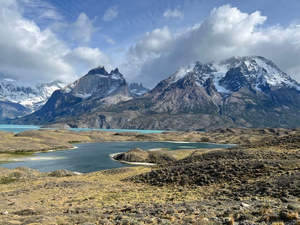
The view and the finishThe route opens onto a treeless, wind-battered lookout with a broad view over Lago Toro and the…

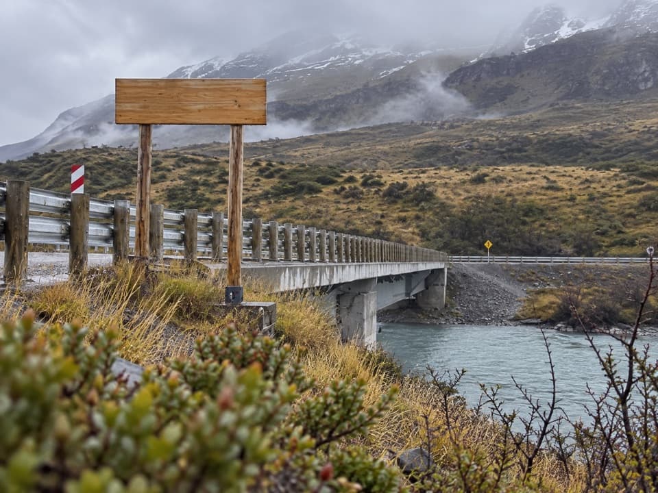
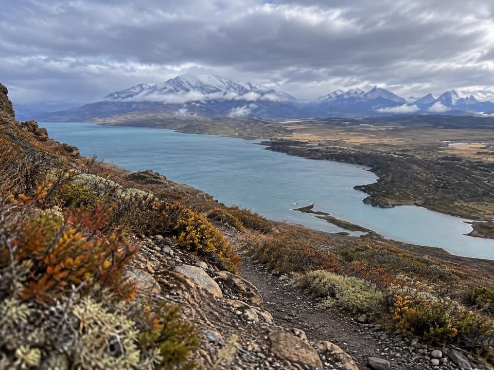
The route opens onto a treeless, wind-battered lookout with a broad view over Lago Toro and the surrounding lakes, backed by the Paine massif. The trail then drops steeply toward the Y-150. Its mapped footpath meets the road north of Puente Weber; the bridge is a separate road walk, so confirm whether your pickup is at the trail exit or farther south. For a photo, keep some of the rocky slope in the foreground with the lake and mountain range behind it.

Forest and wildlifeLenga and coihue are the defining trees here, with red and gold autumn color reported near the…

Lenga and coihue are the defining trees here, with red and gold autumn color reported near the end of the September–April season. Magellanic woodpeckers, huemul and Andean condors are possible in the wider route landscape, but none is a guaranteed sighting.

Sort the logistics firstStart at the Laguna Verde guardería and finish one-way; there is no simple walk back to your…

Start at the Laguna Verde guardería and finish one-way; there is no simple walk back to your vehicle. Use an accredited guide and settle the exact road pickup before leaving. No food, toilets, drinking water or parking capacity are confirmed along the route, and the park map warns that there is no mobile coverage. Pets are not allowed in the park.

Wildlife

Wildlife in Torres del Paine

All Torres del Paine wildlife maps

Sighting maps show where each species has been reported across Torres del Paine. Wildlife moves, so no sighting is guaranteed.

Keep exploring

Near Lazo–Weber Trail

See it all on the map

Trails that start nearby

Places near the trailhead

Parkwolf’s Torres del Paine ranking

Top-rated trails in Torres del Paine

All 35 trails
  1. 1Base Las Torres TrailChallenging · 20.1 km
  2. 2W Trek (Circuito W)Challenging · 75.7 km
  3. 3O Circuit (Circuito Macizo Paine)Challenging · 93 km
  4. 4Mirador Británico TrailChallenging · 10.8 km
  5. 5Valle del FrancésChallenging · 20 km
  6. 6Paine Grande to Refugio Grey TrailModerate · 11 km

Take Parkwolf to Torres del Paine.

The audio tour guide for the drive, plus offline maps, trails, and wildlife heatmaps for when the signal drops.

4.7 from 8,600+ ratings

Download Parkwolf on the App StoreGet Parkwolf on Google Play