Ostrander Lake Trail in Yosemite National Park

Yosemite National Park, CA

Ostrander Lake Trail

A long climb to a granite lake and historic ski hut.

Photo: CC BY 2.0
Length
12mi
Time
9hr
Elev. change
1,608ft
Difficulty
Challenging
  • No dogs
  • High point 8,632 ft
  • #36 of 141 in Yosemite

Hear the audio tour

Ostrander Lake

Overview

About Ostrander Lake Trail

Why go

  • A memorable lake basin with granite walls and a historic ski hut.
  • The walk changes from meadow and forest to open ridge views.

Heads up

  • A long, high-altitude day with a sustained late climb.
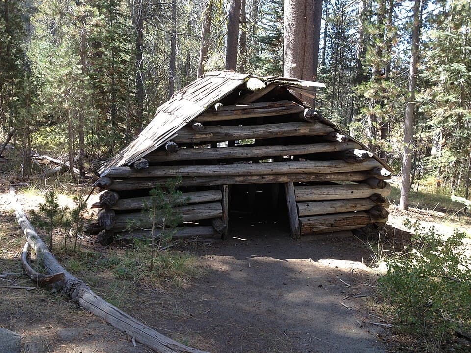
Ostrander Lake Trail is a 12-mile round-trip out-and-back from Ostrander Lake Trailhead on Glacier Point Road to a granite-rimmed lake and back. The reward is a quiet high-country basin, the lake itself and the stone Ostrander Ski Hut nearby. This is a full-day outing, not a quick overlook walk: expect roughly 1,500 feet of climbing and allow 8 to 10 hours. The trailhead sits around 7,000 feet and the lake around 8,500, so the altitude adds to the effort even before the steep part arrives.
Parkwolf’s verdictIs this the day for you?

Map & elevation

The route

Loading the Yosemite map
Full map
Elevation7,024–8,632 ft
TrailheadOstrander Lake Trailhead37.66684, -119.60376
Keep this map with you offline in the Parkwolf app

Plan your hike

Before you go

Parking

Use the Ostrander Lake Trailhead parking on Glacier Point Road. The access has a vault toilet and food-storage lockers. Glacier Point Road typically opens in late May and closes in October or November; dates vary, so check road status before driving.

Safety

The trail starts around 7,000 feet and reaches roughly 8,500 feet, with its sustained climb late in the route. Carry all drinking water; no route water source was confirmed, and allow a full day.

4 active Yosemite alerts

  • ClosureDome Fire closes Glacier Point Road and trailsMentions Glacier Point Road, referenced in this guideGlacier Point Road is temporarily closed because Dome Fire smoke reduces visibility and to allow firefighting operations; some trails south of the road are also closed.Official details
  • CautionMist Trail access limited during October repairsThe Mist Trail between its John Muir Trail junction above the Vernal Fall footbridge and the top of Vernal Fall has limited access through October for repair work.Official details
See all 4 alerts
The Parkwolf Tour Guide on a dash-mounted phone, driving into Yosemite Valley

“You're coming up on Ostrander Lake Trailhead, for a full-day hike to a granite-rimmed lake and a stone ski hut. Allow eight to ten hours for the twelve-mile round trip, with about fifteen hundred feet of climbing.”

Yosemite Tour Guide

Yosemite, narrated.

Parkwolf is a GPS audio tour guide for Yosemite National Park. As you drive, it chimes in with what’s ahead: hidden gems, upcoming stops, history, geology, and wildlife, right through your car’s speakers.

See the Yosemite audio tour

Recorded for this trailhead

Ostrander Lake
0:00 / 0:27
“You're coming up on Ostrander Lake Trailhead, for a full-day hike to a granite-rimmed lake and a stone ski hut. Allow eight to ten hours for the twelve-mile round trip, with about fifteen hundred feet of climbing.”

Plays as you drive up to this trailhead in the Parkwolf Yosemite Tour Guide.

More stories near here in the app

  • Mono Meadow Trailhead
  • McGurk Meadow and Dewey Point
  • How Sunshine Moves Granite
  • Yosemite’s Olympic Bid
  • 125 audio storiesacross Yosemite’s roads, triggered by GPS as you drive
  • Wildlife heatmapsfor Black Bear, Peregrine Falcon, Mule Deer, and 13 more
  • Works offlinemaps, 141 trails, 99 places, and audio download before you lose signal
  • CarPlay readysimple controls built for the drive
★★★★★
“We just drove through Yosemite and it made our trip listening to this app as we drove through. Like having a tour guide in the car with you.”
Roddy 3210App Store review
Download Parkwolf on the App StoreGet Parkwolf on Google Play

4.7 from 8,600+ ratings

Trail guide

Hiking Ostrander Lake Trail

A gentle opening, then two junctionsThe first half rolls through forest and meadow on a mostly gradual incline. At roughly 0.

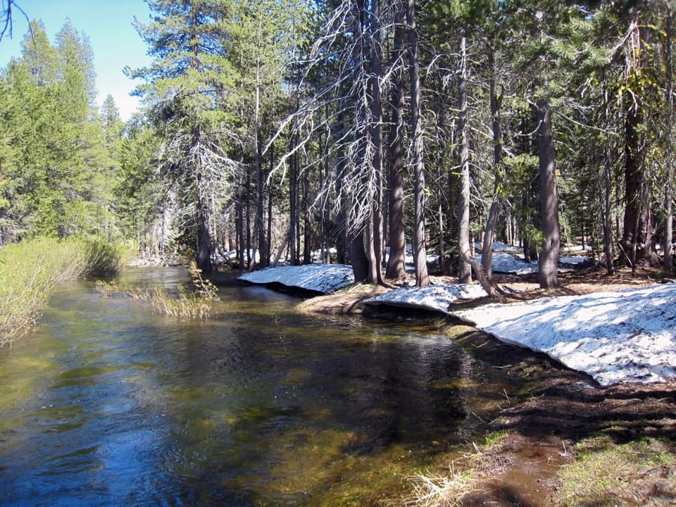
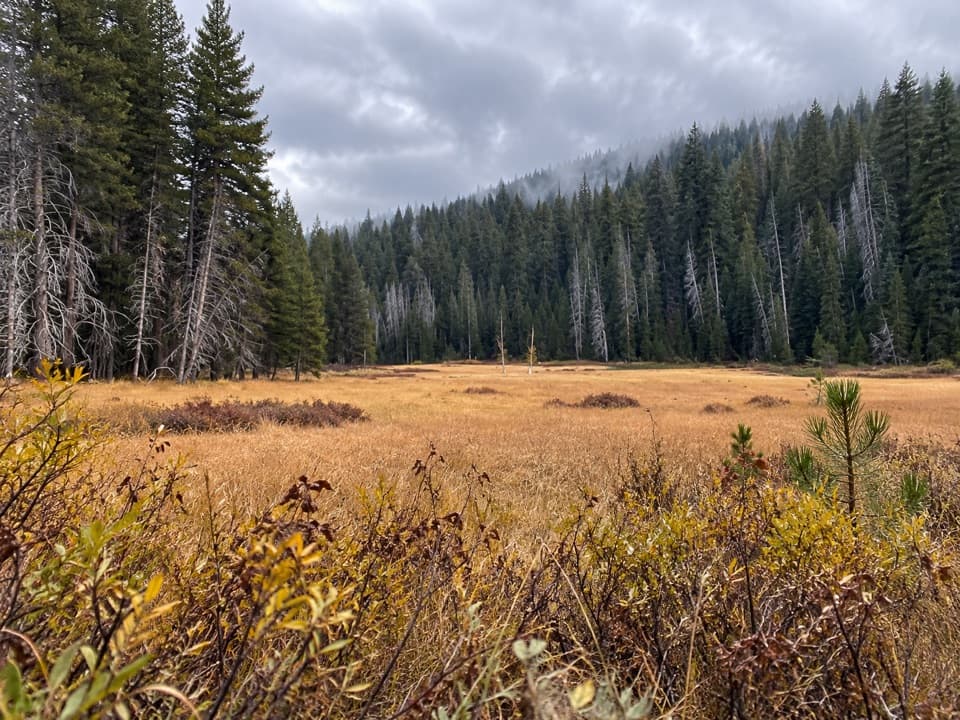
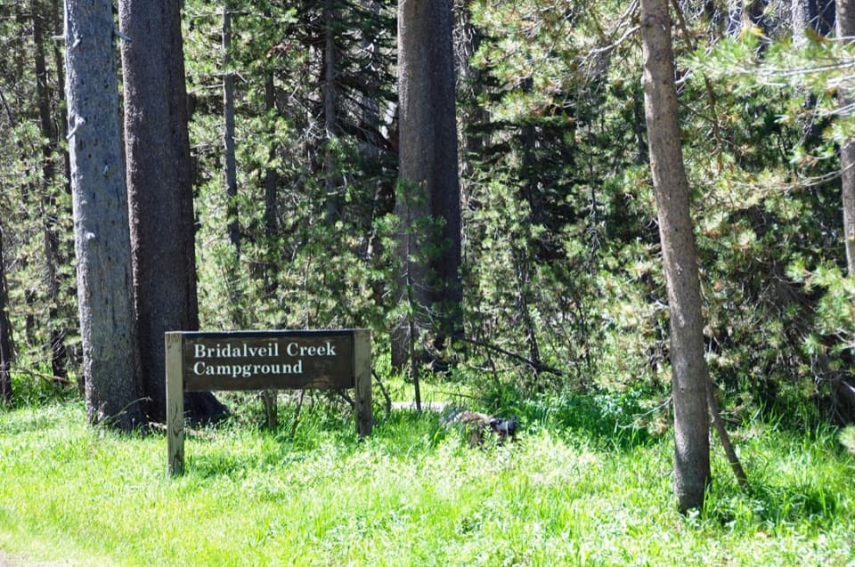
The first half rolls through forest and meadow on a mostly gradual incline. At roughly 0.3 mile, a wooden footbridge crosses a tributary of Bridalveil Creek. Around 1.4 miles, the right-hand branch heads toward Bridalveil Creek Campground; keep left and east for Ostrander. At about 2.6 miles, an overgrown Deer Camp spur branches away. Stay left again. These junctions are easy to mistake for the route if you follow every worn-looking path, so keep the lake as your destination and check the map at each split.

The climb to Horizon RidgeBeyond the second junction, the trail turns uphill in earnest.

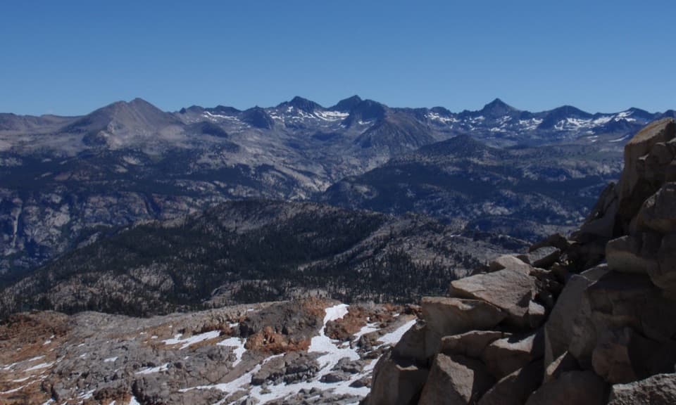
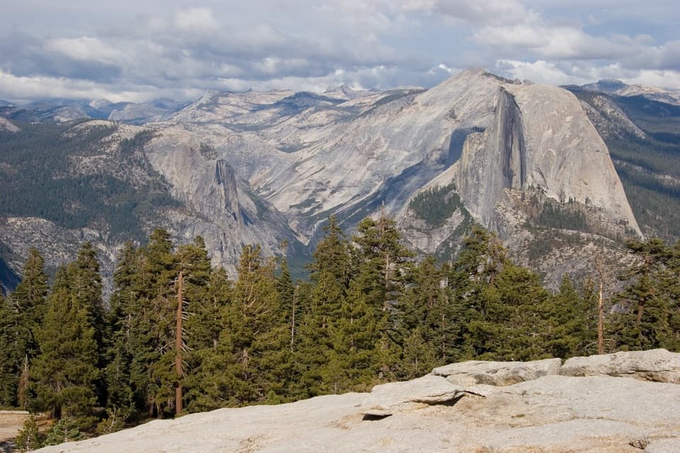
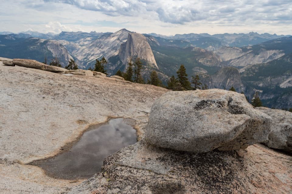
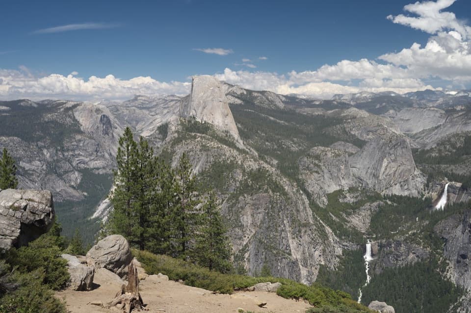
Beyond the second junction, the trail turns uphill in earnest. It gains about 800 feet over the next 1.7 miles to Horizon Ridge, with burned patches and recovering forest giving way to more open granite. The first view openings are partly screened by trees; clearer panoramas appear at open spots near the crest and just east of the trail where it bends south. Look for Mount Starr King, Half Dome, Mount Hoffman and the Clark Range. If you stop for a photo, keep a little tread or granite foreground in frame so the broad ridgeline has scale.

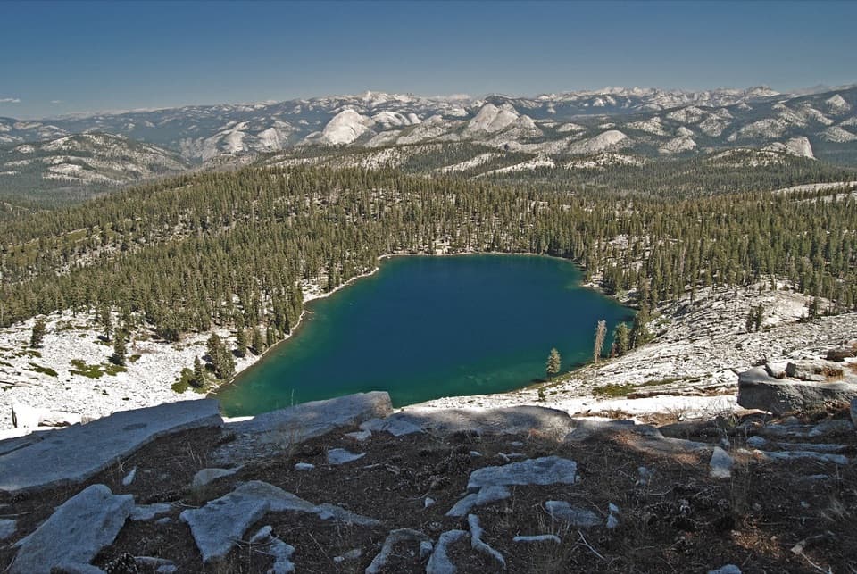
The lake basinPast the ridge, the path stays rocky and uneven, rising and dipping before a final drop of…

Past the ridge, the path stays rocky and uneven, rising and dipping before a final drop of about 75 feet from a wooded knoll to the shore. Ostrander Lake is about six miles from the trailhead; the same corridor brings you back. The stone hut stands near the lake on the right as you arrive. Built in 1941 for cross-country skiers coming from Badger Pass, it is a winter hut, not a summer shelter hikers should count on entering. The lake is also the source of Bridalveil Creek, which continues toward Bridalveil Fall.

Save energy for the returnThe approach is gentlest early and hardest later, so the first few miles can make the hike feel…

The approach is gentlest early and hardest later, so the first few miles can make the hike feel easier than it is. Keep food and water for the late climb and the walk back along the same six-mile corridor. There is no confirmed drinking-water source on the route; carry what you need for the full day. If the high elevation or late sustained climb does not suit your group, choose a shorter hike rather than treating the lake as a casual out-and-back.

Trailhead and rulesStart at the named Ostrander Lake Trailhead on Glacier Point Road.

Start at the named Ostrander Lake Trailhead on Glacier Point Road. A vault toilet and food-storage lockers are listed at the access. The road typically opens in late May and closes in October or November, with dates changing from year to year, so check its status before driving. Pets and bicycles are not allowed on Yosemite hiking trails. An overnight backpacking trip requires a wilderness permit; the day hike described here returns to the road the same day.

Wildlife

Wildlife in Yosemite

All Yosemite wildlife maps

Sighting maps show where each species has been reported across Yosemite. Wildlife moves, so no sighting is guaranteed.

Keep exploring

Near Ostrander Lake Trail

See it all on the map

Trails that start nearby

Places near the trailhead

Parkwolf’s Yosemite ranking

Top-rated trails in Yosemite

All 141 trails
  1. 1Half Dome TrailChallenging · 14.3 mi
  2. 2Clouds Rest TrailChallenging · 14 mi
  3. 3Nevada Fall Loop via Mist and John Muir TrailsChallenging · 6.4 mi
  4. 4Yosemite Falls TrailChallenging · 7.2 mi
  5. 5Panorama TrailChallenging · 8.2 mi
  6. 6Four Mile TrailChallenging · 4.8 mi

Take Parkwolf to Yosemite.

The audio tour guide for the drive, plus offline maps, trails, and wildlife heatmaps for when the signal drops.

4.7 from 8,600+ ratings

Download Parkwolf on the App StoreGet Parkwolf on Google Play