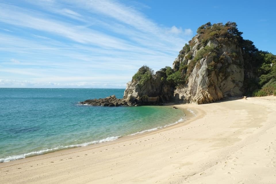
Tōtaranui to Separation Point in Abel Tasman National Park

#7 of 43 trails in Abel Tasman

Abel Tasman National Park, TA

Tōtaranui to Separation Point

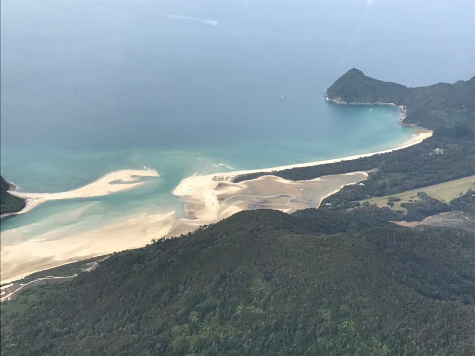
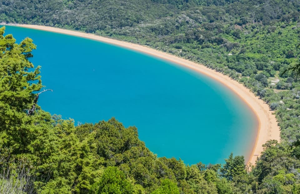
Golden beaches, nikau gullies, and a headland between two bays.

Photo: Public Domain
Length
14.4km
Time
4.5hr
Elev. change
95m
Difficulty
Moderate
  • No dogs
  • High point 95 m

Hear the audio tour

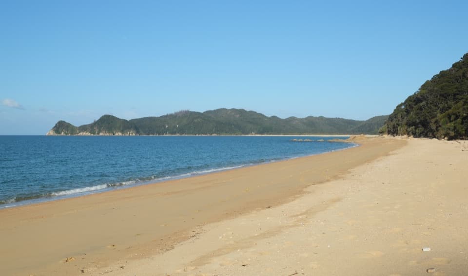
Tōtaranui Beach and Campground

Overview

About Tōtaranui to Separation Point

Why go

  • Links three contrasting bays with a headland walk between two gulfs.
  • Seal and seabird habitat adds interest beyond the beaches.

Heads up

  • A 14.4 km return with repeated climbs and sandy sections.
  • No food is sold on the route; bring a full day’s provisions.

Map & elevation

The route

Loading the Abel Tasman map
Full map
Elevation0–95 m
TrailheadTōtaranui Campground car park / Coast Track access-40.82246, 173.00425
Keep this map with you offline in the Parkwolf app

Plan your hike

Before you go

Parking

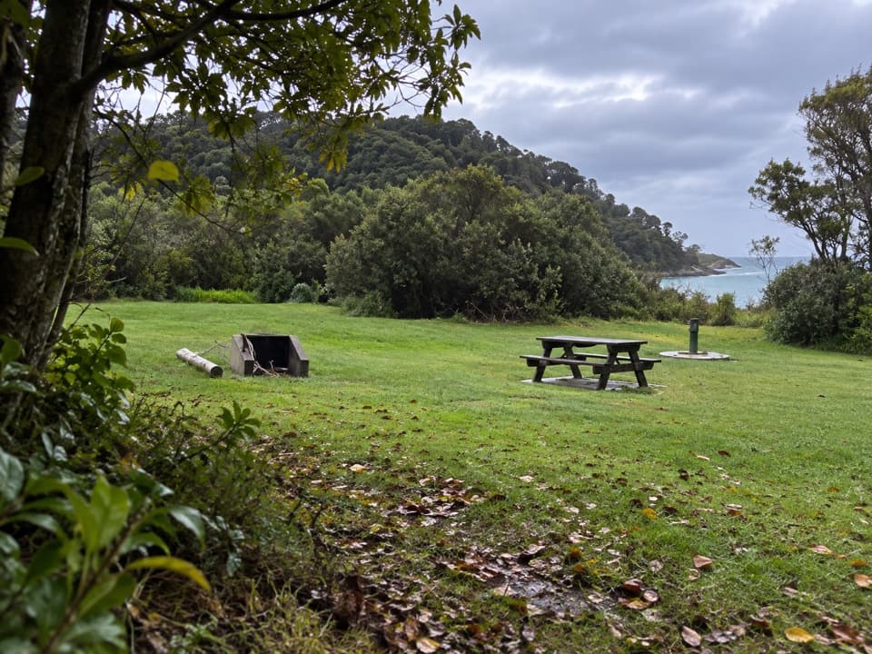
Use the DOC car park at Tōtaranui campground beside the beachfront and Coast Track access. The final 12 km of the road is unsealed, though DOC says it is suitable for campervans. The mapped route uses the all-tide road connection around the inlet.


Safety

The shorter beach crossing at Tōtaranui is suitable only when the tide is out; use the all-tide road route otherwise. The maintained track ends before the rough descent to the rocky headland, which is outside this route.

A park ranger sits on a dash-mounted phone, talking, as Parkwolf’s Tour Guide plays “Army Cutworm Moths: A Grizzly Bear Buffet” on Grand Loop Road below Dunraven Pass in Yellowstone
Parkwolf Tour GuideThe highest, rockiest slopes around here are a summer buffet for grizzly bears.

Abel Tasman Tour Guide

Your drive to Tōtaranui to Separation Point, narrated.

Parkwolf is a GPS audio tour guide for Abel Tasman National Park. As you drive, it chimes in with what’s ahead: hidden gems, upcoming stops, history, geology, and wildlife, right through your car’s speakers.

Recorded for this trailhead

Tōtaranui Beach and Campground
0:00 / 0:33
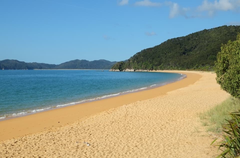
“You're coming up on Tōtaranui Beach and Campground, where the long golden beach is just across the road from the main camp.”

Plays as you drive up to this trailhead in the Parkwolf Abel Tasman Tour Guide.

More stories near here in the app

  • The Tide Sets the Walking Day
  • The Coughs in the Birdsong
  • A Fur Seal's Night Shift
  • Pigeon Saddle and Awapoto Hut
  • 23 audio storiesacross Abel Tasman’s roads, triggered by GPS as you drive
  • Wildlife heatmapsfor Kea, New Zealand Fur Seal, Little Penguin, and 13 more
  • Works offlinemaps, 43 trails, 65 places, and audio download before you lose signal
  • CarPlay readysimple controls built for the drive
★★★★★
“Fantastic app with many points of information… It’s great to just turn on while you’re driving and it gives you an audio tour of the national Park. We love it!!!!”
JMJamesApp Store review
Download Parkwolf on the App StoreGet Parkwolf on Google Play

4.7 from 8,600+ ratings

Trail guide

Hiking Tōtaranui to Separation Point

The longer coastal day walkTōtaranui to Separation Point is a 14.

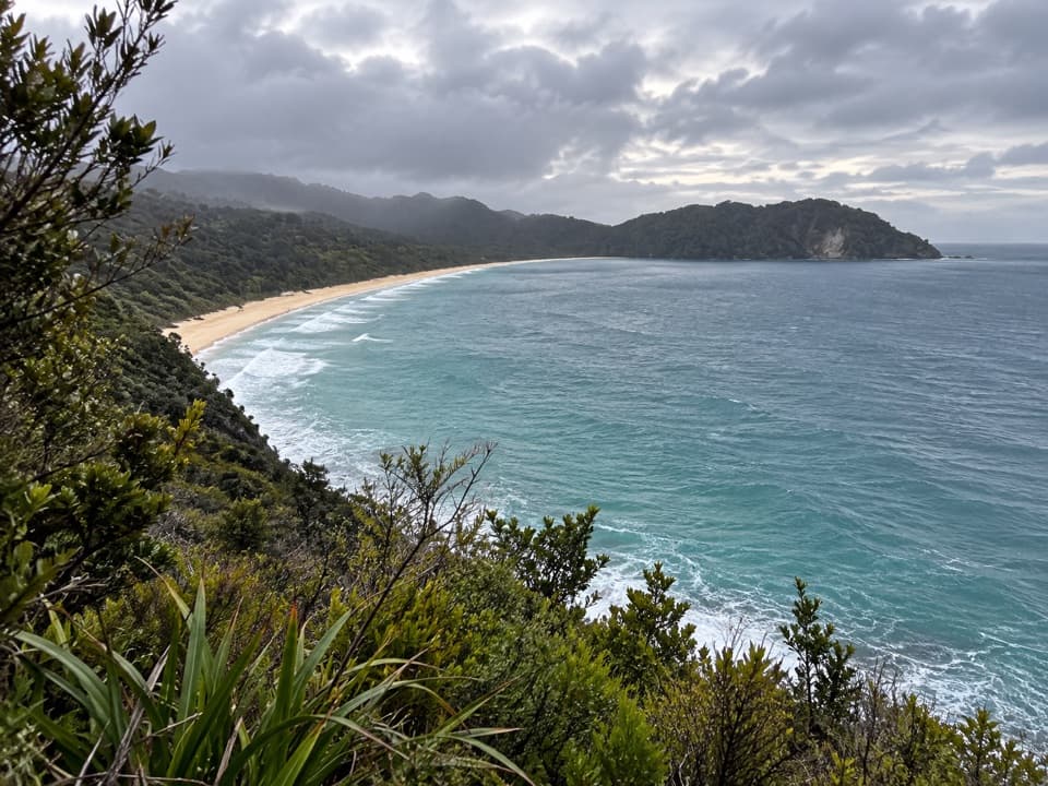
Tōtaranui to Separation Point is a 14.4 km return walk on the Abel Tasman Coast Track and its Separation Point branch, with 7.2 km each way to the official track end. It links sheltered coves, sandy bays and a wooded ridge before reaching a headland between Golden Bay and Tasman Bay. Allow about 4 hours 30 minutes; the track is moderate, with repeated climbs and beach walking. The stored route follows the all-tide connection around the Tōtaranui inlet and turns back at the maintained track end, before the rough descent to the rocks.

Getting north from TōtaranuiFrom the campground car park, the all-tide route follows the access road and gravel around the…

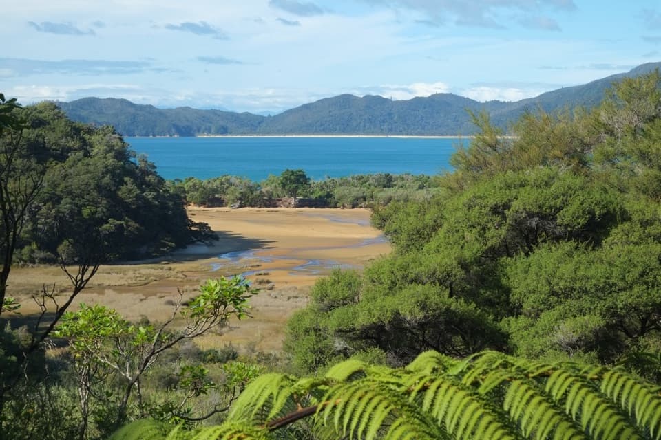
From the campground car park, the all-tide route follows the access road and gravel around the head of the inlet, then rejoins the track in native bush. There is a shorter beach crossing, but use it only when the tide is out; look for the orange DOC marker on the far side where the track resumes. Check the tide information at the campground before setting out. The official distances are measured to each bay from Tōtaranui, which makes Anapai a useful shorter turnaround if you do not want the full day.

The first climb and AnapaiThe path climbs over a low saddle, then descends through a shady gully thick with nikau palms…

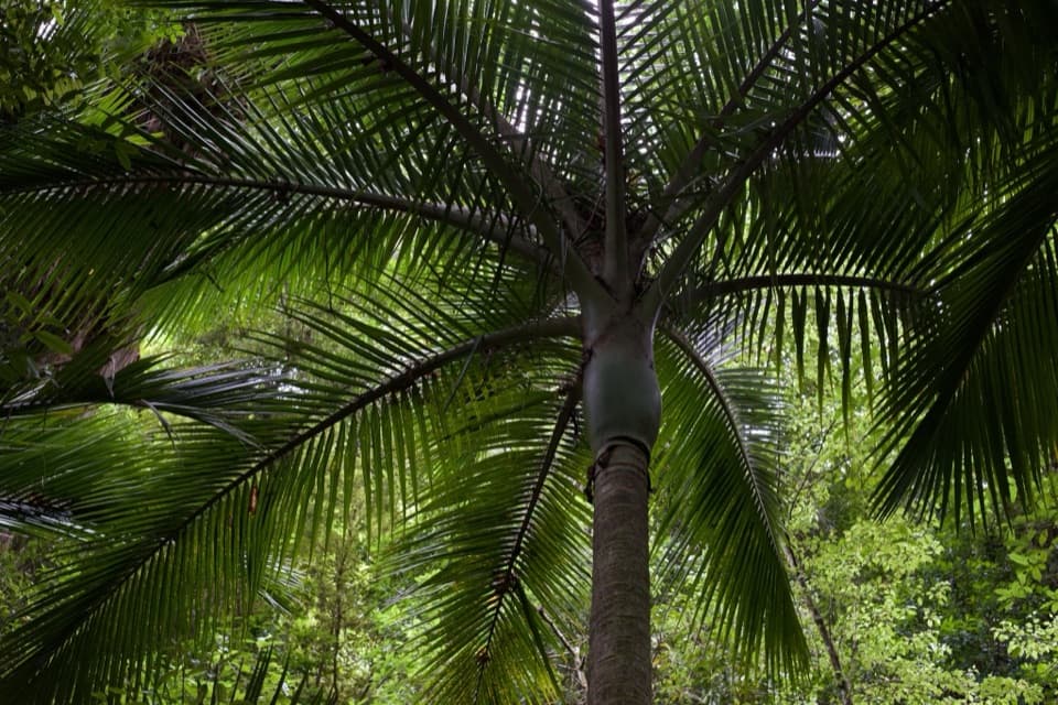
The path climbs over a low saddle, then descends through a shady gully thick with nikau palms to Anapai Bay, roughly 45 minutes from the start. The campsite sits above the sandy beach, and toilets are available at campsites. It is a pleasant first pause, but the point is still several kilometres farther on.

Between Anapai and AnatakapauLeaving Anapai, the track climbs past tall rata trees and skirts a rocky stretch rather than…

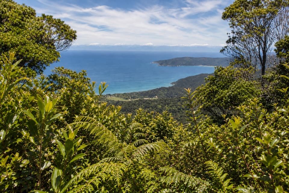
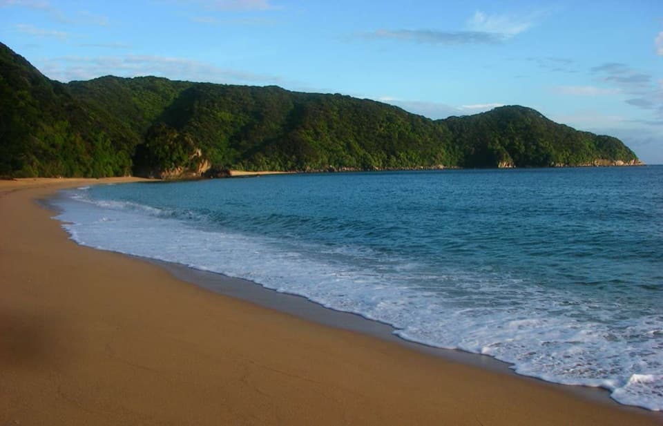
Leaving Anapai, the track climbs past tall rata trees and skirts a rocky stretch rather than dropping to the shore. Gaps in the trees open views down to the coast; then the path eases downhill to Anatakapau Bay. Its golden beach runs for about half a kilometre. The cove just north of Anapai and the rock stacks at Anapai are good places to frame the water and granite together; Anatakapau gives you a wider beach view.

The bays before the pointAt the northern end of Anatakapau, the main Coast Track turns inland toward Whariwharangi Hut.

At the northern end of Anatakapau, the main Coast Track turns inland toward Whariwharangi Hut. For Separation Point, stay on the beach route, cross the small headland and rocky cove into Mutton Cove, then walk to the far end of that beach. The track climbs the hillside to the ridge and continues to the official end. Keep the turnoff in mind on the way back so you do not follow the inland hut route by mistake.

Stop at the track endThe maintained track stops short of the rocky headland.

The maintained track stops short of the rocky headland. The rough descent beyond it is not part of this walk, and the route here ends at the official track end. From the ridge, clear weather opens views toward Farewell Spit across Golden Bay and D’Urville Island across Tasman Bay. Kekeno (fur seals) rest on rocks below, and seabirds use the headland. If you want a different return, a longer coastal ridge route joins the Coast Track above Whariwharangi before coming back toward Anatakapau; it is not included in the 14.4 km out-and-back.

The name and the wildlifeSeparation Point, also called Te Matau, marks the division between Golden Bay and Tasman Bay.

Separation Point, also called Te Matau, marks the division between Golden Bay and Tasman Bay. French explorer Jules Dumont d’Urville named it in 1827 after noting the two bays separated by the point. Along the walk, listen for korimako (bellbirds), pīwakawaka (fantails) and kererū (wood pigeons); shags are often seen around rocky headlands. These are wild sightings, not a guarantee, so give seals and birds room.

Make the day workThere is no food for sale along the track, so carry what you need.

There is no food for sale along the track, so carry what you need. Filtered water is available at Tōtaranui campsite; treat water collected elsewhere before drinking. Day walking is free, but campsites such as Anapai and Mutton Cove require advance booking and payment. Dogs are not allowed on the Coast Track. The last 12 km of the road to Tōtaranui is unsealed, though it is suitable for campervans. October to April is the busiest period; winter is quieter but brings shorter daylight, and strong westerlies are common in late spring and summer.

Wildlife

Wildlife in Abel Tasman

All Abel Tasman wildlife maps

Sighting maps show where each species has been reported across Abel Tasman. Wildlife moves, so no sighting is guaranteed.

Keep exploring

Near Tōtaranui to Separation Point

See it all on the map

Trails that start nearby

Places near the trailhead

Parkwolf’s Abel Tasman ranking

Top-rated trails in Abel Tasman

All 43 trails
  1. 1Abel Tasman Coast TrackChallenging · 60 km
  2. 2Mārahau to AnchorageModerate · 12.4 km
  3. 3Anchorage to Bark BayModerate · 11.5 km
  4. 4Wainui Falls TrackModerate · 3.4 km
  5. 5Pitt Head Loop TrackModerate · 3.2 km
  6. 6Tōtaranui to Anapai BayModerate · 6.4 km

Take Parkwolf to Abel Tasman.

The audio tour guide for the drive, plus offline maps, trails, and wildlife heatmaps for when the signal drops.

4.7 from 8,600+ ratings

Download Parkwolf on the App StoreGet Parkwolf on Google Play