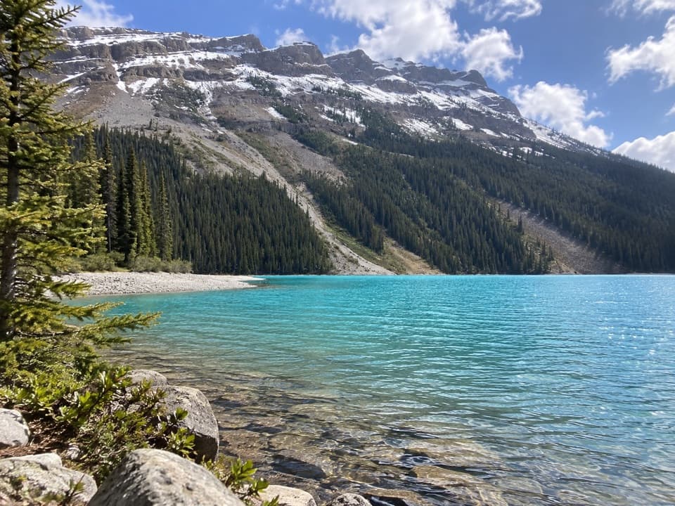
Peyto Lake Trail in Banff National Park

Banff National Park, AB

Peyto Lake Trail

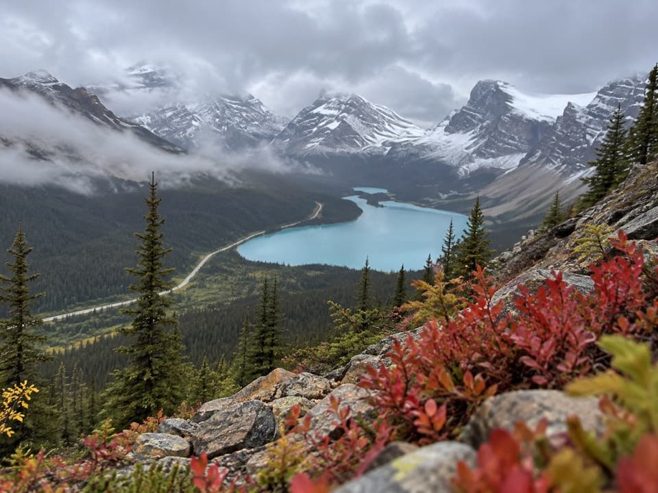
Trade the overlook for Peyto's shore on a steep descent.

Length
2.5km
Time
2hr
Elev. change
272m
Difficulty
Challenging
  • Dogs allowed
  • High point 2,112 m

Hear the audio tour

Peyto Lake Viewpoint at Bow Summit

Overview

About Peyto Lake Trail

Why go

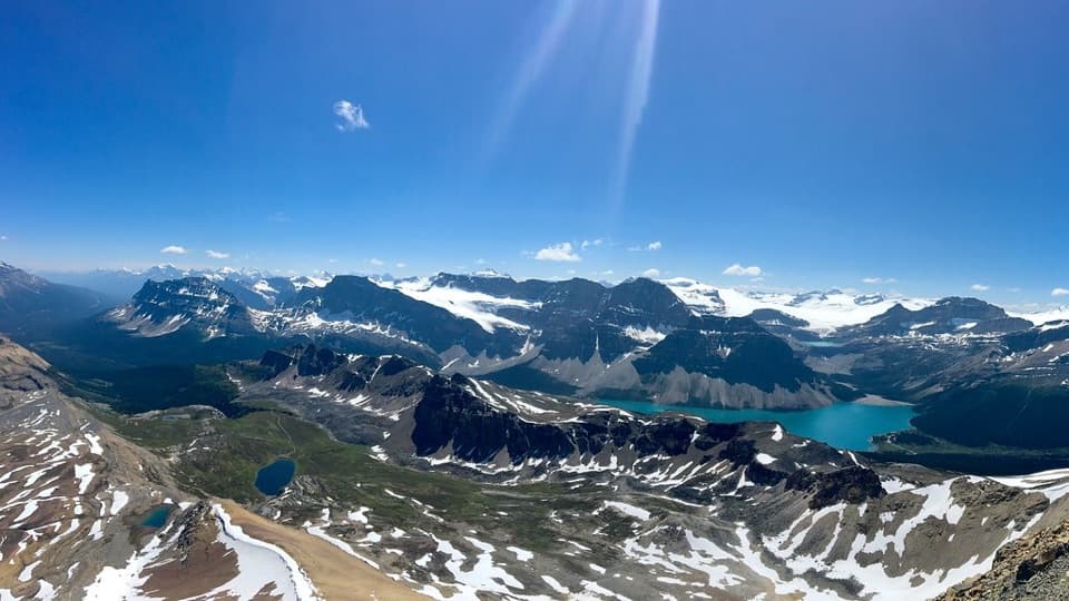
  • A close shoreline view beneath the Waputik Range
  • A dramatic forest-to-shore descent

Heads up

  • Steep, rough tread and a hard climb back
  • The paved approach from parking adds walking

Map & elevation

The route

Loading the Banff map
Full map
Elevation1,840–2,112 m
TrailheadCaldron Peak Trail junction beside Peyto Lake Viewpoint51.71705, -116.50734
Keep this map with you offline in the Parkwolf app

Plan your hike

Before you go

Parking

Use the regular-vehicle lower lot at the Peyto Lake day-use area off the Icefields Parkway; the upper lot is reserved for accessible and commercial vehicles. Follow the paved path to the viewpoint, then continue to the small right-hand branch for the shore descent.

Safety

The route is steep and rough and intended for experienced hikers. The return is a sustained climb on the same switchbacks; the final short shoreline approach is not mapped precisely.

8 active Banff alerts

  • ClosureJohnston Canyon Trail and Day Use Area closedJohnston Canyon Trail and Day Use Area are closed to all traffic and travel through December 11, 2026, because construction work requires protecting public and workers’ safety.Official details
  • ClosureBaker Lake and Hidden Lake campgrounds closed to campingCamping is prohibited at Baker Lake and Hidden Lake campgrounds through December 1, 2026, because a grizzly bear entered campsites and investigated tents and gear; the closures reduce risk to…Official details
See all 8 alerts
A park ranger sits on a dash-mounted phone, talking, as Parkwolf’s Tour Guide plays “Army Cutworm Moths: A Grizzly Bear Buffet” on Grand Loop Road below Dunraven Pass in Yellowstone
Parkwolf Tour GuideThe highest, rockiest slopes around here are a summer buffet for grizzly bears.

Banff Tour Guide

Your drive to Peyto Lake Trail, narrated.

Parkwolf is a GPS audio tour guide for Banff National Park. As you drive, it chimes in with what’s ahead: hidden gems, upcoming stops, history, geology, and wildlife, right through your car’s speakers.

See the Banff audio tour

Recorded for this trailhead

Peyto Lake Viewpoint at Bow Summit
0:00 / 0:29
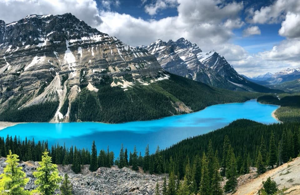
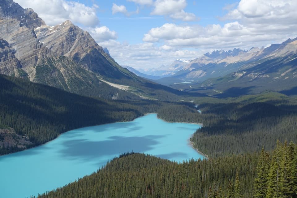
“Up ahead is the parking area for Peyto Lake Viewpoint at Bow Summit. I'd make this stop for the high view of the lake, whose outline looks like a wolf's head beneath the peaks.”

Plays as you drive up to this trailhead in the Parkwolf Banff Tour Guide.

More stories near here in the app

  • A Bird’s Bed in the Snow
  • One Aspen, Many Trunks
  • The Songbird Under the Water
  • Bow Lake: North Shore and a Café Stop
  • 185 audio storiesacross Banff’s roads, triggered by GPS as you drive
  • Wildlife heatmapsfor Grizzly Bear, Brown Bear, Gray Wolf, and 13 more
  • Works offlinemaps, 162 trails, 90 places, and audio download before you lose signal
  • CarPlay readysimple controls built for the drive
★★★★★
“…Loved the commentary as you drove thru. I’m sure the app can do more than I know but the tips were very helpful. I’m gonna use it when we go to Banff next month.”
tesja22App Store review
Download Parkwolf on the App StoreGet Parkwolf on Google Play

4.7 from 8,600+ ratings

Trail guide

Hiking Peyto Lake Trail

The shore routeThis is a steep, rough out-and-back from the fork beside Peyto Lake Viewpoint to the lake shore.

This is a steep, rough out-and-back from the fork beside Peyto Lake Viewpoint to the lake shore. The mapped trail is about 0.77 mile each way, or 1.55 miles round trip from the fork. From the public day-use lot, the paved walk to the fork adds distance; the full outing is roughly 2.3–2.5 miles, depending on time spent at the shore. Allow about two hours. This route is for experienced hikers, and the return climbs the same switchbacks.

Find the forkUse the regular-vehicle lower lot at the Peyto Lake day-use area.

Use the regular-vehicle lower lot at the Peyto Lake day-use area. The upper lot is reserved for accessible and commercial vehicles. Follow the paved path to the viewing platform and continue until a smaller path branches right. That branch is the shore trail; the short barrier-free walk to the platform is a separate outing.

Down to the waterThe path begins in forest, with occasional lake glimpses, then drops through a steep open…

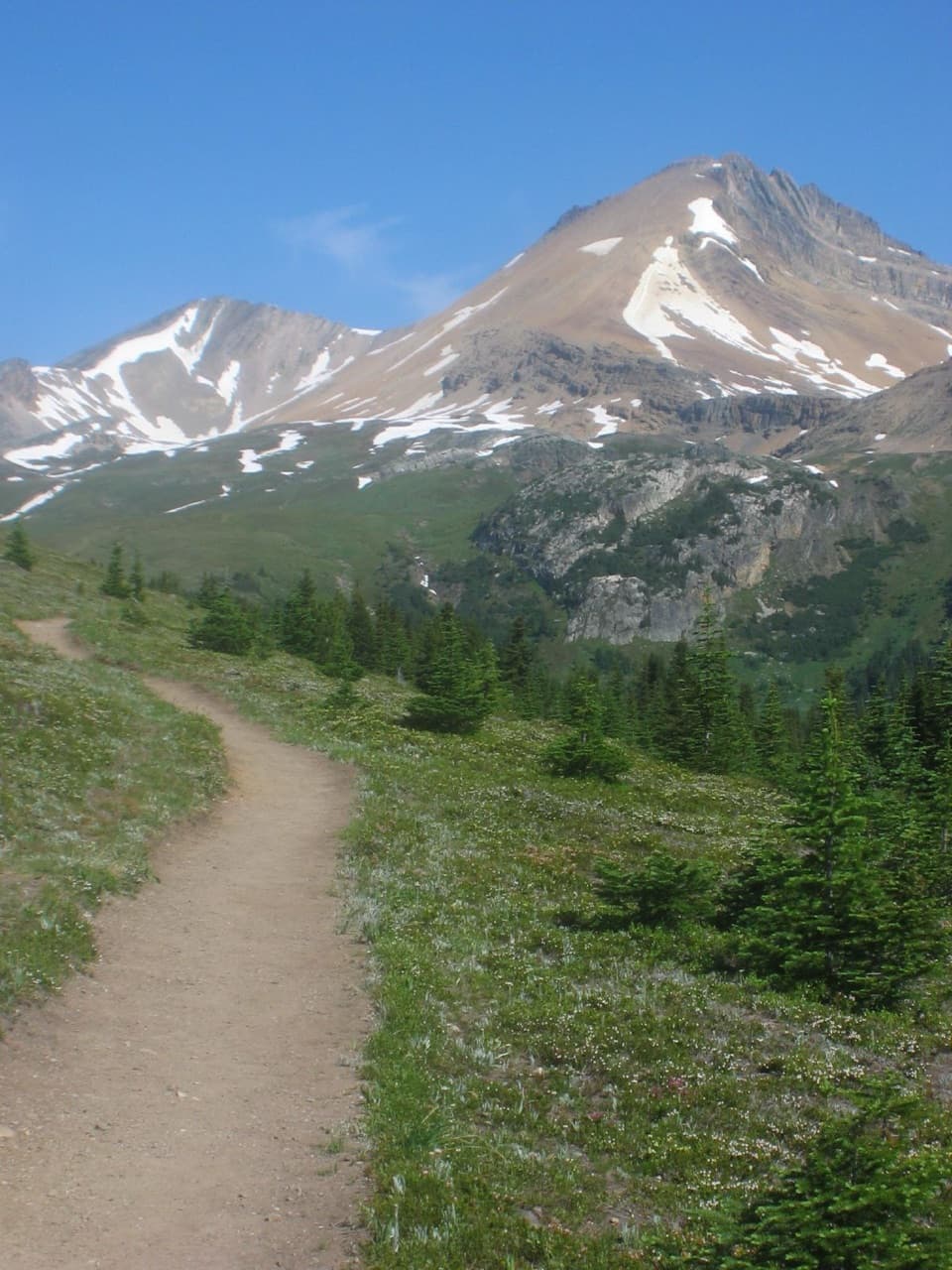
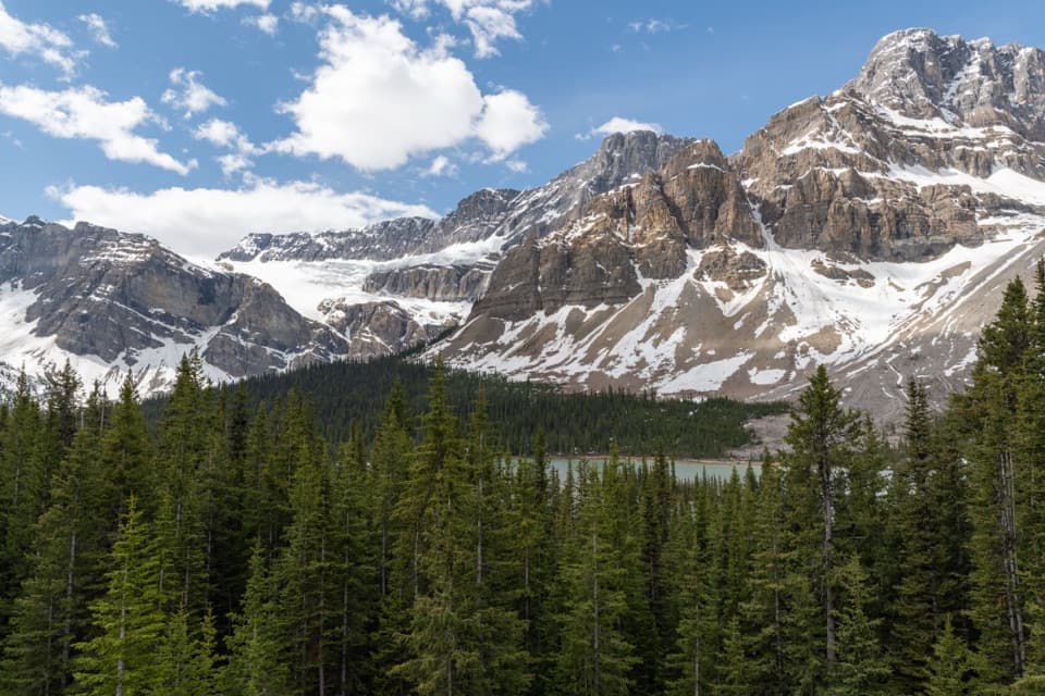
The path begins in forest, with occasional lake glimpses, then drops through a steep open ravine on repeated switchbacks. The tread is rough, and the climb back feels much harder than the mileage suggests. The mapped line follows the descent; its final short approach to the water is not shown precisely on the map.

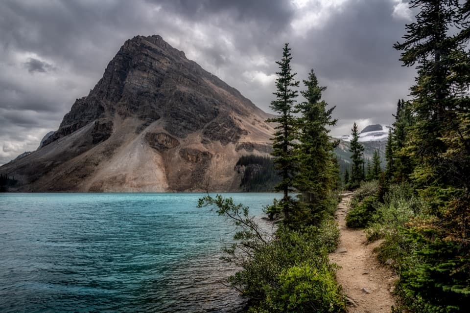
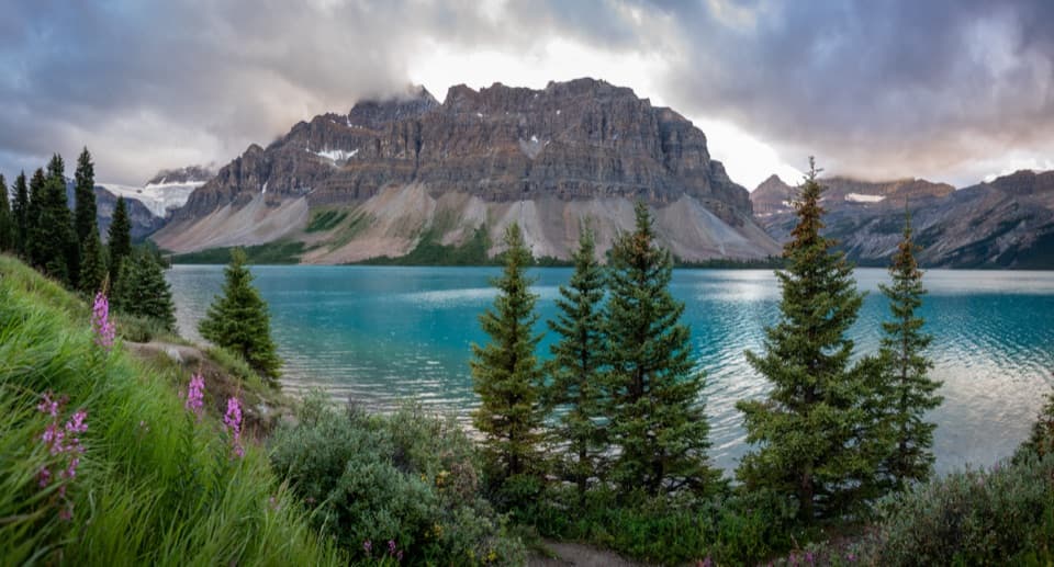
At shoreFrom water level, the Waputik Range feels closer than it does from the overlook.

From water level, the Waputik Range feels closer than it does from the overlook. Peyto's turquoise color comes from glacial rock flour and minerals carried into the lake by meltwater. Turn back toward the ravine from shore to see the height of the descent.

If you want the easy versionThe paved, barrier-free viewpoint walk is a better choice for the high view without the steep…

The paved, barrier-free viewpoint walk is a better choice for the high view without the steep descent; it does not reach the lake. Prime hiking season is generally July to mid-September, so check current conditions outside that window. Dogs are allowed on park trails unless a posted restriction says otherwise and must stay leashed.

Wildlife

Wildlife in Banff

All Banff wildlife maps

Sighting maps show where each species has been reported across Banff. Wildlife moves, so no sighting is guaranteed.

Keep exploring

Near Peyto Lake Trail

See it all on the map

Trails that start nearby

Places near the trailhead

Parkwolf’s Banff ranking

Top-rated trails in Banff

All 162 trails
  1. 1Sentinel Pass via Larch Valley TrailChallenging · 11.2 km
  2. 2Plain of Six Glaciers TrailModerate · 11.6 km
  3. 3Lake Agnes TrailModerate · 7.8 km
  4. 4Johnston Canyon Trail to Upper FallsEasy · 4.8 km
  5. 5Larch Valley / Minnestimma Lakes TrailModerate · 9 km
  6. 6Parker Ridge TrailModerate · 5.6 km

Take Parkwolf to Banff.

The audio tour guide for the drive, plus offline maps, trails, and wildlife heatmaps for when the signal drops.

4.7 from 8,600+ ratings

Download Parkwolf on the App StoreGet Parkwolf on Google Play