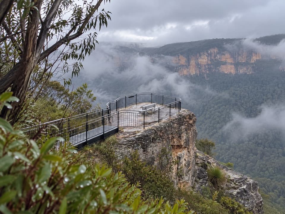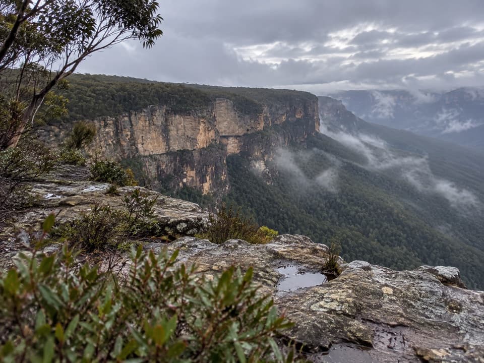
Butterbox Point walking track in Blue Mountains National Park

Blue Mountains National Park, NSW

Butterbox Point walking track

Grose Valley views and ironstone shapes from a short ridge walk.

Length
3.3km
Time
1.5hr
Elev. change
112m
Difficulty
Moderate
  • No dogs
  • High point 841 m
  • #19 of 110 in Blue Mountains

Hear the audio tour

Butterbox Point from Mount Hay Car Park

Overview

About Butterbox Point walking track

Why go

  • A short walk reaches a striking sandstone outlook above the Grose Valley
  • Unusual ironstone patterns add a second reason to explore the ridge

Heads up

  • The last stretch of road is long and unsealed
  • One path beside The Butterbox is narrow and exposed
Butterbox Point walking track is a direct out-and-back from Mount Hay Carpark to a rocky lookout above the Grose Valley. The mapped route is about 2.1 miles (3.3 km) round trip, following the same line back; allow about 1.5 hours if you want time at the point and the rock formations. It’s a good pick for a short walk with a big escarpment view, but the exposed ridge and long gravel-road approach make this more of a deliberate outing than a quick roadside stop. Mount Hay summit and Butterbox Canyon are separate routes from the same trailhead.
Parkwolf’s verdictWhy this one is worth the drive

Map & elevation

The route

Loading the Blue Mountains map
Full map
Elevation729–841 m
TrailheadMount Hay Carpark-33.63007, 150.40203
Keep this map with you offline in the Parkwolf app

Plan your hike

Before you go

Parking

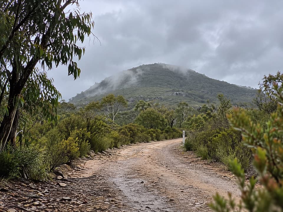
Mount Hay Carpark is a small, unpaved lot at the end of Mount Hay Road, beside the information board. The final roughly 12.5 km is unsealed and can worsen after heavy rain; check current road advice before driving. There is no public transport.

Safety

The ridge and final lookout are exposed, with an unguarded drop. One short path beside The Butterbox hugs the cliff; use the less exposed side in wind or skip the ledge if heights bother you. The route back climbs to the carpark over uneven rock.

3 active Blue Mountains alerts

  • ClosureRoads and tracks closed across Blue Mountains National ParkMany roads, fire trails and walking tracks across Blue Mountains National Park are closed; do not enter closed areas.Official details
  • CautionPark-wide solid-fuel fire banA park fire ban is active across Blue Mountains National Park: campfires and solid-fuel barbecues and stoves are prohibited. - Gas and electric cookers are permitted, subject to safety rules.Official details
See all 3 alerts
A park ranger sits on a dash-mounted phone, talking, as Parkwolf’s Tour Guide plays “Army Cutworm Moths: A Grizzly Bear Buffet” on Grand Loop Road below Dunraven Pass in Yellowstone
Parkwolf Tour GuideThe highest, rockiest slopes around here are a summer buffet for grizzly bears.

Blue Mountains Tour Guide

Your drive to Butterbox Point walking track, narrated.

Parkwolf is a GPS audio tour guide for Blue Mountains National Park. As you drive, it chimes in with what’s ahead: hidden gems, upcoming stops, history, geology, and wildlife, right through your car’s speakers.

See the Blue Mountains audio tour

Recorded for this trailhead

Butterbox Point from Mount Hay Car Park
0:00 / 0:26
“You're approaching Mount Hay car park, where I'd choose the Butterbox Point walk for Grose Valley views and unusual rock formations. Allow about an hour and a half for the three point three kilometre return walk.”

Plays as you drive up to this trailhead in the Parkwolf Blue Mountains Tour Guide.

More stories near here in the app

  • The Cockatoo's Timber Lunch
  • The Walk to Lockley Pylon
  • Fortress Rock from Fortress Ridge Car Park
  • Perrys Lookdown and Blue Gum Forest
  • 188 audio storiesacross Blue Mountains’s roads, triggered by GPS as you drive
  • Wildlife heatmapsfor Grey Kangaroo, Wombat, Red-necked Wallaby, and 13 more
  • Works offlinemaps, 110 trails, 84 places, and audio download before you lose signal
  • CarPlay readysimple controls built for the drive
★★★★★
“Fantastic app with many points of information… It’s great to just turn on while you’re driving and it gives you an audio tour of the national Park. We love it!!!!”
JMJamesApp Store review
Download Parkwolf on the App StoreGet Parkwolf on Google Play

4.7 from 8,600+ ratings

Trail guide

Hiking Butterbox Point walking track

Follow the point trackStart at the information board in Mount Hay Carpark.

Start at the information board in Mount Hay Carpark. After about 200 metres, keep left at the signed split for Butterbox Point; Mount Hay goes right. At the next signed junction, stay on the point track and leave the Butterbox Canyon access spur alone. The early path crosses an open ridge, so views arrive quickly. Look down for pale-green patches of hanging swamp: water seeps through the sandstone, collects over underlying clay and leaves waterlogged, peat-forming ground.

Around The ButterboxThe track climbs a small rocky rise toward The Butterbox, a blocky sandstone plateau roughly 30…

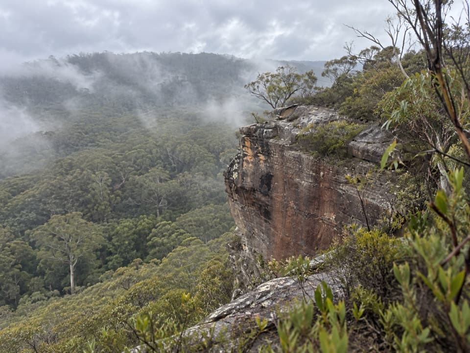
The track climbs a small rocky rise toward The Butterbox, a blocky sandstone plateau roughly 30 metres high and 100 metres across. Local bushwalker Cyril Byles named it in 1918 because it looked like a butter box. Paths skirt both sides and meet again. The right-hand line runs close to the cliff for a short stretch; the left stays farther back and passes eroded caves and overhangs. I’d take the left side if it’s windy or if exposed edges make you hesitate.

At the pointThe route drops toward a rocky outcrop above the Grose Valley.

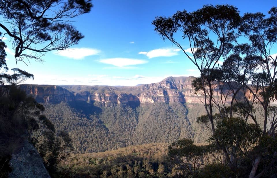
The route drops toward a rocky outcrop above the Grose Valley. From there you can pick out Walford Wall, Lockleys Pylon, Mount Banks and the winding line of Rocky Point Creek below. Reaching the lowest ledge means stepping down a couple of rocky steps, but you can stop above it and still get the view. Keep away from the unguarded edge, especially in strong wind. For a photo, include a little of the ledge or ridge in front of the wall so the scale reads.

The ironstone patternsThe ridge has broad sandstone slabs striped with hard, iron-rich layers.

The ridge has broad sandstone slabs striped with hard, iron-rich layers. Erosion has left rings, swirls and sharp wave-like shapes beside the escarpment. The circular bands are commonly called Liesegang rings; iron carried in groundwater precipitated into the rock, and the softer sandstone wore away around it. The deeper origin of the iron is less certain, so the patterns themselves are the story worth looking for. Give yourself a few minutes to wander among the formations, then return to the signed track rather than following faint lines toward the canyon.

Access and effortMost of the walk is short and fairly straightforward, but expect uneven rock, an exposed ridge…

Most of the walk is short and fairly straightforward, but expect uneven rock, an exposed ridge and a climb back to the carpark. The final roughly 12.5 kilometres of Mount Hay Road are unsealed and can worsen after heavy rain; reports differ on what vehicle can manage it, so check current road advice before setting out. The carpark is small and there’s no public transport. No toilets, potable water or food service were identified at the lot. Pets aren’t permitted in this national park.
Wildlife

Wildlife in Blue Mountains

All Blue Mountains wildlife maps

Sighting maps show where each species has been reported across Blue Mountains. Wildlife moves, so no sighting is guaranteed.

Keep exploring

Near Butterbox Point walking track

See it all on the map

Trails that start nearby

Places near the trailhead

Parkwolf’s Blue Mountains ranking

Top-rated trails in Blue Mountains

All 110 trails
  1. 1Grand Canyon trackModerate · 6.3 km
  2. 2Three Sisters walkEasy · 0.8 km
  3. 3Lockley Pylon walking trackModerate · 7 km
  4. 4National PassChallenging · 5.1 km
  5. 5Wentworth Pass loop walking trackChallenging · 5 km
  6. 6Prince Henry Cliff walkModerate · 7 km

Take Parkwolf to Blue Mountains.

The audio tour guide for the drive, plus offline maps, trails, and wildlife heatmaps for when the signal drops.

4.7 from 8,600+ ratings

Download Parkwolf on the App StoreGet Parkwolf on Google Play